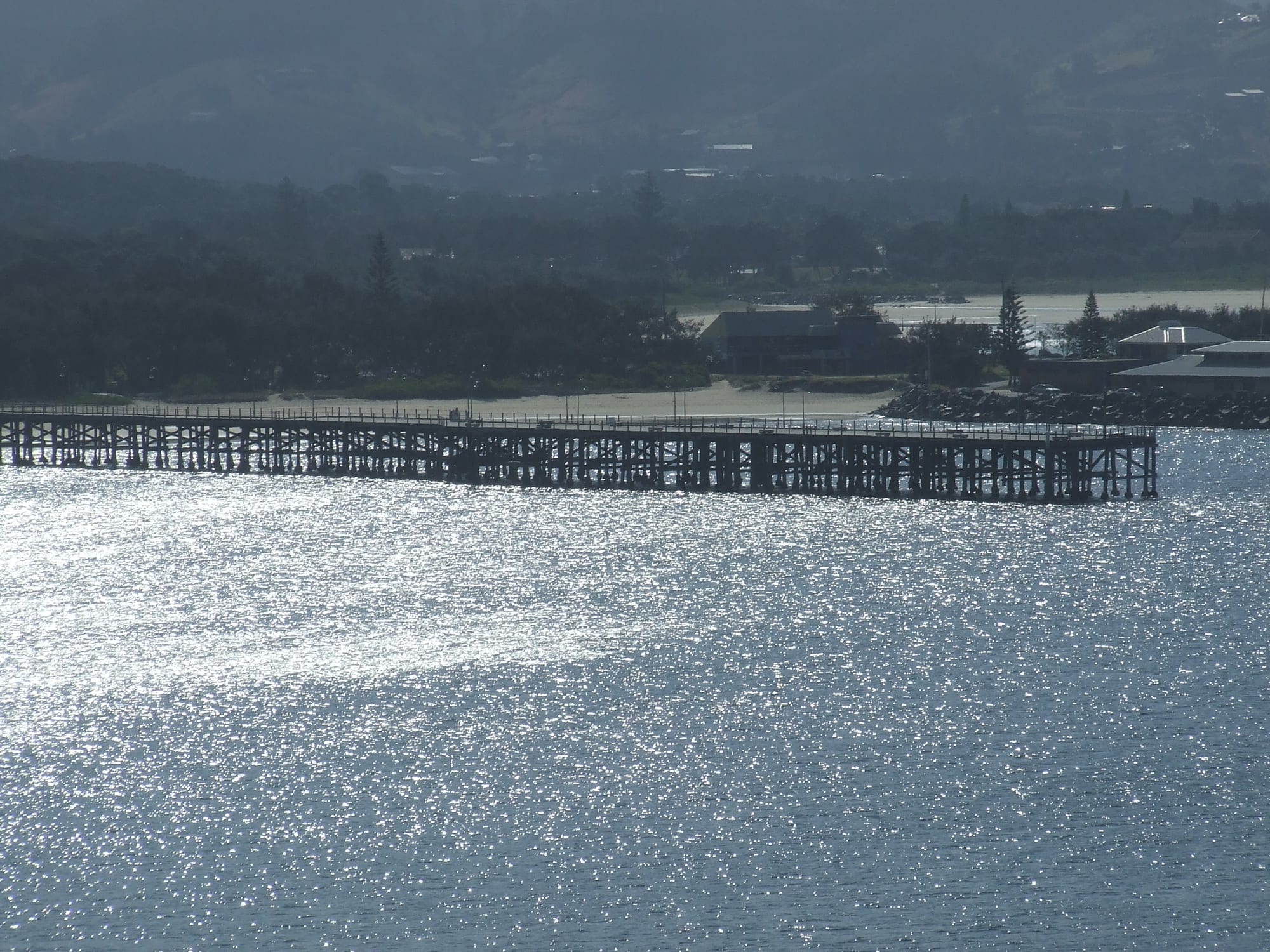
The long wooden Coffs Harbour Jetty crossing sunlit, sparkling water, with a sandy beach, trees and hills behind

Sydney, New South Wales & the ACT, Australia

Coffs Harbour

The historic timber jetty at Coffs Harbour, built to ship timber from the hinterland. (Daniel Ainsworth / Wikimedia Commons · CC BY 3.0)

A coastal city on the Mid North Coast of New South Wales, 529 kilometres north of Sydney and 390 kilometres south of Brisbane, where the Great Dividing Range meets the sea. Built on timber shipped from a long wooden jetty and later on bananas, it is now a regional centre and holiday city of surf beaches, a boat harbour and a protected island seabird colony.

Neighbourhoods

  • The Jetty
    • First-time visitors
    • Waterfront
    • Best for food

    The old port area at the end of Harbour Drive, where the timber jetty runs out to sea beside the boat harbour and the breakwater to Muttonbird Island. Restaurants, cafés and the Sunday market cluster along the foreshore, and the beach between the jetty and the harbour is calm and popular with families.

    Open in Maps
  • City Centre
    • Shopping
    • Close to public transport
    • Local life

    The commercial heart a couple of kilometres inland, around the pedestrian mall and Harbour Drive, with shops, offices, cafés and the bus interchange. Coffs Creek runs through it, with a walking path and the botanic garden along its banks.

    Open in Maps
  • Park Beach and the northern beaches
    • Beaches
    • Families
    • Holiday stays

    A long run of surf beaches north of the harbour, from Park Beach to Korora, Sapphire and Moonee, backed by holiday apartments, caravan parks and banana-covered hills. This is where most of the city's holiday accommodation stands.

    Open in Maps
  • Sawtell
    • Quiet and residential
    • Beaches
    • Cafés

    A seaside town about 10 kilometres south that has grown into a satellite of the city, with a café and restaurant scene, surf beaches and Bonville and Boambee creeks.

    Open in Maps
  • Woolgoolga
    • Beaches
    • Sikh heritage

    A beach town about 22 kilometres north, known for its long-established Sikh community and its two gurdwaras, a headland with views along the coast and a relaxed village centre.

    Open in Maps

Things to do

Famous landmarks

  • Big Bananalandmark

    A giant walk-through banana beside the highway north of the city, built in 1964 as one of the first of Australia's Big Things, now part of a fun park set amongst a banana plantation.

    Open in Maps
  • South Solitary Island Lightlandmark

    A lighthouse on a rocky island offshore, first lit in 1880 and visible from headlands along the coast.

    Open in Maps

Islands, sea and beaches

  • Muttonbird Island Nature Reservepark

    A small island joined to the harbour by the northern breakwater, where thousands of wedge-tailed shearwaters return each year to breed and a walking track climbs to a lookout used for whale watching.

    Open in Maps
  • Solitary Islands Marine Parkpark

    A marine park along the coast influenced by the warm East Australian Current, where tropical and temperate marine life overlap, popular with divers and snorkellers.

    Open in Maps
  • Moonee Beachbeach

    A sheltered beach and creek mouth north of the city, inside a nature reserve with headland walks.

    Open in Maps

Parks and gardens

  • North Coast Regional Botanic Gardenpark

    A botanic garden beside Coffs Creek in the city centre, with rainforest, mangrove boardwalks and plants of the subtropical east coast.

    Open in Maps
  • Bongil Bongil National Parkpark

    Coastal forest, wetlands and quiet beaches south of Sawtell, an important habitat for koalas.

    Open in Maps

Short trips from the city

  • Dorrigo National Parkpark

    Subtropical rainforest on the escarpment west of the city, part of the Gondwana Rainforests World Heritage Area, with an elevated skywalk and waterfall walks.

    Open in Maps
  • Bellingenattraction

    A small town on the Bellinger River south-west of the city, known for its arts community, markets and the river valley below the Dorrigo plateau.

    Open in Maps
  • Woolgoolga Sikh Templelandmark

    The Guru Nanak Sikh Temple, one of the largest Sikh temples in regional Australia and a landmark of the Sikh community that came to own most of the area's banana farms.

    Open in Maps

Eat and drink

Long-standing places and food districts in Coffs Harbour. Hours, ratings and directions come from your maps app, always current.

Coffs classics

  • Seafood at the Jettyneighborhood

    Restaurants and takeaways around the boat harbour serve fish and chips, prawns and oysters beside the boat harbour.

    Open in Maps
  • Harbourside Marketsmarket

    A Sunday craft and produce market at the jetty foreshore, selling handmade goods and local food, with live music.

    Open in Maps

Food districts

  • Sawtell's First Avenueneighborhood

    A street of cafés and restaurants in Sawtell, a short walk from the beach.

    Open in Maps
  • Woolgoolga's Indian restaurantsneighborhood

    Punjabi food served in a beach town that has had a Sikh community since the middle of the 20th century.

    Open in Maps

Experience Coffs Harbour

History

The Coffs Harbour coast is the country of the Gumbaynggirr people, one of the largest coastal Aboriginal nations in New South Wales, who have lived here for many thousands of years. Their name for the harbour, Gitten Mirreh, means "big moon". The English name comes from John Korff, a shipbuilder who sheltered from a storm here in 1847 and called it Korff's Harbour; the name was accidentally changed by the Crown surveyor who reserved land in the area in 1861.

European settlement grew slowly in the second half of the 19th century, drawn by the cedar and other timber of the hinterland forests. With no railway yet built along the coast, timber was carried by tramways to jetties and loaded onto coastal ships. The timber jetty, built in the 19th century as the longest of its kind on the coast by the state's public works department, became the town's lifeline and the centre of the harbour, and a breakwater was later built out to Muttonbird Island to shelter it. The North Coast railway reached the town in 1915 and gradually replaced coastal shipping.

In the 20th century bananas spread across the steep hillsides, and the region became known as the Banana Coast. Sikh families began to settle around Woolgoolga during the Second World War, when labour shortages relaxed the ban on non-European workers in the banana industry, and afterwards acquired plantations of their own. The Big Banana, opened in 1964, marked the shift towards tourism. Today, with banana farming much reduced, it lives mainly on services, health, education and tourism.

Culture & Customs

Coffs Harbour is a beach city first, built around surfing, swimming, fishing and walks on the headlands. Surf life-saving clubs anchor the main beaches, and rugby league and touch football are widely played. The city's international stadium has hosted national and international rugby and football matches, and Coffs has long been a base for sporting events and training camps.

Gumbaynggirr language and culture have been the focus of revival efforts since elders set up the Muurrbay Aboriginal Language and Culture Co-operative in 1986; language classes began in 1997, and the city has a Gumbaynggirr school, the Giingana Gumbaynggirr Freedom School. Woolgoolga, to the north, was an early centre of Sikh migration and has one of the largest regional Sikh communities in Australia, and its gurdwaras and Punjabi shops are part of the coast's identity.

The hinterland adds its own character. Bellingen and the Dorrigo plateau draw artists, musicians and people seeking a slower life, and markets and small festivals run through the year. Locals tend to be informal and friendly, proud of their beaches and quick to point visitors towards a favourite headland or swimming spot.

Daily Life

About 79,000 people live in the Coffs Harbour urban area, which stretches along the coast from the southern suburbs and Sawtell to the northern beaches. It is one of the largest urban centres on the North Coast and serves a wide surrounding region for hospitals, shopping, education and government services, with a university campus and a large TAFE.

The economy has moved from timber and bananas to health care, retail, construction, education and tourism. Banana plantations still cover some hillsides, but many have been replaced by blueberries, now a major crop across the hinterland. Many residents are retirees or families who moved up from Sydney for the climate and lifestyle.

Daily life starts early, with surfers and walkers on the beaches at dawn, and settles down early too. Housing costs have risen as people move from the cities, and the heavy traffic of the Pacific Highway through the city has been a long-running problem that a highway bypass is intended to relieve. Floods and heavy rain events are a regular concern.

Food

Seafood is the heart of eating in Coffs Harbour. Local waters supply prawns, fish and other catch, and fish and chips eaten on the foreshore near the jetty is a popular way to enjoy them. Sydney rock oysters, farmed in the estuaries of the coast, and fresh local prawns appear on many menus.

The farms of the hinterland supply much of the rest. Bananas are the old symbol of the area, and locally grown ones are sold at roadside stalls and markets; blueberries, macadamias, cucumbers and tomatoes are other important crops. The weekend market at the jetty and farmers' markets in the region sell produce straight from the growers.

Woolgoolga's Sikh community has brought Punjabi cooking to the coast, and Indian restaurants and sweet shops there are a local favourite. Curryfest, a celebration of the culture of the local Sikh community, has been held in Woolgoolga since 2006. In Sawtell and around the Jetty, cafés serve the brunches and good coffee found across coastal New South Wales.

Planning tools

Budget

Coffs Harbour is cheaper than Sydney or Byron Bay, though prices rise in the summer and Easter school holidays, when beachfront apartments fill. Beaches, headland walks, the botanic garden and Muttonbird Island cost nothing; a hire car or day tours are needed for the rainforest and the hinterland.

Daily Budget Midrange
USD 160–280 (motel or holiday apartment, restaurant meals, a hire car or a boat trip)
Daily Budget Shoestring
USD 70–120 (hostel bed or caravan-park cabin, takeaways and self-catering, local buses)

Book accommodation early for school holidays and big sporting events, when rooms along the beaches sell out.

Best Time to Visit

Pleasant all year. September to November and March to May are warm and usually less humid, and whales pass the coast from about June to November. December to February is hot, humid and the wettest period, but it is the main beach season; winter is mild and sunny, cool enough at night for a jumper.

Suggested Number of Days

Two or three days cover the city, the harbour and a few beaches. Four to six allow time for the rainforest and the hinterland towns, and longer stays suit anyone who wants to surf, dive or simply spend time on the beaches.

First Visit
2–3 days
With Surroundings
4–6 days

Transportation

A car is the easiest way to get around: the city sprawls along the coast, and local buses run on limited routes and frequencies. Taxis and ride-hailing are available. Cycling and walking paths follow Coffs Creek and parts of the foreshore.

The Pacific Highway carries heavy traffic through the area; allow extra time in holiday periods and drive with care on wet hinterland roads.

Airport & Station Connections

Coffs Harbour Airport, a few kilometres south of the centre, has daily flights from Sydney, Melbourne and Brisbane. NSW TrainLink trains between Sydney and Brisbane stop at the station near the Jetty, and long-distance coaches run along the Pacific Highway. By road it is roughly six hours from Sydney and four from Brisbane.

Walkability

Walkable in parts rather than as a whole. The Jetty area, the harbour and Muttonbird Island make a pleasant walk, and the creekside path links the city centre with the foreshore, but the beaches and suburbs are spread along many kilometres of coast. Summer heat and humidity make midday walks tiring.

Safety

Coffs Harbour is safe for visitors. The main risks are at sea: rip currents on surf beaches, strong surf in big swells and occasional sharks. Summer brings heavy rain and flooding, and bushfires can threaten the hinterland in dry years.

Swim between the flags at patrolled beaches, follow local warnings in storms and floods, and check fire danger ratings before heading into the hinterland in summer. Check current official travel advice before travelling.

Climate

A humid subtropical climate with hot, wet summers and short, mild winters, strongly seasonal rainfall and a relatively sunny record over the year.

Summer
December to February is warm, wet and humid, with days of about 26–27°C, nights near 18–20°C and heavy showers and storms
Winter
June to August is mild, with days of about 19–20°C, cool nights around 8–9°C and the year's lightest rain

Local Customs

Coffs Harbour is relaxed and casual, with beach dress acceptable in most cafés but not in clubs and some restaurants in the evening. Tipping is not expected, though rounding up for good service is appreciated. The city stands on Gumbaynggirr country, which is acknowledged at many public events.

Remove shoes and cover the head when visiting a gurdwara in Woolgoolga, and follow the signs on Muttonbird Island, where walkers must stay on the path to protect the nesting burrows. The legal drinking age is 18.

Common Payment Methods

The currency is the Australian dollar. Cards and contactless payment are accepted almost everywhere, including at most market stalls, and ATMs are easy to find in the city centre and shopping centres. A little cash is useful for small market stalls and roadside fruit stands.