History · Cyprus
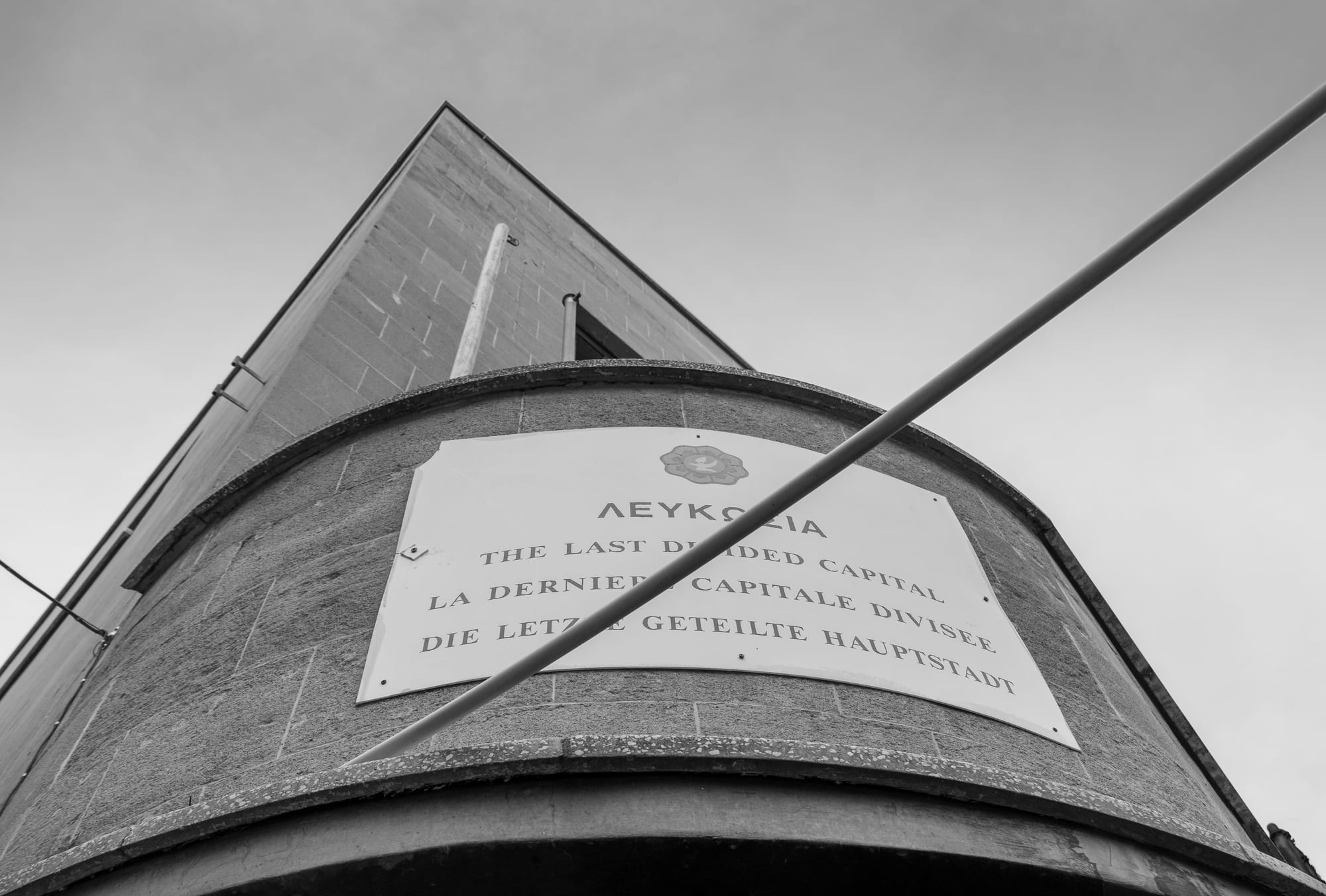
Why does Cyprus have Europe's last divided capital?
A line drawn in green pencil after the violence of 1963 hardened into a ceasefire line in 1974, and half a century of peace talks have not erased it.
By Globeway Editorial · 13 October 2026
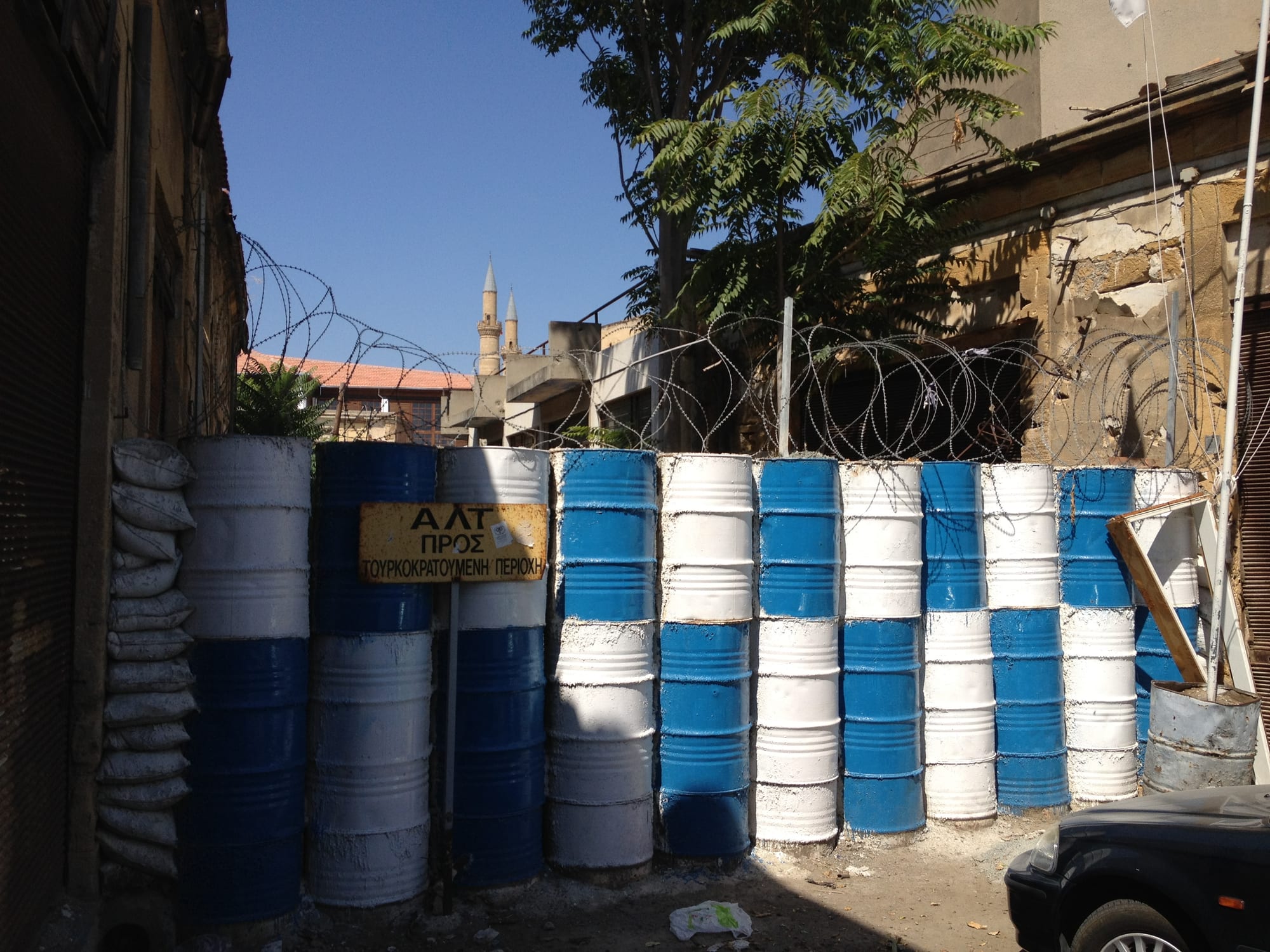
The short answer
Nicosia is divided because Cyprus is divided. When the island became independent from Britain in 1960, its Greek Cypriot majority and Turkish Cypriot minority were meant to share power, but the arrangement broke down within three years. After fighting at Christmas 1963 the two communities separated in the capital, and a British officer drew a ceasefire line across a map of the city in green pencil. In 1974 a coup backed by the military government in Athens was followed by a Turkish invasion, and the island was split along a ceasefire line that runs straight through Nicosia.
That line is now a United Nations buffer zone. The south of the city is the capital of the Republic of Cyprus, a member of the European Union; the north is the capital of the Turkish Republic of Northern Cyprus, which only Turkey recognises. Since the Berlin Wall fell in 1989, no other European capital has been split this way. Every attempt to reunite the island has failed, so the line remains.
A capital for a thousand years
Nicosia has been inhabited for more than 5,500 years and has been the capital of Cyprus since around 965, when the Byzantine Empire moved its government inland from coasts exposed to raids. Its rulers changed many times: the Lusignan kings, Venice, the Ottomans from 1570, and Britain from 1878. In 1567 the Venetians ringed the city with new walls about 5 kilometres round, with eleven pentagonal bastions. Those walls still define the old city, and the modern division runs right through the middle of them.
Under British rule two political dreams pulled in opposite directions. From 1955 the Greek Cypriot organisation EOKA fought the British for enosis, union with Greece, which most Greek Cypriots supported. Some Turkish Cypriots wanted the opposite, taksim, or partition of the island. Independence in 1960 gave neither. The new Republic of Cyprus had a power-sharing constitution for a population that was about 78 per cent Greek Cypriot and 18 per cent Turkish Cypriot.
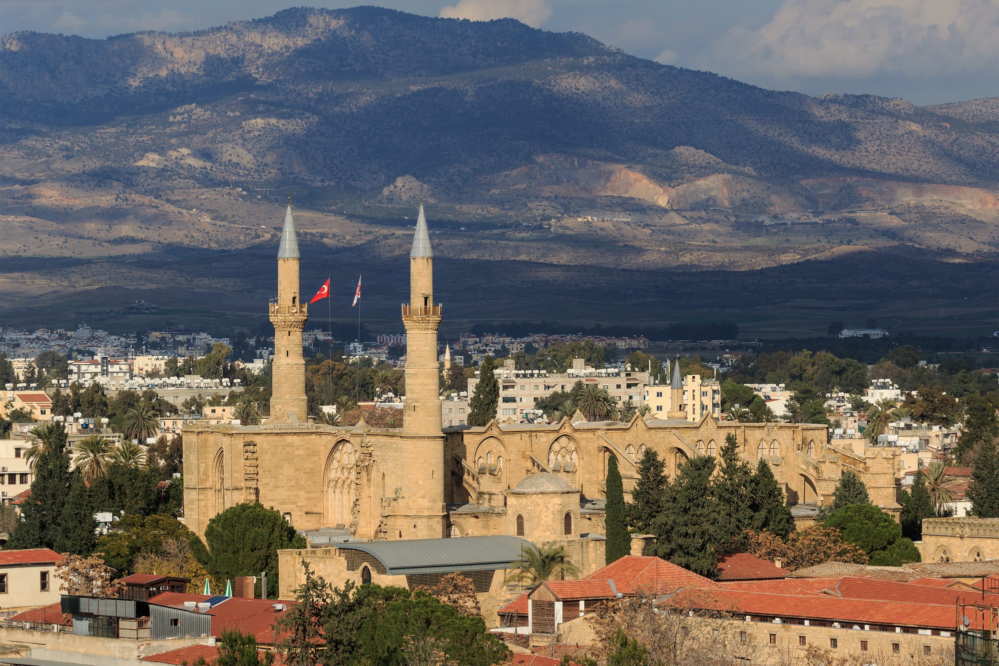
The old city holds both communities' landmarks. The chief mosque of the north began life as a Latin cathedral, started in the early 13th century in the style of medieval France and converted after the Ottoman conquest of 1570.
A line drawn in green pencil
In 1963 the Greek Cypriot leadership proposed changes to the constitution, which the Turkish Cypriot community rejected. Fighting broke out in Nicosia on 21 December 1963, in what became known as Bloody Christmas, and spread across the island. In the violence that followed, 364 Turkish Cypriots and 174 Greek Cypriots were killed and 25,000 Turkish Cypriots were displaced, and the power-sharing government collapsed. How exactly it collapsed is still contested: Greek Cypriots argue that Turkish Cypriots withdrew to form their own administration, while Turkish Cypriots maintain they were forced out.
On 30 December 1963, after a twelve-hour meeting, Major-General Peter Young, commander of a British truce force, drew the agreed ceasefire line on a map with a green chinagraph pencil, a wax crayon for marking maps. It became the Green Line. In 1964 Nicosia's Turkish Cypriots and Greek Cypriots separated into the north and south of the city, and streets crossing the line, including the main shopping street, Ledra Street, were barricaded. Many Turkish Cypriots moved into the Turkish quarter, which became severely overcrowded.
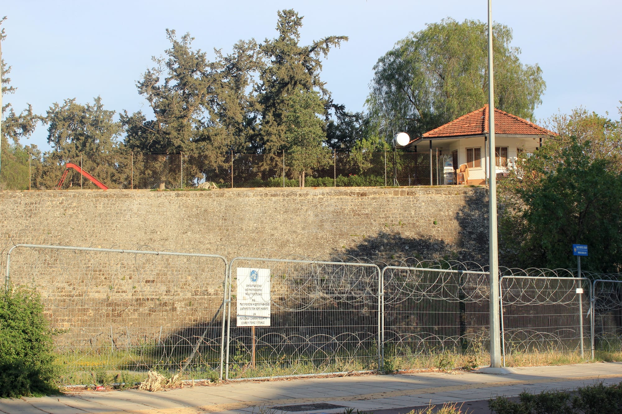
Across the island the buffer zone runs for 180 kilometres and covers 346 square kilometres. Its width varies from less than 20 metres to more than 7 kilometres, and in the capital it cuts the walled old city in two.
1974: from a line to a frontier
On 15 July 1974 the Cypriot National Guard, backed by the military junta then ruling Greece, overthrew President Makarios III in a coup aimed at union with Greece. Turkey invaded on 20 July. A second offensive began on 14 August, and by the ceasefire on 16 August Turkish forces held about 37 per cent of the island, including the northern part of Nicosia. The ground between the two armies became the UN buffer zone, and the old Green Line through the capital became part of it.
The war turned the island's map into a map of refugees. Between 140,000 and 160,000 Greek Cypriots fled the north or were evicted, and the remaining 51,000 Turkish Cypriots in the south were resettled in the north. Nicosia International Airport, inside the buffer zone, lost almost all of its commercial flights that year and became the headquarters of the UN peacekeeping force. In 1983 Turkish Cypriots proclaimed the Turkish Republic of Northern Cyprus, recognised only by Turkey; the rest of the world regards the north as part of the Republic of Cyprus but outside its effective control.
- 1960 — Cyprus becomes independent with a power-sharing constitution.
- 21 December 1963 — Fighting breaks out in Nicosia and spreads across the island.
- 30 December 1963 — Peter Young draws the Green Line on a map of the city.
- 20 July 1974 — Turkey invades, five days after a coup backed by the Greek junta.
- 15 November 1983 — The Turkish Republic of Northern Cyprus is proclaimed.
- 23 April 2003 — The Ledra Palace crossing opens, the first crossing since 1974.
- 24 April 2004 — The two communities vote on the UN's Annan Plan; it fails.
- 3 April 2008 — Ledra Street reopens across the line.
Why the talks keep failing
The United Nations has tried to broker a settlement for decades, and its Security Council has long described the goal as a bicommunal, bizonal federation with political equality: one state with two zones. The closest attempt was the Annan Plan, named after UN Secretary-General Kofi Annan. In simultaneous referendums on 24 April 2004, Turkish Cypriots approved it by almost two to one, while Greek Cypriots rejected it by about three to one. The Republic of Cyprus joined the European Union that year; the north remains outside it.
Talks restarted in 2015 and ended without a deal at Crans-Montana in Switzerland in July 2017. After that, the Turkish Cypriot leadership and Turkey switched to calling for two separate states, UN-led talks in 2021 failed, and in October 2024 the UN Secretary-General said there was no common ground for negotiations. In October 2025 Turkish Cypriots elected Tufan Erhürman, who supports resuming talks and reunifying the island as a federation.
Crossing the line today
For almost 30 years crossing was barely possible. That changed in April 2003, when the Turkish Cypriot administration eased restrictions and the Ledra Palace crossing, just outside the old city walls, opened. In 2008 Ledra Street, the historic shopping street of the walled city, reopened as a pedestrian crossing. Generally anyone with a passport may now cross at the official checkpoints, and Ledra Street, about a kilometre long, once again links the northern and southern halves of the old city.
On the southern side, Ledra Street leads towards Faneromeni Square, the centre of Nicosia before 1974; on the northern side, next to the checkpoint, lie the Arasta shopping streets and the Büyük Han, the largest caravanserai on the island, built by the Ottomans in 1572.