Attractions & Natural Wonders · Canada
Why does the Bay of Fundy have the highest tides in the world?
The bay rocks in time with the tide like a pushed swing, and its narrowing, shallowing funnel squeezes that motion into a rise and fall of more than 16 metres.
By Globeway Editorial · 13 October 2026
The short answer
The Moon and the Sun raise a tide in every ocean, but out at sea it is small, around a metre from high to low on average. The Bay of Fundy, between New Brunswick and Nova Scotia on Canada's Atlantic coast, turns that modest push into a giant one through tidal resonance. Together with the Gulf of Maine outside it, the bay forms a basin whose water naturally sloshes back and forth in step with the tide. Each new tide arrives just in time to add to the last swing, the way a child on a swing goes higher when pushed at the right moment.
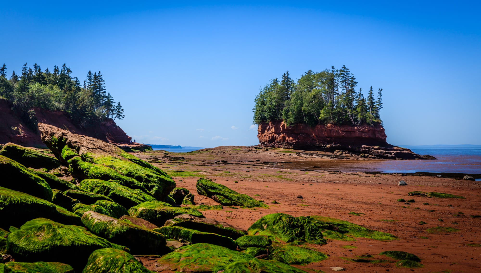
The bay's shape finishes the job. It narrows and shallows towards its head, squeezing the incoming water into less and less space, so it has to rise higher. At Burntcoat Head, near the far end, the difference between high and low water averages around 12 metres, and on the biggest spring tides it has been measured at 16.3 metres (53 feet). Ungava Bay, off Arctic Quebec, comes within a hair of that at the extremes, but Fundy has the larger average range.
A small pull from the Moon
Tides happen because the Moon's gravity, and to a lesser degree the Sun's, pulls unevenly on different parts of the Earth. On an imaginary planet with no land and an ocean of even depth, the Moon would raise a tide only about 54 centimetres high. Because the Moon moves along its orbit while the Earth turns, high tides come not every 12 hours but every 12 hours and 25 minutes or so, which is why the tide times shift later each day.
The size of the tide also follows a monthly rhythm. Around new moon and full moon, when the Sun, Moon and Earth line up, the Sun's pull reinforces the Moon's and the range is at its largest: these are the spring tides, which have nothing to do with the season. The highest of all come when a spring tide coincides with the Moon at its closest to the Earth, called a perigean spring tide.
None of this explains Fundy on its own. The real ocean has coasts, shelves and basins, and these can shrink a tide almost to nothing or enlarge it many times over.
A basin that rocks in time
Any enclosed or partly enclosed body of water, from a bath to a bay, has a natural rhythm at which it sloshes from end to end, a standing wave known as a seiche. Its timing depends on the length and depth of the basin. When outside pushes arrive at that same rhythm, each one adds energy and the motion grows. Oceanographers call this tidal resonance, and the shape of a coastline, the depth of the water and the distance to the edge of the continental shelf all decide how strongly a coast responds.
The Gulf of Maine and the Bay of Fundy fit that pattern almost perfectly. Their shape, depth and distance from the edge of the continental shelf give the whole system a natural rhythm close to the 12-hour-25-minute beat of the Atlantic tide. The ocean nudges the water at just the right moment, twice a day, and the bay's response is enormous. The same effect, less extreme, gives the Bristol Channel between England and Wales some of the largest tides in the world.
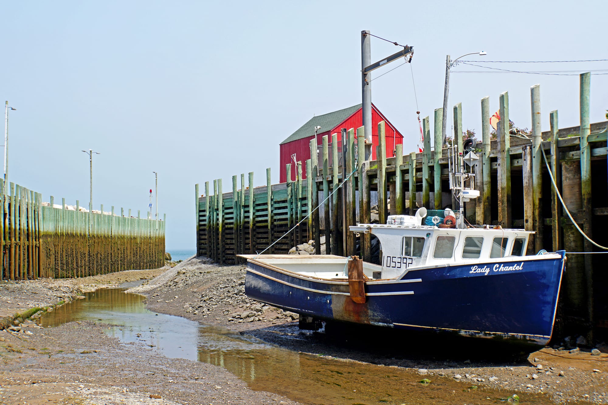
The tall wharf posts and the weed line on them show how far the water climbs at high tide.
The funnel at the end
Resonance makes the tide big; the funnel makes it extreme. The Bay of Fundy narrows as it runs inland and splits at its head into two arms, Chignecto Bay to the north and the Minas Basin to the east, which ends in Cobequid Bay, where Burntcoat Head stands. As the tide pushes into ever narrower and shallower water, the same volume has nowhere to go but up.
The quantities are hard to picture. In one half-day tidal cycle, around 100 billion tonnes of water flows in and out of the bay, about twice the combined flow of all the rivers on Earth over the same time. Off Cape Split, at the entrance to the Minas Basin, currents at mid-tide exceed 8 knots, about 4 metres a second. When the water drains away, wide mudflats lie exposed around the upper bay.
The incoming tide even runs uphill into the rivers. Most rivers that flow into the bay have a tidal bore, a wave at the front of the rising tide that travels upstream against the current. The Petitcodiac River had one of the world's largest, up to two metres high, until a causeway built in 1968 choked it with silt. Since the causeway gates were opened in 2010 the bore has been returning, and in 2013 surfers rode it a record 29 kilometres. At Saint John, the tide forces the Saint John River backwards through a narrow gorge at the Reversing Falls.
A close race with Ungava Bay
Fundy's crown is real, but narrow. The largest mean tidal range anywhere, 11.7 metres, is at Burntcoat Head; second comes Ungava Bay, off Arctic Quebec, at 9.75 metres, then the Bristol Channel at 9.6. At the extremes the gap almost closes. Measurements at Burntcoat Head in November 1998 recorded a maximum range of 16.3 metres, with a highest predicted extreme of 17 metres. At Leaf Basin in Ungava Bay in March 2002, the figures were 16.2 metres and 16.8 metres, only 20 centimetres short and within the margin of measurement error, and Canada's hydrographers have treated the two as a statistical tie. In 2025 Makivvik, the organisation representing the Inuit of Nunavik, reported new measurements at Leaf Basin that it says beat Burntcoat Head, and sent them to the Canadian Hydrographic Service for review. Both lie at similar distances from the edge of the continental shelf, but Ungava Bay is free of pack ice for only about four months a year, while Fundy rarely freezes.
The highest water ever recorded in the Bay of Fundy, 21.6 metres, came in October 1869, when the Saxby Gale, a tropical cyclone, drove a two-metre storm surge into the bay on top of a perigean spring tide. Waves broke through the dykes protecting farmland in the Minas Basin and the Tantramar Marshes and flooded far inland.
The Mi'kmaq, who have lived around the bay for centuries, have their own explanation: in one of their stories the tide was created when Glooscap wanted to take a bath.
Seeing the tide today
The tide is easiest to grasp at places where it uncovers the seabed. At the Hopewell Rocks in New Brunswick, sea stacks 12 to 21 metres tall, carved from red-brown conglomerate and sandstone, stand with their bases under water twice a day; at low tide it is possible to walk on the ocean floor between them. Burntcoat Head Park in Nova Scotia gives public access to the seabed at the spot where the record was measured, and in harbours along the Nova Scotia shore fishing boats sit on the mud at low water.
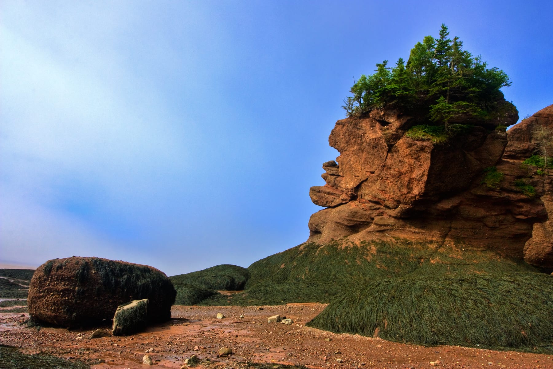
Tides and waves wear away the bases of these rocks faster than their tops, giving them their flowerpot shapes.
High and low water are a little over six hours apart, so a single visit can take in both, and the largest ranges come in the days around new and full moon. The bay is a UNESCO Global Geopark, and its waters draw fin, humpback and minke whales as well as the endangered North Atlantic right whale.