Attractions & Natural Wonders · Sweden
Why is Stockholm built on fourteen islands?
Land still rising after the Ice Age turned a Baltic bay into a lake, and Stockholm was founded on the islets that guard the narrow point where it drains.
By Globeway Editorial · 13 October 2026
The short answer
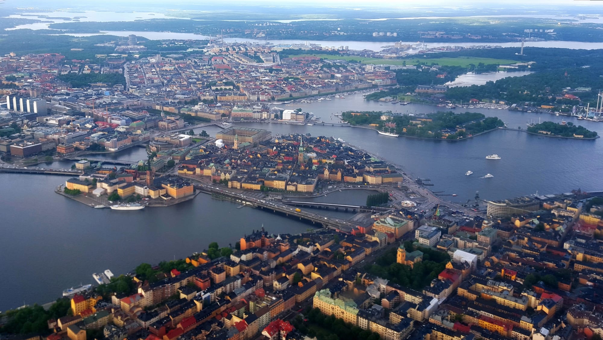
Stockholm sits exactly where Lake Mälaren, Sweden's third-largest lake, drains into the Baltic Sea, and that outlet is crowded with islands. They are there because the land is rising. Under the last Ice Age, Scandinavia was pressed down by ice up to 3 kilometres thick, and since the ice melted the ground has been slowly springing back. Low ridges of rock and glacial gravel that once lay underwater have emerged as islands, and the sea channels between them have narrowed into the short, fast streams that link the lake to the sea.
The city was built on those islands on purpose. By about 1200 the rising land had made the mouth of Mälaren so shallow that ships could no longer sail freely into what had been a bay of the Baltic. Whoever held the islets in the narrow outlet controlled the trade and the defence of the whole Mälaren region, and Stockholm grew up on them from the middle of the 13th century. The city has since spread onto the mainland to the north, south and west, but its central parts still occupy fourteen islands.
A coastline that is still rising
At the end of the last ice age, about 11,000 years ago, ice sheets up to 3 kilometres (about 1.9 miles) thick covered much of northern Europe. Their weight pushed the Earth's crust down. When the ice melted, the land began to rebound, a process geologists call post-glacial rebound. At first the uplift was rapid, about 7.5 centimetres a year, for roughly 2,000 years; then it slowed to about 2.5 centimetres a year and kept slowing. Across the region the total rise since the ice left can reach 400 metres.
It has not stopped. The islands of the Stockholm archipelago are still rising by about three millimetres a year, and studies suggest the rebound will continue for about another 10,000 years. As the land climbs, the coast shifts outward and rocks that were once submerged break the surface.
Ridges, cracks and a lake that used to be the sea
Why islands rather than a smooth coast? Stockholm lies in what geologists call a joint valley landscape: erosion along cracks in the bedrock has carved valleys, leaving small plateaus and ridges between them. As the land rose, the higher blocks emerged while the valleys between them stayed under water. One of the city's main landforms is a fault scarp, a steep rock face along a geological fault, that runs along the heights of Skinnarviksberget and Stadsgården.
The other is the Stockholm esker, a ridge of glacial gravel about 60 kilometres long. It runs past Arlanda airport, through the old town and on towards Södermalm, and together with the fault scarp it gives the city most of its shape. The part on the northern district of Norrmalm, called Brunkebergsåsen, has largely been dug away over the centuries, partly to make way for new streets.
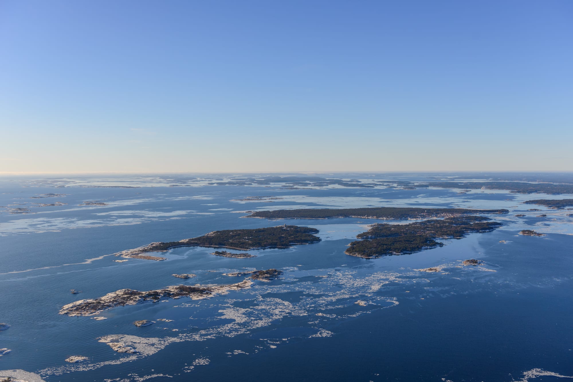
Stockholm's fourteen central islands are really the innermost part of the Stockholm archipelago, which stretches about 60 kilometres east of the city and counts slightly over 24,000 islands, islets and skerries, all of them still being lifted by the same rebound.
The uplift also changed Mälaren itself. In the Viking Age the lake was still a bay of the Baltic, and seagoing ships could sail far into the interior of Sweden; the Viking trading town of Birka stood on one of its islands. By about 1200 the entrances had become so shallow that ships had to unload near the mouth, and the bay gradually became a freshwater lake. Its surface now lies on average only about 0.7 metres above sea level.
Founding a city on a choke point
The islets in the outlet had become large enough by the 900s to support a permanent fishing settlement. Logs found on Helgeandsholmen, one of the islets, were cut down between 970 and 1020, according to tree-ring dating, and they may explain the city's name: Stockholm is usually taken to mean "log islet". Its earliest written mention dates from 1252, in a letter of the statesman Birger Jarl, who is traditionally regarded as its founder.
According to the medieval Erik's Chronicle, the city was founded to protect Sweden from sea raids after Karelian raiders sacked Sigtuna, a town on Mälaren, in 1187. A fortress built around the islet barred the way to the lake, turning the narrow outlet into a lock on the whole Mälaren region. Stockholm also became the gateway for iron from the mines of Bergslagen, shipped down Mälaren to the coast, and it grew rich on the Baltic trade of the Hanseatic League.
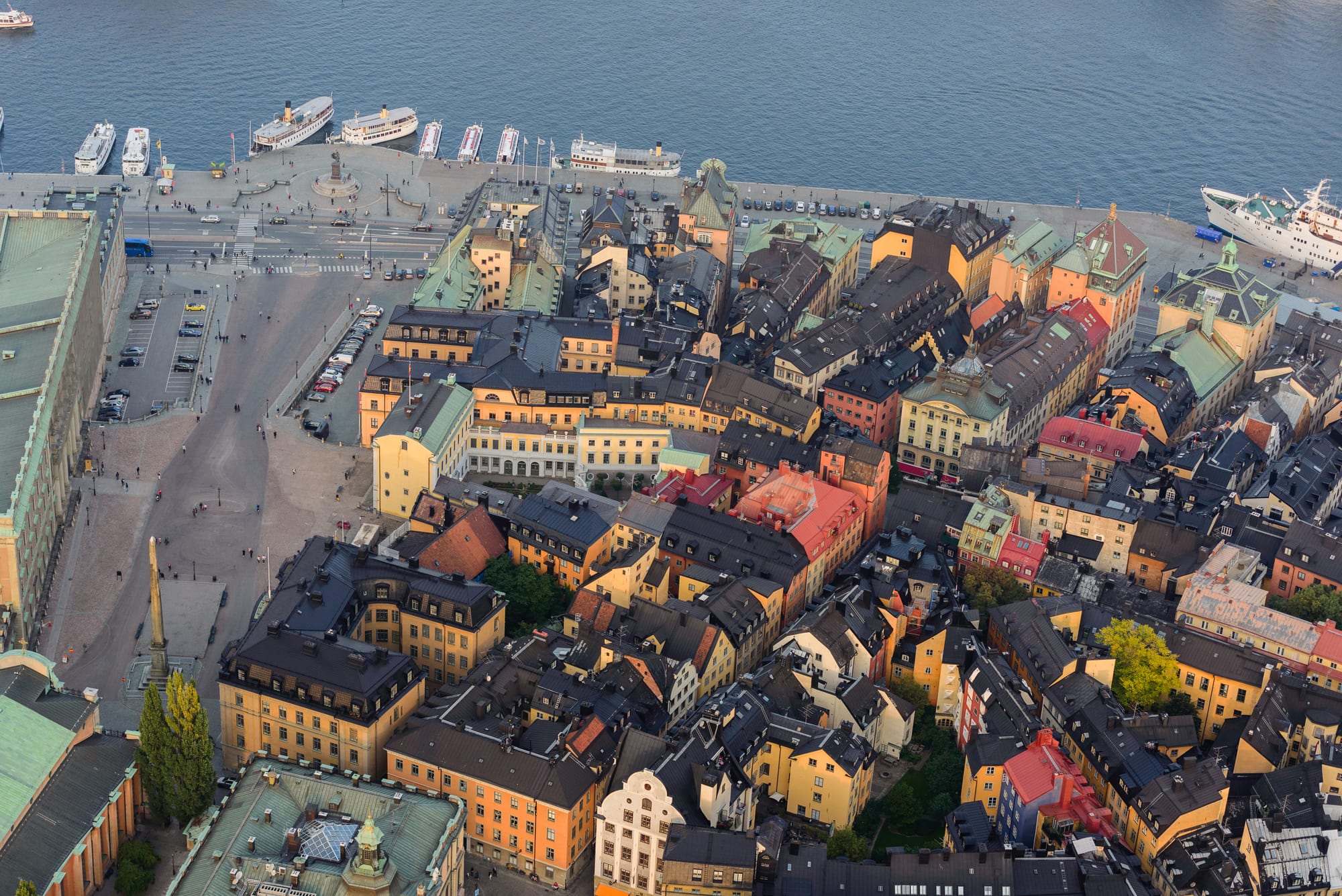
The medieval town occupied the central island, Stadsholmen, inside a city wall. Ships from the Baltic moored on its eastern side, where the quay of Skeppsbron is today, and boats from Mälaren on the western side. As the town grew crowded in the 14th century, people built on the shores and filled in the water between jetties, which created the long, narrow blocks and alleys of today's old town.
Living between a lake and the sea
The city spread from its first island to the ridges north and south, Norrmalm and Södermalm, and then onto neighbouring islands such as Kungsholmen, in Mälaren, and Djurgården, whose name means the royal animal park. In 1929 the Danvik Canal, on the eastern edge of Södermalm, opened a second shipping route between Mälaren and the sea. More than 30 per cent of the city's area is water, and the many channels make every new motorway an expensive system of bridges and tunnels.
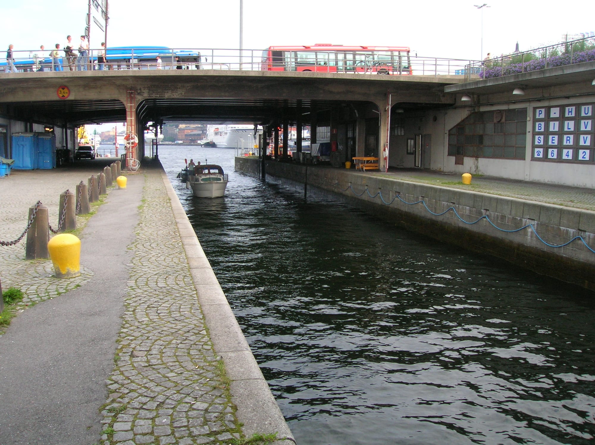
Because Mälaren normally sits higher than the Baltic, water runs out of it through two natural channels on either side of the old town: Norrström to the north, one of the shortest rivers in Europe, and Söderström to the south. A lock at Slussen, between the old town and Södermalm, has let boats pass from lake to sea since 1642, and the area has been rebuilt since 2016 with new channels to regulate the water level.
The water in the city centre is clean enough for people to dive and fish in. Sea trout and salmon spawn in central Stockholm, and Norrström is a popular spot for anglers.