History · Iran
Why was Isfahan called half the world?
Shah Abbas rebuilt Isfahan as a dazzling imperial capital around 1600, and its proud citizens boasted that it held half the world's wonders.
By Globeway Editorial · 13 October 2026
The short answer
"Esfahān nesf-e jahān ast", Isfahan is half the world, is an old Persian boast that plays on the sound of the city's name. It grew out of the city's fame in the 17th century, when Shah Abbas the Great of the Safavid dynasty made Isfahan his capital in 1598 and rebuilt it into one of the largest and most splendid cities of its age.
The saying meant that whatever the world had to offer could be found in Isfahan: a vast royal square, tiled mosques and palaces, gardens and bridges, and merchants, craftsmen and envoys from Armenia, Georgia, India, China and Europe. Its people were so proud of what they had built that they claimed to live in half of everything worth seeing.
A capital moved to the centre
Isfahan was already ancient when Abbas arrived. It had been a regional centre under the Medes, the capital of the Seljuk Turks in the 11th century, and lay where Iran's two main routes, north to south and east to west, cross. What it had not been for centuries was the seat of an empire.
Abbas moved his court there from Qazvin, in the north-west, in 1598. The new site was an oasis of intense farming on the Zayanderud, "the life-giving river", in the middle of an arid plateau. It put the capital further from the armies of the Ottomans and the Uzbeks, the Safavids' great rivals, and closer to the Persian Gulf, where the Dutch and English East India companies had recently made trade routes. The move was also political. Abbas wanted to weaken the military chiefs and provincial governors who had competed for power before him, and a grand new capital built around his own household was a way of drawing everything to the centre.
The square that was an image of the world
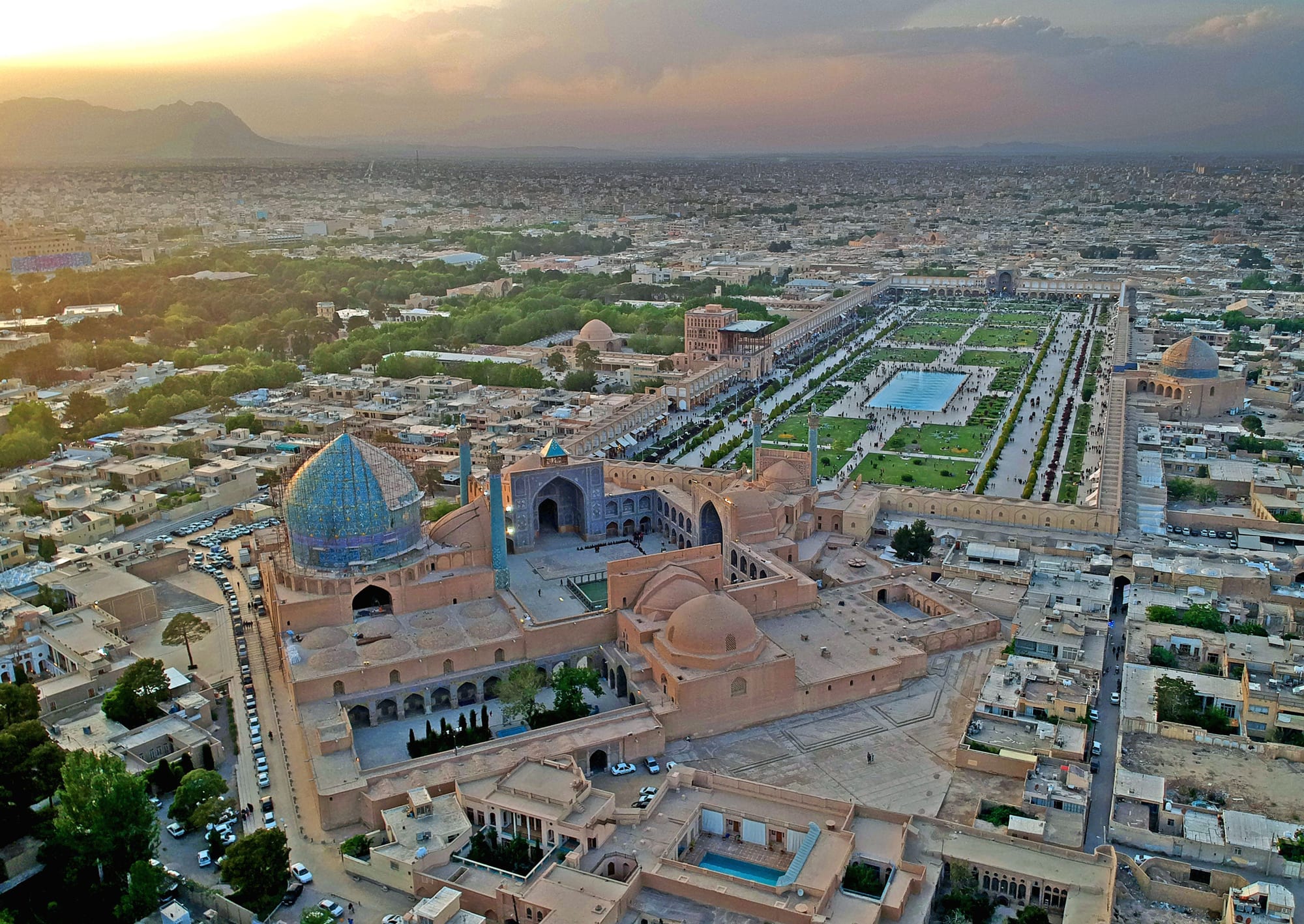
The chief planner, the scholar Shaykh Bahai, built the new city around two features: a long tree-lined avenue, the Chahar Bagh, where foreign dignitaries had their residences, and a vast royal square. The square's name, Naqsh-e Jahan, means "Image of the World". Laid out between 1598 and 1629, it measures 160 by 560 metres (about 520 by 1,840 feet).
The design gathered the three powers of the state on its four sides. To the south stood the Shah Mosque, for the clergy. To the north a gate led into the Grand Bazaar, for the merchants. On the west side, the Ali Qapu palace was the shah's own gateway, and from its upper galleries the rulers watched polo, horse races and military displays on the square below. Opposite it rose the smaller Sheikh Lotfollah Mosque.
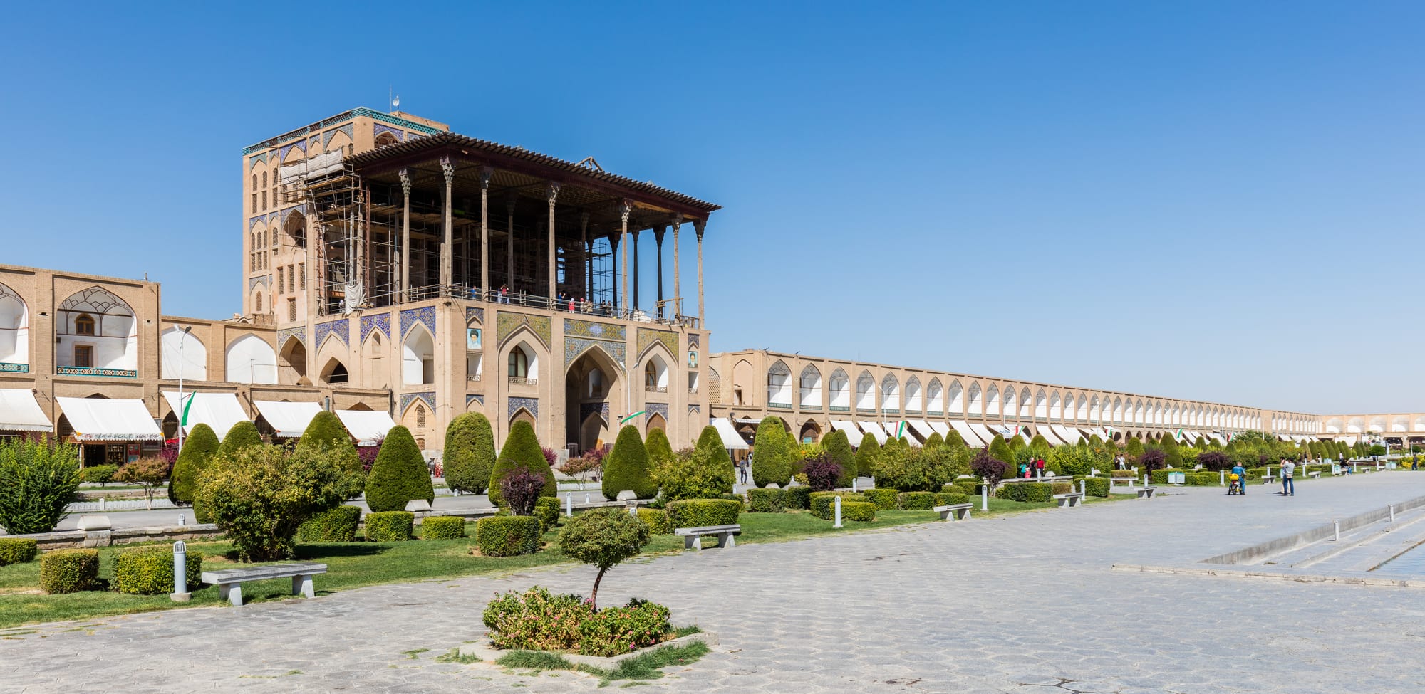
By day the square was crowded with traders' tents and stalls, food sellers and coffee-houses at the bazaar entrance. At dusk the shopkeepers packed up and the space was taken over by dervishes, jugglers, puppeteers and acrobats. At Nowruz, the Persian New Year, it was cleared for public celebrations. The Italian traveller Pietro Della Valle, who saw it nearly finished in 1617, judged it superior to anything in Constantinople or Christian Europe, and ranked it above the Piazza Navona in Rome.
Mosques of tile and light
The buildings around the square are among the masterpieces of Persian architecture. The Shah Mosque, begun in 1611 and completed around 1630, carries a dome 52 metres (171 feet) high. Because the square does not face Mecca, the mosque's entrance makes a half-turn so that its prayer hall does, and the angle also keeps the great dome in view from anywhere in the square.
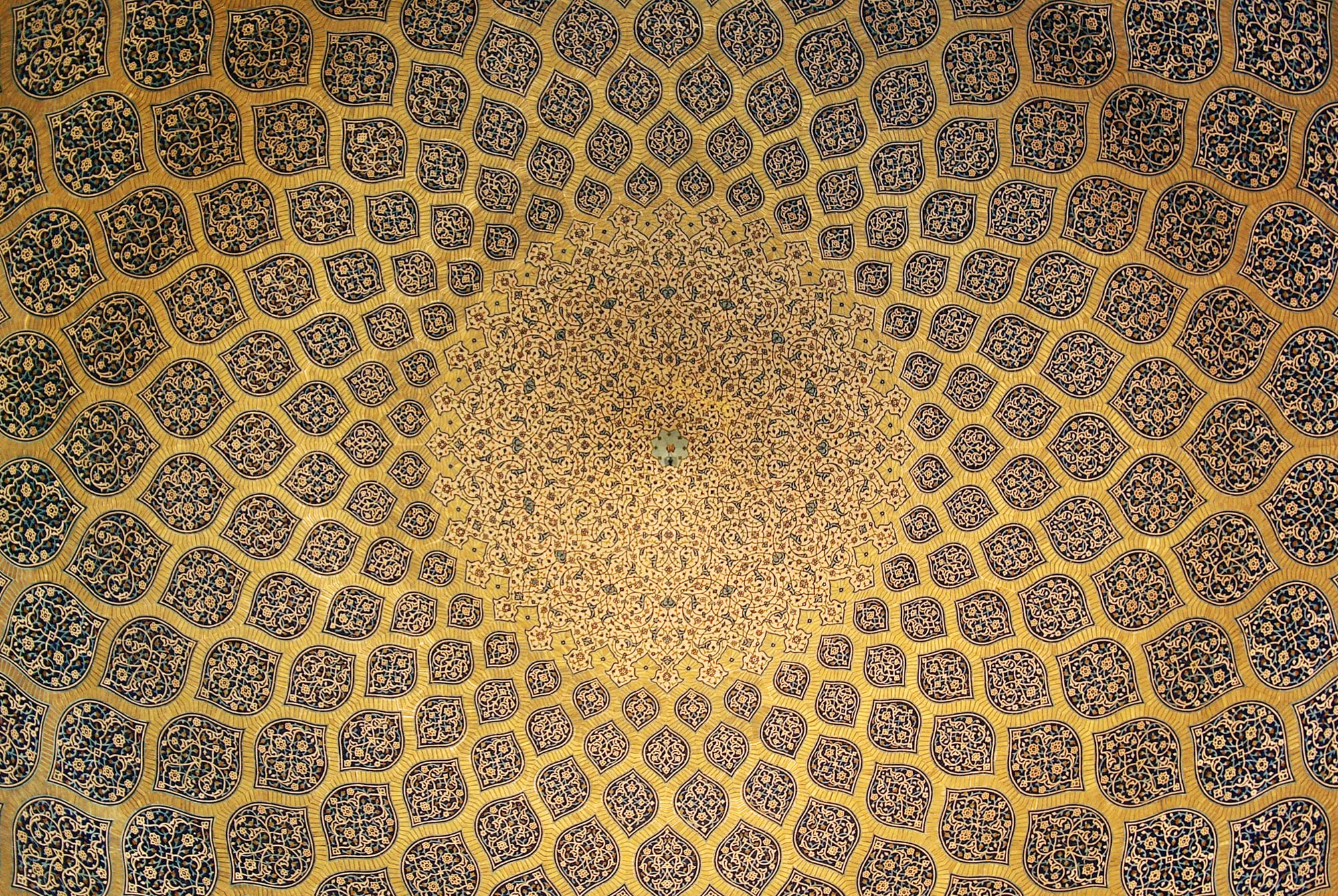
The Sheikh Lotfollah Mosque, built between about 1603 and 1619, has no minarets and is much smaller because it was meant to be private to the royal court rather than open to the public. Inside, its dome is a net of lemon-shaped tiled panels that shrink as they rise towards a stylised peacock at the summit.
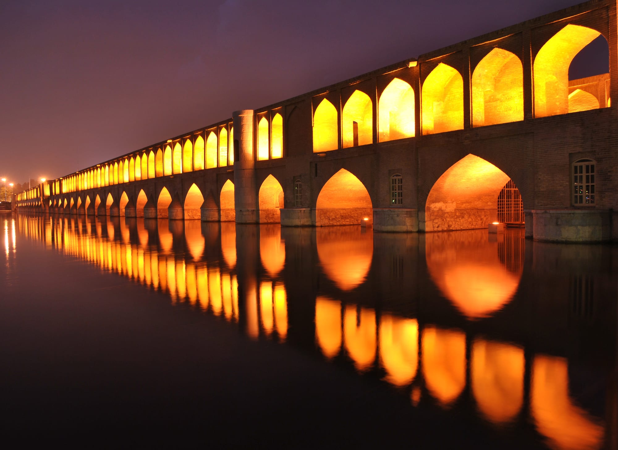
Down by the river, the Allahverdi Khan Bridge, popularly Si-o-se-pol, "the bridge of thirty-three spans", was built in the early 17th century as both a crossing and a dam. It is the largest of the eleven historic bridges on the Zayanderud.
Half the world came to live there
The other half of the boast was people. Under Abbas, Isfahan became a cosmopolitan city of Turks, Georgians, Armenians, Indians, Chinese and a growing number of Europeans. Indian merchants and money-changers filled caravanserais set aside for them. Abbas brought in some 300 Chinese artisans to work in the royal workshops and teach porcelain-making. Europeans arrived as merchants, Catholic missionaries, artists and even artillery experts, and travellers such as the Frenchman Jean Chardin, who reached the city in 1673 and stayed four years, made it famous in Europe.
Much of this was forced. To protect his north-western frontier from the Ottomans, Abbas uprooted as many as 300,000 Armenians from their homeland, and thousands died on the march. Many were settled in New Julfa, a new quarter across the river from Isfahan, where they were given a cathedral, religious freedom, interest-free loans and their own mayor, because Abbas wanted their silk-trading networks to enrich his treasury. New Julfa is still one of the largest Armenian quarters in the world.
After the golden age
The splendour lasted about a century. In 1722 an Afghan army led by Mahmud Hotak besieged Isfahan from March to October; famine set in, and the shah surrendered the city and abdicated, the beginning of the end of the Safavid dynasty. The capital later moved to Mashhad, then Shiraz, and in 1775 to Tehran.
Isfahan never regained its old rank, but it remains Iran's third-largest city, with about 2.2 million people, and Naqsh-e Jahan Square is a UNESCO World Heritage Site. During the war that began in February 2026, strikes on the city on 9 March damaged the square, the Shah Mosque and the Ali Qapu palace, among other historic buildings.