Attractions & Natural Wonders · United States
How did the Grand Canyon form?
Layers laid down over nearly two billion years were lifted thousands of feet, then the Colorado River sliced through them, mostly in the last six million years.
By Globeway Editorial · 13 October 2026
The short answer
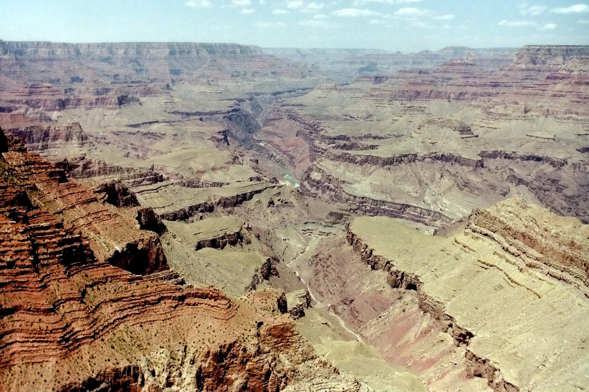
The Grand Canyon was made in two great stages. First, over nearly two billion years, layer upon layer of rock built up in this part of North America, much of it on the floors of warm, shallow seas and some of it as desert sand dunes. Then, starting about 65 million years ago, the whole region, now called the Colorado Plateau, was pushed up by 5,000 to 10,000 feet (1,500 to 3,000 metres). A river flowing across a rising plateau runs faster and steeper, and it cuts down into the rock beneath it.
That river is the Colorado. Most geologists think it took its present course through the area about 5 to 6 million years ago, and since then it has sliced down through the stacked layers while side streams, floods and rockfalls widened the gorge. The result is 277 miles (446 kilometres) long, up to 18 miles (29 kilometres) wide and more than a mile deep. Some researchers argue that parts of the canyon are far older, and that debate is not settled.
A two-billion-year stack of rock
The canyon walls are a record of ancient landscapes. At the very bottom, in the Inner Gorge, lies the Vishnu Schist and related rocks, formed between about 1.75 and 1.73 billion years ago when sediments on an ancient sea floor were squeezed, heated and welded onto the edge of the continent. Above them come the tilted beds of the Grand Canyon Supergroup, laid down between about 1.2 billion and 740 million years ago.
Higher still lie nearly 40 major sedimentary layers, the near-horizontal bands that give the canyon its striped look. Most were deposited in warm, shallow seas or along old coastlines. The Redwall Limestone is full of fossil sea creatures, from corals to trilobites. The pale Coconino Sandstone, near the rim, formed about 275 million years ago when sand dunes spread across a growing desert. The rim itself is the Kaibab Limestone, about 270 million years old.
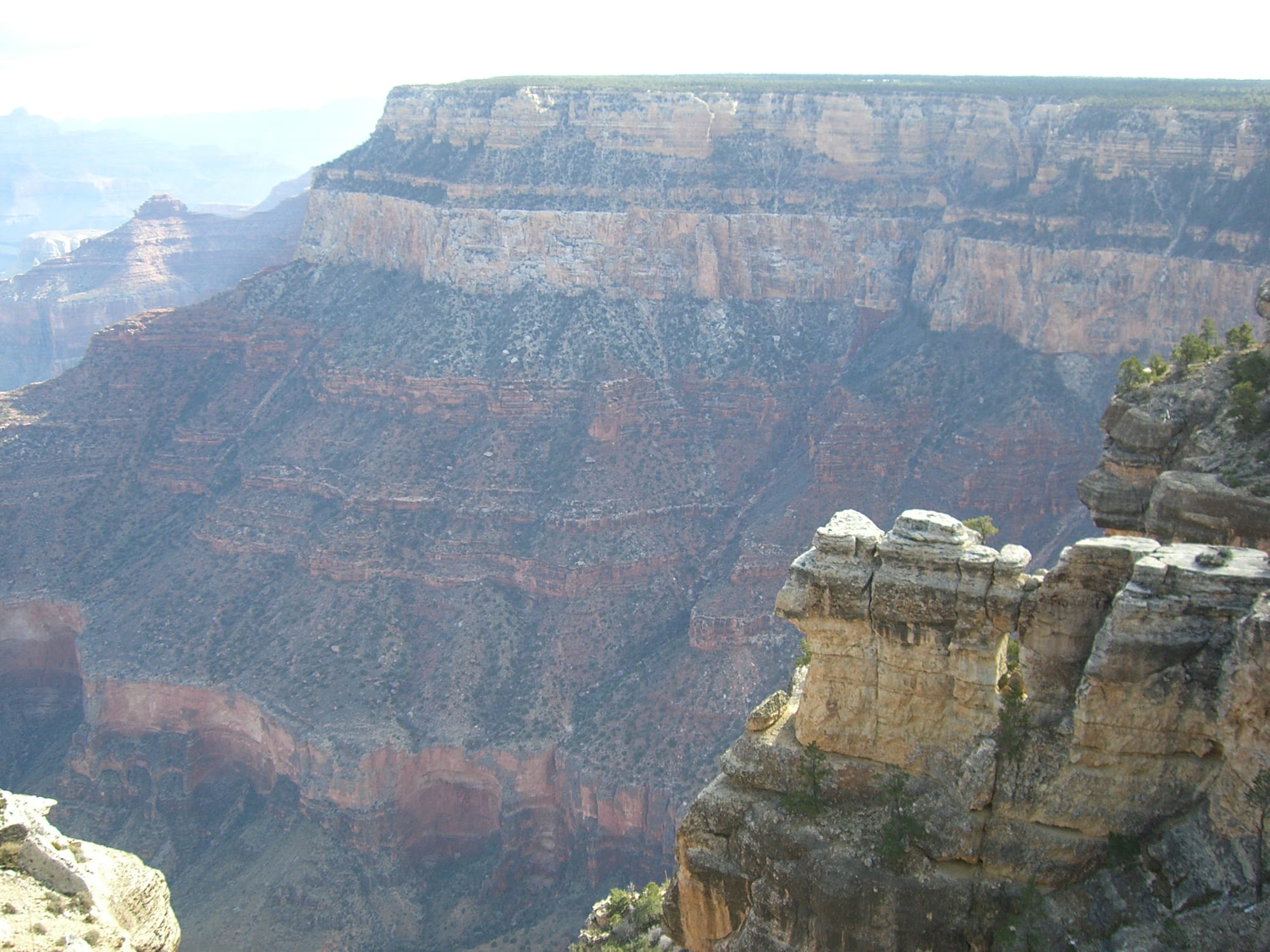
Hard layers such as limestone and sandstone stand up as cliffs; softer shales erode into slopes. That alternation is what gives the canyon its stepped profile.
The stack is not complete. In places, whole chapters of time are missing, eroded away before the next layer was laid down. The most dramatic gap, the Great Unconformity, was noticed by the explorer John Wesley Powell in 1869. Where the Tapeats Sandstone rests directly on the Vishnu rocks, as much as 1.2 to 1.6 billion years of history is simply absent.
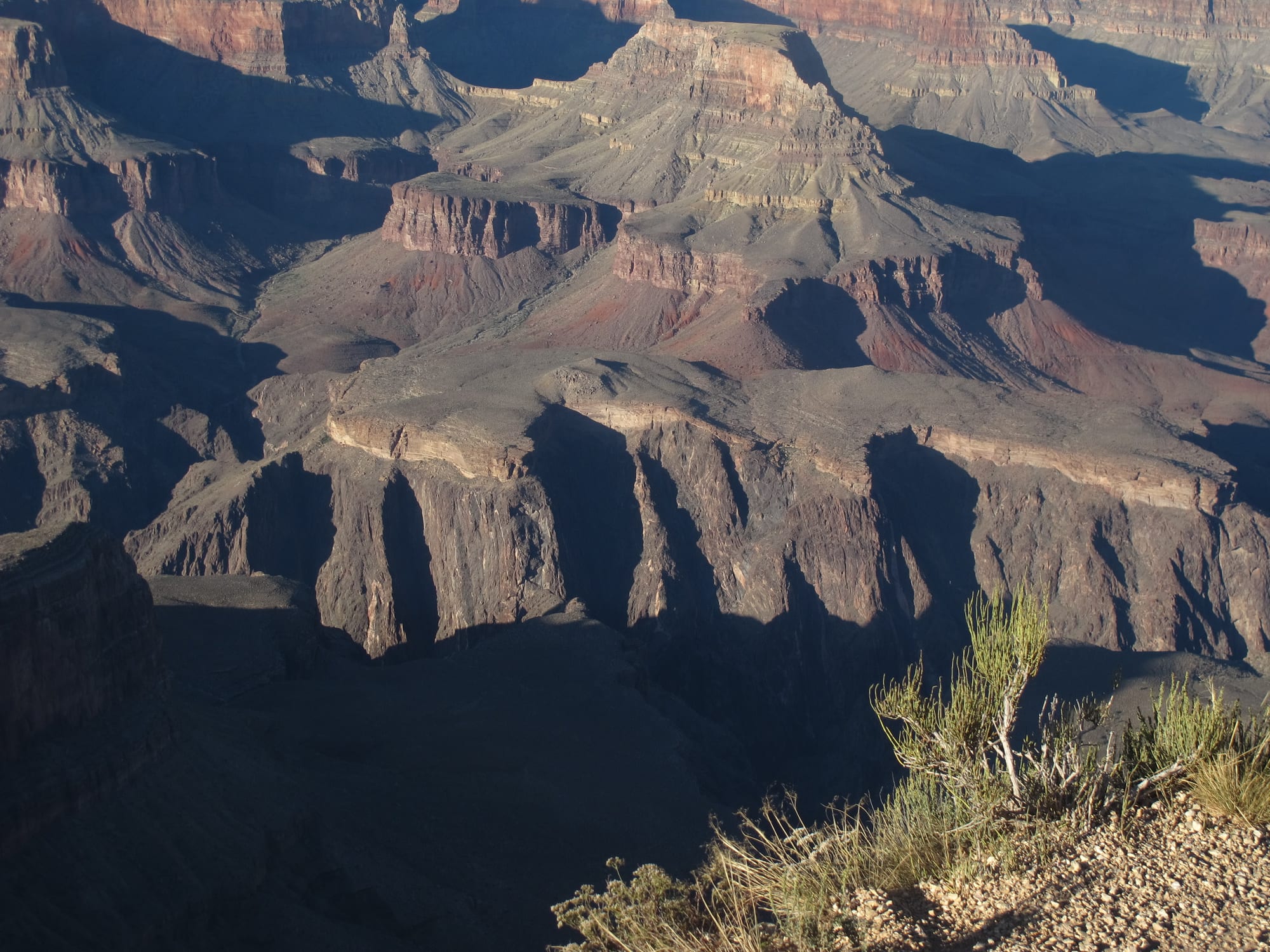
The line between the dark lower rock and the pale ledge above marks a gap in the record of more than a billion years.
Lifting the plateau
Most of these rocks formed below sea level. Today the North Rim averages about 8,000 feet (2,400 metres) above it. The difference is uplift. Starting about 65 million years ago, during a period of mountain building called the Laramide orogeny, the Colorado Plateau was raised by 5,000 to 10,000 feet.
Uplift was the canyon's engine. As the land rose, the rivers flowing across it became steeper, which made them faster and more able to cut through rock. The rise was also uneven: the Kaibab Plateau, which the canyon slices through, is more than 1,000 feet (300 metres) higher on the North Rim than on the South Rim. As a result the side canyons on the north side are deeper and longer, while those on the south side are shorter and steeper.
A river finds its way
Exactly how the Colorado River came to flow through the plateau is one of geology's longest-running puzzles, debated for more than 150 years. The leading account begins far to the south. About 6 million years ago, the Gulf of California began to open. That lowered the base level, the lowest point a river can cut down to, and allowed a vigorous river to eat its way northeast from the gulf. Between about 5.5 and 5 million years ago, erosion at its head joined up older streams into one major river, and this new river captured the drainage of much of the Colorado Plateau. How that capture happened is not known; ideas include erosion working backwards upstream, or the bursting of a natural dam holding back a lake.
Once the river was connected to the sea, erosion sped up. Wetter climates during the ice ages, beginning around 2 million years ago, sent more water down the river, and the canyon was nearly as deep as it is today by about 1.2 million years ago.
Building the Grand Canyon
- 1.75–1.73 billion years ago
The Vishnu Schist and related rocks form at the base of the future canyon.
- 1.2 billion–740 million years ago
The Grand Canyon Supergroup is laid down in a shallow sea.
- About 275 million years ago
Desert dunes form the Coconino Sandstone.
- About 270 million years ago
The Kaibab Limestone, today's rim rock, is deposited.
- From about 65 million years ago
The Colorado Plateau begins to rise by 5,000 to 10,000 feet.
- About 6 million years ago
The Gulf of California opens, giving rivers a new low outlet.
- 5.5–5 million years ago
Streams join into the ancestral Colorado River.
- By 1.2 million years ago
The canyon is nearly as deep as it is today.
Young canyon or old?
Not everyone accepts the 5 to 6 million-year story. In 2008 the researcher Victor Polyak dated caves near the canyon and placed their origin about 17 million years ago. The same year Rebecca Flowers reported evidence, from minerals that record when rocks cooled as they neared the surface, that parts of the canyon had been cut close to their present depth around 20 million years ago. In a 2012 study in the journal Science she suggested that the western part could be as old as 70 million years.
One way to reconcile the evidence is to see the canyon as several older canyons joined together. One study divides it into segments: a central section called the Hurricane segment formed 50 to 70 million years ago, the eastern Grand Canyon was cut 15 to 25 million years ago, and only Marble Canyon and the westernmost stretch were carved in the last 5 to 6 million years. On this view, the young Colorado River did not dig the whole canyon alone but linked and deepened stretches of valley that already existed.
Fire, floods and a canyon still changing
The canyon has had dramatic interruptions. Between 725,000 and 100,000 years ago, more than 150 flows of basalt lava from volcanoes in the western canyon dammed the Colorado River at least 13 times.
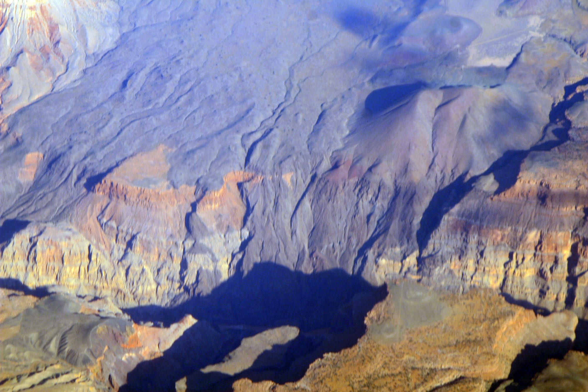
Lava from this field poured into the canyon and repeatedly blocked the river. The river has since cut through every one of the dams.
The canyon is still being shaped, though more slowly. The end of the last ice age brought a drier climate, and human activity, above all the Glen Canyon Dam upstream, has greatly reduced the river's power to dig. The dam traps sediment that the river once carried, and controlled floods have been released to test whether they can rebuild beaches. Meanwhile, an average of two debris flows a year rush out of side canyons into the river, forming or enlarging its rapids. Grand Canyon Village, on the South Rim, grew up around the railway that reached the rim in 1901, and the canyon became a national park in 1919.