Attractions & Natural Wonders · Venezuela
How was Angel Falls discovered?
The Pemon knew it long before outsiders did; explorers reported it from 1910, but a gold-seeking American pilot made it famous and gave it his name.
By Globeway Editorial · 13 October 2026
The short answer
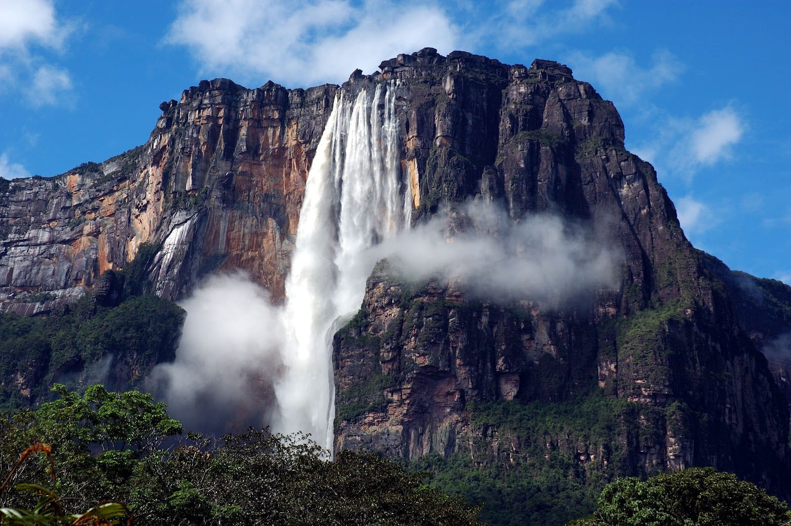
Angel Falls was never discovered in a single moment. The Pemon, the Indigenous people of this corner of south-eastern Venezuela, knew the waterfall long before outsiders did and call it Kerepakupai Vená, "the waterfall of the deepest place". Among outsiders, a Venezuelan naval officer, Ernesto Sánchez La Cruz, is credited in Venezuelan accounts with reporting it in 1910, and the Spanish explorer Fèlix Cardona saw it in 1927.
The falls only became known to the wider world on 16 November 1933, when the American bush pilot Jimmie Angel flew over them while searching for a valuable ore bed. When he returned in 1937 and crash-landed his plane on the mountain above, the story of his escape spread, and the waterfall was named after him. The first documented expedition to reach its foot, and to measure it, came in 1949.
A waterfall the outside world could not see
The falls drop from Auyán-tepui, a vast table-top mountain whose Pemon name means "House of the Gods". Its summit plateau covers about 667 square kilometres and rises to 2,450 metres, ringed by sheer sandstone walls. The water pours from a cleft near the top: 979 metres in all, including an unbroken plunge of 807 metres, a drop nineteen times higher than that of Niagara Falls.
That geography explains why the falls stayed hidden for so long. They lie in isolated jungle, far from roads, on the flank of a mountain walled by cliffs. The Pemon live around the tepuis (from their word for these mountains) and believe them to be home to the Mawari spirits. Auyán-tepui itself was regarded as a dangerous place and was not visited, so although the falls had a Pemon name, there is no convincing evidence that the Pemon had named the smaller streams on the summit.
Older European claims are weak. Walter Raleigh, hunting for the golden city of El Dorado in the 1590s, described what may have been a tepui, but the idea that he saw the falls is considered far-fetched.
Surveyors and explorers before the pilot
The first documented report by an outsider dates, in Venezuelan accounts, to
- Ernesto Sánchez La Cruz, a lieutenant in the Venezuelan navy on an
exploring mission, described a waterfall "that seemed to come out of the sky", drew a sketch and wrote up the area.
Seventeen years later, in 1927, Fèlix Cardona, a Catalan explorer who had trained at the nautical school in Barcelona, travelled up the Caroní River with his companion Joan Maria Mundó i Freixas until they reached Auyán-tepui and saw the falls. Cardona went on to help map this part of Venezuela, and Spanish-language accounts credit his articles and maps with drawing Jimmie Angel to the area. Some of these accounts go further, crediting Cardona with finding the falls, a discovery they say is often wrongly attributed to Angel.
Jimmie Angel's flight and fall
James Crawford Angel, known as Jimmie, was born in Missouri in 1899 and became a bush pilot. On 16 November 1933 he flew over the falls while looking for a valuable ore bed, and the sight brought him back.
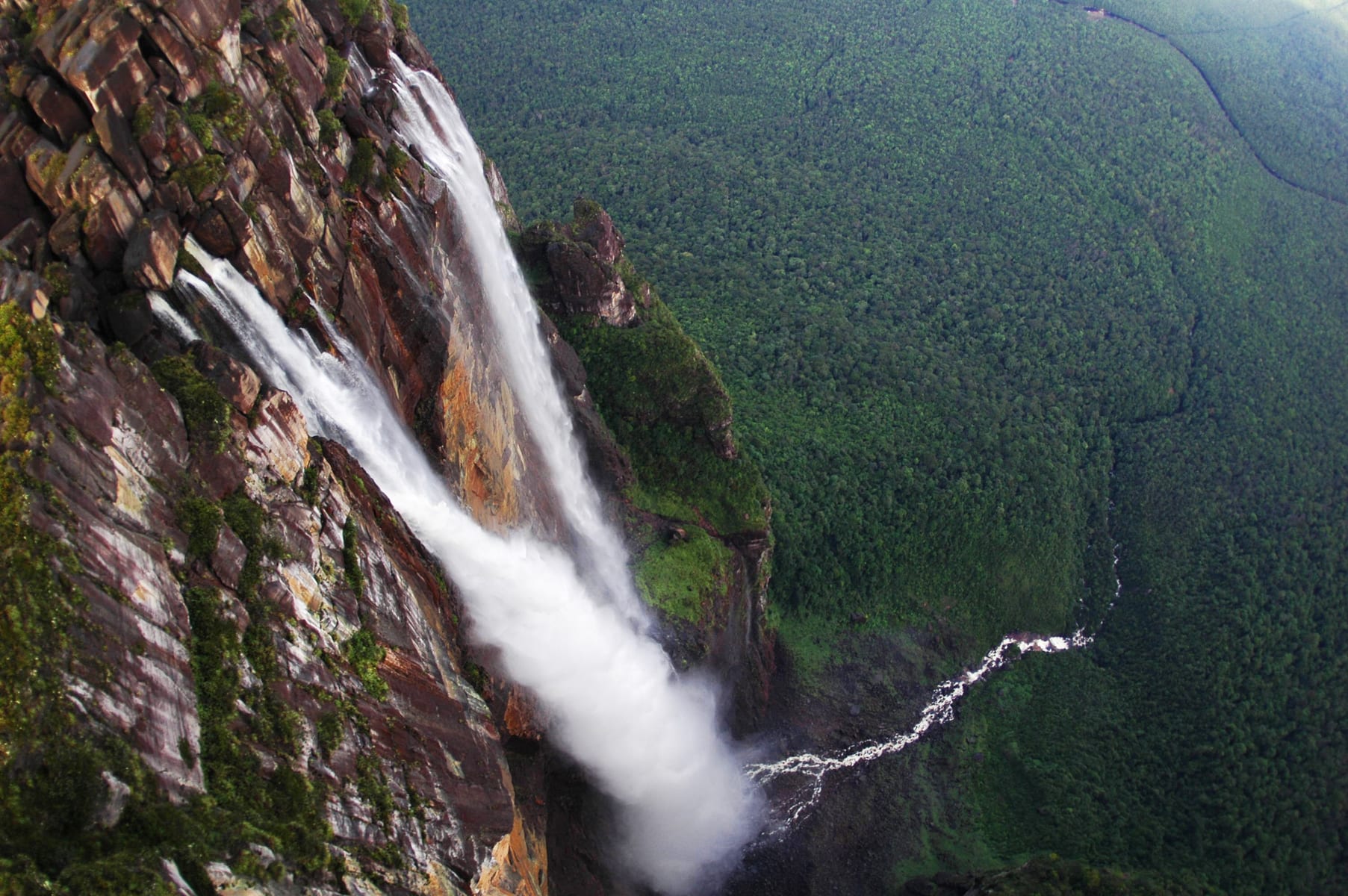
From above, the falls can be seen to pour into a gorge before running on through the forest towards the Churún River.
In 1937 Cardona flew with Angel over the falls. Then, on 9 October 1937, Angel set out to land on top of Auyán-tepui in his Flamingo monoplane, El Río Caroní. On board were his wife Marie, Gustavo Heny and Heny's gardener, Miguel Delgado. The touchdown went well, but at the end of the run the wheels sank into marshy ground and the plane nosed into the mud. Nobody was hurt, but take-off was impossible.
The four walked off the mountain. With little food, they picked their way across the plateau and down its gently sloping back side, reaching the settlement of Kamarata after 11 days. When word of the adventure spread, international interest in the Gran Sabana region grew sharply, and scientific expeditions followed in the years after. The name "Salto del Ángel" first appeared on a Venezuelan government map in December 1939.
Reaching the foot of the falls
Flying over the falls was one thing; reaching them on the ground was harder. The Latvian explorer Aleksandrs Laime, who settled at Canaima in 1942, is recorded as reaching the base of the falls alone in 1946. The first documented expedition to get there was organised by the American photojournalist Ruth Robertson. Setting out on 23 April 1949 with Laime and ten Kamarakoto Pemon, her team travelled up the Churún River in dugout canoes through heavy rain.
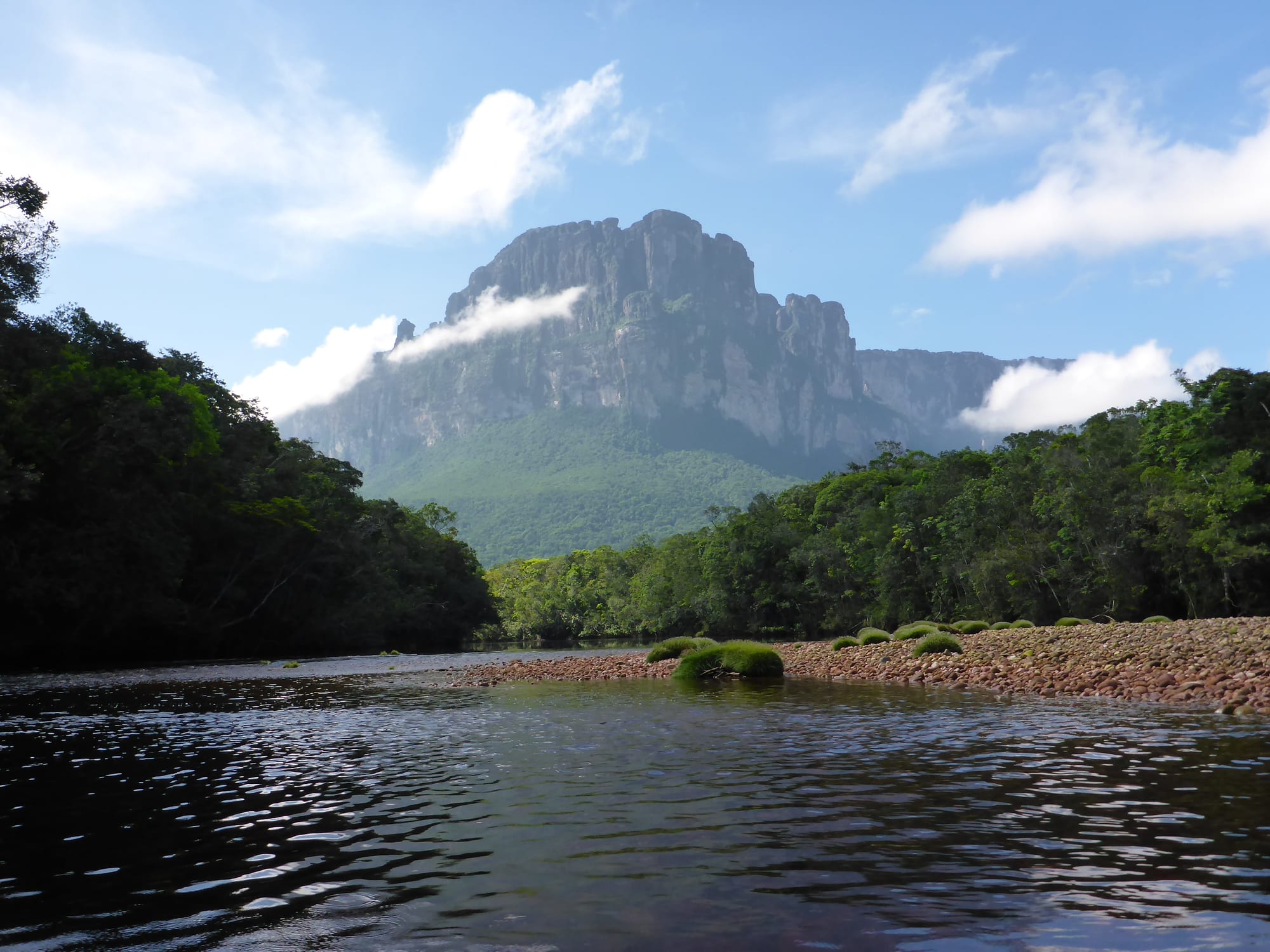
The Churún River runs out of the canyon that cuts into the mountain from the north.
They reached the falls in May, and the survey carried out on 13 May 1949 gave the official height that is still quoted today. Robertson's report appeared in National Geographic that November, under the title "Jungle Journey to the World's Highest Waterfall".
Laime went on to climb the back of the tepui in 1955 and, with his companion Manuel Fiorentino, was the first to reach Angel's abandoned plane, 18 years after the crash. The plane stayed on the summit until 1970, when Venezuelan military helicopters brought it down; restored, it now stands outside the airport at Ciudad Bolívar. Angel himself died in Panama in 1956, and on 2 July 1960 his family scattered his ashes over the falls.
Bringing Angel Falls to the world
- 1910
Ernesto Sánchez La Cruz of the Venezuelan navy reports and sketches the falls.
- 1927
Fèlix Cardona and Joan Maria Mundó see the falls from the Auyán-tepui area.
- 16 November 1933
Jimmie Angel flies over the falls while searching for ore.
- 9 October 1937
Angel's plane bogs down on the summit; the crew walk out in 11 days.
- December 1939
"Salto del Ángel" first appears on a Venezuelan government map.
- May 1949
Ruth Robertson's expedition reaches the foot of the falls and measures them.
- 1955
Aleksandrs Laime reaches Angel's plane on the summit.
- 2 July 1960
Angel's ashes are scattered over the falls.
A name still argued over
The waterfall's name has never quite settled. In 2009 President Hugo Chávez said it should carry its Indigenous name, arguing that the land was Indigenous long before Angel arrived; he later said he would not decree a change, only defend the use of Kerepakupai Vená. Its height claim is debated too: because the measurements of both waterfalls were taken from a distance, there is still uncertainty over whether Angel Falls or South Africa's Tugela Falls is the taller.
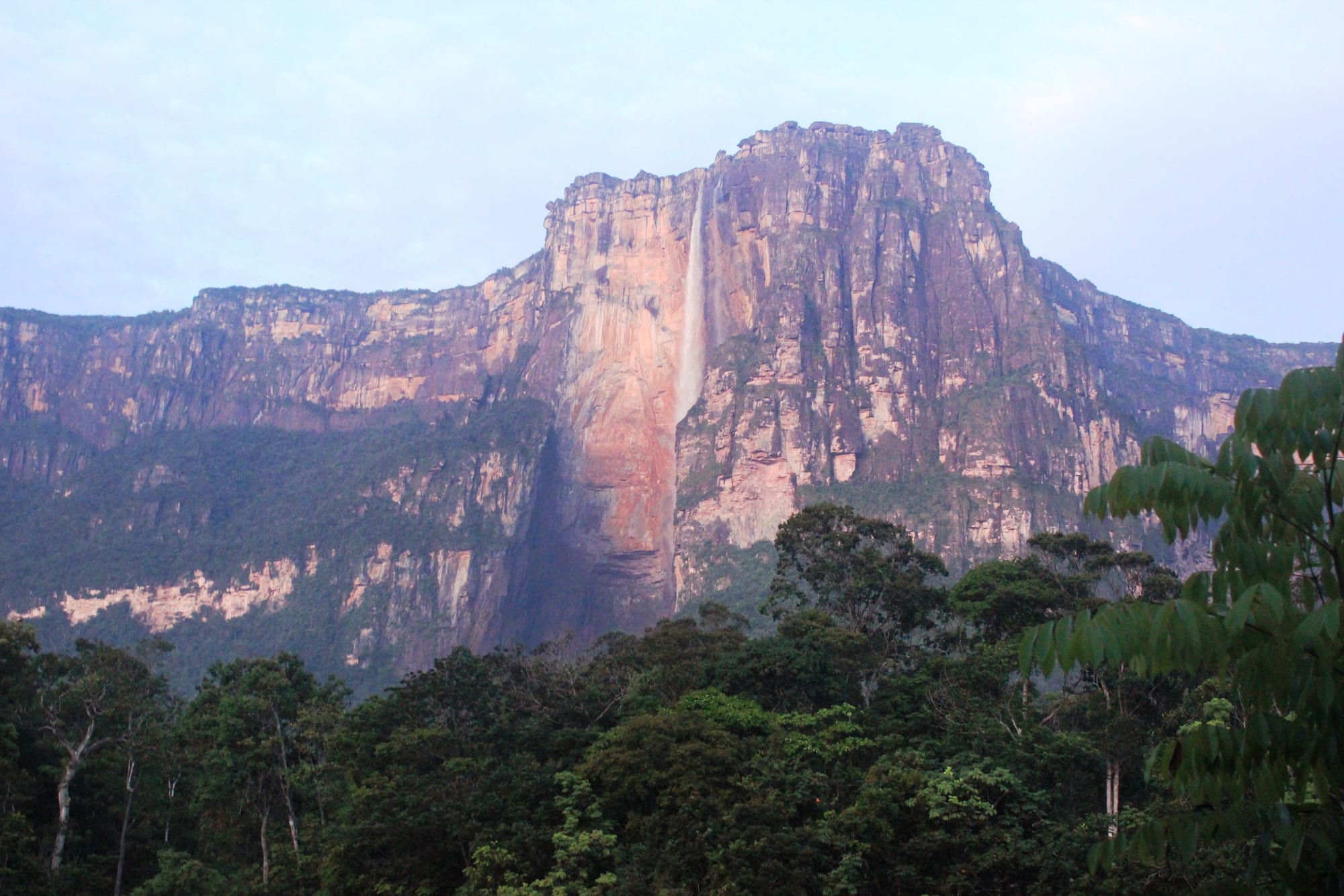
In the dry season the falls carry far less water and thin to a narrow ribbon against the cliff.
Today the falls sit inside Canaima National Park, created in 1962 and named a UNESCO World Heritage Site in 1994. Getting there still echoes the explorers' journeys: a flight to Canaima camp, which Laime helped found, then a river trip by canoe with Pemon guides, and finally the trail Laime cleared to a lookout named Mirador Laime in his honour. River trips usually run from June to December, when the water is deep enough for the canoes; in the dry season, from December to March, far less water goes over the edge.