Attractions & Natural Wonders · Mexico
What do the cenotes of Yucatán have to do with the dinosaurs?
A ring of sinkholes in northern Yucatán traces the buried rim of the Chicxulub crater, left by the asteroid that ended the age of the dinosaurs.
By Globeway Editorial · 13 October 2026
The short answer
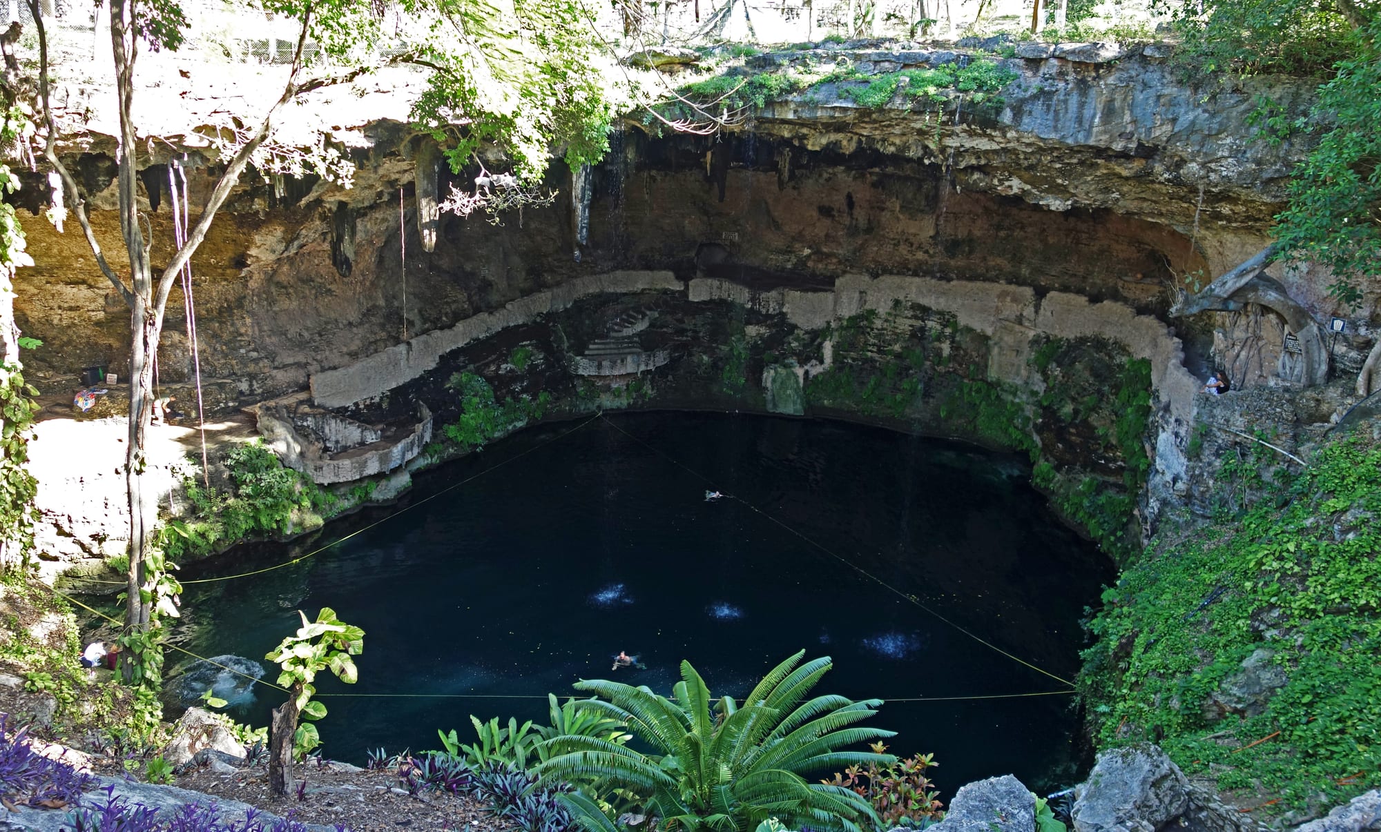
Cenotes are natural wells: sinkholes where the limestone of the Yucatán Peninsula has dissolved and collapsed, opening a window onto the groundwater below. Thousands are scattered across the peninsula, but in the north-west they cluster in a striking arc. That arc sits directly above the buried rim of the Chicxulub crater, the scar left when an asteroid about 10 kilometres (6 miles) wide struck here a little over 66 million years ago. The impact is now widely accepted as the main cause of the mass extinction that wiped out about three-quarters of the plant and animal species on Earth, including all the dinosaurs except the birds.
The cenotes were not made by the impact itself. They formed far later, as rainwater ate into the rock. But the crater fractured the ground in a great circle, and water flowing along that weakened zone has dissolved it faster, so the sinkholes line up along the old rim. The ring of cenotes was one of the clues that helped scientists find the crater in the first place.
How a cenote forms
The Yucatán Peninsula is a low, flat slab of porous limestone. Rain picks up carbon dioxide from the air and soil, forming a weak carbonic acid that slowly dissolves limestone. Instead of running off in rivers, the water sinks into the rock, and the northern part of the peninsula has almost no rivers above ground. Underground, it carves out voids and caves. When the roof of a void grows too thin, it collapses, and a cenote appears: often a round pool tens of metres across with sheer rock walls, though most are smaller and some show no open water at the surface.
There are at least 6,000 cenotes on the peninsula, by some estimates around 10,000. Their water is often startlingly clear, because it is rain that has filtered slowly through the ground. Below it lies a layer of salt water that seeps in from the sea; fresh water floats on top, and the sharp boundary between the two, a halocline, sits 10 to 20 metres below the water table at the coast and 50 to 100 metres down in the middle of the peninsula. Divers passing through it see the water blur.
The day the dinosaurs died
Sixty-six million years ago this part of Yucatán lay under a shallow sea. The asteroid hit water between about 100 and 1,200 metres deep and drove into rock made largely of limestone, dolomite and anhydrite, a sulphur-rich mineral. The crater it left is estimated at 200 kilometres across, now buried about a kilometre beneath younger rock. The blast and the rush of water back into the hole set off megatsunamis more than 100 metres high.
The worst damage came from the sky. Vaporised rock, sulphur and soot from burning oil deposits filled the atmosphere and blocked sunlight from reaching the surface for a decade or longer. Temperatures plunged in an impact winter that halted photosynthesis in plants and plankton, and food chains collapsed. The fallout settled worldwide as a thin layer of clay rich in iridium, a metal rare on Earth but common in asteroids. In 1980 the physicist Luis Alvarez and his son, the geologist Walter Alvarez, with colleagues, reported iridium in this layer at as much as 160 times the normal level, and proposed that an impact had caused the extinction. What they lacked was a crater.
Finding a crater nobody could see
The crater had in fact already been spotted. In the late 1970s the geophysicists Antonio Camargo and Glen Penfield, searching for oil for Mexico's state oil company, Pemex, noticed a circular "bullseye" about 180 kilometres across in magnetic and gravity data. The company put it down to volcanic activity, and the idea stalled. In 1990 Penfield was put in touch with the researcher Alan Hildebrand; old drill samples showed rock altered by the shock of an impact, and in 1991 they published the crater's identification, naming it after the nearby town of Chicxulub Pueblo.
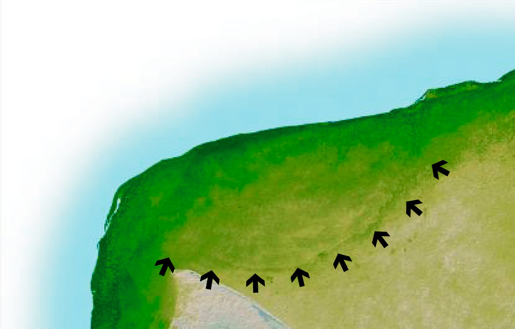
Nothing of the crater is visible on the ground; its outline shows in the line of cenotes that follows the buried rim.
At about the same time, a team of researchers in California studying satellite images found a ring of cenotes centred on Chicxulub Pueblo that matched Penfield's circle. More recent evidence suggests the full crater may be around 300 kilometres wide, with the 180-kilometre ring forming an inner wall. In 2016 a joint British and American drilling expedition recovered the first offshore cores from the crater's peak ring, a ring of high ground raised inside it, and Chicxulub is the only large impact crater on Earth whose peak ring is intact and directly accessible to scientists.
Why the sinkholes form a ring
Geophysical surveys show that the main rim of the crater, with a radius of 70 to 85 kilometres, lines up with both the ring of cenotes on land and a circular change in the strength of gravity. The impact left the buried rock around the rim heavily fractured. Those cracks make it a favoured path for groundwater, which flows through the limestone from a recharge zone in the south towards the coast. More water moving through more cracks means faster dissolving, more caves and more collapses, so the cenotes cluster along the line of the rim.
The pattern is clearest on the southern and western sides. On the eastern side the cenotes are more numerous but scattered at random, because the limestone there is more fractured and permeable everywhere, not just along the rim. In effect, the ring of cenotes is the surface expression of a crater buried a kilometre down, still steering the flow of water 66 million years later.
Water for the Maya
The same sinkholes shaped human history. With almost no rivers in the north, the Maya depended on cenotes for water, and major cities, including Chichén Itzá, were built around them. The Maya believed cenotes were portals to Xibalba, the underworld, and home to the rain god Chaac. At Chichén Itzá, the Sacred Cenote, 60 metres across with sheer walls dropping about 27 metres to the water, was a place of pilgrimage. Both Maya and Spanish accounts say people threw valuables and human beings into it as offerings to Chaac, and 20th century excavations recovered human skeletons and sacrificial objects from its depths.
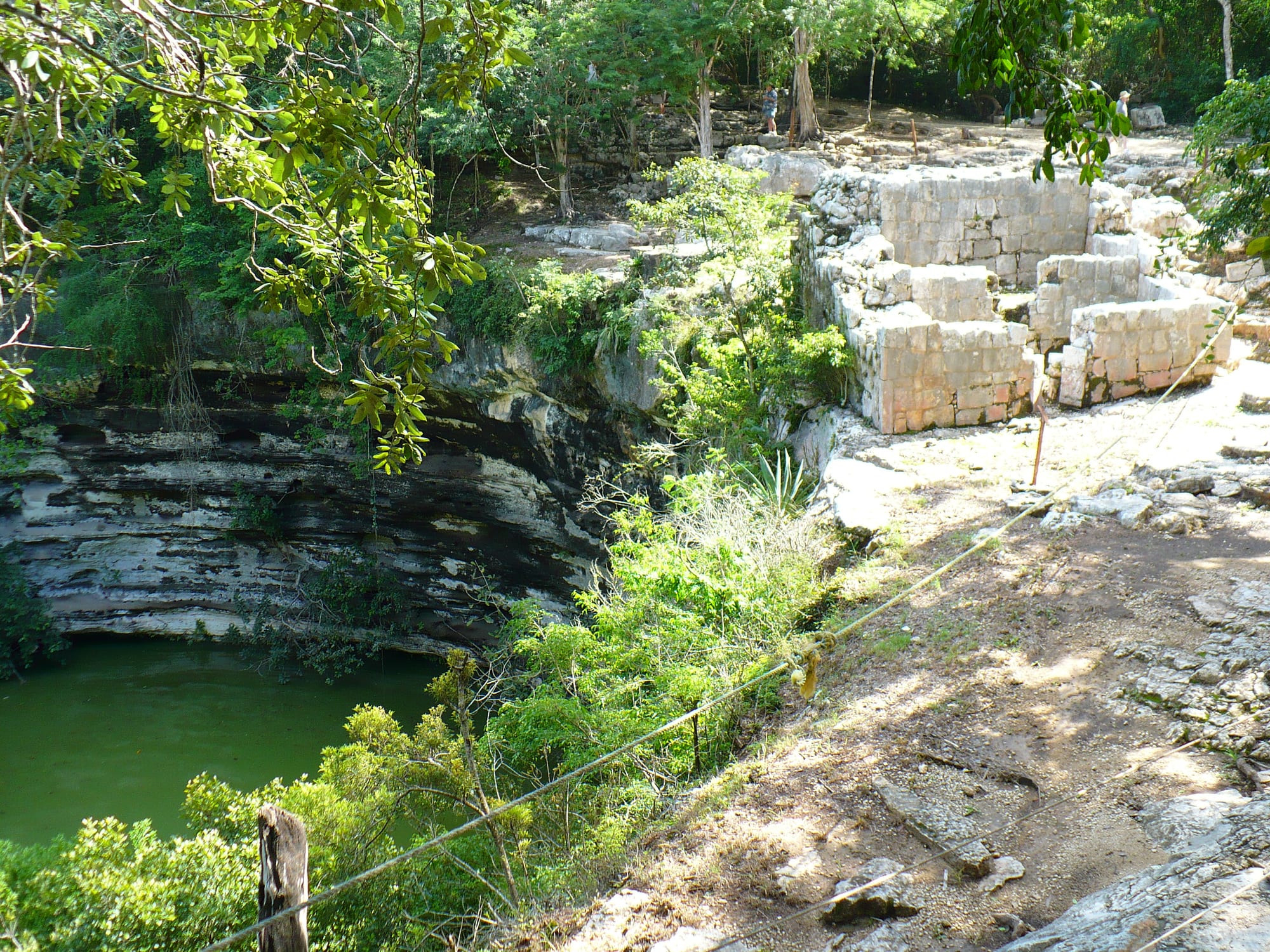
A raised stone causeway about 300 metres long linked this cenote to the ceremonial heart of the city.
Today cenotes are among Yucatán's best-loved places to swim and dive, and divers have mapped vast flooded cave systems under the peninsula. Some are at risk of damage from construction for the new Maya Train. Few of the people floating in their clear water know that they are swimming in the echo of the event that ended the age of the dinosaurs.