Attractions & Natural Wonders · Colombia
Why does a river in Colombia turn red every year?
The water of Caño Cristales stays crystal clear; what turns red is a rare riverweed that carpets its rocky bed for a few months each year.
By Globeway Editorial · 13 October 2026
The short answer
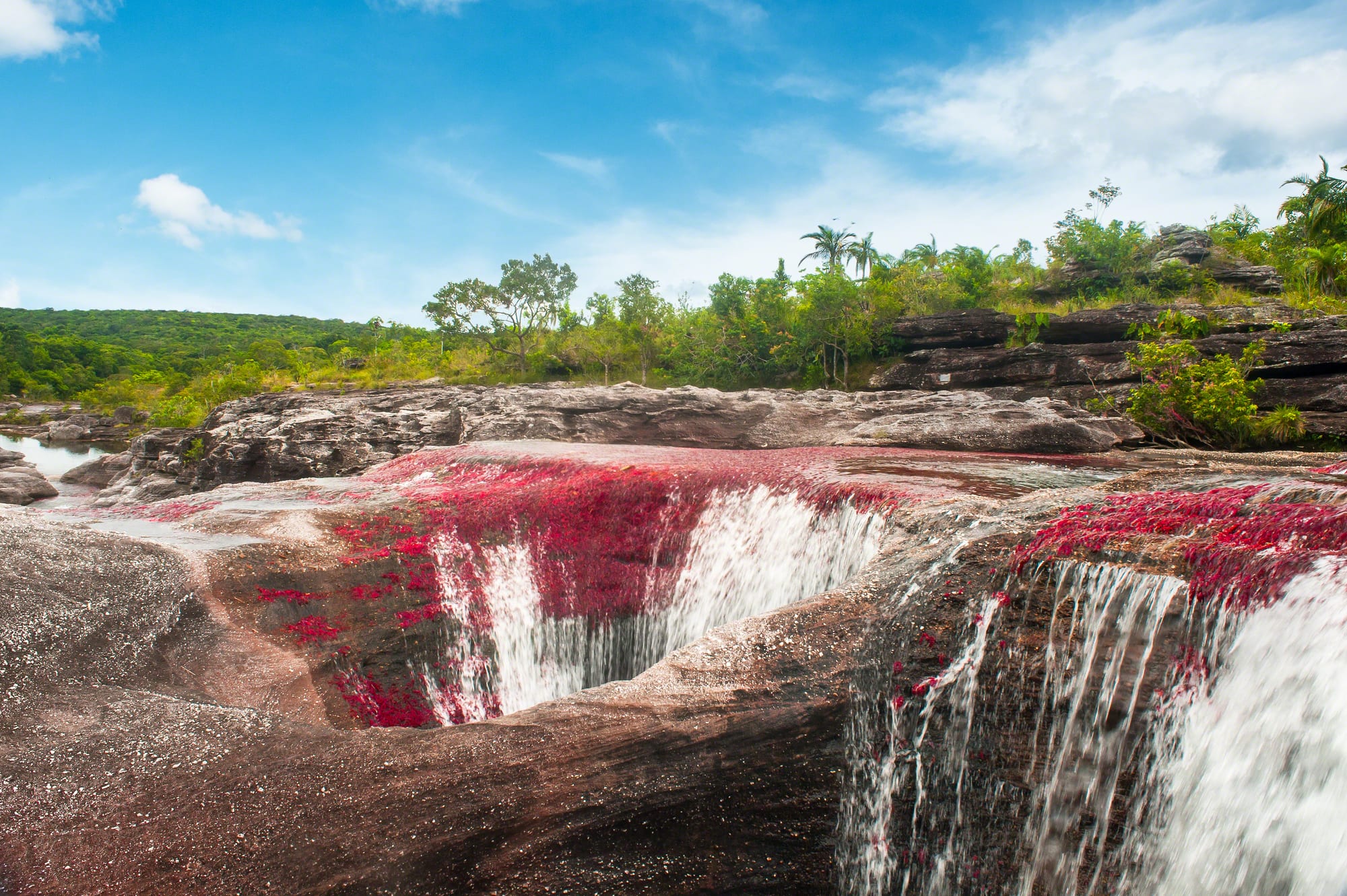
The river is Caño Cristales, in the Serranía de la Macarena of central Colombia, and its water never turns red at all. It stays so clear that every stone on the bottom can be seen. What turns red is a plant: an aquatic riverweed called Rhyncholacis clavigera, long known as Macarenia clavigera, which grows in great quantities on the rocks of the riverbed. Young plants are green; as they mature, and as the sun reaches them through the shallow, clear water, they turn yellowish and then deep red and pink.
The display is seasonal because the plant lives by the rhythm of the rains. In the dry months the river shrinks and the plants are left high and dry; when the rains return and water flows over the rocks again, they grow and colour. The riverbed is usually at its most vivid from around the end of June or July until November, when the red mixes with yellow and green plants, dark water draining from the forest, the reflected blue of the sky and white foam, earning the river its nicknames, the "River of Five Colours" and the "Liquid Rainbow".
A clear river on ancient rock
Caño Cristales, "Crystal Channel", is a small river by Colombian standards: less than 100 kilometres long and nowhere more than 20 metres wide. In the local usage a caño is a smaller river, as opposed to giants such as the Amazon. It rises on the southern plateau of the Serranía de la Macarena, an isolated range about 120 kilometres long that stands apart from the Andes, and runs to the Guayabero River, part of the Orinoco basin.
The rock it flows over is very old. The quartzite of the Macarena tableland formed about 1.2 billion years ago and is a western extension of the Guiana Shield, the ancient block of rock that also underlies parts of Venezuela, Guyana and Brazil. The river is a chain of rapids, waterfalls and pools across this hard rock, and its bed is pocked with round pits known as giant's kettles. They form when a fragment of harder rock falls into a hollow and the current spins it round and round, grinding the hollow wider and deeper.
The water is extremely clear because it carries almost no nutrients and very few small particles. With so little sediment to cloud it, whatever grows on the rock is on full display.
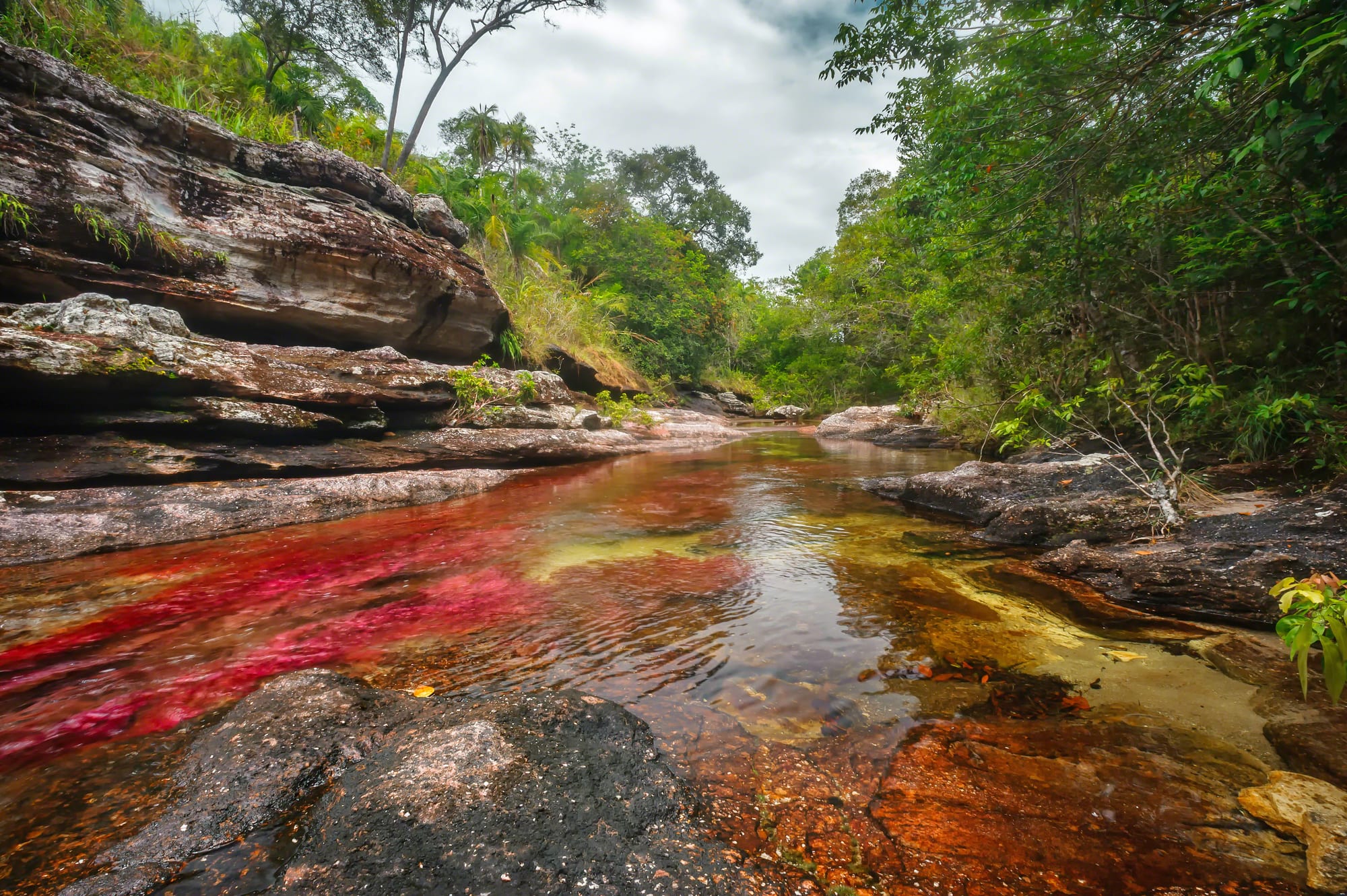
The colour lies on the rocks of the bed; the water itself is almost perfectly transparent.
The plant behind the colour
Rhyncholacis clavigera belongs to the Podostemaceae, the riverweed family, about 300 species of unusual aquatic plants found mostly in tropical and subtropical regions. Riverweeds are specialists in fast water. They cling to bare rock in rapids and waterfalls with roots specially built for gripping, and in Caño Cristales the red plants hold tight to the rocks exactly where the current runs fastest.
Many riverweeds live in a very small area, sometimes in a single river or waterfall, and this one is no exception. It is found in Caño Cristales and only a few other rivers of the Macarena region, such as the Caño Siete Machos. The Colombian biologist Jesús Idrobo identified it. Because so many riverweeds have tiny ranges, many are seriously threatened, above all by dams that flood the rapids they live in.
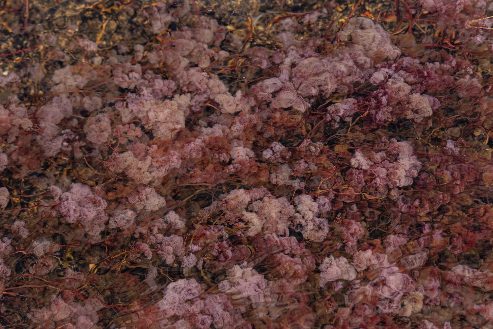
Seen up close, the "red river" is a dense carpet of small plants clinging to the rock.
Why only part of the year
The river's rocky bed holds little water, so it responds fast to the weather. Even moderate rain can make it rise dramatically, sometimes enough to strand people on its banks, and it falls again just as quickly. In the dry season the water drops away and the plants are exposed.
That cycle suits a riverweed. Like others in its family, it lives underwater when the river is high, and in the dry season leads an almost land-based existence, flowering at that time. On Caño Cristales the dry months are when the red plants get their chance to multiply. Once water runs over the rocks again, the plants grow beneath it, green at first, then yellow, then red as they mature in the sunlight. The months from around late June or July to November are when the bed shows these colours at their best.
The colours do not run the whole length of the river. They fade out at La Cachivera, where an old trail known as the camino real, now a road, crosses the stream, and Caño Cristales reaches the Guayabero without them.
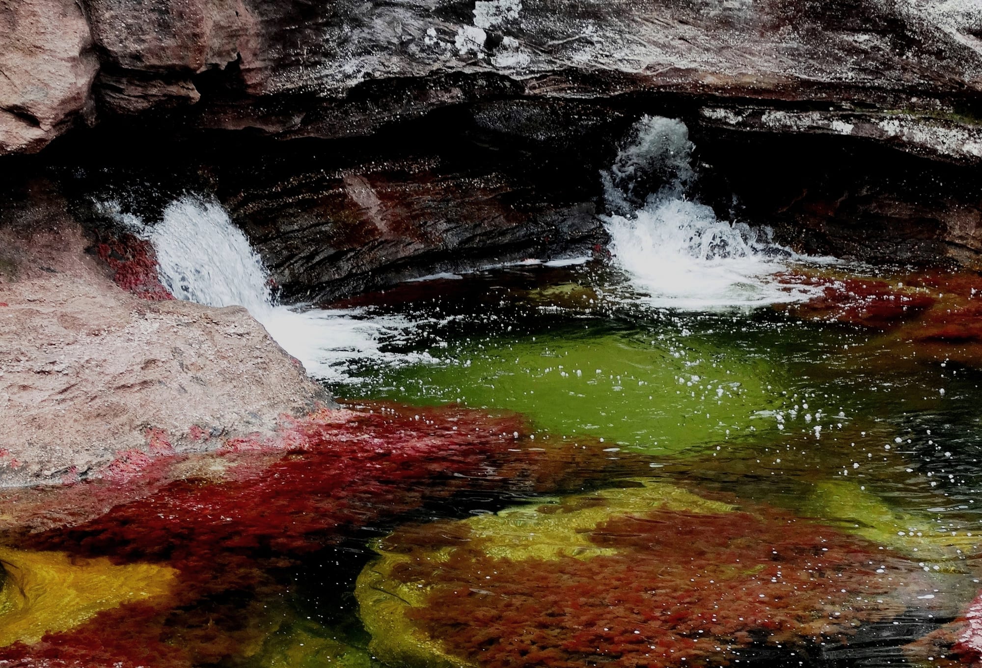
Young plants are green, older ones yellowish and the mature ones red, so one pool can show several colours at once.
From conflict zone to nature reserve
The Macarena is a place where ecosystems meet: the Andes, the eastern plains known as the Llanos and the Amazon rainforest. Its central part became Colombia's first national reserve under a law of 1948, and in 1971 it was made a national natural park covering 6,200 square kilometres.
For decades, though, few outsiders could come. From the middle of the 20th century thousands of farmers driven out of the Andean regions by violence settled in the area, and the FARC guerrilla movement became strong there. The town of La Macarena lay inside the former El Caguán demilitarised zone. By one account the river was found by cattle farmers in 1969; the Colombian writer and explorer Andrés Hurtado García walked to it in 1989 and his photographs and newspaper columns drew wider attention. With the army and police back in control of the town, and the FARC demobilised under the 2016 peace accord, La Macarena has become a growing ecotourism destination. The river had more than 16,000 visitors in 2016.
Seeing the colours today
Visitors reach the river from the town of La Macarena, which has its own airport, about 280 kilometres south of Bogotá. The climate is hot all year, with average daytime highs of around 29 to 33°C. The season for colour runs from roughly the end of June or July to November; outside those months the riverbed is much plainer. The wider park also holds large waterfalls, such as Caño Canoas and the Salto de Yarumales, and petroglyphs left by ancient cultures on the Guayabero River, at the sites known as Angosturas I and II.