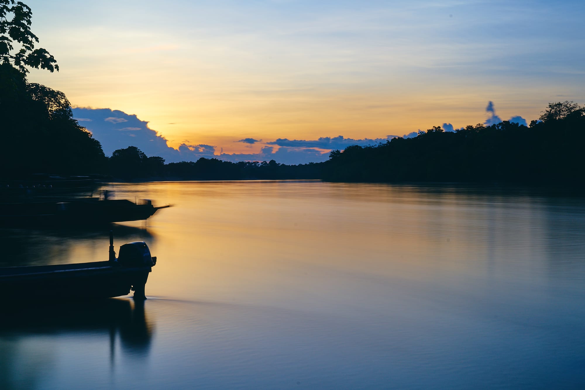
A calm, wide river at sunset with moored motorboats in silhouette and a dark line of forest on both banks

Los Llanos & the Orinoco, Colombia

La Macarena

Boats on the Guayabero river at La Macarena at dusk. (Pedro Szekely from Los Angeles, USA / Wikimedia Commons · CC BY-SA 2.0)

A small cattle town on the Guayabero river in southern Meta, founded by settlers in the 1950s and long caught up in Colombia's armed conflict. Since the peace process it has become the base for guided visits to Caño Cristales, the river in the Serranía de la Macarena whose bed turns red, yellow and green for part of each year, reached mainly by small plane.

Neighbourhoods

  • The town centre
    • First-time visitors
    • Close to the airport

    A small, orderly grid of streets around the shaded park by the church, a few minutes' walk from the airstrip. Hotels, restaurants, bakeries and tour agencies are all within a few blocks, and shops sell hats and gear for the trip to the river.

    Open in Maps
  • The riverside and the port
    • River views
    • Departures to Caño Cristales

    The road down from the far side of the park to the landing on the Guayabero, where boats carry visitors across the river on the way to Caño Cristales.

    Open in Maps

Things to do

Around the town

  • Guayabero Riverviewpoint

    The river on which the town stands, part of the Orinoco basin, crossed by boat at the start of every trip to Caño Cristales.

    Open in Maps
  • Caño de Piedrasbeach

    A river with a natural pool a short mototaxi ride out of town, popular with local people for swimming.

    Open in Maps
  • Jardín Botánico de La Macarenapark

    A private botanical garden and nature reserve near the village of La Esperanza, about 18 km from town, devoted to the recovery of native plants and animals, explored on foot or on horseback.

    Open in Maps
  • Madrevieja del Carmenpark

    An old, abandoned channel of the Guayabero about 17 km from town, on a farm working on forest restoration, surrounded by archaeological remains and forest wildlife.

    Open in Maps
  • El Raudalviewpoint

    Rapids on the Guayabero, also called El Raudal de Angosturas I, where the river runs between walls of ancient rock; the site is managed by the local community, and petroglyphs of ancient cultures are found at Angosturas.

    Open in Maps

Short trips: Caño Cristales and the Serranía

  • Caño Cristalespark

    The 'River of Five Colours', a fast, clear tributary of the Guayabero whose bed turns red, yellow, green, blue and black from about late June or July to November, when the aquatic plant Rhyncholacis clavigera colours its rocks.

    Open in Maps
  • Cristalitostrail

    A smaller tributary of Caño Cristales, higher up the mountain, with a campsite, a small farm and views over the region.

    Open in Maps
  • Serranía de la Macarenapark

    An isolated range of ancient quartzite tableland, about 120 km long, where the Andes, the Llanos and the Amazon meet, protected as a national park and home to hundreds of bird species.

    Open in Maps

Eat and drink

Long-standing places and food districts in La Macarena. Hours, ratings and directions come from your maps app, always current.

La Macarena classics

  • Bakeries of the towncafe

    The town has a notably large number of panaderías, where locals meet over coffee and visitors buy arepas for the day in the park.

    Open in Maps
  • Packed lunches in banana leavesrestaurant

    For the long days at Caño Cristales, restaurants prepare hot meals wrapped in banana leaves to carry on the trail.

    Open in Maps

Food districts

  • Restaurants around the parkneighborhood

    Simple, mostly inexpensive restaurants, several of them on the main park by the church, serve hearty, simple food.

    Open in Maps

Experience La Macarena

History

The land along the Guayabero was home to the Guayabero Indigenous people long before settlers arrived. The town itself is young: in the 1950s colonos, settlers from Caquetá fleeing the violence of the period, cleared the savanna here and named their settlement El Refugio, the refuge. The founding is dated to 1954, when a group of settlers, first among them the González family, established the town; an Italian pilot, Aldo Leonardi, landed on the savanna they had burned, and the airstrip became the town's lifeline. The airport still carries the name El Refugio.

Caño Cristales was found by a group of cattle farmers in 1969, and was later made widely known by the photographs and newspaper columns of Andrés Hurtado García. The area became a stronghold of the FARC, and from the late 1990s to 2002 the town lay inside the demilitarised zone ceded to the guerrillas during peace talks. A coca boom lasted until about 2004. In 2010, after reports of a mass grave in the town's cemetery, the UN human rights office visited the site; it confirmed that 446 unidentified bodies, reported as guerrillas killed in combat since 2002, were buried there, found no signs of a mass grave or of clandestine burials, and called for the bodies to be identified.

As security improved and the 2016 peace agreement followed, tourism grew quickly: visitors to the municipality rose from about 3,800 in 2012 to about 15,900 in 2017, and the town is now best known as the gateway to Caño Cristales.

Culture & Customs

La Macarena is a town of settlers and cattle farmers, and its rhythm is set by the campesinos of the surrounding countryside, who come in at weekends for supplies. Because Sunday is a working day for the town's shops, Wednesday is the local day of rest, when many businesses are shut and townspeople head to the natural pool at Caño de Piedras.

Tourism has created a new local culture of guides and community organisations. Guides are compulsory for visits to Caño Cristales, and many guides are local people who know the plants and wildlife of the Serranía; a short tour of the town is often part of the arrival. The rapids of El Raudal are managed by the community that lives beside them, and the Jardín Botánico and Madrevieja del Carmen combine visits with forest restoration and education for farmers.

Protection of the river shapes behaviour. Travel guides report that sunscreen and insect repellent are banned in the park, and visitors must keep to set routes with their guides. Local people speak of the years of conflict as a frightening time, and conversations about it are best left to them to begin.

Daily Life

By an undated estimate, the municipality has about 27,000 inhabitants, of whom about 4,000 live in the town itself; the rest are spread across an enormous rural area. The town serves as the regional centre for the farmers of the surrounding countryside, who mostly raise cattle, and cattle, farming and tourism are the mainstays of the economy.

Daily life is shaped by isolation. Goods and people arrive by small plane or by road, from Vistahermosa on a long and very rough route and from San Vicente del Caguán on a shorter one. Power cuts are frequent, and travel guides describe the town's ATM as unreliable and report no money transfer service.

The tourist season, from about June to December, fills the small hotels and keeps guides, boatmen, mototaxi drivers, restaurants and shops busy; outside it the town returns to its farming pace. Deforestation by slash-and-burn farming, and coca in remote parts of the park, remain pressures on the Serranía around it.

Food

La Macarena eats simply and well. Restaurants in town are mostly cheap and serve hearty, simple food, and the town has a notably large number of panaderías, bakeries where locals linger over coffee and visitors stock up on arepas before a day in the park.

For the long excursions to Caño Cristales, restaurants prepare packed meals wrapped in banana leaves, which guides help arrange and which are eaten beside the river. A small farm at Cristalitos sells local food to visitors.

The cheese used in town is a strong-flavoured Colombian variety that not every visitor takes to. The town belongs to the wider cooking of the eastern plains, whose signature dish is mamona, veal roasted for hours over an open fire, and whose rivers supply cachama and other fish, fried or grilled. Water is the most important drink on any outing: about two litres a person a day is the usual advice for the heat.

Planning tools

Budget

La Macarena is not a cheap trip. Most visitors buy a package from Bogotá or Villavicencio that includes flights, lodging, meals, guides and park fees, which is often both easier and cheaper than travelling independently. Daily costs in town are low, but a guide and transport to Caño Cristales are compulsory and cost far more than food or a room.

Daily Budget Midrange
USD 150–300 (all-inclusive package with flights, lodging, meals, guides and park fees, averaged per day)
Daily Budget Shoestring
USD 80–120 (shared guide and transport to the river, simple hotel, meals in town; flights extra)

Bring all the cash needed: cash machines in town have been unreliable, and there has been no money transfer service.

Best Time to Visit

Caño Cristales opens to visitors for a season running roughly from June to December, and the river shows its colours from about late June or July to November, after the rains have raised the water. Sunny weather, which brings out the colours best, is most likely from about September.

Suggested Number of Days

Allow at least two full days at the river plus travel days, which makes three days the usual minimum. Four or five give room for the other sights around the town and for flights delayed by weather, which happens often enough to plan for.

First Visit
3 days
With Surroundings
4–5 days

Transportation

The town is tiny, and every hotel is within a few minutes' walk of the airstrip. Trips to Caño Cristales must be made with a guide: visitors cross the Guayabero by boat and then continue by jeep, motorbike, bicycle or on horseback for most of the way. Mototaxis reach the nearer sights.

Wear long, light, quick-drying clothes and shoes that can get wet; travel guides report that sunscreen and insect repellent are banned in the park to protect the river plants.

Airport & Station Connections

The practical way in is by air to La Macarena Airport, also called El Refugio Airport, on the edge of town: Satena has run scheduled flights, and small charter planes fly from Villavicencio, usually as part of a package. Overland, the road from Vistahermosa is long and very rough and can be impassable in the rainy season, while the trip from San Vicente del Caguán is much shorter, with shared pickups. Airlines may ask for proof of yellow fever vaccination.

Walkability

The town can be crossed on foot in minutes on a simple grid of streets. Visits to Caño Cristales involve walking on rock and through shallow water in strong sun.

Safety

Colombia is far safer for visitors than its reputation, and the main cities and tourist regions are well travelled, but crime requires attention. The organised Caño Cristales trips are visited without serious trouble, but armed groups and trafficking networks are present in rural parts of southern Meta, so local advice should be sought before heading anywhere beyond the guided routes.

Keep to organised trips with licensed guides, carry about two litres of water a day, and take malaria and yellow fever advice. Check current official travel advice before travelling.

Climate

Hot and humid all year, with lows of about 21–23°C and highs of about 26–32°C. Torrential rain is common in the wet months, and the drier season from about December to March is when the plains brown and the river falls.

Summer
the drier season, about December–March, is hot and sunny with highs of about 26–32°C, but the river's colours have faded by then
Winter
the rainy months bring heavy storms and lows of about 21–23°C, and raise the river that feeds the colour season

Local Customs

La Macarena is a farming town whose campesinos come in at weekends, so Wednesday is the local day of rest and many businesses close. The river is strictly protected: visitors must stay with their guides and keep to set routes.

Follow the guide's instructions at the river, do not step on the coloured plants, and ask before photographing people.

Common Payment Methods

The currency is the Colombian peso (COP). La Macarena is a cash town: hotels, restaurants, guides and mototaxis expect pesos, and the town's ATM has been unreliable and can fail during power cuts. Bring enough cash from Bogotá or Villavicencio.