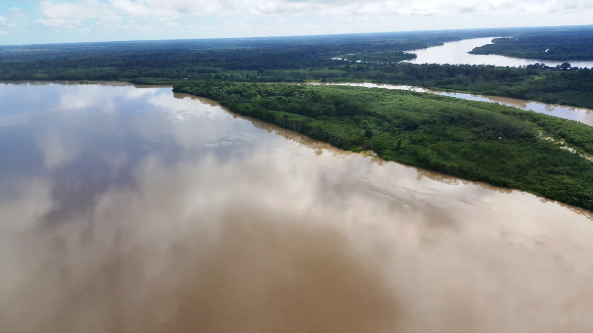
A wide brown river seen from the air, with a long forested island and dense green forest stretching to the horizon

Los Llanos & the Orinoco, Colombia

San José del Guaviare

The Guaviare River and its forested islands seen from the air near San José del Guaviare. (CarlosE Duarte / Wikimedia Commons · CC BY 3.0)

The capital of Guaviare, a river-port town on the Guaviare River where the eastern plains give way to the Amazon forest. It grew from a settlers' and rubber tappers' village into a department capital, was long marked by armed conflict and coca, and is now the base for the ancient rock paintings of the Serranía de la Lindosa.

Neighbourhoods

  • Centro
    • First-time visitors
    • Best for food
    • Shops and services

    The central barrio, where many of the town's shops, offices and eating places are found. The town is laid out on wide, crossing avenues with several parks, and the centre is the natural base for arranging trips into the surrounding countryside.

    Open in Maps
  • The riverfront
    • River views
    • Local life

    The town grew up on the banks of the Guaviare, which is still a working river port with a pier. Boats carry people and goods to settlements up and down the river, and the bank is the place to watch the water and the evening light.

    Open in Maps

Things to do

In town

  • The Guaviare River pierviewpoint

    The town's pier on the Guaviare, the river port that gave the town its start and still links it with riverside settlements in the department.

    Open in Maps

Short trips from the town

  • Serranía de la Lindosalandmark

    A range of rock formations between the Guaviare and Inírida rivers whose cliffs carry tens of thousands of red and yellow ochre paintings of people, animals and geometric forms, part of which was declared a protected archaeological area in 2018.

    Open in Maps
  • Cerro Azullandmark

    A painted rock shelter in the Serranía de la Lindosa about 26 km west of the town, excavated from 2014, where finds show people living in the region at least 12,000 years ago; visits are made with local guides.

    Open in Maps

Eat and drink

Long-standing places and food districts in San José del Guaviare. Hours, ratings and directions come from your maps app, always current.

San José del Guaviare classics

  • River fish restaurantsrestaurant

    Fishing has been part of the town's economy since its early days, and cachama and other river fish are served fried or grilled with cassava, plantain and rice.

    Open in Maps
  • Eating places in the Centroneighborhood

    Set lunches, roast and grilled meat and fresh fruit juices in the town centre, where shops also sell products made from Amazonian plants.

    Open in Maps

Experience San José del Guaviare

History

Before settlers arrived, the river banks of the region were home to peoples of the Guahibo language family, such as the Guayabero and Sikuani, and to Arawak-speaking groups like the Piapoco and Kurripako, Tukano-speaking Cubeo, and the Tinigua and Puinave, who lived by hunting, fishing and growing crops. The interior of the forest has been the home of the Nukak, once known as the Makú, for centuries. Far older traces lie in the nearby Serranía de la Lindosa, where excavations at painted rock shelters such as Cerro Azul show that people lived in the area at least 12,000 years ago.

The town itself began in the early 20th century, when settlers came up the Guaviare River and built their huts on its right bank, followed by rubber tappers heading for Calamar. A small village had formed by 1910, and its founders named it after Saint Joseph, adding the name of the river. When the capital of the Vaupés commissariat moved from Calamar to the new town of Mitú in 1931, Calamar almost disappeared while San José grew. A first general store opened in 1943 and the first churches and schools in 1950, but the political violence of 1952 saw houses burned and the village almost entirely rebuilt.

From the 1960s San José became a base for the colonisation of the forest. It was made a municipality on 7 June 1976 and the following year became the capital of the new commissariat of Guaviare, which the 1991 constitution turned into a department. The area was deeply marked by violence and coca growing: the FARC made Guaviare one of its strongholds, and since the 2016 peace accord the ELN and FARC dissidents have continued to fight in the department.

Culture & Customs

The municipality is home to several Indigenous peoples. The reserve of the Nukak, among the last nomadic peoples of Colombia, covers more than a fifth of its territory, and there are further reserves of the Guayabero, Sikuani, Tukano, Desano, Piratapuyo and Kurripako. Local crafts include brooms and brushes made from the fibre of the chiquichiqui palm, along with handicrafts that are mostly the work of the Nukak.

The town's best-known cultural treasure is far older. The cliffs of the Serranía de la Lindosa carry tens of thousands of paintings in red and yellow ochre — people, hand prints, plants, animals and geometric patterns, with hunting scenes and figures that seem to climb ladders to reach the high walls. They were recorded by the mapmaker Agustín Codazzi in the 19th century and by the botanist Richard Evans Schultes in 1943, and were widely publicised in the 2020s. Their age is debated: some researchers link them to ochre found in layers about 12,600 years old and see extinct animals among the figures, while others argue they are much more recent.

Local sources also point to the rock formations of the 'Ciudad de Piedra', a natural rock arch, natural bridges and tunnels, waterfalls and river rapids in the wider municipality. Sport is popular, from football, volleyball and cycling to motocross and coleo, the plains sport of bringing down a running bull by its tail. The regional public television channel Canal Trece has its base in the town.

Daily Life

San José is a small town of some tens of thousands of people and the capital of a thinly populated department. It stands about 175 metres above sea level, around 400 km south of Bogotá, in country where the savannas of the plains meet tropical forest. The town is laid out on wide avenues with parks and a pier on the Guaviare, and it is divided into barrios such as the Centro, Veinte de Julio, El Porvenir and La Esperanza.

The economy rests on farming, cattle, fishing and services. Across the department the main crops are plantain, cassava, cacao, sugar cane and rubber, and shops in town sell products made from Amazonian plants. Tourism has grown in recent years as the rock-art sites have become better known, but the region still lives with the effects of coca growing and armed groups, and the forests of Guaviare have among the highest deforestation rates in Colombia, as land is cleared for crops and pasture.

Life follows the heat: business starts early, slows in the middle of the day and picks up again in the late afternoon. The river remains a route for people and goods, and the airport, with flights to Bogotá, is the town's quickest link with the rest of the country.

Food

Food in San José del Guaviare mixes the cooking of the eastern plains with that of the Amazon. River fish are central: cachama and other fish are fried or grilled and served with cassava, plantain and rice, and fishing has been part of the town's economy since its first fishing business opened in 1958. From the plains come roast and grilled beef, pisillo — dried, shredded beef or fish — and gallina criolla, a stew of free-range chicken, with tamales made for celebrations.

Cassava is the staple of the forest peoples, eaten as casabe, a flat bread, and as fariña, a coarse toasted flour, and made into fermented and sweet drinks. Plantain, cassava and cacao are grown across the department, and tropical fruit is turned into fresh juices in water or milk. As elsewhere in Colombia, lunch for many people is the menú del día of soup, main course and juice, and the day is punctuated by small cups of sweet tinto coffee.

Planning tools

Budget

Everyday costs in the town are low: simple hotels, set lunches and local transport are inexpensive. The main costs are the flight from Bogotá and guided trips to the rock-art sites, which need transport and a local guide.

Daily Budget Midrange
USD 80–160 (comfortable hotel, restaurant meals, a guided day trip to the rock art)
Daily Budget Shoestring
USD 30–50 (simple hotel, set lunches, local transport)

Arrange trips into the countryside through established local guides, who know which routes are open.

Best Time to Visit

The town is hot all year. Across the plains the drier months run from about December to March, which generally makes road trips easier, while the forests of Guaviare stay wet and humid for much of the year.

Suggested Number of Days

Two or three days are enough for the town and the nearest rock-art sites. Rain, road conditions and the availability of guides can add a day, and flight schedules often decide the length of a stay.

First Visit
2–3 days
With Surroundings
3–4 days

Transportation

The town is small and easily covered on foot, by motorcycle taxi or by taxi. Roads and tracks lead out to the surrounding farmland, and the Guaviare and Guayabero rivers serve as routes to nearby settlements. Trips to the rock-art sites are made by hired vehicle with a guide.

Unpaved roads can become difficult after heavy rain; allow extra time for trips out of town.

Airport & Station Connections

Jorge Enrique González Torres Airport lies just north of the town, its runway running parallel to the Guaviare River, with scheduled flights to and from Bogotá. By road the town is about 400 km south of Bogotá, by a route across the plains through Villavicencio, and bus companies run services to and from the capital.

Walkability

The centre is compact and flat, laid out on wide avenues, and the river is close by. The heat makes long walks tiring in the middle of the day, and the rock-art sites outside town need transport.

Safety

Colombia is far safer for visitors than its reputation, and the main cities and tourist regions are well travelled, but crime requires attention. Guaviare was long a stronghold of the FARC, and armed groups and trafficking networks are still present in rural parts of the department, where the ELN and FARC dissidents continue to fight.

Check regional security before trips into the countryside, travel to outlying sites with established local guides, keep valuables out of sight and take malaria and yellow fever advice. Check current official travel advice before travelling.

Climate

A hot, humid lowland climate at about 175 metres above sea level, at the meeting of the plains and the Amazon forest. Rain falls for much of the year, with a drier spell around the turn of the year.

Summer
the drier months, roughly December–March: hot and sunnier; Colombia's hot lowlands in general see about 28–34°C
Winter
the rainy months, roughly April–November: still hot and humid, within the general 28–34°C band of Colombia's hot lowlands, with heavy storms and higher rivers

Local Customs

Colombians tend to be warm but formal in address: a greeting and the polite 'usted' are expected before getting down to business. Dress is light and casual in the heat, though neat clothes are worn for churches and offices. The Nukak and other Indigenous peoples of the municipality live largely in their own reserves.

Ask before photographing people, especially Indigenous people, and do not touch or chalk the rock paintings; follow the guide's instructions at the sites.

Common Payment Methods

The currency is the Colombian peso (COP), with prices running into the thousands. Cards are accepted in some hotels and larger shops, but cash is needed for most small businesses, transport and guides; use ATMs inside banks during the day and carry enough cash for trips out of town.