Attractions & Natural Wonders · United States
Why does Niagara Falls keep moving upstream?
The river eats away soft shale beneath a hard cap of dolomite until the lip collapses, so the falls have walked almost seven miles south since the ice age.
By Globeway Editorial · 13 October 2026
The short answer
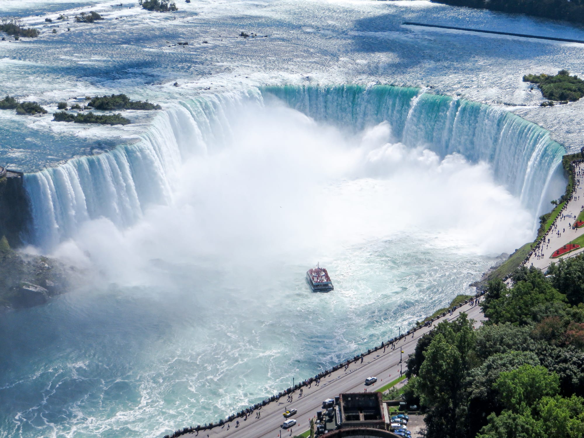
Niagara Falls moves upstream because it is eating its own foundations. The lip of the falls is a layer of hard limestone and dolomite, but beneath it lies soft, crumbly shale. The water pounding into the basin wears the shale away faster than the hard rock above, until the overhanging cap has nothing beneath it and breaks off in great chunks. The edge of the falls is then a little further upstream, and the process begins again.
Repeated for more than 10,000 years, this has moved the falls about 6.8 miles south from where they began, at the Niagara Escarpment between Queenston, Ontario, and Lewiston, New York, and has left behind the Niagara Gorge. Over at least the last 560 years the falls retreated an average of 3.3 to 4.9 feet a year. Today, after decades of engineering on a river that now loses much of its water to hydroelectric plants, the rate is about 12 inches a year.
A hard lid on a soft cake
The rocks at Niagara were all laid down on the floor of an ancient sea, but conditions in that sea kept changing, so the layers are very different. On top is the Lockport Formation, a hard, erosion-resistant limestone and dolomite from the Silurian period. The same tough layer forms the cliff of the Niagara Escarpment, which runs in an arc for about 650 miles from New York through Ontario, Michigan and Wisconsin. The escarpment is not a fault but the product of uneven erosion: the hard rock survives while softer rock around it wears away.
Immediately below the caprock lies the Rochester Formation, made mostly of shale with a few thin limestone bands. Below that, hidden under the river in the lower valley, are the shales and fine sandstones of the Queenston Formation. This sandwich is what makes a waterfall that walks. Water and spray scour out the soft shale at the base of the cliff, cutting a hollow behind the falling curtain. The dolomite above is left overhanging, and eventually the overhang collapses.
Seven miles of retreat
When the ice sheets of the last ice age melted back, meltwater filled the basins they had scoured and formed the Great Lakes. The upper lakes began to drain through the Niagara River, which ran north from Lake Erie and tumbled over the escarpment towards Lake Ontario. Estimates of when the falls began range from about 10,900 to 12,500 years ago.
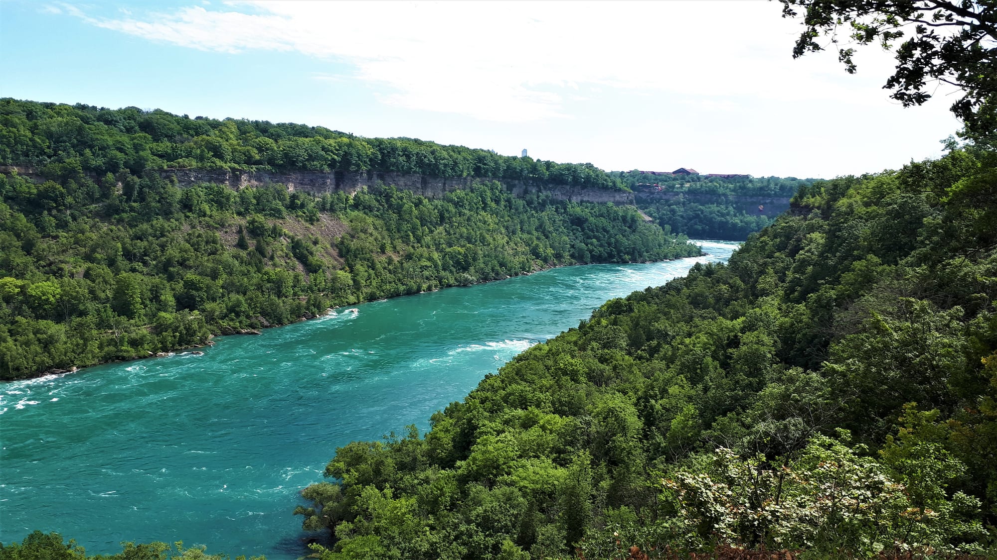
The steep walls on either side show the layered rock the falls have cut through on their long retreat upstream.
Ever since, the falls have been backing up the river towards Lake Erie, and the trench they leave behind is the Niagara Gorge, a canyon about 6.8 miles long running from the foot of the falls to the escarpment near Queenston. The current through it is among the most powerful in the world, which is why kayaking the gorge has generally been forbidden.
The retreat has not always been steady. About 4,200 years ago, the falls cut into an old river valley, St David's Buried Gorge, which the glaciers had filled with loose sediment and rock. The river washed the fill out quickly, and because the buried valley ran almost at right angles to the Niagara, the water was forced into a sharp turn. The result is the Niagara Whirlpool, a rounded basin up to 125 feet deep.
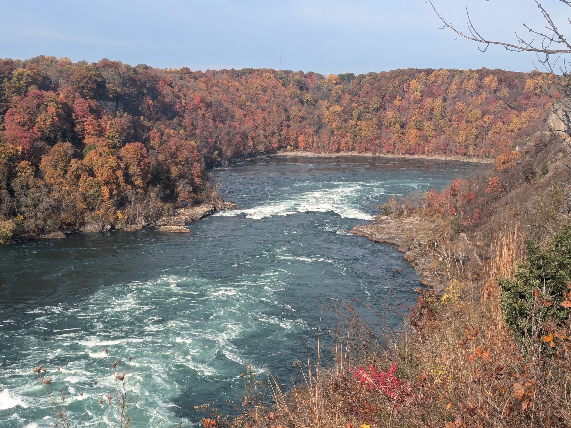
Here the falls broke into an ancient buried valley, and the river now turns sharply where the two meet.
Two falls, two speeds
Goat Island splits the river just above the falls. On the Canadian side is the Horseshoe Falls, about 187 feet high and 2,592 feet wide, which takes around 90 per cent of the water. On the American side are the much smaller American and Bridal Veil Falls. The Horseshoe's shape has changed as it retreated, from a small arch to a horseshoe bend and now to a sharper V.
The American Falls tells a different story. Rockfalls over the past 150 years have piled a huge mound of broken rock, called talus, at its base, the most notable from the collapse of Prospect Point in 1954. That is why its drop varies from roughly 70 to 110 feet. In June 1969 the U.S. Army Corps of Engineers built a temporary dam and turned the American Falls off completely for several months. While the Horseshoe Falls took the extra water, engineers studied the dry riverbed and bolted and strengthened faults that would have sped up its retreat. A plan to clear the talus was dropped because of the cost, and in the mid-1970s the authorities decided to let nature take its course.
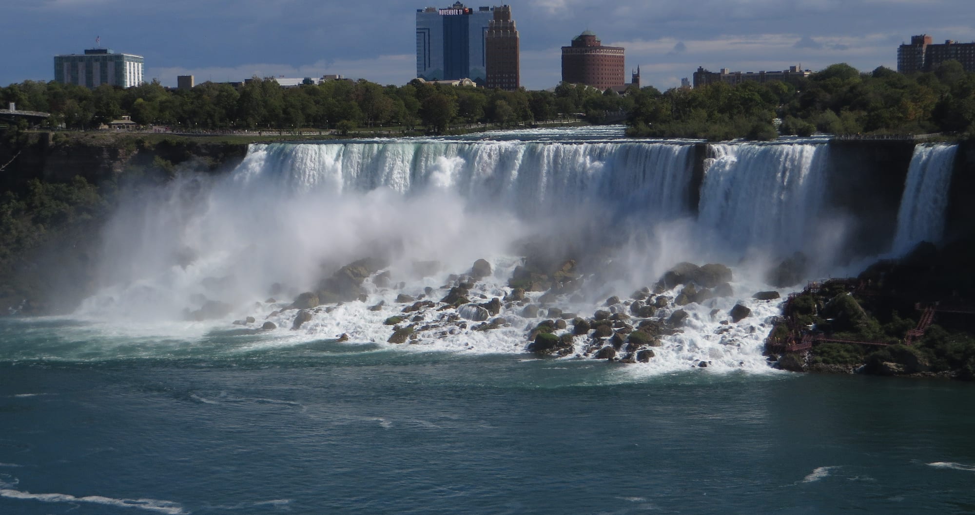
The boulders are pieces of the caprock that have collapsed from the lip over the past century and a half.
A managed retreat
People have been reshaping the falls for more than a century. A 1909 treaty between the United States and Canada first limited how much water could be taken out for power. Its replacement, the Niagara River Treaty of 1950, is designed to guarantee an unbroken curtain of water: during daylight in the tourist season, from 1 April to 31 October, at least 100,000 cubic feet per second must flow over the falls, and at night and in winter half that. Between 50 and 75 per cent of the river's flow is now diverted through huge tunnels that begin far upstream, feeding power plants on both sides of the border.
Engineering has also slowed the erosion directly. Underwater weirs steer the most damaging currents away from the crest, and the top of the falls has been strengthened. The result is a retreat of about a foot a year, down from several feet a year in earlier centuries.
The falls have not stopped moving, though. At the current rate, Niagara will have eroded the remaining 20 miles back to Lake Erie in about 50,000 years, at which point the falls will cease to exist.