Attractions & Natural Wonders · Botswana
Why does the Okavango River never reach the sea?
Movements in the Earth's crust cut the river off from the ocean, and the Kalahari sun now drinks almost all its water in a vast inland delta.
By Globeway Editorial · 13 October 2026
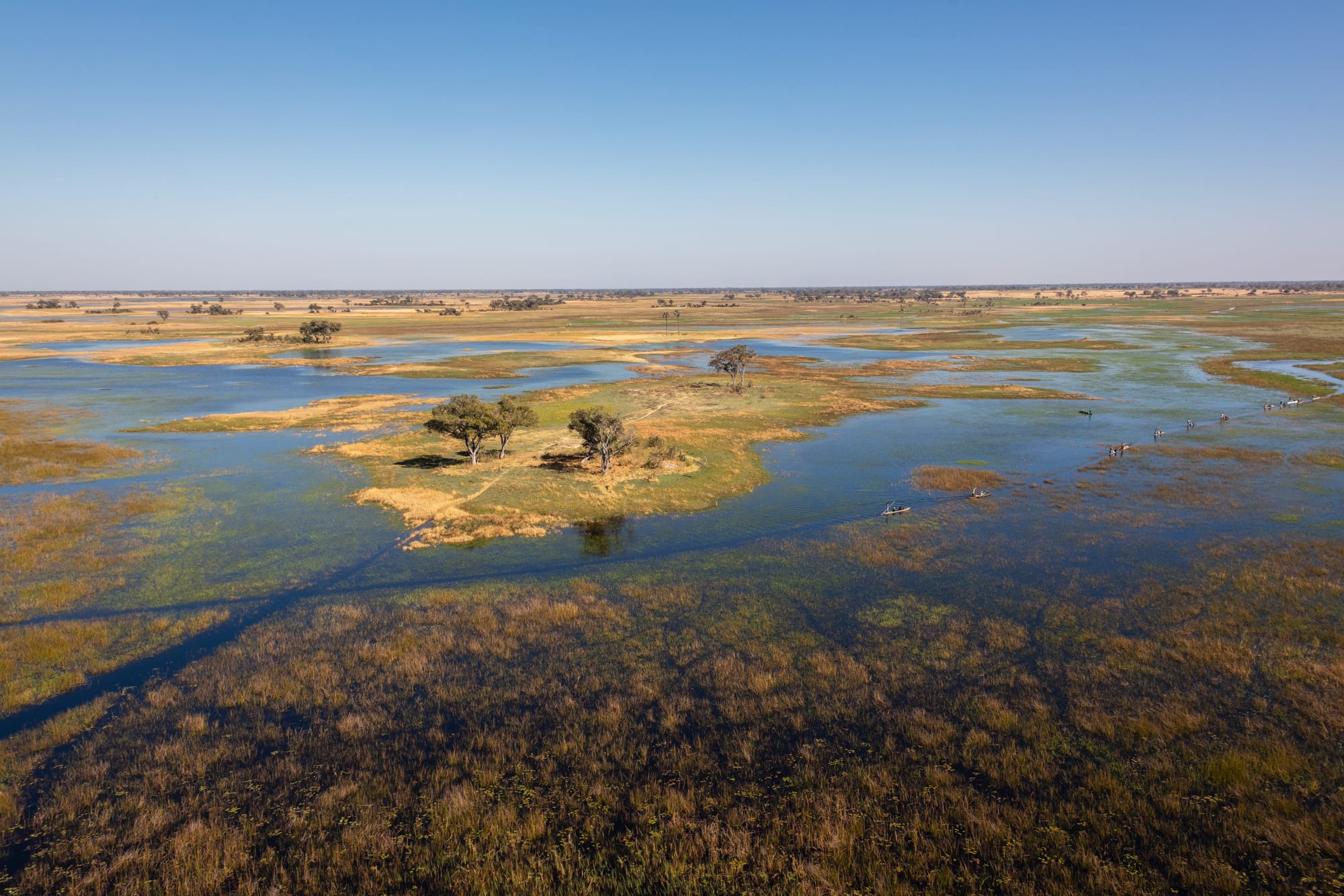
The short answer
The Okavango has nowhere to go. It rises in the highlands of Angola and runs south-east for about 1,600 kilometres, through Namibia and into Botswana, where it pours into a shallow, sand-filled trough in the middle of the Kalahari Desert. That trough is part of an endorheic basin: a closed basin with no outlet to the ocean. About 2 million years ago, slow movements in the Earth's crust raised a barrier across the old route that once carried the region's rivers to the Indian Ocean, and the water has been trapped ever since.
Once it is trapped, the desert does the rest. The river spreads out into the Okavango Delta, a maze of channels, lagoons and islands, and some 96 to 98 per cent of the water that enters it is lost to evaporation, to plants and to the ground beneath. Only a small share trickles out through the Thamalakane and Boteti rivers towards the salt pans further east. Strictly speaking, "never" is slightly too strong: in very wet years a little of the flow can escape north-east and reach the Zambezi, which does reach the sea. But the Okavango itself ends in the desert.
A river that used to reach the ocean
The Okavango did not always end in Botswana. About 3 million years ago, strong easterly winds piled long dunes across the middle of the Kalahari, and in wetter times these dunes channelled the great rivers of the area, the Okavango, the Chobe and the Upper Zambezi, south-eastward to join the Limpopo River and flow on into the Indian Ocean.
Beneath the sand of northern Botswana run deep fault lines, which geologists think are the southernmost extension of the same system of faults that formed East Africa's Great Rift Valley. About 2 million years ago one of them, known as the Ovamboland-Kalahari-Zimbabwe axis, flexed upward and cut off the route to the Limpopo. With the exit blocked, the rivers backed up into a huge lake, Lake Makgadikgadi, which may at its largest have covered between 80,000 and 275,000 square kilometres and was about 30 metres deep.
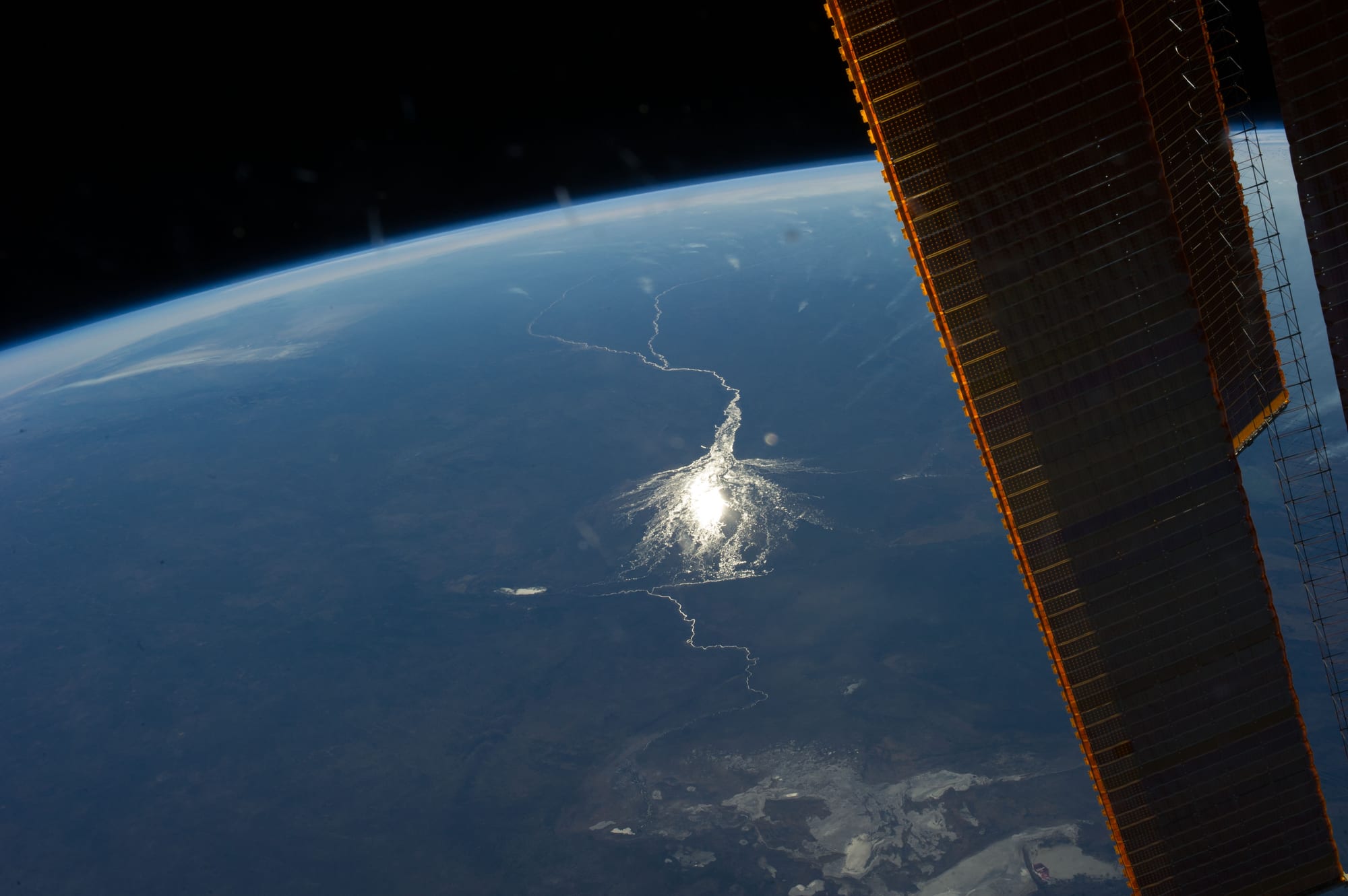
From orbit the shape of the problem is plain: a single river arrives from the north-west, fans out, and fades into the desert. Lake Makgadikgadi eventually filled to the brim and, about 20,000 years ago, began to overflow at its lowest point to the north-east. That overflow linked the middle and lower Zambezi and formed Victoria Falls. A drier period followed, and by about 10,000 years ago the great lake was well on its way to drying out.
How a fault built the fan
The delta's fan shape is also the work of the crust. As Lake Makgadikgadi shrank, a fault known as the Gumare fault formed and lowered the land in the river's path. The Okavango, arriving at this sunken trough at an elevation of 930 to 1,000 metres, spread out over a much larger area than before, creating the fan-shaped inland delta seen today. That in turn sent even less water on to Lake Makgadikgadi and hastened its end. Faults still shape the delta: Chief's Island, the largest island in it, was pushed up along a fault line into an area more than 70 kilometres long and 15 kilometres wide.
The ground is astonishingly flat. Across the widest part of the delta, about 150 kilometres, the height varies by less than 2 metres, and the water drops only about 60 metres in total between Mohembo, where the river enters, and the town of Maun at the far edge. On such a gentle slope water moves slowly and spreads wide, and even a small build-up of sand can send a channel off in a new direction.
Where the water goes
Every year about 11 cubic kilometres of water spreads over an area of 6,000 to 15,000 square kilometres, depending on the flood. The Delta is not wet because of local rain. It receives about 450 millimetres a year, roughly a third of what falls on its catchment in Angola, and lies in a hot, arid country. Most of the water that arrives is evaporated from open water or drawn up by plants and released into the air, a combined process called evapotranspiration. A large share also seeps down into the shallow aquifer, the layer of water-holding sand beneath the floodplains, before plants take it up.
What little escapes goes south and east. Some flows down the Thamalakane River at Maun into the Boteti, which in the rainy season carries water on towards the Makgadikgadi Pans, the salt flats left behind by the ancient lake. Some fills Lake Ngami to the south-west, itself another shrunken fragment of Lake Makgadikgadi. In very wet years part of the flow can run north-east along the Magweggana channel and reach the Zambezi. Botswana's Department of Water Affairs has put the loss to evaporation at 97 per cent, a figure that matters greatly in a dry region where Namibia has proposed piping water from the river. In 1994 Angola, Namibia and Botswana set up a joint commission to advise on sharing it.
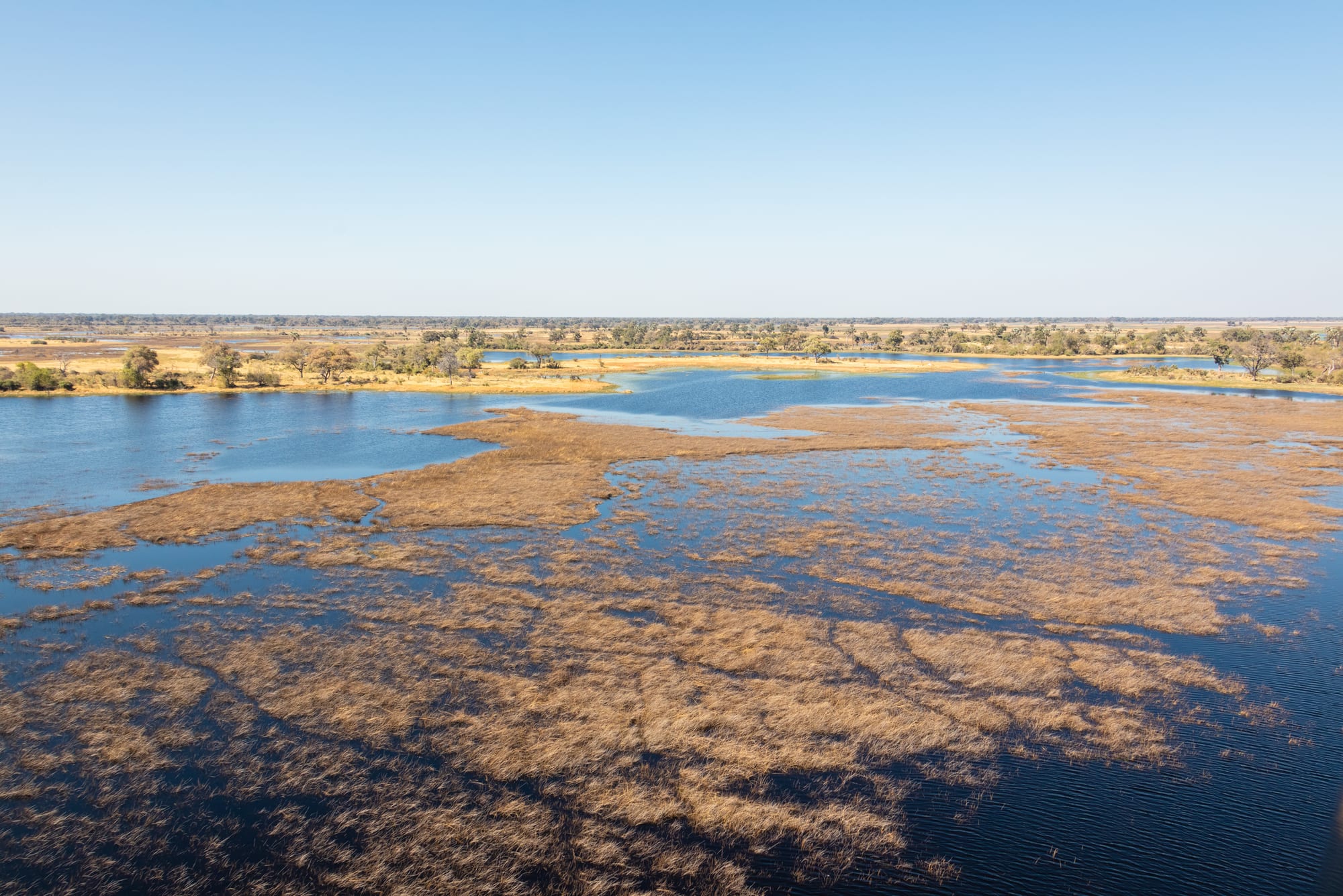
Because the water ends here, so does everything it carries. The river brings about 28,000 tonnes of suspended sediment a year, mostly fine sand, and a similar amount rolled along its bed. Its water is so clear and low in mud that the delta's plants act as the glue that binds the sand into banks. Dissolved minerals, though only about 40 milligrams in each litre, add up to the largest part of what the river delivers, and with no outlet they stay behind.
Salt islands and a flood in the dry season
Those minerals leave visible marks. On many of the delta's thousands of islands, salt builds up around the roots of the plants. Over time the centre of the island becomes too salty for most plants and turns into a bare white patch, ringed by trees and grass on the fresher sand at the edges, with perhaps a salt-tolerant palm in the middle.
The closed basin also produces the delta's strangest rhythm. The summer rains fall on the Angolan highlands in January and February, and the surge takes about a month to travel the first 1,000 kilometres or so of the river. It then needs another four months to filter through the reeds and channels of the delta. So the flood peaks between June and August, in Botswana's dry winter, when the surrounding land is at its driest. The delta then swells to three times its permanent size and draws animals from far around, creating one of Africa's greatest concentrations of wildlife.
Seeing the delta today
The Okavango Delta became the 1,000th site inscribed on the UNESCO World Heritage List on 22 June 2014, recognised as one of the few interior deltas that do not flow into a sea or ocean and whose wetland system remains largely intact. The Moremi Game Reserve lies on its eastern side, and the town of Maun serves as the gateway. Botswana deliberately keeps visitor numbers low and prices high to limit the impact on the wetland.
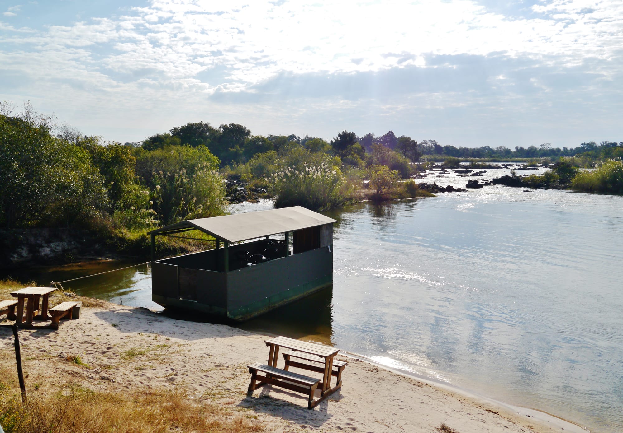
Before it reaches Botswana, the river drops 4 metres through a series of rapids called Popa Falls, which show best when the water is low in the dry season. Inside the delta the classic way to travel is the mokoro, a dugout canoe pushed along with a pole through the shallow channels. Visiting during the flood, from June to August, means water at its fullest under dry, mild days, though nights can fall close to freezing.