Attractions & Natural Wonders · Australia
Why is Uluru red, and why can you no longer climb it?
A grey sandstone rusted red on the outside, and a climb along a sacred ancestral path that its traditional owners finally closed in 2019.
By Globeway Editorial · 13 October 2026
The short answer
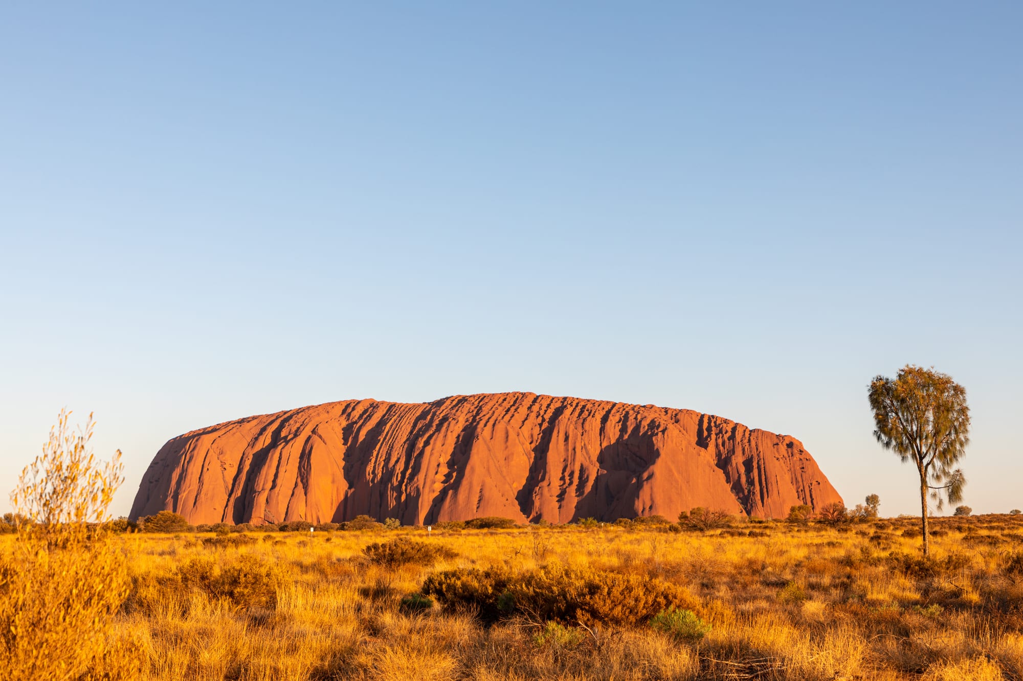
Uluru is red because it is rusting. The rock is a coarse sandstone called arkose, and underneath its skin it is grey. Iron-bearing minerals near the surface have reacted with oxygen over a very long time, coating the outside in iron oxide, the same compound as rust. The rock seems to change colour through the day, and it glows most strongly red at dawn and sunset.
The climb closed on 26 October 2019 because the Aṉangu, the Aboriginal traditional owners of Uluru, had asked visitors for decades not to do it. The route follows the path their ancestral Mala men took when they arrived at Uluru, a sacred track in Aṉangu law, and the owners also felt responsible for the people who were hurt or killed on the steep slope. In November 2017 the national park's board voted unanimously to end it.
A grey rock wearing a coat of rust
Uluru stands 348 metres high and measures 9.4 kilometres around its base. It is made mostly of arkose, a sandstone rich in feldspar, with some conglomerate. On average the rock is about half feldspar, a quarter to a third quartz and up to a quarter fragments of other rock, in coarse grains 2 to 4 millimetres across.
When freshly broken, that rock is grey. The colour comes from weathering: iron-bearing minerals in the outer layer have oxidised, giving the surface a red-brown, rusty coat. Because the colour is a thin outer skin lit by the desert sun, Uluru appears to shift through shades of orange, red and brown, and it is most famous for the deep glow it gives off at sunrise and sunset.
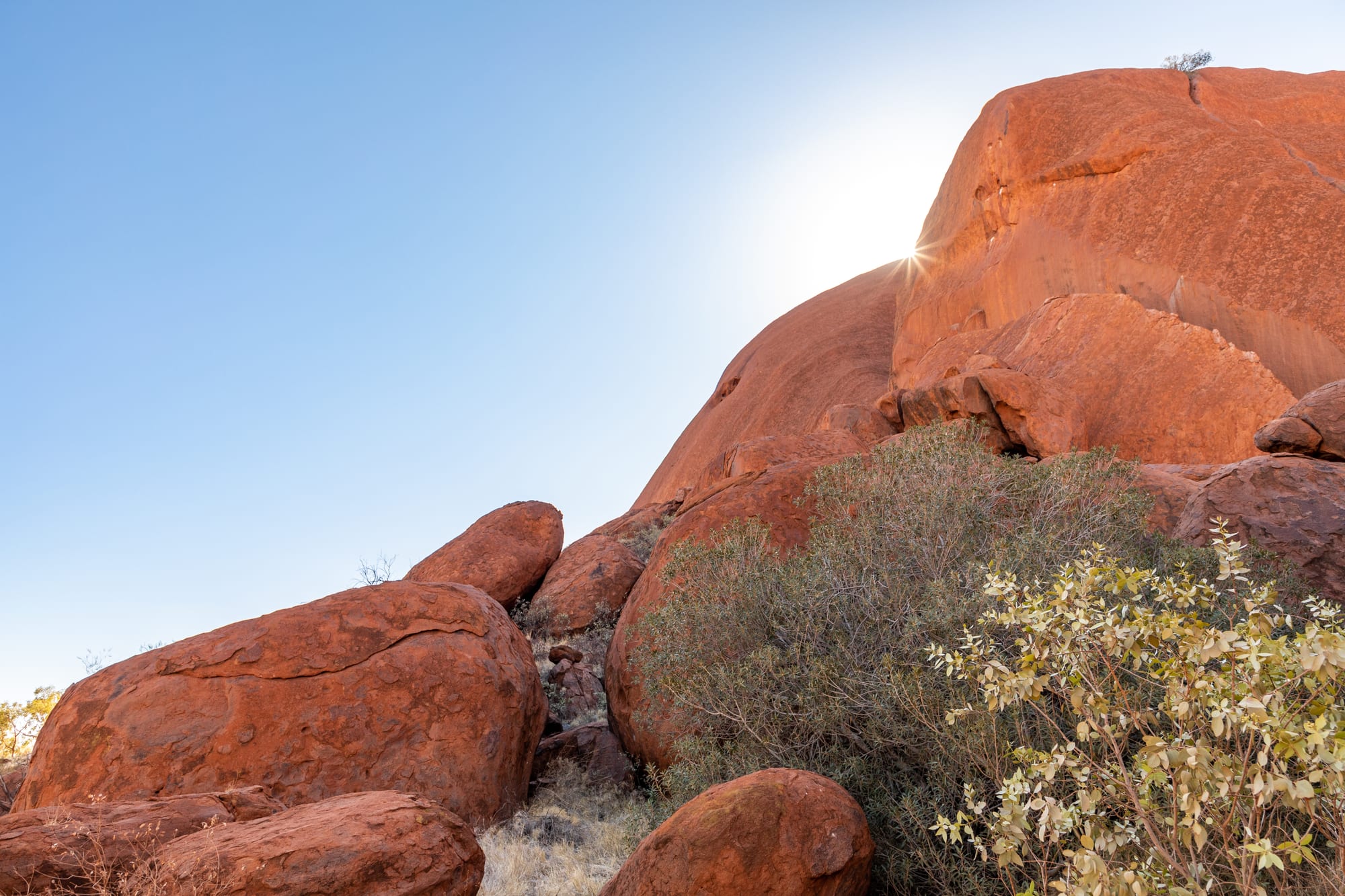
The red colour belongs to a weathered outer layer; the rock beneath is grey.
Sand from vanished mountains, tipped on its end
The rock began as sand. Around 550 to 530 million years ago, a period of mountain building called the Petermann Orogeny raised great ranges to the south and west, the ancestors of today's Musgrave, Mann and Petermann Ranges. Rivers and floods washed sand and grit off their granite slopes and spread it out in a vast alluvial fan, a fan-shaped apron of sediment at the foot of the mountains. The grains were barely rounded or sorted by size, a sign that they were eroded quickly from the growing mountains, and the feldspar in them still looks relatively fresh.
The layers were laid down nearly flat. A later episode of mountain building, possibly the Alice Springs Orogeny between about 400 and 300 million years ago, tilted them until they stood almost upright: today they dip at 85 degrees, and at least 2,400 metres of their thickness is exposed.
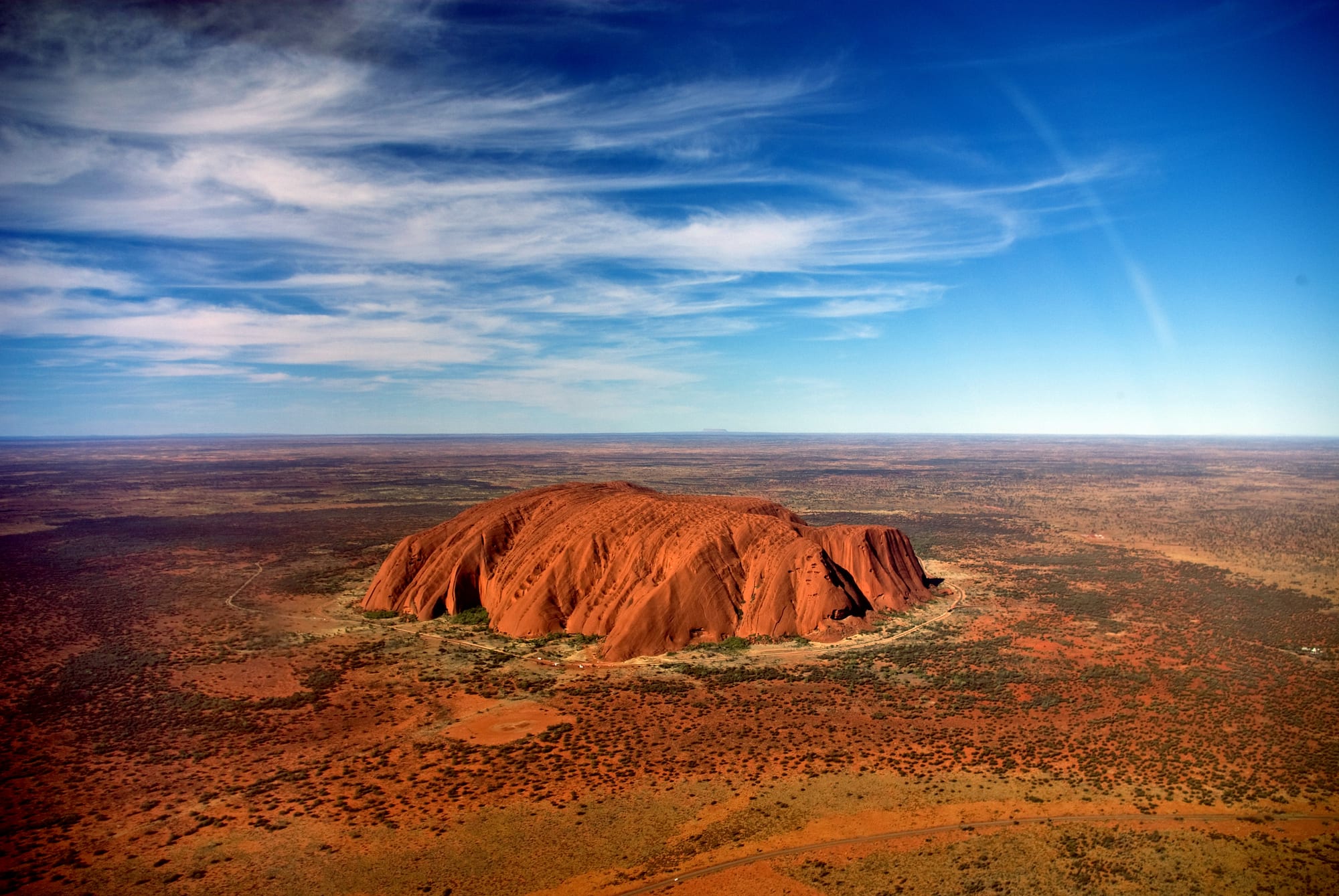
Geologists call a lone hill like this, rising abruptly from a flat plain, an inselberg.
Uluru survived while the land around it wore away because it is unusually uniform: it has few joints or partings between its layers, so little loose rock or soil builds up on it. The layers carry on beneath the plain, and most of the rock's bulk lies underground.
A sacred place, and a chain up its side
Aṉangu stories from the Tjukurpa, Aṉangu law, knowledge and religion, often called the Dreaming in English, explain how ancestral beings shaped the land around Uluru. One of the most important is the story of the Mala, the rufous hare-wallaby people, who came from the north to hold a ceremony at Uluru. Aṉangu believe these ancestors are still present in the rock today, and the climb follows the route the Mala men took when they arrived. Aṉangu do not climb Uluru because of its great spiritual significance.
Outsiders came late. The surveyor William Gosse sighted the rock on 19 July 1873 and named it Ayers Rock, after Sir Henry Ayers, then Chief Secretary of South Australia. The first tourists arrived in 1936, and in 1964 a chain was fixed to the rock to help them up; it was extended in 1976. Even with the chain, it was a steep, windy hike of about 800 metres, and by July 2018, 37 deaths had been linked to the climb.
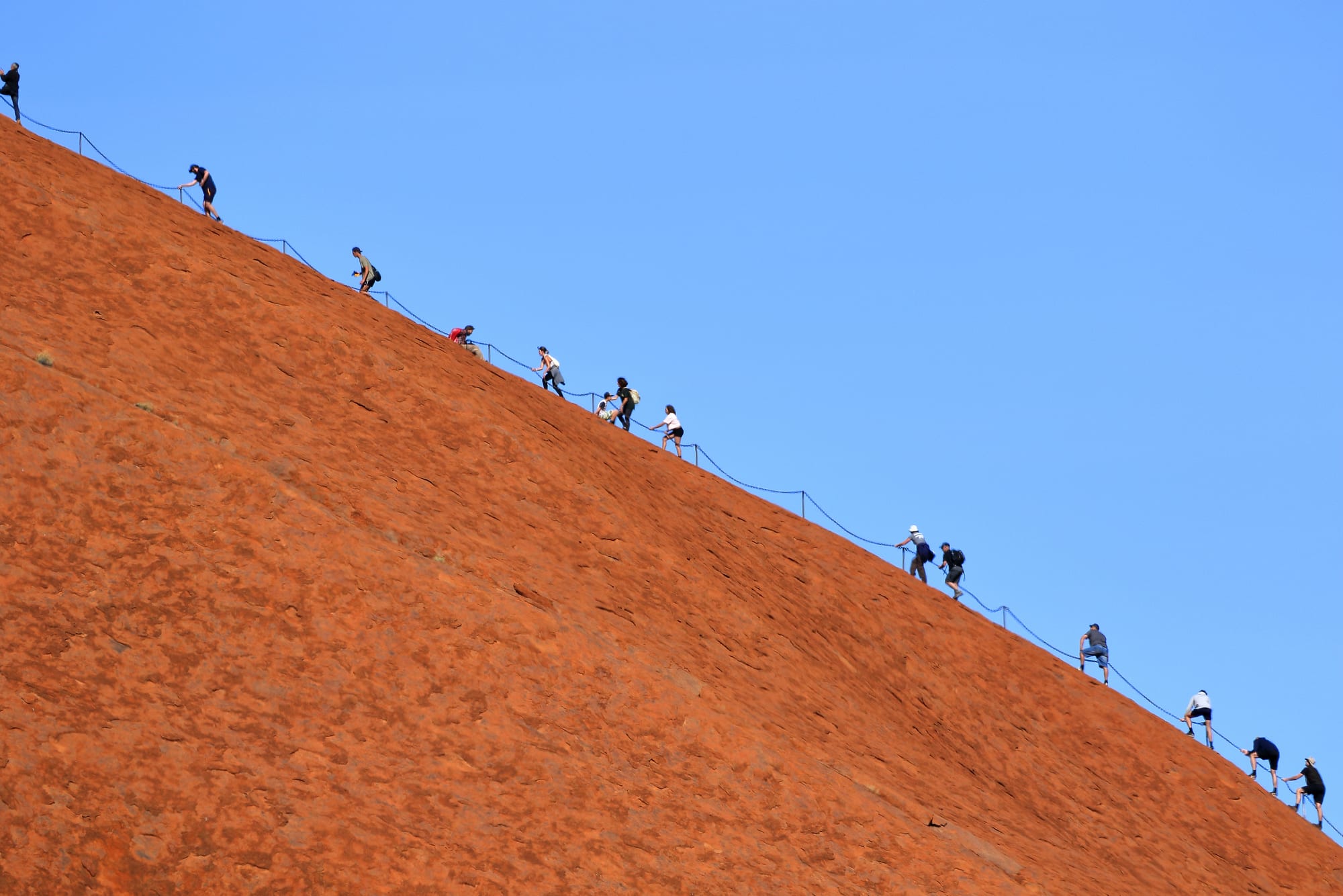
The chain was removed when the climb closed in 2019.
A promise, a lease and a vote
On 11 December 1983 the prime minister, Bob Hawke, promised to hand the land back to its traditional owners and agreed to their 10-point plan, which included ending the climb. When the title deeds were handed over on 26 October 1985, though, the government made continued access to the climb and a 99-year lease (in place of the 50 years agreed earlier) conditions of the deal. Aṉangu leased the park back to the national parks agency and now manage it jointly with it.
For more than three decades the owners asked rather than forbade. The visitors' guide said the climb was not prohibited, but that they would prefer guests to respect Aṉangu law and culture by not climbing. A management plan for 2010 to 2020 said the climb should close once fewer than 20 per cent of visitors made it, or once either of two other conditions was met; there was strong evidence that this threshold had been reached by July 2013, yet the climb stayed open. Stunts on the summit in 2010, including golfing and a striptease, added to calls for a ban.
From Ayers Rock to a closed climb
- 19 July 1873
William Gosse sights the rock and names it Ayers Rock.
- 1936
The first tourists arrive.
- 1964
A chain is fixed to the rock to help climbers.
- 26 October 1985
The title is handed back to the Aṉangu traditional owners.
- 1 November 2017
The park board votes unanimously to close the climb.
- 26 October 2019
The climb closes and the chain is removed.
On 1 November 2017 the park's board voted unanimously to close the climb. The announcement set off a rush of climbers before the deadline. The ban took effect on 26 October 2019, exactly 34 years after the handback, and the chain was taken down. Opinion was divided: a 2017 Northern Territory newspaper poll found 63 per cent of respondents against the ban, while a 2019 Essential poll found 44 per cent in favour and 30 per cent opposed.
Seeing the rock today
Uluru-Kata Tjuta National Park is a UNESCO World Heritage Site, and Aṉangu lead walks that explain the bush, its foods, its plants and animals, and the Tjukurpa stories of the area. A cultural centre on the road to the rock introduces Aṉangu law, art and history. Aṉangu also ask visitors not to photograph certain parts of the rock, which are sites of men's or women's ceremonies. The resort town of Yulara lies just outside the park, 17 kilometres from Uluru by road, and dedicated viewing areas give the classic views at dawn and dusk. On the rare days of heavy rain, short-lived waterfalls pour down the rock's sides.