Attractions & Natural Wonders · Italy
Why is Venice sinking, and can it be saved?
Pumped-out groundwater made Venice drop fast in the 20th century; today rising seas are the bigger threat, and a wall of sea gates is holding them back for now.
By Globeway Editorial · 13 October 2026
The short answer
Venice is a city of stone set on wooden piles in the soft mud of a lagoon, and the ground beneath it has always settled slowly. In the 20th century that settling sped up sharply, because industry on the edge of the lagoon pumped huge amounts of water out of the ground. Once the wells were banned in the 1960s, the sinking slowed to about 1 to 2 millimetres a year. At the same time the sea has been rising. Together, the city now sits about 23 centimetres lower against the water than it did in 1897, and floods that were once rare arrive several times a year.
Can it be saved? For now, largely yes. Since October 2020 a line of 78 steel gates on the seabed at the lagoon's three entrances can rise to shut out the Adriatic during the worst tides. But the gates were designed for a sea about 60 centimetres higher than today, and some projections for 2100 go well beyond that. Venice has bought time, not a permanent answer.
A city built on tree trunks and mud
Venice sits near the centre of the Venetian Lagoon, a shallow bay of about 550 square kilometres joined to the Adriatic Sea by three inlets, at Lido, Malamocco and Chioggia. The lagoon formed six to seven thousand years ago, when the sea flooded the coastal plain after the Ice Age, and its land has been sinking slowly ever since. River sediment used to make up the loss.
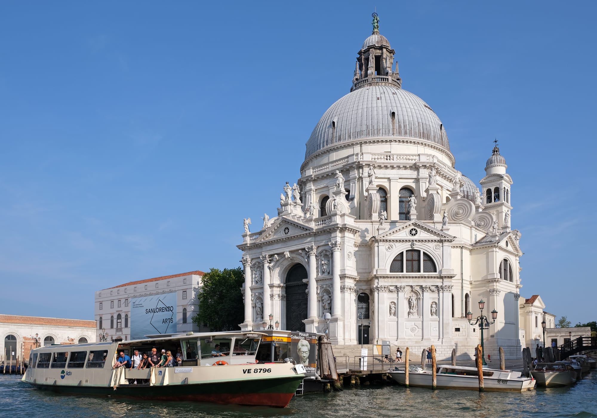
The people who fled to these sandy islands after the fall of Rome learned to build by driving closely spaced trunks of alder, a wood that resists water, down through the mud and sand until they hit a harder layer of compressed clay. Plates of Istrian limestone went on top of the piles, and the buildings on top of those. The great domed church of Santa Maria della Salute alone stands on a platform of 1,000,000 wooden piles.
The Venetians reshaped their lagoon on purpose. About six hundred years ago, to protect themselves from attack by land, they diverted all the major rivers that flowed into it, which also stopped sediment filling the water around the city. Hydraulic works in the 15th and 16th centuries stopped the lagoon turning into marsh, but without fresh river mud the lagoon grew deeper.
How the 20th century made it worse
The sharpest drop came with modern industry. During the 20th century many artesian wells were sunk around the edge of the lagoon to supply factories, above all at Porto Marghera, the industrial zone on the mainland just behind the city. As water was drawn out of the layers beneath, the ground above compacted and Venice began to subside. Once the cause was understood, the wells were banned in the 1960s, and the sinking slowed markedly.
The city's tide centre has measured what the 23 centimetres lost since 1897 are made of. Rising sea level accounts for 9 centimetres and natural subsidence for 3; subsidence caused by human activity adds 13; and an "elastic recovery", the ground springing back slightly, has won back 2 centimetres.
Porto Marghera also filled in low islands called barene, which used to soak up surplus water at high tide, and a deep "Oil Channel" was dredged across the lagoon for tankers. Both let the sea reach the city more easily.
Why the water comes in: acqua alta
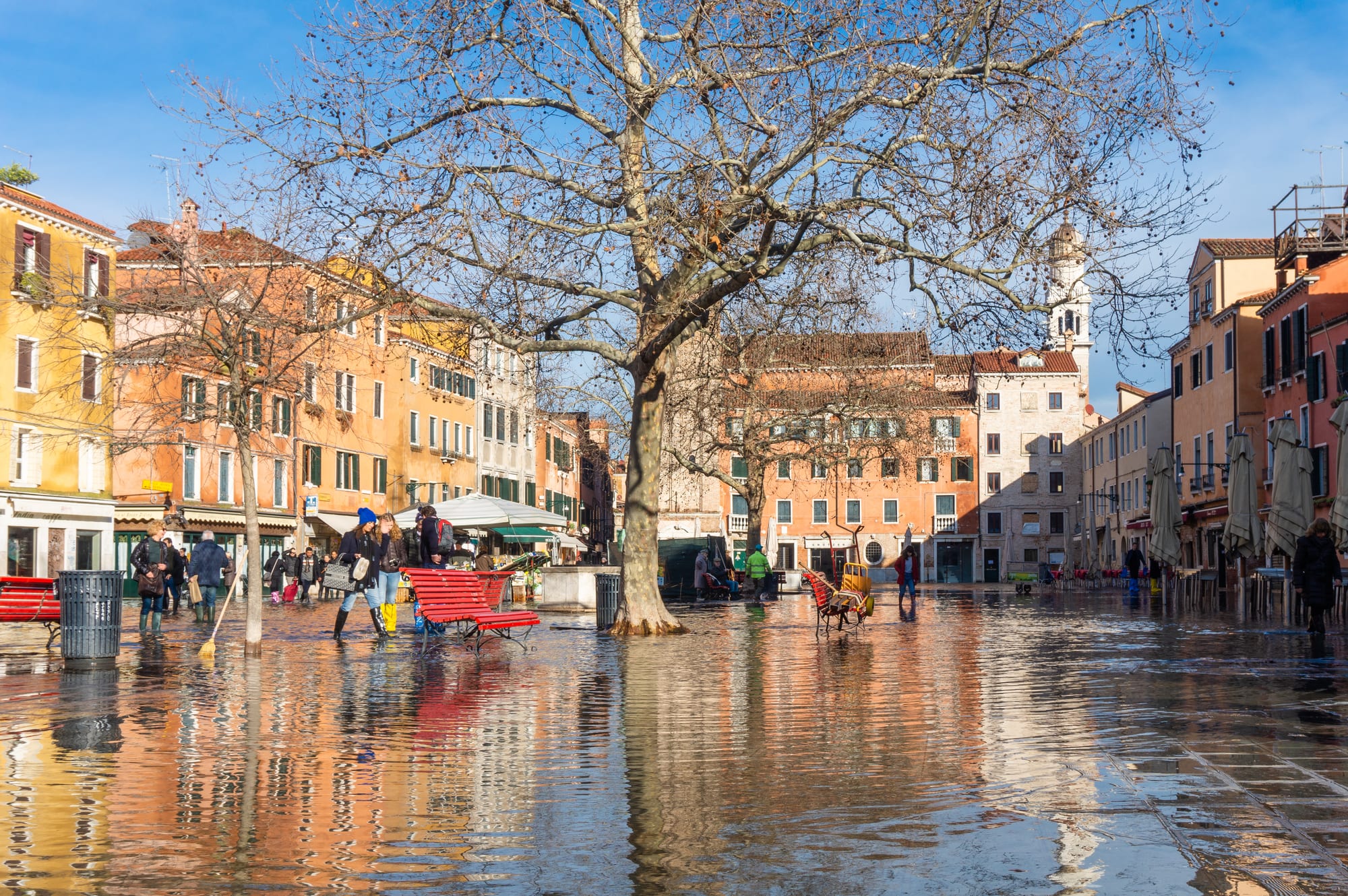
Floods in Venice have a name, acqua alta, "high water". They happen mainly between autumn and spring, when an ordinary tide is pushed higher by the weather. The Adriatic is a long, narrow sea, and its water sloshes back and forth in a slow swing called a seiche, with a period of 21 hours and 30 minutes. When that swing lines up with the tide, and a south-easterly sirocco or a north-easterly bora wind blows water towards the lagoon inlets and stops it draining away, one high tide piles on top of the last.
A tide of up to 90 centimetres above the reference level leaves Venice virtually dry, but another 50 centimetres floods more than half the city. The lowest point, around St Mark's Basilica, is only 64 centimetres above sea level. The record is 194 centimetres, on 4 November 1966, when Venice, Chioggia and the other lagoon towns were submerged. On 13 November 2019 the water reached 187 centimetres, covered more than 80 per cent of the city and damaged more than 50 churches.
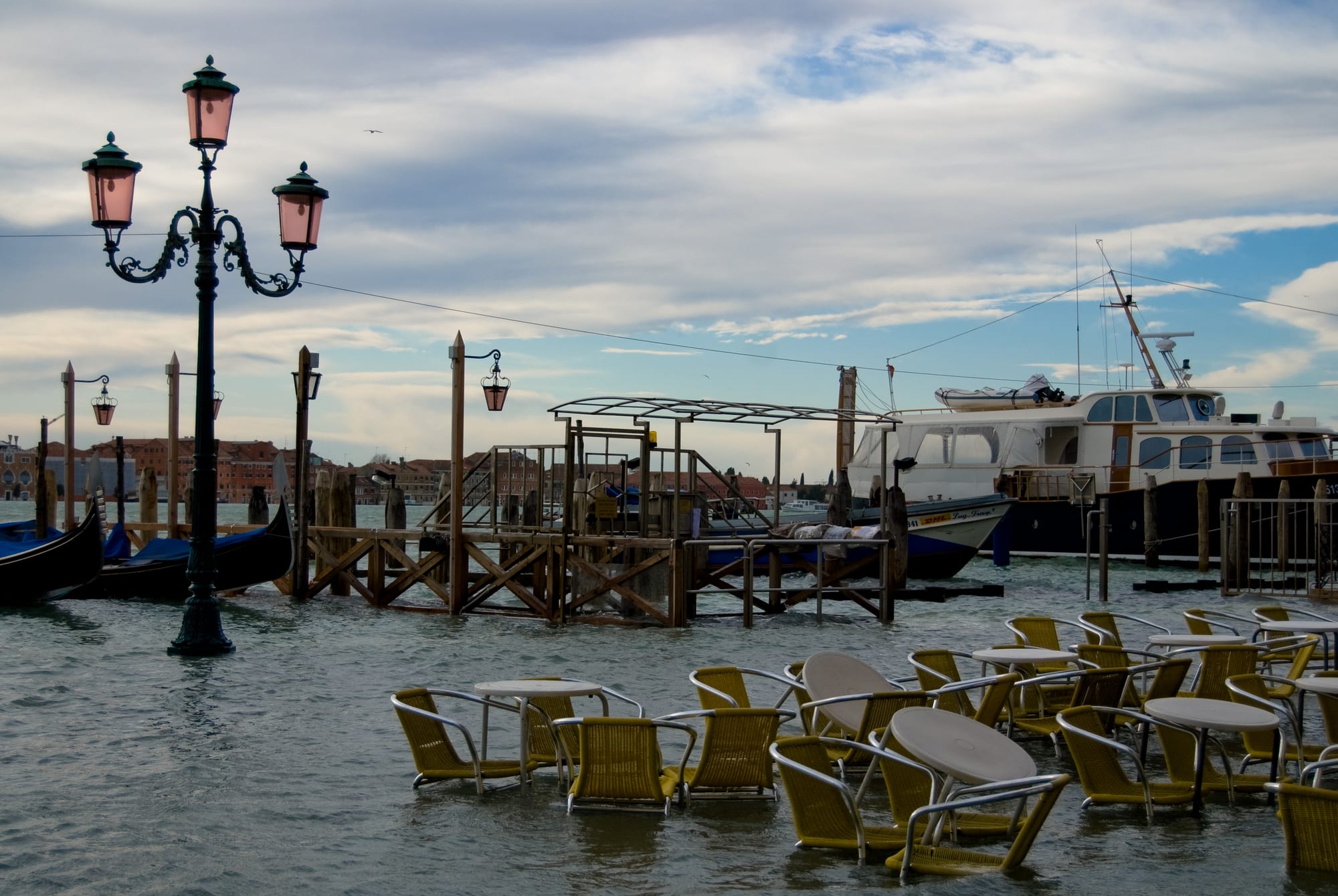
Even ordinary high waters do lasting harm: in many old houses the former ground floor has become uninhabitable.
The gates named after Moses
After 1966 the Italian state declared saving Venice a matter of "priority national interest". The answer it settled on was MOSE, short for Modulo Sperimentale Elettromeccanico, a name that also nods to Moses parting the Red Sea. It is a set of 78 hollow steel gates, each 20 metres wide, lying in concrete housings on the seabed across the three inlets: two rows at Lido, one at Malamocco and one at Chioggia, about 1.6 kilometres of barrier in all.
Normally the gates are full of water and invisible. When a dangerous tide is forecast, compressed air is pumped in, the water is pushed out, and the gates swing up on their hinges until they break the surface and seal the lagoon from the sea. Raising takes about 30 minutes, lowering about 15, and the inlets stay closed for four to five hours.
The project, begun in 2003, has been slow, costly and controversial. It missed deadlines of 2011, 2018 and 2021 and its completion date kept slipping after that. Its cost was estimated at €5.496 billion, €1.3 billion over the first projections, and in 2014 corruption arrests reached the city's own mayor. On 3 October 2020 the gates were raised against a real high tide for the first time, and St Mark's Square stayed dry.
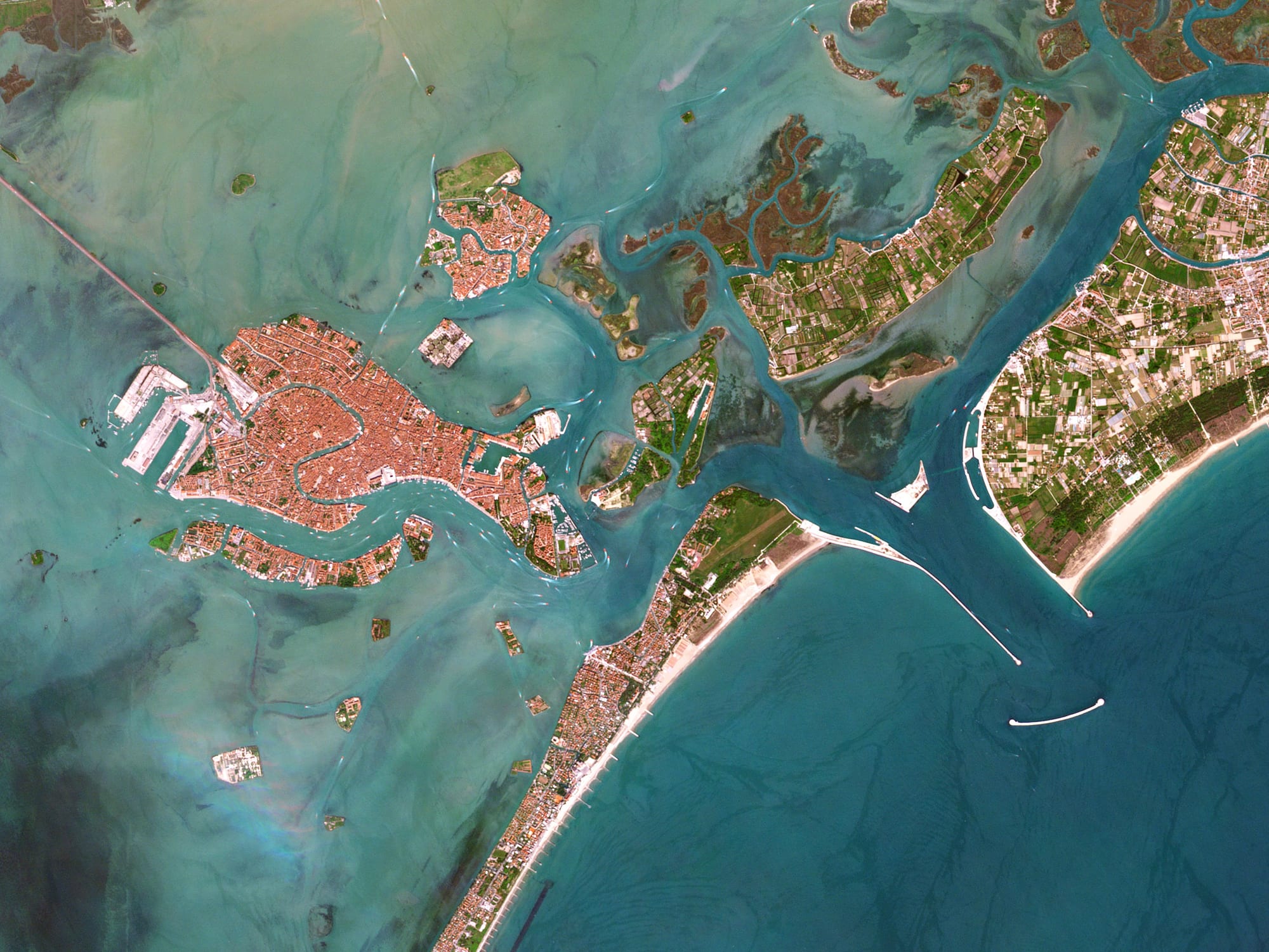
At the Lido inlet the two rows of gates meet at an artificial island that houses the machinery for raising them.
Will it be enough?
The gates work. Within two years of their first use they had been raised 49 times, far more than the five times a year their designers had estimated. By 2023 the rule was to raise them only for tides forecast at more than 1.30 metres, which still lets lower floods into the lowest streets around St Mark's.
The long-term problem is the sea itself. MOSE was built to cope with a rise of 60 centimetres. In 2019 the Intergovernmental Panel on Climate Change estimated a rise of 60 to 110 centimetres by 2100 if emissions keep growing, beyond what the system was designed for. Tides of 110 centimetres, which now come about four times a year, are expected to come 60 times a year within 50 years. Critics such as Luigi D'Alpaos, an emeritus professor of hydraulics, warn that the gates might then have to stay shut so often that they became a near-permanent wall, cutting the lagoon off from the sea and turning it into a stagnant pool.
Venice is saved from the great floods for now, and no longer sinks fast. Whether it stays above water this century depends on how high the Adriatic climbs.
Seeing it today
Acqua alta is most likely between autumn and spring. When a high tide is due, sirens across the city sound a rising number of tones to signal how high the water will reach, and raised wooden walkways go up along the main routes. Venice and its lagoon were inscribed together as a UNESCO World Heritage Site in 1987.