Attractions & Natural Wonders · Algeria
Why was the Sahara once green?
A slow wobble in Earth's orbit pushed the African monsoon north, and grass, lakes and less dust kept the rain coming, until about 5,000 years ago.
By Globeway Editorial · 13 October 2026
The short answer
The Sahara was green because Earth's orbit shifted. Our planet's axis slowly wobbles, a motion called precession, and this changes the time of year when Earth passes closest to the Sun. Between about 11,000 and 10,000 years ago that closest approach fell in northern summer, giving North Africa about 8 per cent more summer sunshine. The hotter land drew the West African monsoon, the summer rain belt, far deeper into the desert than it reaches today.
That alone would not have been enough. Once rain fell, grass and trees spread, lakes filled and dust stopped blowing, and each change helped the next year's rain. From roughly 14,500 years ago until about 6,000 to 5,000 years ago, much of the Sahara was savanna dotted with lakes, home to hippos, crocodiles and cattle herders. Scientists call this the African humid period.
A desert that comes and goes
The green Sahara was not a one-off. Scientists have identified more than 230 humid periods in North Africa over the past eight million years, recurring roughly every 21,000 years. Between them, the desert returns.
Just before the last humid period, the Sahara was at its harshest. During the coldest part of the last ice age it was much larger than today, reaching 500 to 800 kilometres further south. Huge sheets of dunes were on the move, lakes as far south as Lake Victoria had dried out, and the desert was almost empty of people, who had retreated to the Mediterranean coast and the Nile valley. Big ice sheets in the north had squeezed the tropical rain belt towards the equator.
As the ice age ended, that squeeze eased. Around 14,500 years ago lakes began to appear in the dry interior, and the wet conditions went on to spread across the desert.
Earth's wobble and the monsoon
A monsoon is a seasonal wind that brings rain. In summer, sunshine heats the land of North Africa more strongly than the ocean, creating an area of low pressure that pulls in moist air from the Atlantic. The stronger the summer heating, the stronger the pull and the further north the rain reaches.
Precession sets how strong that heating is. Earth's orbit is slightly oval, and over thousands of years the season at which the planet passes closest to the Sun drifts round the calendar. When it coincides with northern summer, as it did in the early part of the humid period, summer sunshine over North Africa increases. Between 15,000 and 5,000 years ago, it was at least 4 per cent higher than now. The tropical rain belt was probably drawn five to seven degrees of latitude further north than today.
The idea that the orbit controls the monsoon was first put forward in the late 19th century and was formally tested by the meteorologist John Kutzbach in
- It is now widely accepted as the underlying driver of these long cycles.
How a little sunshine became a green Sahara
Climate models show that the orbital change on its own cannot produce enough rain to explain the lakes and vegetation the humid period left behind. The landscape amplified it. Bare sand reflects much of the sunlight that falls on it; plants are darker and absorb more, so more energy is available to drive the monsoon. Plants also release moisture into the air. Lakes covered some of the main sources of dust, and less dust in the sky made clouds rain more readily.
The result was a Sahara that received an estimated 300 to 400 millimetres of rain a year, enough to support an open savanna of grass, shrubs and trees across almost all of it. Today the desert's southern edge is defined by just 150 millimetres a year, and its northern edge by 100.
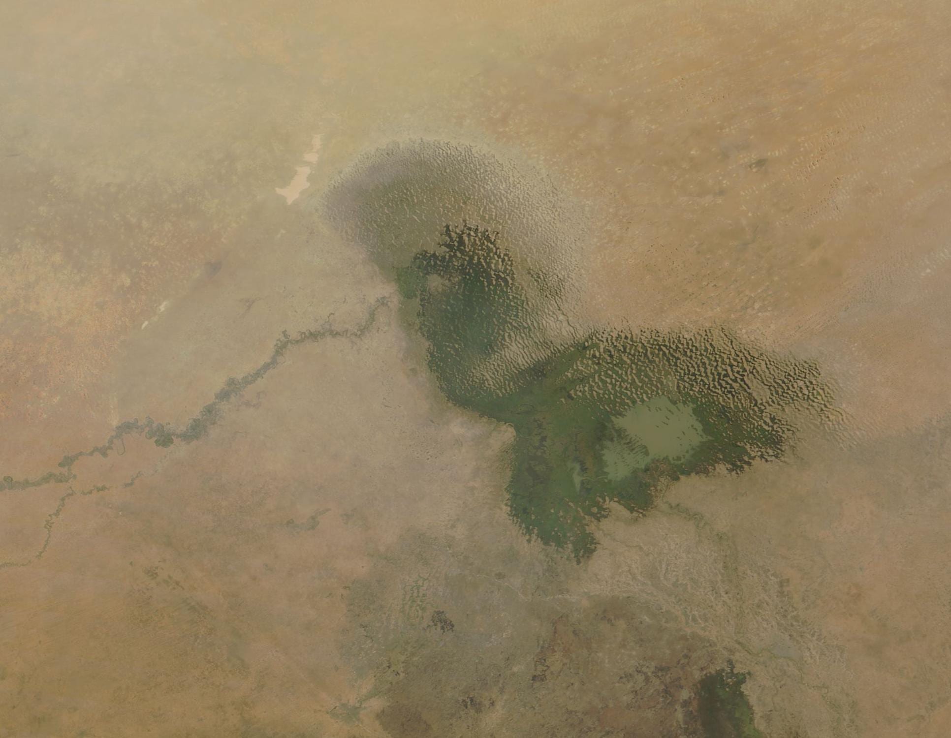
The largest of the Saharan lakes was Lake Chad, which grew to at least ten times its present size to form Lake Megachad, covering more than 300,000 square kilometres and then the largest lake on Earth. Skeletons of elephants, hippos and humans have been found on its old northern shore. Between 2013 and 2016 the open water of Lake Chad averaged about 1,876 square kilometres.
Hippos, lakes and herders
The animals of the green Sahara read like a list from an East African game park: elephants, giraffes, rhinoceroses, hippopotamuses, crocodiles, antelopes, pelicans, Nile perch and catfish. Rivers and lakes formed corridors along which crocodiles and fish spread. People followed the water. Many lived by fishing and hunting, and the Dufuna canoe, one of the oldest known boats in the world, appears to date from this period. Later, herders moved in with cattle, sheep and goats.
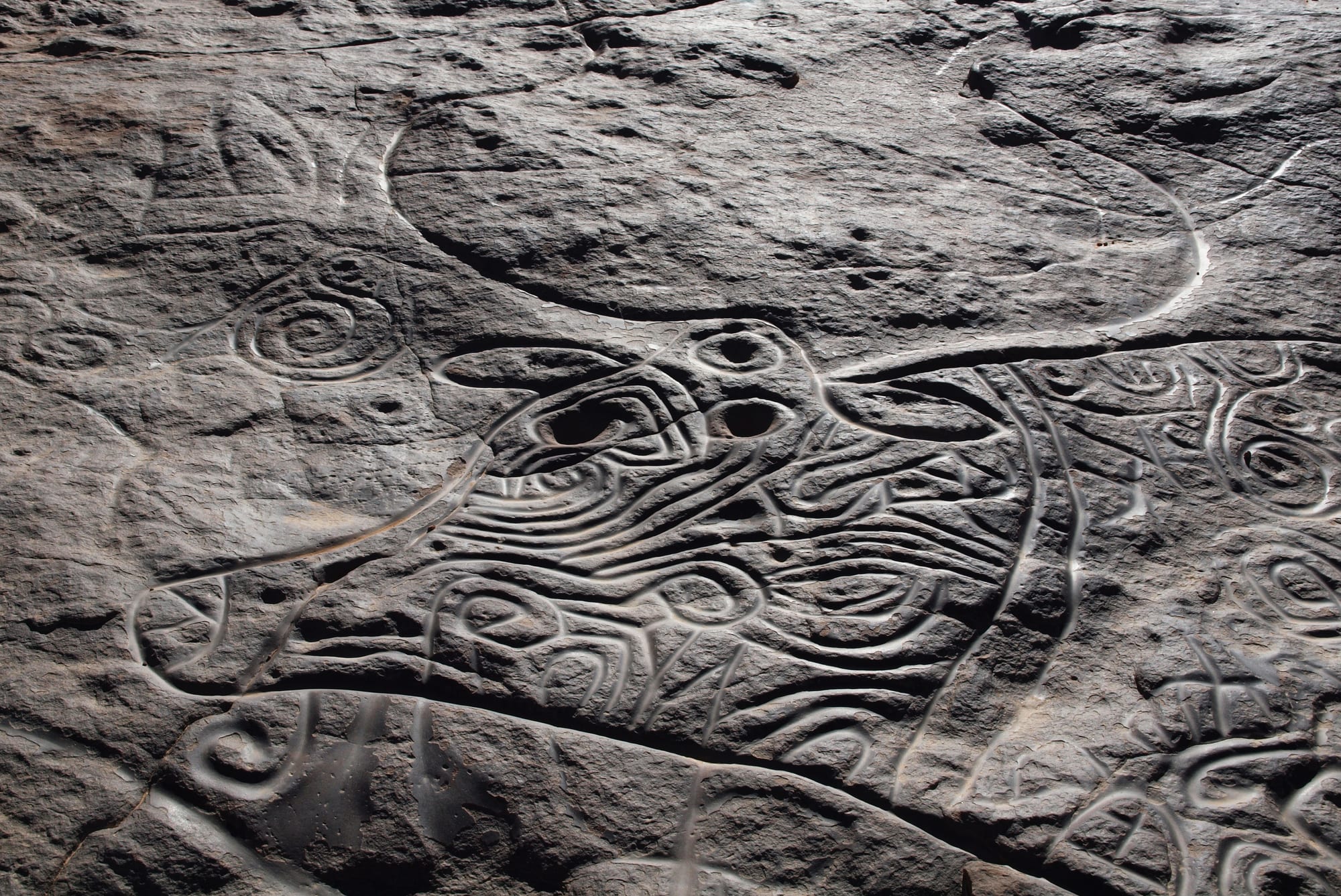
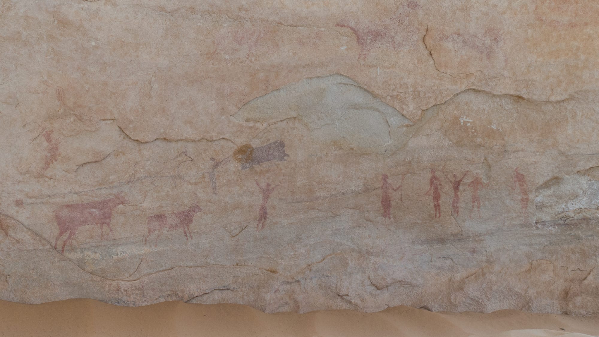
The clearest record of that world is on the rocks. Tassili n'Ajjer, a sandstone plateau of more than 72,000 square kilometres in south-eastern Algeria, holds one of the most important collections of prehistoric rock art on Earth, with around 15,000 engravings identified. The earliest may be 12,000 years old. They show wild animals such as antelopes and crocodiles, then herds of cattle, then, as the land dried, horses and finally camels.
The art was what first made scientists suspect the desert had changed. The explorer Heinrich Barth wondered about a wetter past after finding engravings in the Murzuq Desert in 1850, and in the 1930s the desert explorer László Almásy coined the idea of a green Sahara after seeing more of them.
Why the rain went away
As precession moved on, summer sunshine slowly weakened, and the same feedbacks that had built the green Sahara worked in reverse: less rain meant fewer plants, more bare sand and more dust. The humid period ended about 6,000 to 5,000 years ago. In some places the change was sudden, in others gradual, and scientists still debate how abrupt it was. Climate models suggest that a gradual fall in sunshine can trigger a sudden switch back to desert. Some researchers have also proposed that herders overgrazing the grassland hastened the end.
Dunes began to move again, and people gradually left for places with reliable water, such as the Nile valley and Mesopotamia, where early complex societies grew. The humid period and its end shaped African cultures, including the birth of Ancient Egyptian civilisation.
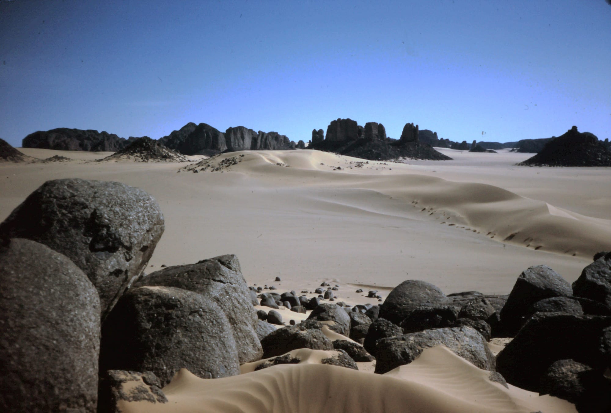
The cycle has not stopped. The Sahara is now in a dry phase, but on the long rhythm of Earth's orbit it is expected to turn green again in roughly 15,000 years. Tassili n'Ajjer, a UNESCO World Heritage Site since 1982, is where the last green age is easiest to see, painted on the walls of a desert.