Attractions & Natural Wonders · Zambia
Why is Victoria Falls called the smoke that thunders?
The whole Zambezi drops into a narrow crack in the rock, throwing up a column of spray that can be seen 50 kilometres away, and local people named it for that.
By Globeway Editorial · 13 October 2026
The short answer
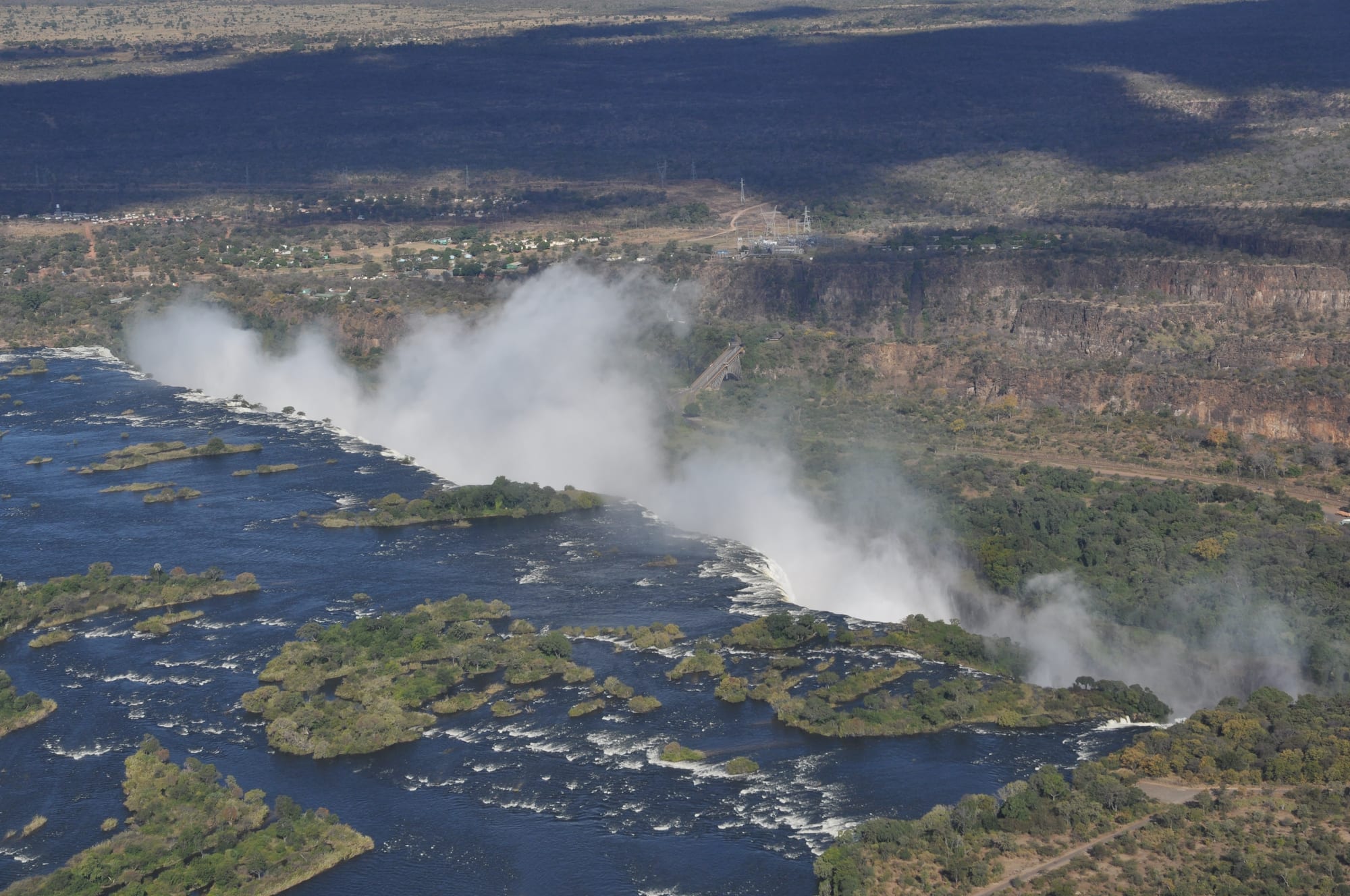
Because that is what it looks and sounds like. The Zambezi River, more than 1.7 kilometres wide at this point, falls up to 108 metres into a narrow chasm in the rock. The plunge throws up a cloud of spray that typically rises more than 400 metres, sometimes twice as high, and can be seen up to 50 kilometres away. From a distance it looks like smoke rising from a fire, and close up the falling water roars.
The name Mosi-oa-Tunya, usually translated as "the smoke that thunders" and sometimes as "the smoke that rises", comes from the Kololo language, one of the roots of Lozi, spoken today in south-western Zambia. David Livingstone, the first European known to have seen the falls, renamed them after Queen Victoria in 1855, but the African name never went away. Both are recognised on the UNESCO World Heritage List.
One name in many languages
Mosi-oa-Tunya was not the only name, and not the oldest. The southern Tonga people called them Shungu na mutitima, a name sometimes translated as "boiling water". The Ndebele, or Matabele, who arrived later, used aManz' aThunqayo, and the Batswana and the Kololo said Mosi-o-Tunya. All of these are said to mean essentially the same thing: the smoke that thunders. Livingstone also recorded the older names Seongo and Chongwe, which mean "the place of the rainbow".
The Kololo were a Sotho-Tswana people from what is now South Africa who moved north in the early 19th century and conquered the kingdom of the Luyana on the upper Zambezi. They ruled only until 1864, when the local population overthrew them, but by then their language had mixed with Luyana to form Silozi, the Lozi language. That is why a Kololo name survives on the map of Zambia.
Livingstone first saw the falls on 16 November 1855, from the island near the lip that now bears his name. He had been told about them before he arrived. Earlier European maps had already marked a waterfall here, including one drawn by Nicolas de Fer in 1715, but local people had known it for a very long time: stone tools excavated around the falls date back to the Early Stone Age.
Where the smoke comes from
Victoria Falls has an unusual shape. Upstream, the Zambezi flows across a flat plateau of basalt, a dark volcanic rock, until it meets a crack running straight across its path. The entire width of the river, 1,708 metres, plunges in a single vertical drop into this chasm, called the First Gorge, which is 80 metres deep at its western end and 108 metres in the centre. Measured by width and height together, it is the largest sheet of falling water in the world.
The water has nowhere easy to go. The only way out of the First Gorge is a gap about 110 metres wide, two-thirds of the way across, so the whole river is squeezed into a narrow cleft. Out of this trench rises the column of mist, and in the flood season the spray is so dense that the foot and face of the waterfall cannot be seen at all.
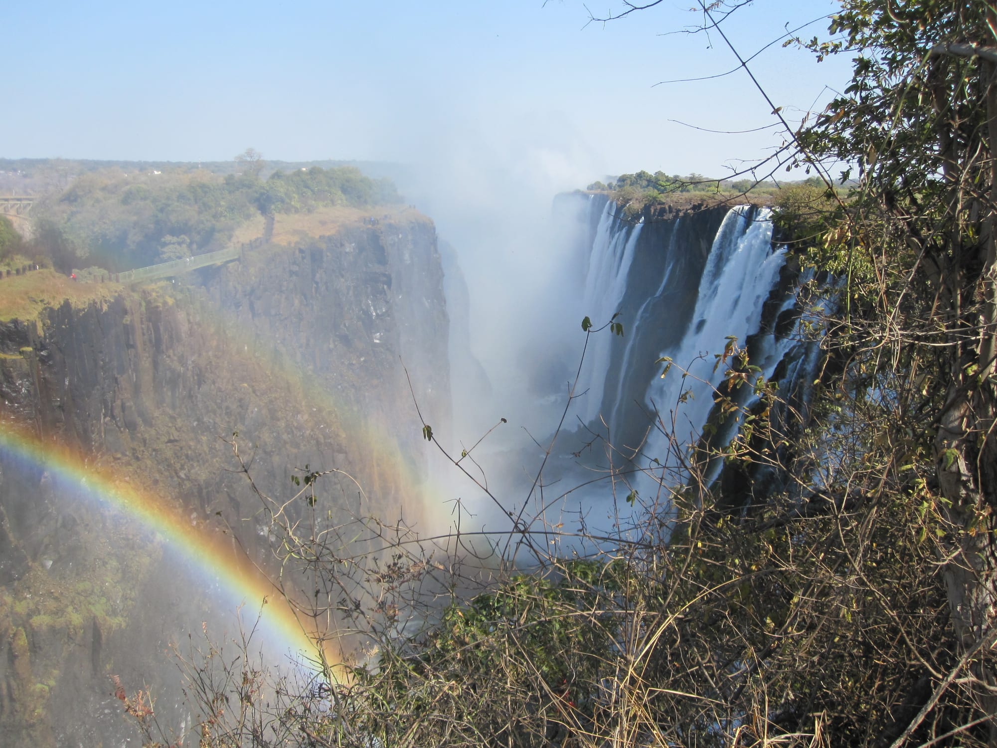
The constant drizzle feeds a strip of rainforest on the cliff opposite the falls, with plants that are rare in this dry savanna region, such as ebony, ivory palm, wild date palm and pod mahogany. When Cecil Rhodes planned a railway bridge across the Zambezi, he told the engineers to build it where passing trains would catch the spray. The Victoria Falls Bridge opened in 1905 across the Second Gorge, just below the falls.
A waterfall that keeps moving
The chasm exists because the falls are slowly eating their way upstream. Until about 2 million years ago, the upper Zambezi drained south through what is now Botswana. When the land rose and blocked that route, a vast lake formed in the Kalahari, and around 20,000 years ago, in a wetter climate, it overflowed eastward and began cutting a gorge through the basalt.
The basalt here is crossed by joints and faults, and the river exploits them. Each time the falling water wears through one crack, the waterfall retreats to the next, leaving behind a zigzag of gorges below the present falls, which mark eight earlier positions of the waterfall. The process has not stopped: at the Devil's Cataract, near the Zimbabwean bank, the lip is lowest and carries the most water in flood, and the falls may already have begun cutting the next gorge there.
When the smoke is thickest
The amount of smoke depends on the season. Upstream of the falls the Zambezi has a rainy season from late November to early April, and the river's flood follows, from February to May with a peak in April. That is when the most water goes over the edge. At full moon the spray can also produce a moonbow, a rainbow made by moonlight.
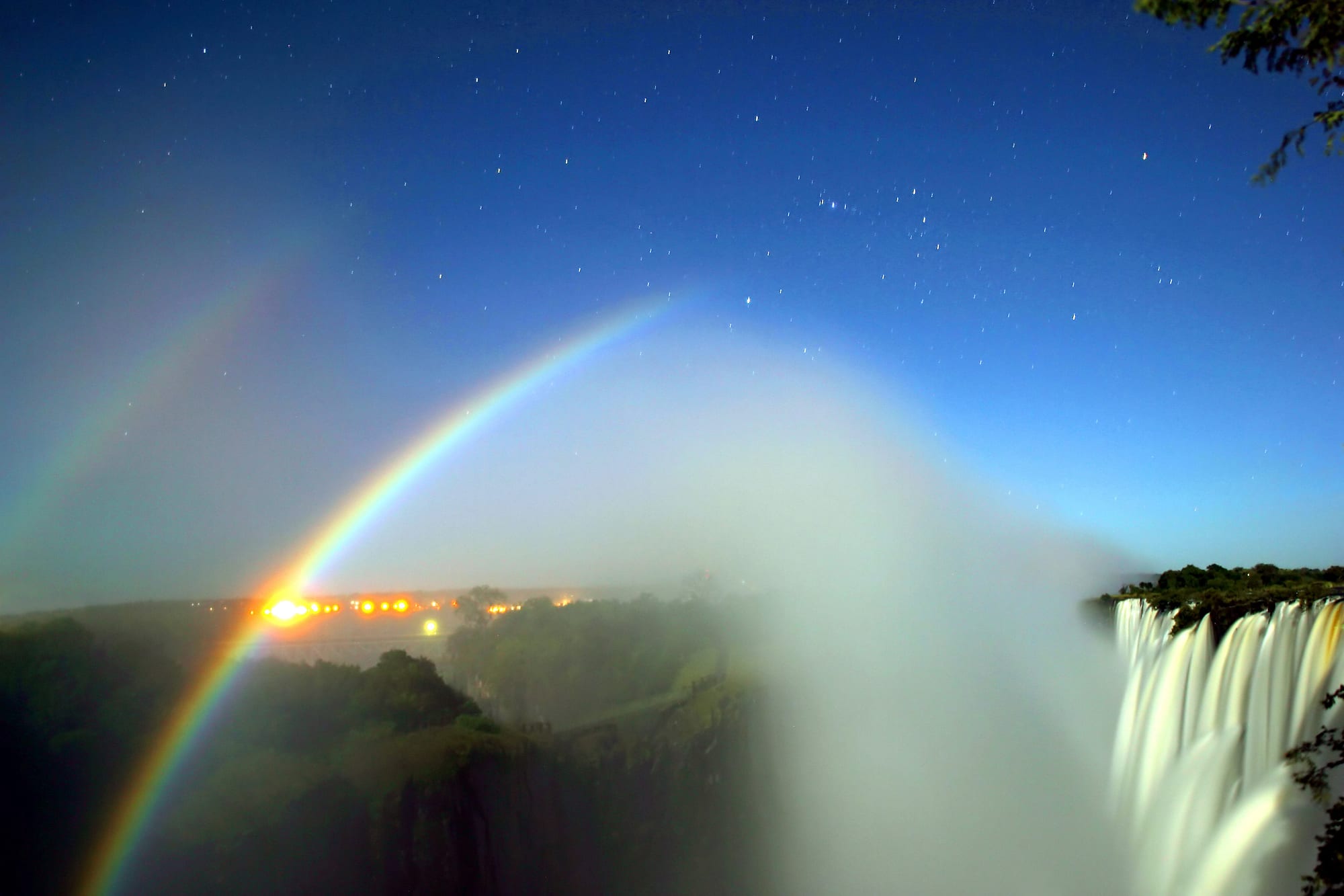
Older local names for the falls already linked them to rainbows. A moonbow is much fainter than a rainbow made by sunlight, because the Moon reflects far less light, so it needs a moon at or near full and a very dark sky. To the naked eye its colours are hard to make out.
In the dry season the falls change character. The minimum flow, in November, is around a tenth of the April peak, a bigger swing than at other major waterfalls. From September to January up to half of the rock face may be dry, and the bottom of the First Gorge comes into view along most of its length. In 2019 unusually low rain cut the flow to its lowest level in a century, and drought years in the region are becoming more frequent and intense.
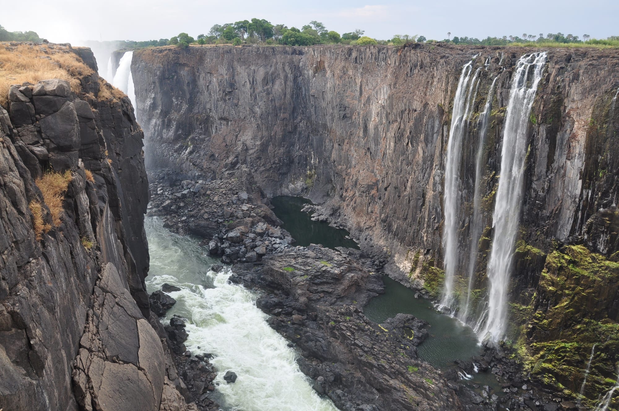
The falls are shared by Zambia and Zimbabwe. On the Zambian side, around the town of Livingstone, they lie within Mosi-oa-Tunya National Park; on the Zimbabwean side, within Victoria Falls National Park. In the low-water months it becomes possible to walk to the bottom of the First Gorge on the Zimbabwean side, and the cliff face hidden by spray in the flood season is laid bare.