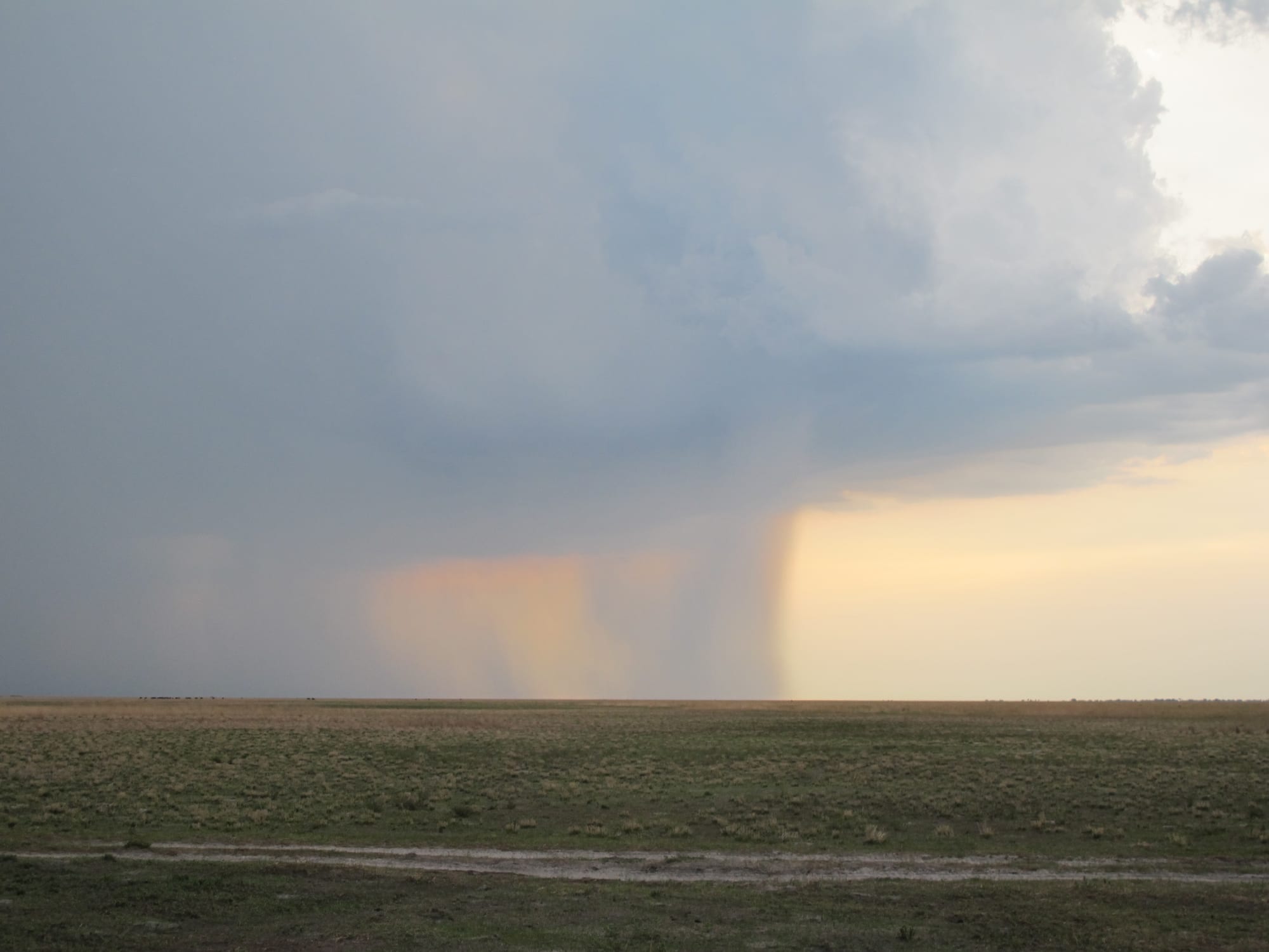
A flat, open grassland stretching to the horizon under a dark storm cloud with a column of rain

Zambia

Livingstone, Victoria Falls & the West

Open grassland under a passing rainstorm in Liuwa Plain National Park, in Zambia's Western Province. (S1m0nB3rry / Wikimedia Commons · CC BY-SA 2.0)

The southern and western half of Zambia — the Southern, Western and North-Western provinces — running from Livingstone and the Zambian side of Victoria Falls along the Zambezi to Lake Kariba's northern shore, and west across the Kafue wilderness to the Lozi kingdom's Barotse floodplain and the river's source near Mwinilunga.

Explore Livingstone, Victoria Falls & the West

History

The Tonga, long settled on the Southern Province plateau and in the Gwembe Valley, are among the oldest communities of the region. Near the Zambezi at Ingombe Ilede, burials of around the sixteenth century contained gold, copper crosses, glass beads and cloth, evidence that the valley was linked into trade with the Indian Ocean coast.

In the west, the Lozi built a kingdom on the Barotse floodplain, organised around the annual flood. In the 1830s it was conquered by the Makololo, invaders from the south under Sebitwane, before the Lozi regained power in 1864. It was on a journey with Kololo companions that David Livingstone reached the Falls in 1855. The Lozi king Lewanika signed concessions with the British South Africa Company from 1889, and Barotseland kept a distinct status under British rule. The Barotseland Agreement of 1964, which folded it into independent Zambia, was later abrogated, and some Lozi still campaign for its restoration.

Livingstone town was laid out near the Falls in 1905, when the railway bridge opened, and served as the capital of Northern Rhodesia until 1935. The Kariba Dam, completed in 1959, flooded much of the Gwembe Valley and displaced tens of thousands of Tonga people from both banks. Since the 2000s the North-Western Province has become a major copper producer, with large mines around Solwezi.

Culture & Customs

The region holds three distinct cultural worlds. The Tonga of the south are cattle people, and bride payments, cattle wealth and the plateau's maize farms define the rural economy; the Lwiindi rain ceremonies are held by Tonga chiefs. The Lozi of the west have Zambia's best-known monarchy: in the Kuomboka, the Litunga is paddled in the great barge Nalikwanda from his dry-season palace at Lealui to higher ground at Limulunga, with royal drums, paddlers in regalia and crowds along the water.

In the North-West, the Luvale, Chokwe, Luchazi and Mbunda peoples perform the Makishi masquerade, whose masked dancers mark the end of boys' initiation; UNESCO lists it as intangible heritage. The Luvale Likumbi Lya Mize festival near the town of Zambezi is one of its main public stages.

Silozi is the common language across Western Province, Tonga in the south, and Luvale, Lunda and Kaonde in the North-West, with English in the towns. Basketry is a regional craft: Lozi and Tonga baskets are woven from palm and grasses, and Livingstone's markets sell carvings and textiles made across the country.

Daily Life

Livingstone is the south's tourism town, and Choma, the provincial capital, and Mazabuka, surrounded by sugar estates, are the other main centres of Southern Province. Mongu is the capital of Western Province, perched on the edge of the floodplain, and Solwezi, the capital of the North-West, has grown quickly with the copper mines.

The Southern Province plateau is one of Zambia's main farming areas, with maize, cattle and commercial sugar, and the Kariba shore lives by kapenta fishing and hydropower. Western Province is poorer, depending on floodplain farming, cattle, fishing and timber, and families move with the water, farming the plain in the dry season and retreating to the edges in the flood. Mining has transformed the North-West, bringing jobs, traffic and rapid growth to Solwezi and new mine towns.

Recent droughts have hit the south hard, shrinking harvests and lowering Lake Kariba, which cut electricity output across the country.

Food

Nshima is the staple, made from maize in the south and often from cassava in the west and North-West. In Tonga and Lozi homes it is eaten with mabisi, thick sour milk, or with fish: bream and catfish from the Zambezi and its floodplain, and kapenta from Lake Kariba, dried and fried with tomato and onion. Beef is more common here than in the north, reflecting the region's cattle wealth.

The Barotse floodplain around Mongu is Zambia's main rice-growing area, and beekeepers around Mwinilunga in the North-West produce honey for export. Pumpkin leaves, beans and groundnuts are everyday relishes, and roasted maize and sweet potatoes are sold on roadsides at harvest time.

Munkoyo, the fermented drink, is popular in the west, alongside Chibuku sorghum beer. Mosi lager, named after Mosi-oa-Tunya, the local name for the Falls, is the national beer.

Attractions & Natural Wonders

Victoria Falls from the Zambian side is closer and more physical than from the opposite bank. Paths in Mosi-oa-Tunya National Park lead along the Eastern Cataract, across the Knife-Edge Bridge through the spray and down to the Boiling Pot, and at low water guided trips go to Livingstone Island and Devil's Pool on the lip of the falls. Livingstone town, a few kilometres away, has the Livingstone Museum, river cruises above the Falls and the game area of Mosi-oa-Tunya, where guided walks visit white rhino.

Downstream, the northern shore of Lake Kariba is best seen from Siavonga, near the dam wall, or Sinazongwe, where kapenta rigs set out at dusk. Inland, Lochinvar National Park protects Kafue lechwe on the Kafue Flats, and Kafue National Park, Zambia's largest, spreads its woodland, rivers and Lake Itezhi-Tezhi across several provinces, with lions and the seasonally flooded Busanga Plains in the far north-west.

Further west lies the Barotse floodplain around Mongu, best experienced at the Kuomboka or by boat in the flood. Liuwa Plain National Park, beyond Kalabo, has its wildebeest migration and hyena clans, and the Ngonye Falls interrupt the Zambezi near Sioma. In the far North-West, the source of the Zambezi rises in a patch of forest near Mwinilunga, a marshy dambo that grows into one of Africa's greatest rivers.

Cities in Livingstone, Victoria Falls & the West

Planning basics

Budget

Livingstone is the one place in the region geared to tourists, with the full range from backpacker hostels to riverside luxury lodges, and Victoria Falls activities such as rafting, flights and Livingstone Island tours priced in US dollars. Siavonga has mid-range lakeside hotels. The west is cheap to live in but costly to explore: Kafue and Liuwa camps are remote, and self-drivers need a well-equipped 4x4.

Daily Budget Midrange
USD 130–330 (lodges, one paid Falls activity, guided drives)
Daily Budget Shoestring
USD 45–85 (Livingstone hostels, buses, park entry to the Falls, local food)

Buy the Falls extras separately rather than as bundles, and budget Kafue or Liuwa as a package that includes transfers.

Safety

Livingstone is relaxed, though touts and street money-changers work around the Falls entrance and bus stations. The Zambezi is the main hazard: strong currents, crocodiles and hippos, and Devil's Pool is only for guided, low-water visits. Western Province is peaceful, although demands for Barotseland's autonomy have occasionally led to tense demonstrations. Remote parks mean long distances from medical care.

Change money at banks or bureaux, swim only at guided sites, carry water and fuel on western roads, and take malaria precautions. Check current official travel advice before travelling.

Climate

Southern Province and the Zambezi valley are among the hottest parts of Zambia: Livingstone and the Kariba shore bake before the rains in October and November. The Western Province floodplain is shaped by the annual Zambezi flood, which rises from the early rains and spreads widest around March and April. The North-Western highlands around Mwinilunga are cooler and markedly wetter.

Summer
hot and wet, often 30–35°C in the valleys; storms most afternoons
Winter
dry, sunny days around 24–27°C, with cold nights on the plateau and in the Kalahari sands

Transportation

Livingstone has an international airport and is linked to Lusaka by the main highway, roughly a day's bus ride. The Victoria Falls Bridge leads into Zimbabwe, and the Kazungula Bridge crosses to Botswana. A paved road runs west from Lusaka through Kafue National Park to Mongu, and from there a causeway crosses the floodplain towards Kalabo and Liuwa. The North-West is reached via the Copperbelt on the road to Solwezi. Distances are long and public transport beyond the main roads is sparse.

Use a 4x4 with a local driver for Kafue, Liuwa and the far north-west, and check whether flood-season roads and pontoons are open.

Best Time to Visit

Victoria Falls is at its fullest from about March to May, when spray hides much of the gorge, and lowest from about September to December, when Devil's Pool opens and the rock face shows. Kafue is best from June to October, when its roads open. Liuwa's wildebeest gather on the plains in their tens of thousands. The Kuomboka is held at the end of the rains, when the flood allows.