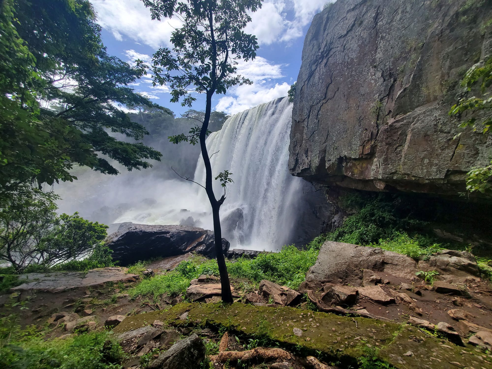
A broad waterfall pouring over a rock lip into spray, framed by a slender tree, green bush and a rock wall

Zambia

Kasama, Bangweulu & the North

Chishimba Falls near Kasama, in the Northern Province of Zambia. (Sheenasitwala / Wikimedia Commons · CC BY-SA 4.0)

Zambia's rainy, sparsely visited north — the Northern, Muchinga and Luapula provinces between the Luangwa Valley, the Congo border and Lake Tanganyika, taking in the Bemba heartland around Kasama, the Bangweulu wetlands, the great waterfalls of the plateau and Zambia's Lake Tanganyika port at Mpulungu.

Explore Kasama, Bangweulu & the North

History

The plateau has an exceptionally deep human past. At Kalambo Falls, archaeologists have found Stone Age tools and, in 2023, interlocking worked logs dated to roughly 476,000 years ago, older than Homo sapiens itself. Rock paintings at Mwela near Kasama are the work of much later hunter-gatherers.

From the eighteenth century two powerful states shaped the region. The Bemba, under their paramount chief the Chitimukulu, built a kingdom around present-day Kasama and expanded through raiding and the ivory and slave trade with Swahili-Arab caravans. In the Luapula Valley, Lunda migrants from the west founded the kingdom of Mwata Kazembe, whose capital near Lake Mweru was visited by Portuguese envoys at the end of the century. David Livingstone crossed the north repeatedly in his last years and died in 1873 just south of the Bangweulu swamps.

The British South Africa Company and Catholic White Fathers missions arrived in the 1890s. Abercorn, now Mbala, was the scene of the formal surrender of the German East African forces under Paul von Lettow-Vorbeck in November 1918, after news of the armistice reached them at the Chambeshi River. In the 1950s and 1960s the north, especially around Chinsali, was a nationalist stronghold: Kenneth Kaunda grew up at the Lubwa mission there. In 1964 the area also saw violent clashes between government forces and Alice Lenshina's Lumpa Church, in which an estimated 700 to more than 1,000 people died.

Culture & Customs

Bemba is the common language across most of the north, spoken far beyond the Bemba themselves, alongside Bisa, Lunda, Namwanga, Mambwe, Lungu, Tabwa and others. Catholicism is strong, a legacy of the White Fathers, and churches and mission stations anchor many villages.

The great ceremonies are royal occasions. The Bemba paramount chief, the Chitimukulu, keeps his headquarters in Mungwi District east of Kasama. The Lunda of Luapula celebrate Mutomboko at the end of July at Mwansabombwe, where Mwata Kazembe performs a victory dance recalling the conquest of the valley. Smaller chiefdoms have their own festivals through the dry season.

Village life keeps traditions such as chitemene, the old Bemba practice of lopping miombo branches and burning them to fertilise millet gardens, although it is declining as population grows. Respect for chiefs, who control customary land, and for elders runs deep, and the north is known in the rest of Zambia for its forceful politics and its sharp sense of humour.

Daily Life

This is a rural region of scattered villages, with no city on the scale of Lusaka or the Copperbelt. Kasama is the largest town and the capital of Northern Province; Chinsali is the capital of Muchinga, created in 2011, and Mansa of Luapula. Mpika, Mbala, Mpulungu, Nakonde and the lakeside fishing towns of Samfya and Nchelenge make up the rest of the urban map.

Most families farm cassava, finger millet, maize and beans, and fishing is the great cash economy on Bangweulu, Mweru and Tanganyika, with dried fish sent by truck to the Copperbelt and Lusaka. Nakonde lives from the truck traffic crossing into Tanzania at Tunduma, and Mpulungu from lake trade. Luapula ranks among the poorest provinces in the country, and many young people leave for the cities.

Days follow the fields and the fishing boats; markets are busiest in the morning, and in the rainy season roads, not distance, decide what is possible.

Food

In much of the north the staple is cassava rather than maize, and nshima (ubwali in Bemba) is often made from cassava meal or a mix with finger millet. It is eaten with fish above all: fresh or smoked bream, catfish and small dried fish from Bangweulu and Mweru, and kapenta and other small fish from Lake Tanganyika.

Chikanda, the savoury loaf of wild orchid tubers and ground peanuts, is a Bemba speciality from this part of Zambia. Ifisashi, greens cooked in groundnut sauce, and cassava leaves pounded and stewed are everyday relishes. The rainy season brings wild mushrooms, sold in heaps on the roadside, and edible caterpillars, dried and fried, are a prized seasonal food. Honey is collected from the miombo woodland.

To drink there is munkoyo, the lightly fermented maize-and-root drink, and home brews of millet, alongside bottled lager and strong sweet tea in the towns.

Attractions & Natural Wonders

Lake Bangweulu and its wetlands are the north's natural centrepiece: open water off Samfya's white-sand shore, and to the east a vast swamp where shoebills hunt among the papyrus and tens of thousands of black lechwe graze the floodplain. Guided canoe trips from the community-run camps are the usual way to find a shoebill. Further north on the Congo border, Lake Mweru and the Ntumbachushi Falls near Kawambwa are rarely visited.

The plateau waterfalls are the other draw. Kalambo Falls, beyond Mbala on the Tanzanian border, drops more than 200 metres into a gorge in a single fall. Chishimba Falls, near Kasama, is an easy excursion from town, as are the Mwela rock paintings. Lumangwe and Kabwelume falls on the Kalungwishi River are larger and wilder. At Mpulungu, the road ends on the shore of Lake Tanganyika, with fishing boats, a working harbour and clear water; Nsumbu National Park lies further along the lakeshore.

In Muchinga, the Mutinondo Wilderness camp lies near Mpika, and Shiwa Ng'andu, the Gore-Browne estate, has its brick manor house, lake and the Kapishya hot springs. North Luangwa National Park, the northernmost of the valley's three parks, protects the upper Luangwa Valley.

Cities in Kasama, Bangweulu & the North

Planning basics

Budget

The north is cheaper than the south for the traveller, simply because there are few tourist-priced places: government rest houses, simple lodges and local buses dominate. The exceptions are the Bangweulu camps and Mutinondo, which charge safari-style rates and are expensive to reach without a 4x4 or a charter flight.

Daily Budget Midrange
USD 100–250 (lodges, hired 4x4 with driver, guided wetland trips)
Daily Budget Shoestring
USD 30–60 (guesthouses, buses, local meals)

Carry enough kwacha for long stretches; cash machines are found in the provincial towns but are scarce beyond them.

Safety

The north is quiet and generally safe, with little crime aimed at visitors. The risks are those of remoteness: long distances, poor roads, limited medical care and patchy mobile coverage. Malaria is high in the wet season, and crocodiles and bilharzia make unmanaged lake and river swimming unwise. Border towns such as Nakonde are busy with truck traffic.

Carry water, fuel and a spare tyre on rural roads, travel by day, and arrange guides for the wetlands and waterfalls. Check current official travel advice before travelling.

Climate

This is the wettest part of Zambia, with heavy rain from November to April that fills the Bangweulu swamps and swells the waterfalls. The plateau around Kasama and Mpika lies at well over 1,000 metres and stays mild, with cool dry-season nights, while the Lake Tanganyika shore at Mpulungu is lower, hotter and more humid.

Summer
warm, humid and very wet on the plateau, around 25–28°C; hot on the lakeshore
Winter
dry and sunny with days around 22–26°C and cool nights on the plateau

Transportation

The Great North Road runs from the Luangwa escarpment through Mpika to Nakonde on the Tanzanian border, with a branch to Kasama, Mbala and Mpulungu. The TAZARA railway follows a similar line through Mpika and Kasama. Luapula is reached by road via the Copperbelt or across the Bangweulu causeway road towards Samfya and Mansa. The Bangweulu camps and Kalambo need a 4x4, and some lodges are served by charter flights.

Plan dirt-road sections for the dry season and allow extra time; many side roads become impassable after heavy rain.

Best Time to Visit

The dry season from May to October makes the roads passable and is best for general travel; the waterfalls are fullest early in that window, from about April to June. Shoebill trips into Bangweulu depend on water levels, so timing is best checked with the camps. The Mutomboko ceremony falls at the end of July.