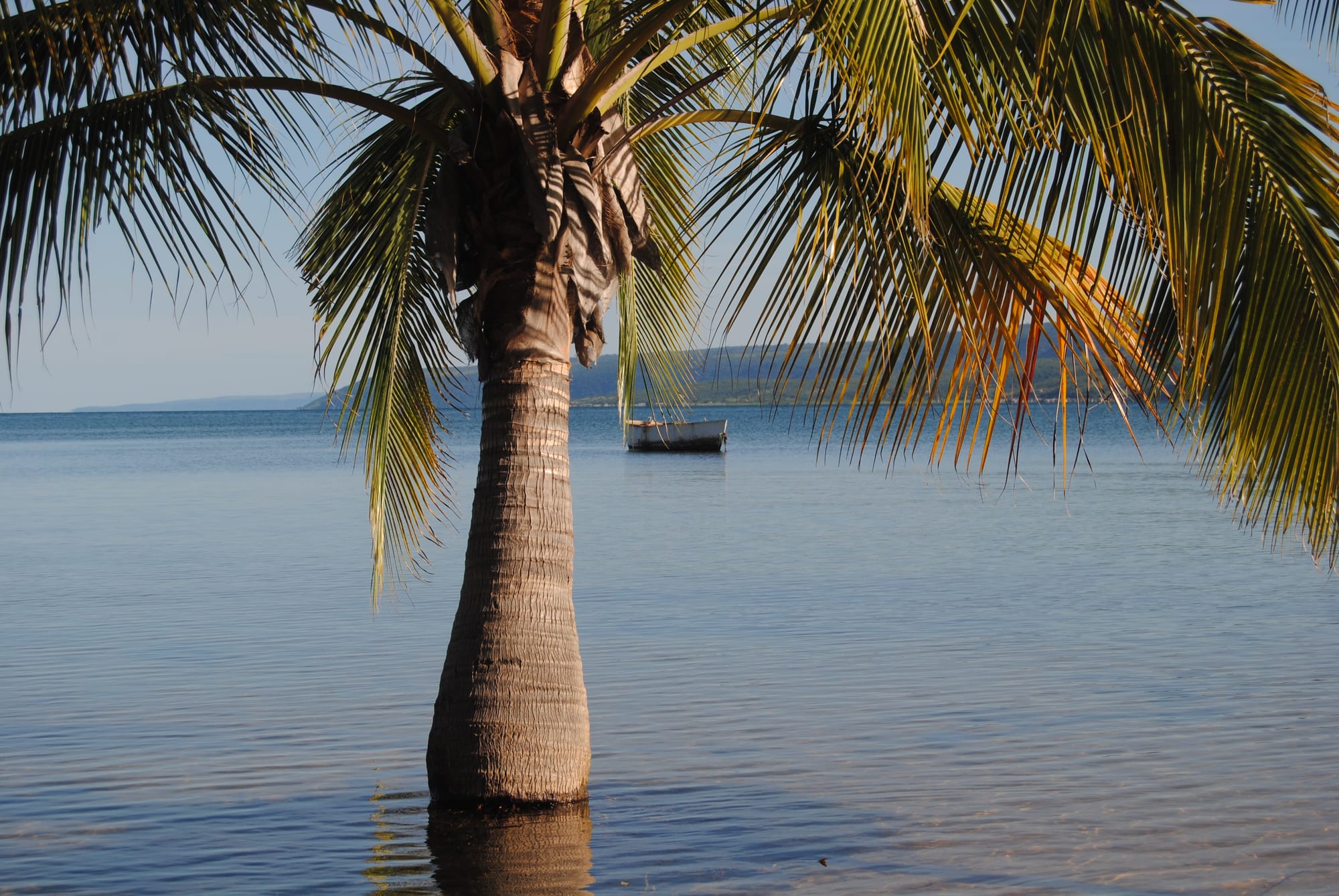
A palm tree standing in shallow calm water, with a small wooden boat moored offshore and low hills across the lake

Kasama, Bangweulu & the North, Zambia

Mpulungu

The shore of Lake Tanganyika in northern Zambia, with a boat moored off the beach. (Mary Milanzi / Wikimedia Commons · CC BY-SA 4.0)

Zambia's port on Lake Tanganyika, at the far northern end of the country where the tarred road from Mbala runs out at the water. It is a working harbour of fishing boats, cargo sheds and fish traders, set among rocky bays and palm-fringed beaches, and the jumping-off point for lake crossings towards Tanzania and for the Kalambo Falls inland.

Neighbourhoods

  • The harbour and town centre
    • First-time visitors
    • Local life
    • Close to transport

    The compact centre sits above the harbour, where cargo sheds, fuel tanks and fishing boats crowd the water and traders move dried fish onto trucks. Shops, the market, banks, guesthouses and the bus stand are all within a few minutes' walk of each other.

    Open in Maps
  • The bays and beaches west of town
    • Beaches
    • Quiet and residential
    • Swimming and boats

    A string of rocky headlands and small sand beaches runs west along the lakeshore from the port, reached by short boat rides or rough tracks. Lodges and campsites sit on the bays here, away from the noise of the harbour, and the water is clear and deep close in.

    Open in Maps
  • Niamkolo and the lakeshore
    • Historic sites
    • Quiet and residential

    The lakeshore just outside the harbour holds the stone ruin of the Niamkolo mission church and a scatter of fishing settlements. It is a quiet, low-lying stretch of lakeside, with the hills of the escarpment rising steeply behind.

    Open in Maps

Things to do

The lake and the town

  • Lake Tanganyikaattraction

    The second-deepest lake in the world, shared by four countries, reaching its southern tip at Mpulungu and famous for the cichlid fish that fill its clear water.

    Open in Maps
  • Mpulungu harbourtransit hub

    Zambia's port on Lake Tanganyika, working cargo and fish traffic and served by the lake vessels that call here from Kigoma and other Tanzanian ports.

    Open in Maps
  • Niamkolo Churchlandmark

    The roofless stone shell of a London Missionary Society church of 1895, listed among Zambia's national monuments as the oldest surviving church building in the country, standing near the lakeshore just outside the town.

    Open in Maps

Short trips from the town

  • Kalambo Fallslandmark

    A single uninterrupted drop of more than 200 metres into a gorge on the Zambia–Tanzania border, and an archaeological site of international importance for its very early wooden finds.

    Open in Maps
  • Moto Moto Museummuseum

    A large ethnographic museum founded from the collection of a missionary priest, covering the material culture, crafts and ceremonies of northern Zambia.

    Open in Maps
  • Mbalaattraction

    The old colonial station of Abercorn, on the plateau above the lake, where German East African forces formally surrendered in November 1918.

    Open in Maps

Eat and drink

Long-standing places and food districts in Mpulungu. Hours, ratings and directions come from your maps app, always current.

Mpulungu classics

  • Lake Tanganyika fishrestaurant

    The big predatory lates of Lake Tanganyika, endemic to the lake, are grilled or fried whole and eaten with nshima; bream and catfish appear on the same plates.

    Open in Maps
  • Kapentamarket

    The small silvery lake fish caught at night under lamps, dried in the sun in great grey sheets and fried with tomato and onion — the town's main trade as well as its everyday relish.

    Open in Maps

Markets and stalls

  • Mpulungu marketmarket

    The town's produce and fish market, with cassava and maize meal, greens, groundnuts, tomatoes and heaps of dried fish for the trucks going south.

    Open in Maps
  • Harbour-side food stallsneighborhood

    Simple stands near the port frying fish and chips, serving nshima with relish and pouring strong sweet tea for dock workers and traders.

    Open in Maps

Experience Mpulungu

History

The southern end of Lake Tanganyika has long been the country of the Lungu and Mambwe, fishing and farming peoples whose villages lined the bays and the rivers running off the escarpment. In the nineteenth century the shore lay on the route of Swahili-Arab caravans trading ivory and slaves between the lake and the Indian Ocean coast, and the lake itself was a highway long before any road reached it.

European missions came in the 1880s and 1890s. The London Missionary Society established a station at Niamkolo, beside the present town, and built the stone church whose ruin still stands; the society also put a steamer on the lake, carried up in pieces from the coast, to serve its stations. The British South Africa Company administered the territory as North-Eastern Rhodesia from the 1890s, with its station on the plateau above at Abercorn, now Mbala, while the lakeshore remained a landing place for boats and goods.

Mpulungu grew into a port between the wars, when a road down from Abercorn, a jetty and a customs warehouse were built in the 1920s and a wharf followed in the 1930s, making it the southern transport terminus of Lake Tanganyika. It mattered more still after Zambian independence in 1964, when the country's landlocked position and the closure of southern routes made a northern outlet valuable. A deep-water harbour was developed to move cargo between Zambia and the lake ports of Tanzania, Burundi and the Congo, and the town became the terminus of the tarred road from Mbala. Fishing grew alongside the cargo trade, and the drying and trucking of small lake fish to the Copperbelt and Lusaka has been the town's economic mainstay ever since.

Culture & Customs

Mpulungu's culture is a lake culture. Work follows the water: boats going out at dusk with pressure lamps, catches landed at first light, and the drying racks and open ground covered with fish through the middle of the day. The rhythms of the harbour, the seasons of the catch and the weather on a lake that can turn rough very quickly shape how people organise their time.

The town is Lungu and Mambwe in origin, with Bemba serving as the language of trade and schooling and English used officially. Traders from Tanzania, Burundi and the Congo pass through the port, and Swahili is heard on the quayside, giving the place a more mixed, cross-border feel than most Zambian towns of its size. Catholic and Protestant churches, several of them descended from the early mission stations, anchor community life, and choirs, church gatherings and funerals draw in the whole neighbourhood.

Hospitality is practised in the ordinary way of northern Zambia: unhurried greetings, deference to elders and to the chiefs who hold customary land, and shared meals eaten by hand from a common dish. Football is followed closely, with pitches of packed sand beside the water, and the road up the escarpment keeps the town tied to Mbala, where the district offices, the hospital and the museum are.

Daily Life

Mpulungu is a small town and the administrative centre of a district counted at about 154,000 people in 2022, stretching along the lakeshore and up onto the escarpment. It lies low and hot at the foot of the escarpment, well below the plateau towns inland, and daily life is arranged around the cooler ends of the day: markets and the fish trade in the early morning, rest and shade in the afternoon, boats heading out as the light goes.

Fishing and the fish trade employ most people, directly or through the drying, packing and trucking that follow. The harbour handles cement, fuel, timber and containers moving between Zambia and the northern lake ports, and a small industrial fringe of workshops, fuel depots and transport yards has grown around it. Government offices, schools, a hospital and a modest tourism trade in the lakeside lodges make up most of the rest of the formal economy.

The pressures are those of a remote district town: declining catches from the southern lake, irregular electricity during the country's load-shedding, water and sanitation that struggle to keep up with growth, and a long road to the nearest large hospital or college. Young people leave for Kasama, the Copperbelt or Lusaka, though the cross-border trade and the fisheries keep more work here than in most towns of the far north.

Food

Fish is the point of Mpulungu's table. The large lates of Lake Tanganyika, predatory fish found nowhere else, are the prized catch, grilled over charcoal or fried in thick steaks; bream and catfish are everyday alternatives, and all of them are eaten with nshima, the stiff maize or cassava porridge that is Zambia's staple, taken by hand. In this part of the north cassava meal, often mixed with finger millet, is as common as maize.

Kapenta — the small silvery lake fish caught at night under lamps — is both the town's export and its standby, dried in the sun and then fried with tomato and onion into a salty relish. Groundnuts thicken green relishes such as ifisashi, made with pumpkin or cassava leaves, and beans, okra and wild mushrooms gathered in the rains fill out the plate. Chikanda, the dense savoury loaf of ground wild orchid tubers and peanuts sometimes called African polony, is a speciality of the Bemba-speaking north and sold in slices at markets.

Roadside and harbour stalls fry fish with chips, roast maize cobs in season and sell fritters and sweet tea. To drink there is munkoyo, a lightly fermented root and maize drink, home-brewed millet beer, cartons of Chibuku sorghum beer and bottled lager, along with mangoes, bananas and pineapples grown on the warm, well-watered ground near the lake.

Planning tools

Budget

Mpulungu is inexpensive by Zambian standards, with guesthouses in town and a few lakeside lodges on the bays. The costs that mount are transport: boat hire along the shore, a vehicle to Kalambo Falls, and the long drive or flight needed to reach this corner of the country at all.

Daily Budget Midrange
USD 100–250 (lakeside lodge, hired vehicle or boat, guided trips to the falls)
Daily Budget Shoestring
USD 30–60 (guesthouse room, nshima and fish, buses and shared taxis)

Bring enough kwacha from Kasama or Mbala, since cash machines are few, and agree boat prices before setting out.

Best Time to Visit

The dry season from May to October is the straightforward time to come, when the roads inland are passable and the lake is calm and clear. The waterfalls inland are at their fullest earlier, from about April to June. Rains from November to April bring storms, humidity and difficult side roads.

Suggested Number of Days

The town itself is small and a day or two covers it. Three or four days allow time on the beaches and a trip inland to the falls and the escarpment towns. Anyone crossing the lake by boat should allow flexibility, as sailings depend on conditions and are not frequent.

First Visit
1–2 days
With Surroundings
3–4 days

Transportation

The town is small enough to walk, and shared taxis and minibuses run the short distances around it and up the escarpment. Boats are the local transport along the shore, hired at the harbour or arranged through lodges, and reach the beaches and fishing villages that have no road.

Ask at the harbour about lake departures rather than relying on published timings, and use a 4x4 for tracks along the shore in the wet season.

Airport & Station Connections

Mpulungu sits at the end of the road: a tarred route climbs the escarpment about 40 kilometres to Mbala and continues about 165 kilometres to Kasama, the provincial capital, with its airport and TAZARA railway services. Most visitors arrive by bus or hired vehicle from Kasama or the Great North Road; others come across the lake by boat from the Tanzanian shore.

Walkability

The centre is easy on foot — the harbour, market, shops and bus stand lie within a few hundred metres of each other, on sloping ground above the water. Lodges on the bays are a different matter, reached by boat or by rough track, and the heat and humidity make midday walking hard work.

Safety

Mpulungu is quiet and crime aimed at visitors is rare, though the harbour and bus stand are busy places where bags should be watched. The real hazards are the lake and the remoteness: crocodiles and strong sun on the water, bilharzia in still shallows, malaria year-round, patchy mobile coverage and limited medical care.

Carry water, fuel and a spare tyre on rural roads, travel by day, and arrange guides for the wetlands and waterfalls. Check current official travel advice before travelling.

Climate

The lakeshore lies well below the northern plateau, so Mpulungu is hotter and more humid than Kasama or Mbala. The year divides into a wet season from November to April and a dry season from May to October, with the hottest, stickiest weeks before the rains break.

Summer
December to February is hot, humid and wet, typically around 30°C by day with heavy storms
Winter
June to August is dry and sunny, around 27–30°C by day, with warm nights by the water

Local Customs

Lungu and Mambwe are the languages of the lakeshore, with Bemba as the common tongue and English in offices and schools. Greetings matter and are unhurried; elders and chiefs are addressed with respect. Churches, Catholic ones above all, are central to community life, and Sunday mornings are quiet in town.

Dress modestly away from the lodge beaches, ask before photographing people, boats or the harbour, and accept that tipping is welcome but not expected outside tourist lodges.

Common Payment Methods

The Zambian kwacha is the currency, and cash is what most of the town uses. There are banks and cash machines in the centre, but they can run out, and lodges may quote in US dollars. Mobile money is widely used for small payments, while cards are accepted at few places outside the lodges.