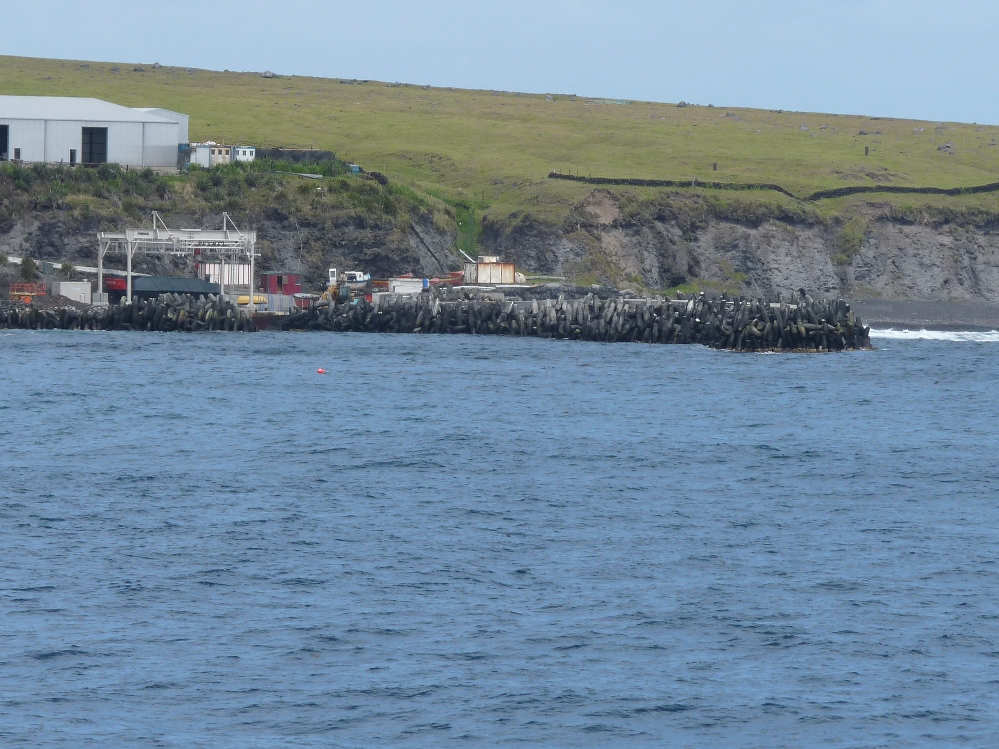
A small breakwater of concrete blocks and a quayside of sheds below a low cliff and green grazing land, seen from the sea

Tristan da Cunha

Edinburgh of the Seven Seas

Calshot Harbour at Edinburgh of the Seven Seas, the island's only landing place, beneath the grazing land above the shore. (michael clarke stuff / Wikimedia Commons · CC BY-SA 2.0)

The only settlement on Tristan da Cunha on what is considered the most remote inhabited island in the world, a cluster of low houses on a narrow coastal plain beneath a volcano in the far South Atlantic. Founded with a garrison in 1816 and kept going by a corporal who stayed on, it is known locally as the Settlement and is reached only by sea.

Neighbourhoods

  • The Settlement
    • First-time visitors
    • Local life

    The village itself, a grid of single-storey houses with gardens, walled against the wind, gathered around the administration building, the shop, the school, the churches and the hall. Everything on the island happens within a few hundred metres of it.

    Open in Maps
  • Calshot Harbour and the shore
    • Working harbour
    • Walks

    The small breakwater harbour below the village, built in the 1960s, where the fishing boats and the launches that meet visiting ships work. It is the island's only landing place and is unusable in heavy swell.

    Open in Maps
  • The Potato Patches and the plain
    • Local life
    • Walks

    The island's main farming area, on the coastal plain and linked to the village by its one road, where potatoes have been grown for over 150 years. All land on the island is communally owned, and cattle and sheep graze the plain.

    Open in Maps

Things to do

Around the Settlement

  • Queen Mary's Peaktrail

    The island's volcanic summit at 2,062 metres, a hard full-day climb to a crater lake, undertaken only with island permission and a local guide and only when the weather allows.

    Open in Maps
  • The Potato Patchesattraction

    The potato farms at the end of the island's one road, nicknamed the M1, worked for over 150 years and still the heart of the island's farming.

    Open in Maps
  • Tristan Thatched House Museummuseum

    A small museum in a traditional thatched island house, built in 2013 after a project begun by the island's pensioners in 2009.

    Open in Maps

Short trips by sea

  • Nightingale Islandsattraction

    Small, steep islands holding vast seabird colonies, including northern rockhopper penguins and the endemic Nightingale finch, landed on only in calm conditions.

    Open in Maps
  • Inaccessible Islandattraction

    A cliff-bound island whose seabird colonies and flightless rail led to its addition in 2004 to far-off Gough Island's UNESCO World Heritage Site, now Gough and Inaccessible Islands.

    Open in Maps

Seasonal events

  • Anniversary DayAugust

    The anniversary of the annexation of the islands on 14 August 1816, kept as a local holiday on Tristan.

  • Ratting Daya date set each year

    A local observance whose date the Chief Islander declares each year, and which can be moved at short notice depending on the weather.

Eat and drink

Long-standing places and food districts in Edinburgh of the Seven Seas. Hours, ratings and directions come from your maps app, always current.

What is eaten here

  • Potatoes from the Patchesrestaurant

    The island's staple, grown by every household and grown at the Patches for over 150 years and once even used as the island's currency.

    Open in Maps
  • Crawfishrestaurant

    The Tristan rock lobster, fished only for local eating until about 1950 and now the island's main export; the local fishery is the one allowed inside the marine protection zone.

    Open in Maps
  • Mutton, beef and island fishrestaurant

    Meat from the island's cattle and sheep, and fish caught from the boats, make up much of the rest of the everyday diet.

    Open in Maps

Where food comes from

  • The island shopmarket

    The island's supermarket stocks canned and imported goods brought by the fishing and supply vessels, and what is available depends on how long it has been since the last ship.

    Open in Maps
  • The Albatross Bar and Café da Cunhacafe

    The Albatross Bar in Prince Philip Hall, a pub since the 1980s, and the café at the post office and tourism centre are where people eat or drink outside their homes.

    Open in Maps

Experience Edinburgh of the Seven Seas

History

The settlement was founded in 1816, when Britain annexed Tristan da Cunha — partly to forestall any attempt to use it as a base to rescue Napoleon from Saint Helena, 1,500 miles to the north — and stationed a garrison on the plain above the shore. When the garrison withdrew the following year, Corporal William Glass stayed on with his family and a few companions, and the community grew from there. Shipwreck survivors, a handful of New England whalers and women brought from Saint Helena joined them, producing the seven surnames the island still carries.

The village was named Edinburgh of the Seven Seas in 1867, after a visit by Prince Alfred, Duke of Edinburgh, though islanders have always called it the Settlement. Its nineteenth century was one of passing ships, whaling and self-reliance, broken by disaster: in 1885 a lifeboat carrying almost all the island's able-bodied men was lost while sailing out to trade with a passing ship; fifteen men died, leaving an island of widows.

In October 1961 the volcano erupted on the edge of the village, and the entire population was evacuated first to Nightingale, then to Cape Town and on to England. After two years at Calshot in Hampshire, most families returned in 1963; the lava of that eruption lies on the plain immediately east of the houses. Calshot Harbour, named after the camp where the islanders had been housed in England, was completed in 1967, and the crawfish fishery built after the war remains the basis of the island's income.

Culture & Customs

About 220 people live here, descended from founders who shared seven surnames — Glass, Green, Hagan, Lavarello, Repetto, Rogers and Swain — with a few more brought by English husbands after the 1960s evacuation. They speak a dialect of their own, Tristan da Cunha English, known locally as Tristanian. Society is egalitarian: all resident families farm, and all land is communally owned.

The year is structured by communal work rather than by entertainment. Farming at the Patches and the lobster fishery occupy most of the community, Ratting Day falls on a date the Chief Islander declares each year, and Anniversary Day in August marks the 1816 annexation. There is one shop, one school, one doctor, one bar and an Island Council of eight elected and three appointed members.

Two churches, Anglican and Catholic, anchor the social calendar alongside the community hall, Prince Philip Hall, home of the Albatross Bar. Hospitality to the very few visitors who arrive each year is generous and formal in its way: guests stay in islanders' houses, are expected at family meals, and are folded into whatever the village is doing. Islanders have long knitted garments from the wool of their own sheep, and the sale of the island's stamps and coins is one of its main exports.

Daily Life

The Settlement holds the whole population of Tristan da Cunha, about 220 people, in low houses built to withstand the wind, each with a garden and a view of either the sea or the cliffs behind. The administration building, the shop, the school, the hospital, the churches and the hall stand within a few hundred metres of one another, and the harbour lies just below.

Two things pay for the island: the crawfish fishery, the main export, and subsistence farming — potatoes in the Patches, cattle and sheep on the common grazing — supplemented by the sale of stamps and coins and by limited tourism. Government is the other main employer on the island.

Supplies come from Cape Town, six days away, on three ships that typically call fewer than a dozen times a year, so the shop's shelves rise and fall with the sailings. Power comes from generators, replaced after a 2008 fire destroyed the old ones and the fish factory, and internet access comes by satellite through an internet café and, after office hours, Wi-Fi to homes. The harbour is small and often unusable in swell, which is the fact that governs everything: when the sea is up, nothing lands, nobody leaves, and the island waits.

Food

Potatoes are the staple, grown by the island's families at the Patches, where potato farms have been worked for over 150 years. In the nineteenth century they were even the island's only currency, and islanders offered them, with albatross eggs, to the crews of visiting ships.

The sea provides the protein. Crawfish, the rock lobster that sustains the island economy, was fished only for local eating until about 1950 and is now the main export; other fish are caught from the boats; and mutton and beef come from the island's sheep and cattle. In hard years, such as 1906, when the potato crop failed and cattle died, longboats took islanders to Inaccessible Island to gather albatrosses, shearwaters and penguins for food.

Between ships, canned and imported goods from the shop bridge the gap, and their range narrows the longer the wait. The Albatross Bar in Prince Philip Hall and the café at the post office are where people eat or drink outside a private house.

Planning tools

Budget

There is no hotel. Visitors stay in islanders' homes or a small guesthouse by prior arrangement, and transport, accommodation and permission must all be organised in advance with the island administration. The cost and the difficulty are almost entirely the sea passage.

Daily Budget Midrange
USD 100–170 (guesthouse or home stay with full board, bar and shop purchases, a boat trip if the sea allows)
Daily Budget Shoestring
USD 60–100 (a home-stay rate with meals, and very little else to spend money on)

Contact the Tristan da Cunha administration months ahead; the fare from Cape Town dominates the budget and nothing can be arranged on arrival.

Best Time to Visit

The southern summer, roughly November to March, gives the calmest seas and the best chance both of landing and of climbing the peak. Sailings from Cape Town run only a handful of times a year and must be booked far ahead, so the schedule decides the season as much as the weather does.

Suggested Number of Days

The ship's schedule sets the length of a stay, not the amount to see: visits are often several days and sometimes weeks, because the next sailing may be a long way off. Flexibility matters more than planning.

First Visit
5–10 days
With Surroundings
2–3 weeks

Transportation

There is no airstrip. The island has one road, nicknamed the M1, running from the village to the Potato Patches; it carries a few private cars and a free minibus for pensioners, and everything in the village is within walking distance. Boat trips along the coast and to the outlying islands depend entirely on the swell.

Walking is the way to get about; on the higher ground, go with an islander, as the weather changes fast.

Airport & Station Connections

Access is by sea from Cape Town, about six days each way, on the fishing and supply vessels that carry a few passengers, or on a very occasional expedition cruise. Permission to land must be granted in advance by the Island Council, with proof of insurance, funds and confirmed transport both ways, and landing at the small Calshot harbour depends on the swell and is often delayed or cancelled.

Walkability

The Settlement is walked end to end in a few minutes, and the Patches lie along the one road across the plain. The ground rises abruptly behind the village up the Main Cliffs, and beyond them the terrain is serious mountain country in a climate that changes within the hour.

Safety

Crime is essentially nonexistent, and the village is as safe a place as exists. The dangers are the sea and the weather: landings and boat trips are often unsafe, the peak is a serious mountain with rapidly changing conditions, and the coast is rugged with large swells. The island has a small hospital and one resident doctor, and there is no air evacuation.

Comprehensive medical and evacuation insurance is essential, the islanders' guidance on the Peak and the coast must be followed absolutely, and visitors should accept that the sea may change their plans. Check current official travel advice before travelling.

Climate

Cool, wet, cloudy and extremely windy oceanic climate, mild in temperature but gale-prone all year, with the weather changing constantly. The settlement lies on the sheltered north-west side, and conditions on the higher ground are far harsher than in the village.

Summer
December–February, the southern summer, mild at roughly 15–20°C and the calmest season for the sea
Winter
June–August, cool at roughly 11–15°C, with frequent gales and snow on the peak from July to September

Local Customs

English is spoken in a distinctive island dialect. The community is Christian, with one Anglican and one Catholic church, all land is communally owned, and an elected Island Council advises the Administrator. Visitors are guests of the household they stay with and of the island as a whole, and are expected to behave accordingly.

Ask before photographing people or houses, respect the communal working days when the whole village turns out, and take nothing from the seabird colonies or the shore.

Common Payment Methods

The pound sterling is used directly, not the Saint Helena pound, and it is a cash economy: card facilities are minimal and there is no bank in the ordinary sense. Sterling cash should be brought for the shop, the bar, stamps and the home-stay rate.