Attractions & Natural Wonders · The Azores
The Azores: Eight Attractions and Natural Wonders
Twin crater lakes, a mountain that makes its own weather, hot springs that cook the village stew, and vineyards planted in fields of black lava
By Worldlore Editorial · 30 September 2026
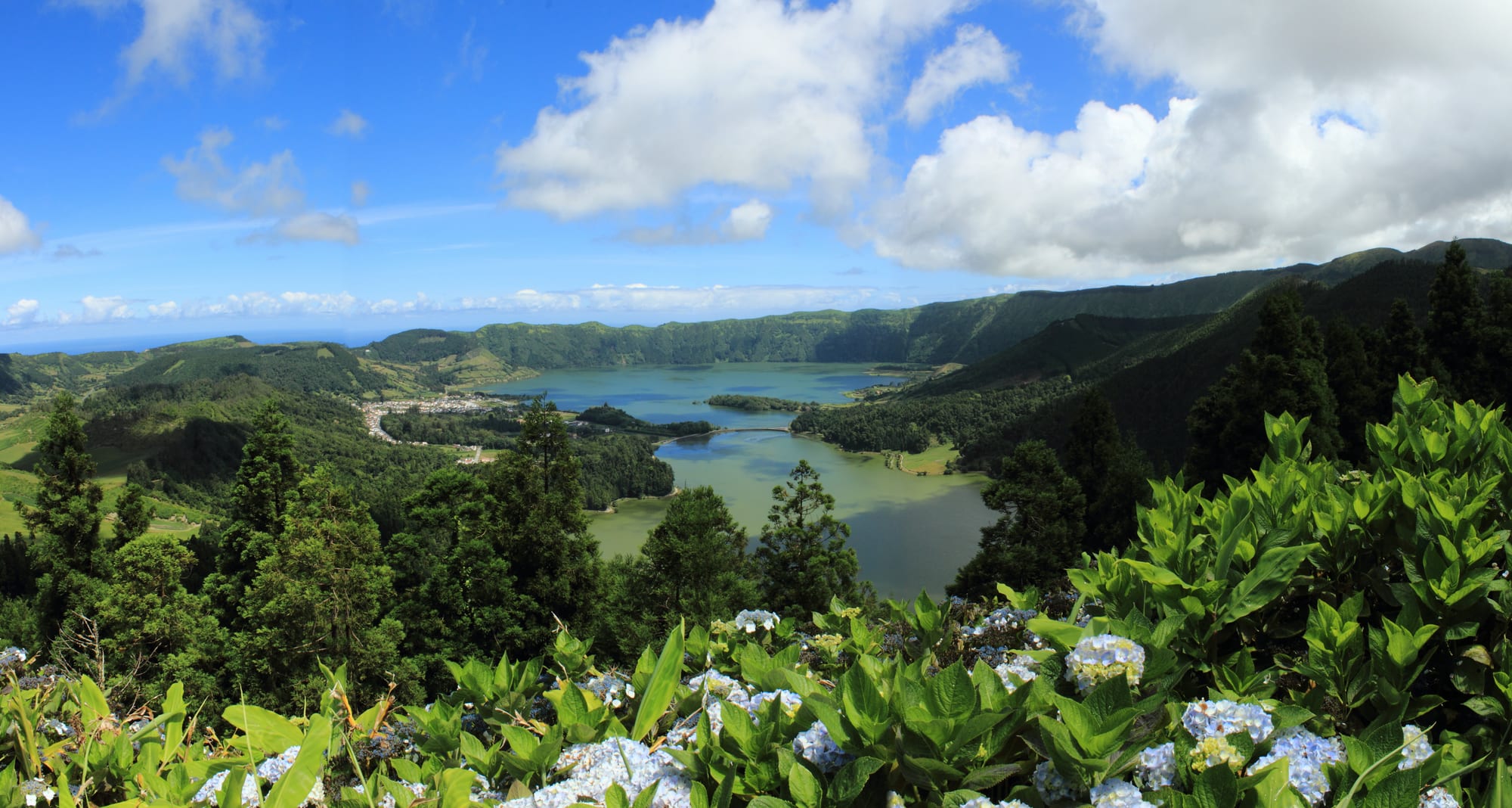
Nine green islands in the middle of the Atlantic
The Azores are an autonomous region of Portugal — nine volcanic islands about 1,400 kilometres west of the Portuguese mainland, out in the North Atlantic. They are green, wet, mild, and thinly populated, with pasture and hydrangeas over old lava, and a landscape of craters, hot springs, and sea cliffs. The mid-Atlantic position also makes them a noted place for whale watching, with whales, dolphins and sea turtles in the surrounding waters.
The eight below are spread across three islands — São Miguel (the largest and easiest), Terceira, and Pico/Faial. Interisland flights and ferries connect them. Weather changes constantly, and late spring to early autumn is generally the most settled time to visit.
1. Sete Cidades
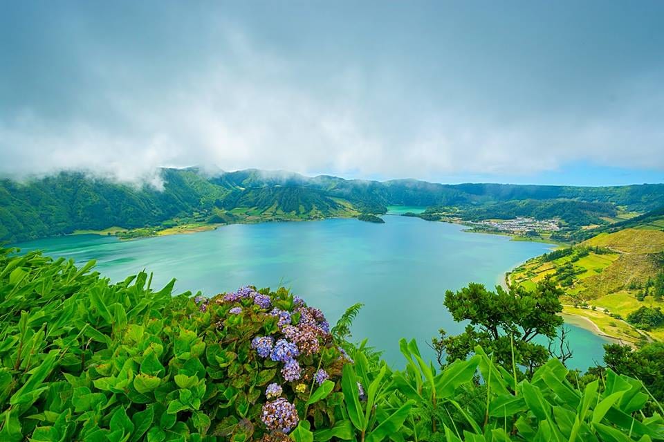
At the western end of São Miguel, a 5-kilometre-wide caldera holds two lakes that are joined by a narrow strait crossed by a bridge — one traditionally described as blue, the other as green, a difference of light and depth that a local legend explains with the tears of two doomed lovers. The village of Sete Cidades sits in the caldera beside them.
The classic views are from viewpoints on the caldera rim, and walking trails lead along the crater edge and down to the lakes below.
2. Lagoa do Fogo
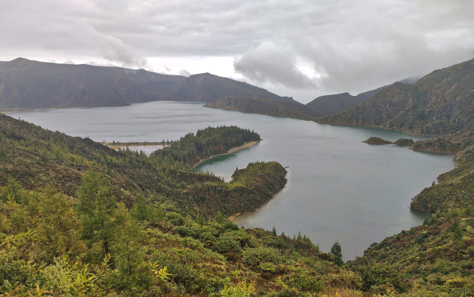
Lagoa do Fogo fills the crater of the Água de Pau volcano at the heart of São Miguel, and it is one of the largest lakes in the Azores — a nature reserve since 1974, an elliptical sheet of water about 3 kilometres long with a pale beach along its northern shore. It sits high and catches cloud, so views come and go.
Its steep crater walls fall to the water from a rim that rises to about 949 metres, and trails lead down to the shore.
3. Furnas
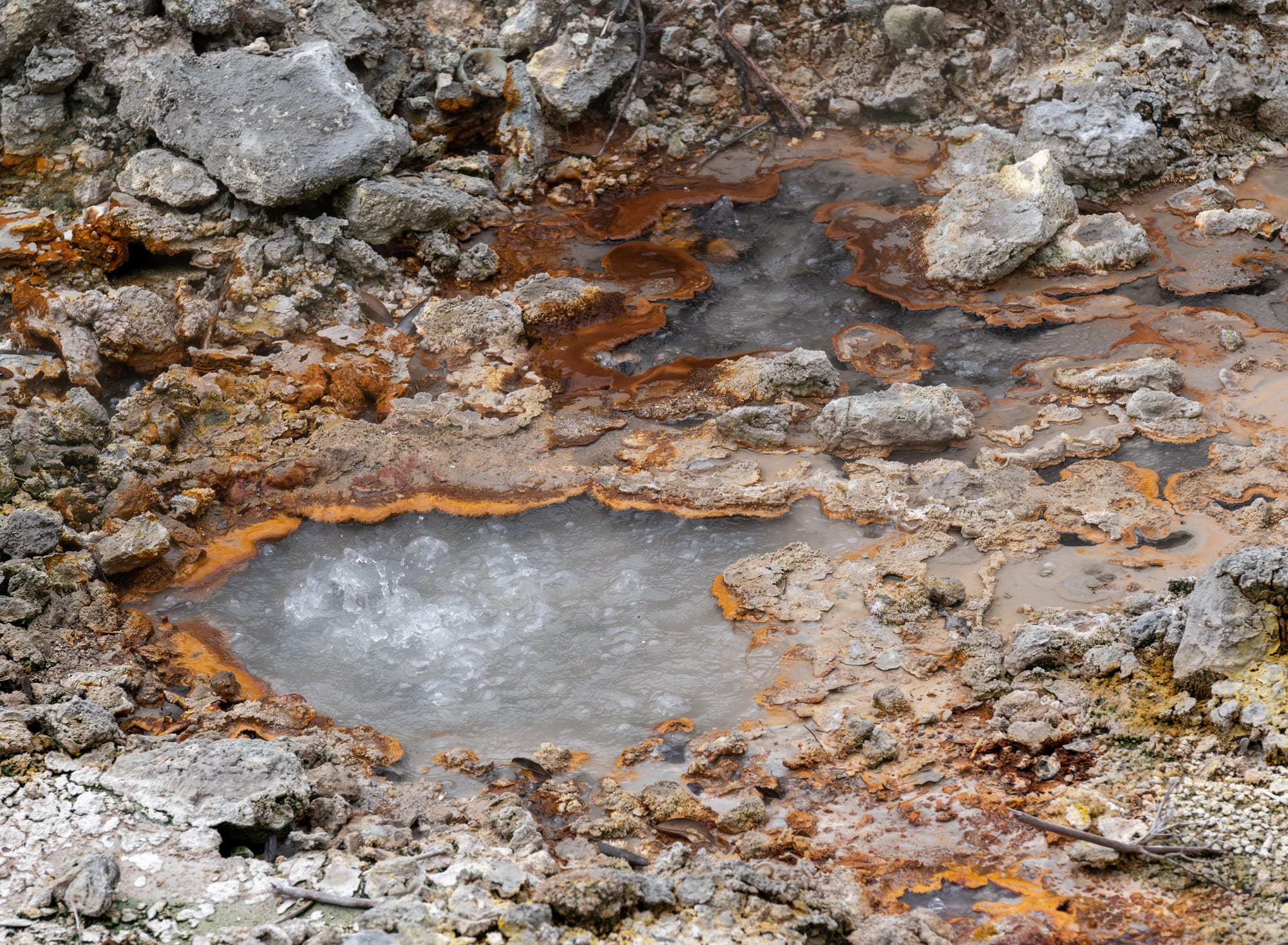
The village of Furnas, in a caldera on eastern São Miguel, is where the island's volcanism is closest to the surface: fields of boiling mud pools and fumaroles, mineral springs bubbling up all over town, and a lakeside pit where cooks lower pots of cozido — meat and vegetables — to steam underground for hours before lunch.
Also here: the botanical garden at Terra Nostra with its brown, iron-rich thermal pool, the hot pools of Poça da Dona Beija, and some thirty springs, each with a different temperature and mineral make-up.
4. Pico: the vineyards and the mountain
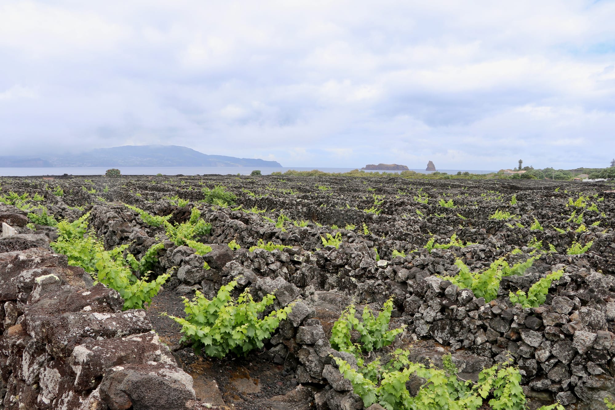
Pico island is dominated by the 2,351-metre volcano that gives it its name — Portugal's highest mountain, more than twice the height of any other peak in the Azores, and a steep, demanding climb. Around the coast, generations of islanders built a landscape, inscribed by UNESCO in 2004 as the Landscape of the Pico Island Vineyard Culture, of tiny vineyard plots walled with black lava to protect the vines from the Atlantic wind, producing a distinctive volcanic wine.
The island also has lava-tube caves (Gruta das Torres), whaling museums in old whale-processing buildings, and some of the best whale watching in the archipelago.
5. Angra do Heroísmo, Terceira
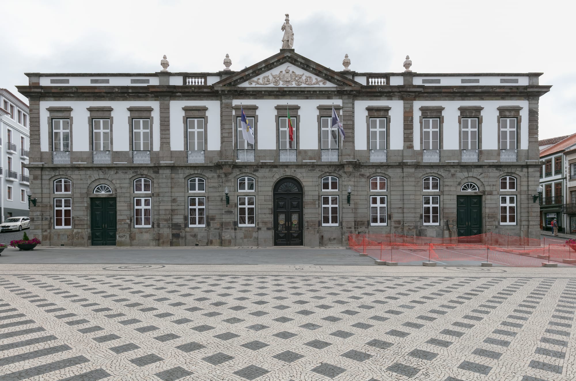
Angra was founded in the 15th century and became a vital port of call for Portuguese fleets returning laden with gold and silver from the Indies, and it grew rich guarding them, with two big fortresses over its bay. Its central zone of pastel townhouses, churches, and palaces has been a UNESCO World Heritage Site since 1983, and was restored carefully after the earthquake of 1 January 1980.
Climb the volcanic cone of Monte Brasil beside the town for the view, and use Angra as a base for the rest of green, cattle-farming Terceira.
6. Algar do Carvão
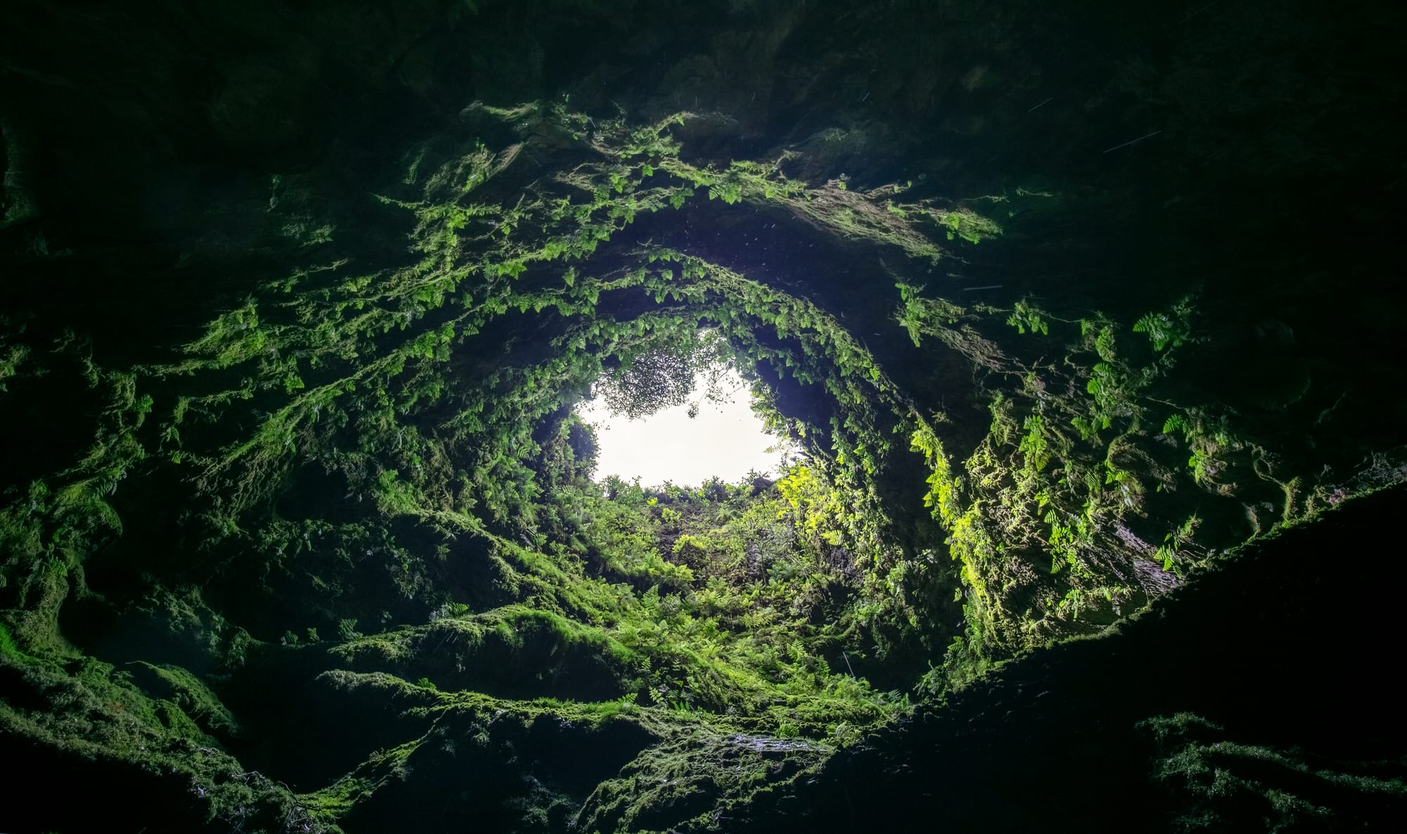
In the middle of Terceira, the Algar do Carvão is the chimney of an extinct volcano: a shaft about 90 metres deep, descended by a lit staircase, past walls hung with ferns and mosses and rare silicate stalactites, to a rainwater pool at the bottom. Daylight pours in through the opening far above.
Nearby, in the centre of the island, are the Furnas do Enxofre, an area of active, steaming volcanic vents.
7. The Capelinhos volcano, Faial
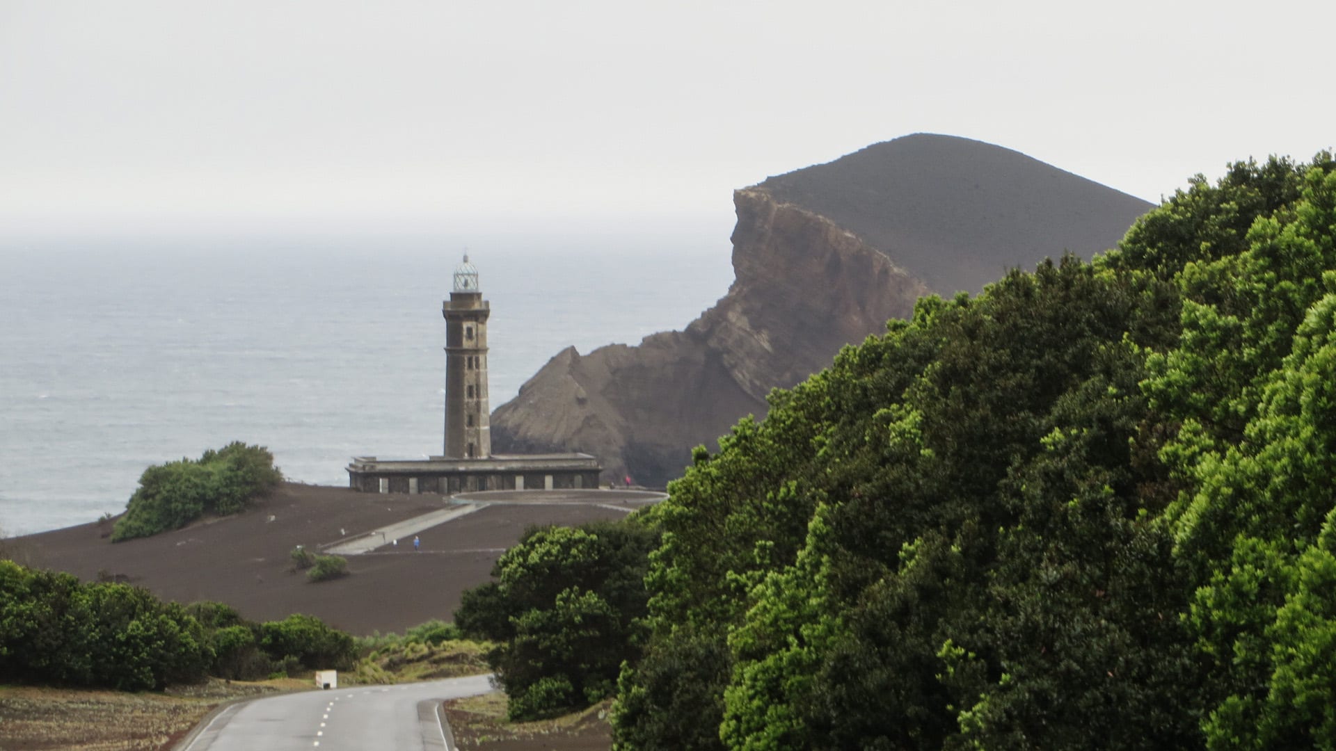
On the western tip of Faial, an offshore eruption in 1957–58 added about 2.4 square kilometres of new land, destroyed some 300 houses, half-swallowed a lighthouse, and drove a wave of emigration to the United States and Canada. Today it is a raw grey moonscape slowly being colonised by plants, with a visitor centre beside the ruined lighthouse and trails up to the crater.
The rest of Faial is greener, centred on the yacht harbour of Horta — where transatlantic sailors paint the names of their boats on the marina walls — and the deep Caldeira crater at the island's heart.
8. Ponta Delgada
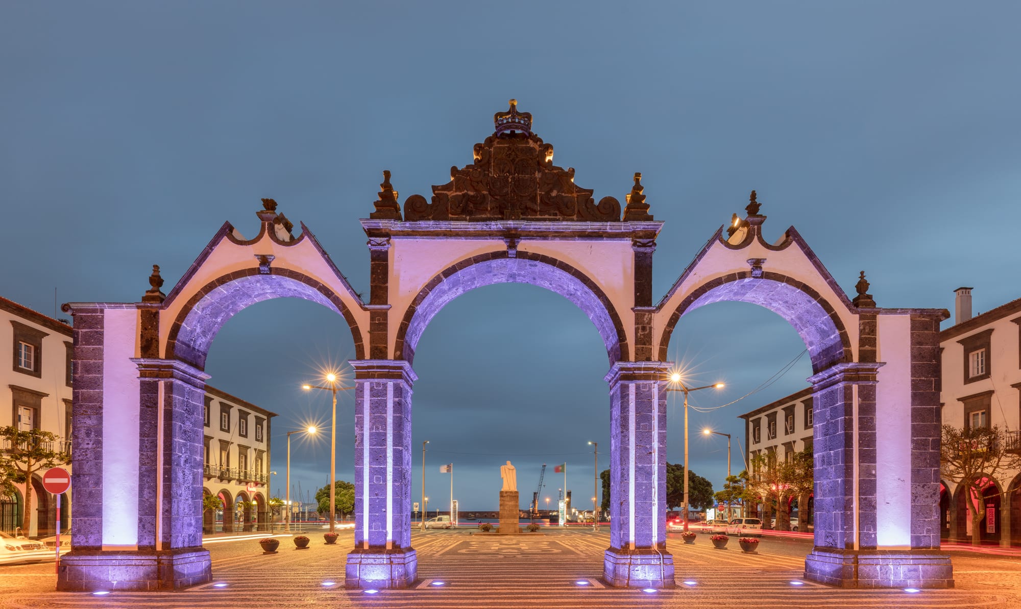
Ponta Delgada is the largest municipality and executive capital of the Azores, and the arrival point for many visitors: a low waterfront town of black-and-white basalt-and-limewash churches, cobbled squares, and the triple-arched city gates on the harbour front. The pineapple greenhouses, the Fort of São Brás, and the market are the set sights.
Mostly it is a base — for the São Miguel lakes and the Furnas valley, for whale-watching boats, and for the tea plantation at Gorreana, the oldest surviving one in Europe.
The Azores work at a slow pace: a week on São Miguel covers most of this list, with a couple of days added for Pico and Faial, and the weather calling for loose plans.