Attractions & Natural Wonders
Why do earthquakes happen where they do?
Most earthquakes strike along the edges of the giant plates that make up the Earth's surface, above all in the Ring of Fire around the Pacific.
By Globeway Editorial · 2 November 2026
The short answer
The Earth's outer shell is broken into huge rigid slabs called tectonic plates, which creep past one another, typically at up to about 10 centimetres (4 inches) a year. Where two plates meet, their edges lock together, strain builds up in the rock for decades or centuries, and then the rock suddenly snaps and slips. That sudden slip is an earthquake. So earthquakes happen mostly along plate boundaries, in long, narrow belts, and much less often in the middle of plates.
The biggest belt by far is the Ring of Fire, a horseshoe around the Pacific Ocean where several plates dive beneath their neighbours. About 90 per cent of the world's earthquakes, including most of the largest, happen there. A second belt runs from Indonesia through the Himalayas, Iran and Turkey to the Mediterranean, where Africa, Arabia and India are pushing into Eurasia.
Rocks that stick, then snap
Scientists estimate that about 500,000 earthquakes a year are strong enough for instruments to detect, and about 100,000 of them can be felt. Since 1900, an average year has brought 18 major earthquakes, of magnitude 7 to 7.9, and one great one of magnitude 8 or more.
Almost all of them work the same way. The two sides of a fault, a crack where blocks of rock meet, would slide past each other smoothly if the surfaces were perfectly even. They are not. Rough patches catch and lock the fault, while the plates keep moving. The rock around it bends and stores energy like a stretched spring, until the stress breaks through the locked patch and the fault lurches forward in seconds. This slow build-up and sudden release is called the elastic-rebound theory.
That is why earthquakes need moving plates. Only the cold, brittle upper part of the crust, and the cool slabs of plate sinking into the hot mantle beneath, can store energy and release it by breaking. The plates move at very different speeds: from 10 to 40 millimetres a year at the Mid-Atlantic Ridge, about as fast as fingernails grow, to around 160 millimetres a year for the Nazca plate off South America, about as fast as hair grows.
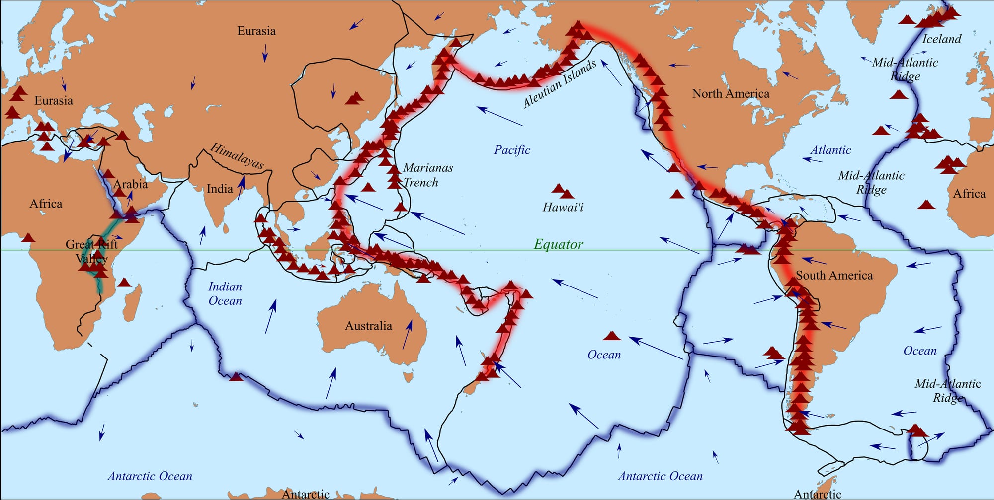
Plate boundaries are so closely tied to earthquakes that a map of where earthquakes happen traces their outlines.
The Ring of Fire: where plates dive
The Ring of Fire is about 40,000 kilometres long and up to about 500 kilometres wide. It is not one structure but a chain of subduction zones, places where one plate is forced down beneath another. The Nazca and Cocos plates sink beneath South America; the Pacific and Juan de Fuca plates beneath North America; the Philippine plate beneath Eurasia.
Subduction zones produce the planet's most powerful earthquakes, called megathrust earthquakes, when the huge sloping fault between the two plates gives way. Every earthquake of magnitude 9 or more since 1900 has been a megathrust earthquake, as have the ten largest ever recorded. Together they release about 90 per cent of all the seismic energy unleashed on Earth. The largest ever measured struck Valdivia in Chile on 22 May 1960, with a magnitude of 9.5. Subduction faults can also rupture over enormous lengths: in Alaska in 1957, Chile in 1960 and Sumatra in 2004, the breaks ran for up to about 1,000 kilometres.
The sinking plate also explains why some earthquakes start very deep. Most begin within a few tens of kilometres of the surface, but in subduction zones they can start 300 to 700 kilometres down, inside the cold slab as it descends. Plotted on a cross-section, these deep earthquakes trace the diving plate like a slanting line of dots, known as a Wadati–Benioff zone.
Collisions, cracks and sliding plates
The second great earthquake belt, the Alpide belt, stretches for more than 15,000 kilometres along the southern edge of Eurasia, from Java and Sumatra through the Himalayas, the mountains of Iran, the Caucasus, Anatolia and the Mediterranean, out into the Atlantic. Here the African, Arabian and Indian plates are moving north into Eurasia, crumpling the crust into mountain ranges from the Atlas to the Himalayas. It is the world's second most active earthquake zone, with 17 per cent of the world's largest earthquakes; the 2004 Indian Ocean earthquake off Sumatra struck within it.
Where plates pull apart, at mid-ocean ridges, new sea floor forms and the earthquakes are many but usually small and shallow. In places like Iceland, which sits on the Mid-Atlantic Ridge, the brittle layer that can break is only about 6 kilometres thick, which limits how big an earthquake can grow. Earthquakes on faults where the crust is being stretched are generally below magnitude 7.
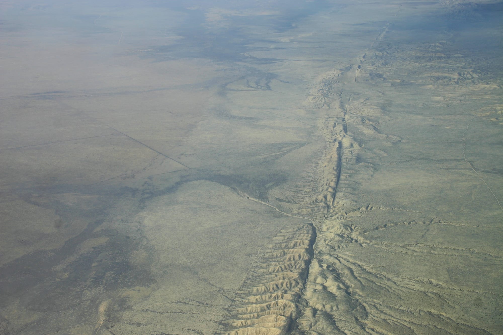
Where plates grind sideways past each other, the result is a transform fault. The best known is the San Andreas Fault, which runs for about 1,210 kilometres through California and forms part of the boundary between the Pacific and North American plates, slipping on average 20 to 35 millimetres a year. Faults of this kind can produce major earthquakes up to about magnitude 8, and long stretches of the San Andreas broke in 1857 and again in the 1906 San Francisco earthquake.
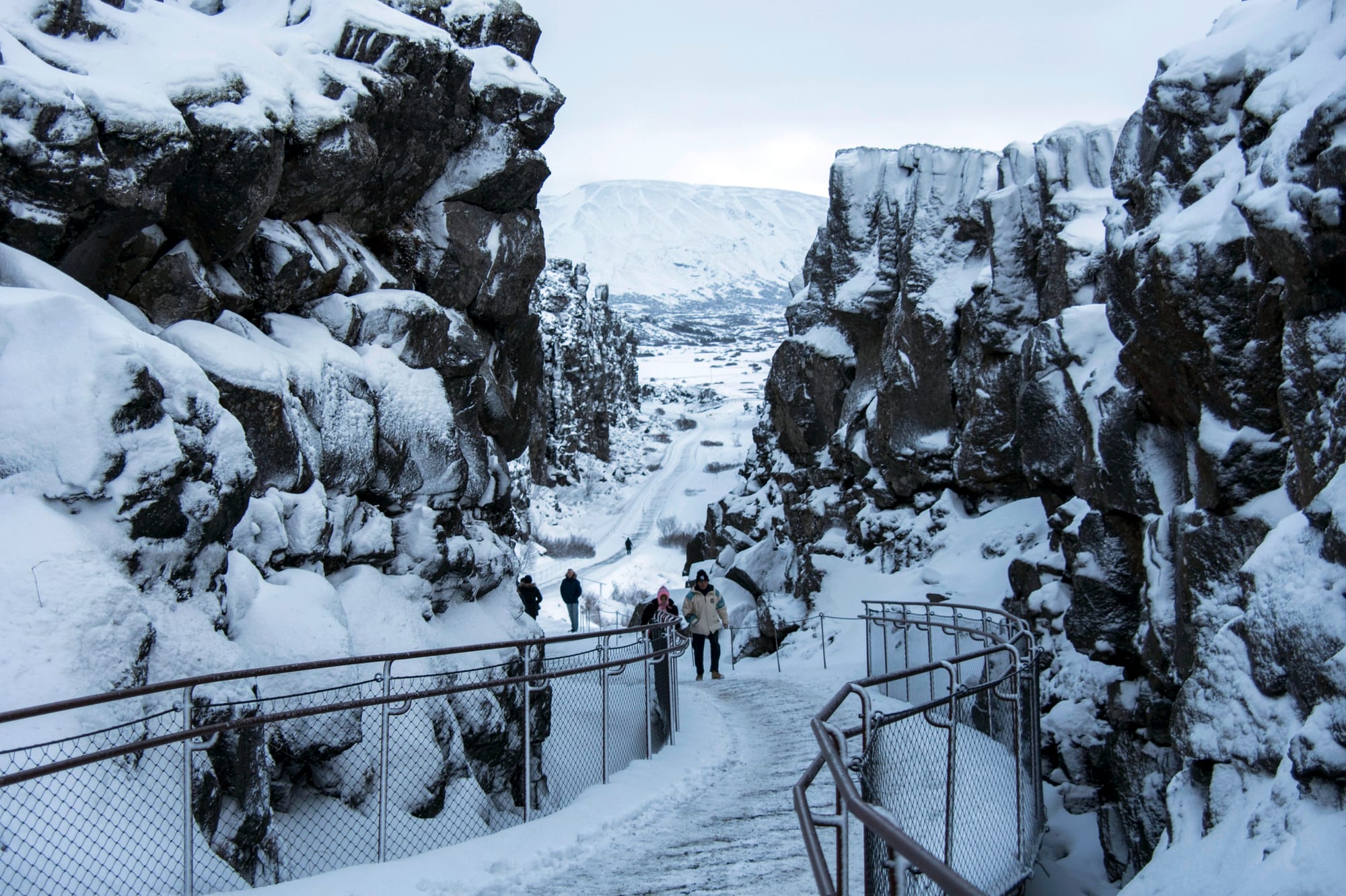
In Iceland, the plates pulling apart under the Atlantic come ashore, and the earthquakes they cause are frequent but mostly shallow.
The surprise earthquakes far from any edge
A minority of earthquakes strike in the middle of plates, and these intraplate earthquakes can be especially damaging, because buildings far from plate boundaries are rarely designed to withstand them. Between December 1811 and February 1812, a series of earthquakes centred on New Madrid, a town on the Mississippi River in today's Missouri, reached magnitudes of about 7 to 8. They remain the most powerful to hit the United States east of the Rocky Mountains in recorded history, and were felt strongly across about 130,000 square kilometres. In 1886 Charleston, South Carolina, was shaken by a damaging earthquake in an area with almost no history of even minor ones.
The causes of these earthquakes are often uncertain. Many occur along ancient failed rifts, places where a continent once began to split apart and then stopped, leaving a weakness in the crust that still gives way under the slow squeeze of the moving plate. Other suspected causes include fluids rising along old faults and the crust adjusting after ice sheets melted.
People can trigger earthquakes too. Filling large reservoirs, mining, and pumping fluids underground can all change the stresses in the crust. The magnitude 5.7 earthquake in Oklahoma in 2011 is thought to have been caused by wastewater from oil production injected into deep wells.
The pattern matters most for cities. With fast-growing megacities such as Mexico City, Tokyo and Tehran sitting in zones of high earthquake risk, some seismologists warn that a single earthquake could one day claim up to three million lives.