History
Why do old cities have such narrow, winding streets?
Most were never planned. They grew house by house for people on foot, squeezed inside walls, and once built, their lanes proved almost impossible to straighten.
By Globeway Editorial · 2 November 2026
The short answer
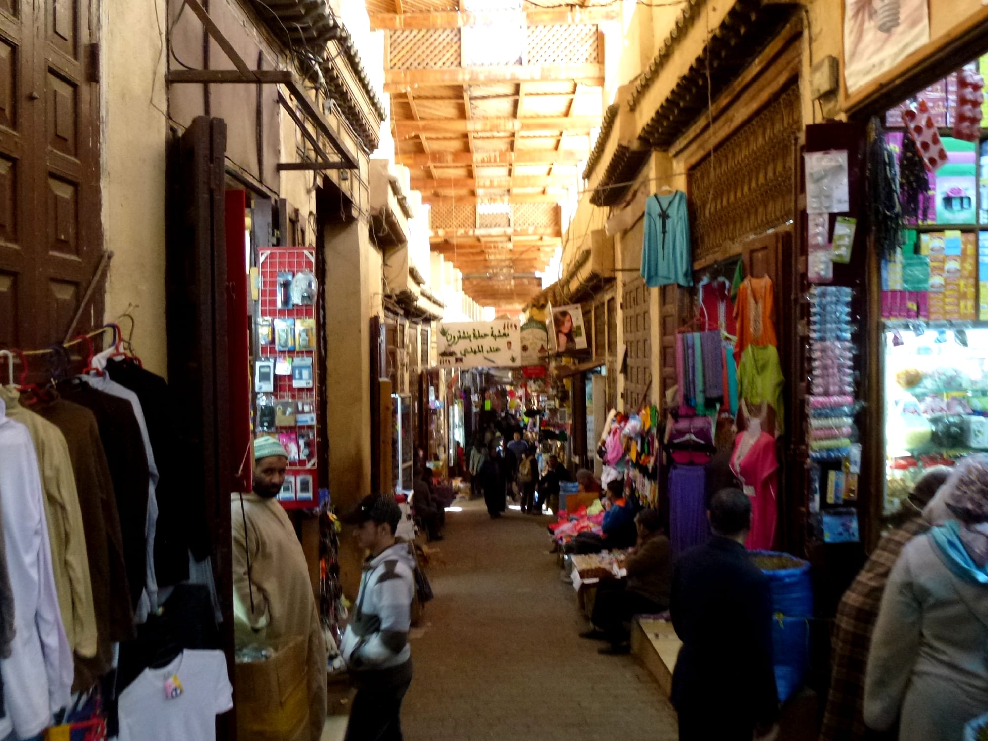
Most old streets were never designed at all. They grew a house at a time, over centuries, around paths that people and animals were already using, and they only had to be wide enough for someone on foot, a loaded pack animal or a handcart. Land inside a city wall was precious, so buildings crept forward, upper storeys leaned out over the lane, and the gaps between them shrank. Hills, rivers and property lines bent the routes further.
Once a street existed, it was very hard to change. Every plot along it had an owner, and straightening the lane meant taking land from all of them. So even when fire or reformers swept part of a city away, the old lines often came back. Where a strong ruler did impose a plan, the result was usually the opposite of a maze: a grid of straight streets.
Grown, not drawn
Straight streets are not a modern invention. By 2600 BC, Mohenjo-daro and Harappa, two great cities of the Indus Valley, were laid out on a grid of straight streets running north to south and east to west. In Greece the grid spread from the 5th century BC, when Hippodamus of Miletus became so linked with the idea that the grid is still called the Hippodamian plan. The Romans stamped standard grids on their forts and colonial towns, and Japan's ancient capitals, including Kyoto, copied the chequerboard of the Chinese capital Chang'an.
What these places share is a planner with the power to draw lines before anyone moved in. Cities that grew on their own looked very different. Many old towns grew organically, house by house and lane by lane, even though medieval Europe also founded hundreds of planned new towns. In 1659 the English diarist John Evelyn called London an "inartificial congestion of Houses", by which he meant unplanned and makeshift. The narrowness of old streets says less about their age than about the absence of anyone in charge of their shape.
Geography did the rest. Majorna, an old district of Gothenburg in Sweden, began as unplanned wooden housing on hilly ground, where lanes had to follow the lie of the land rather than any surveyor's ruler.
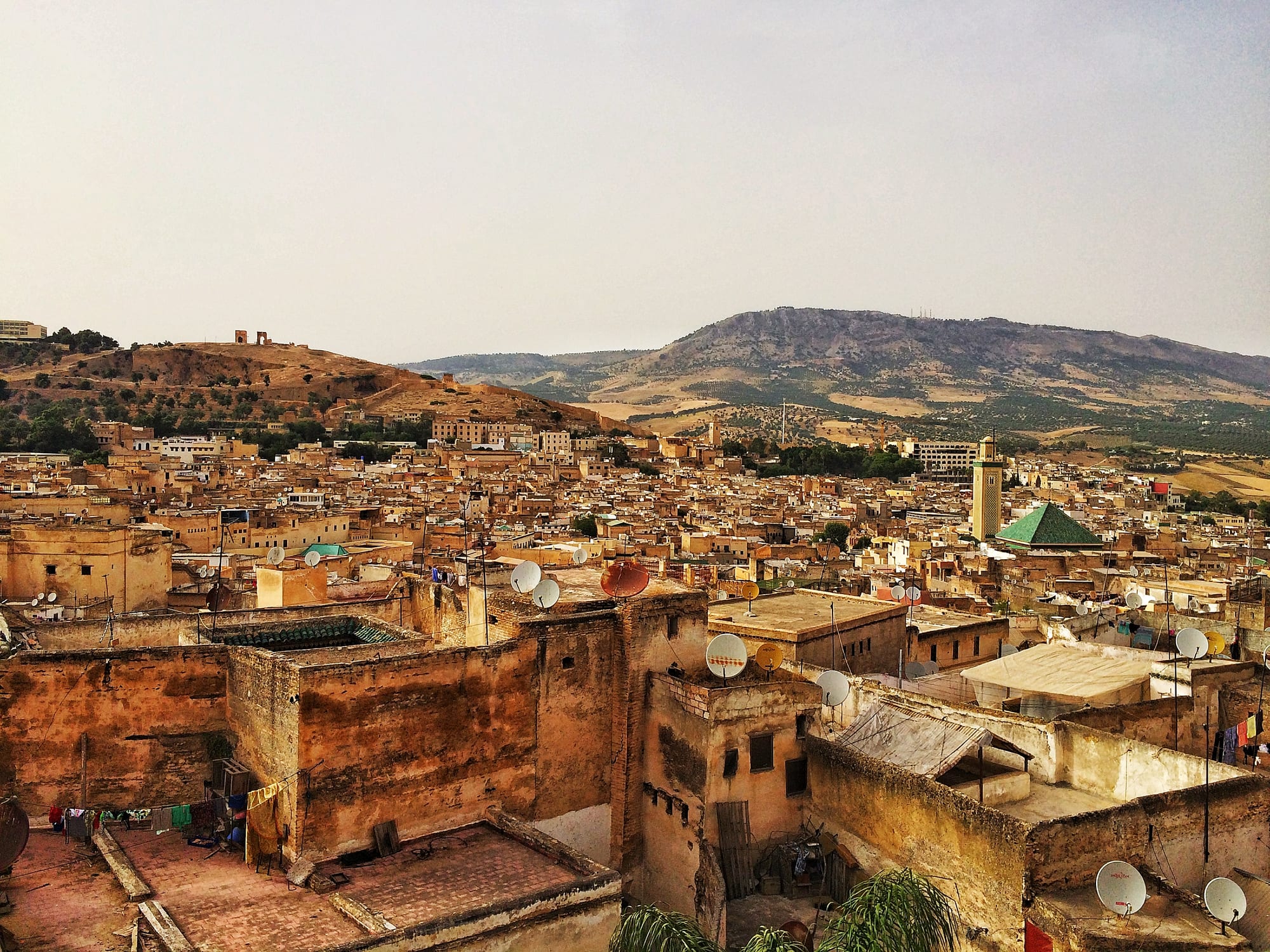
From above, the medina of Fez looks almost solid; its streets run as narrow cracks between the houses.
Built for feet, hooves and handcarts
Before cars, a street had to fit people, animals and the occasional cart, and anything wider wasted ground that could hold a house or a shop. In Venice, still Europe's largest car-free urban area, a maze of lanes and alleys called calli threads between the canals. The narrowest, Calletta Varisco, is just 53 centimetres (21 inches) wide.
Fes el Bali, the old heart of Fez in Morocco, was founded between 789 and 808 AD and still keeps its market streets and narrow, winding alleys. It is now a car-free urban area of about 300 hectares, simply because its lanes are too narrow for cars. Its layout also reflects how people lived. As in many medieval Islamic cities, the main market streets run from the city gates to the great mosque at the centre, the Qarawiyyin. Most lanes that branch off them lead only to small residential alleys called derbs, and many of those end in dead ends. Strangers had little reason to leave the main routes, and the quiet lanes behind belonged to the families who lived along them.
Squeezed inside the walls
Walls made space scarce. In medieval European towns, a typical property was a house on a long, narrow plot with only a slim frontage on the street. Buildings then pushed outwards and upwards. In London before 1666, houses had a narrow footprint at ground level but made the most of their land by "encroaching" on the street, each upper storey jutting out a little further than the one below. Near the top these overhangs, called jetties, almost met across the alleys. The old Roman wall around the City allowed traffic in and out through only eight narrow gates.
Narrow streets brought real benefits in hot places. In the old town of Ghadames in the Libyan desert, where average July highs reach around 41°C (106°F), the upper floors of the houses overhang covered alleys, creating something close to an underground network of shaded passages. Many people from the newer town still return to the old town in summer, because its buildings protect them better from the heat.
Defence played a part too. When Edo, today's Tokyo, was laid out around its castle, its planners avoided a grid for reasons of defence and chose an irregular network of streets instead.
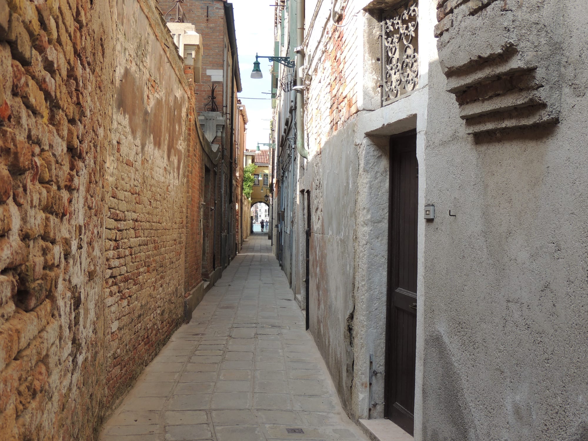
Venice's calli were made for walking, and many are barely wider than two people side by side.
Why fire and reformers rarely won
The real puzzle is not how these streets formed but why so many survived. London's Great Fire of 1666 tore through what was essentially a medieval city of narrow, winding, cobbled alleys, and the narrowness of the streets was the main thing that defeated the firefighters. After the fire, Christopher Wren, Robert Hooke and John Evelyn each proposed rebuilding the City on a grid. None of the grid plans was adopted: compensating property owners for such a large-scale remodelling proved unrealistic. London was rebuilt on essentially the same medieval street plan, which still exists today.
Paris took the opposite path. Its centre, on the Île de la Cité and in the Arcis quarter between the Louvre and the Hôtel de Ville, had changed little since the Middle Ages: the widest streets were only 5 metres wide and the narrowest one or two. Cholera struck in 1832 and 1848, and in the 1848 epidemic five per cent of the people in these two neighbourhoods died. Seven armed uprisings and revolts broke out in the centre of Paris between 1830 and 1848, and residents blocked the narrow lanes with barricades. Between 1853 and 1870 Napoleon III and his prefect, Georges-Eugène Haussmann, demolished whole medieval neighbourhoods and cut wide, straight boulevards through them. Haussmann later described it with satisfaction as "the gutting of old Paris". Historians still debate how far the boulevards were meant to help troops put down revolts.
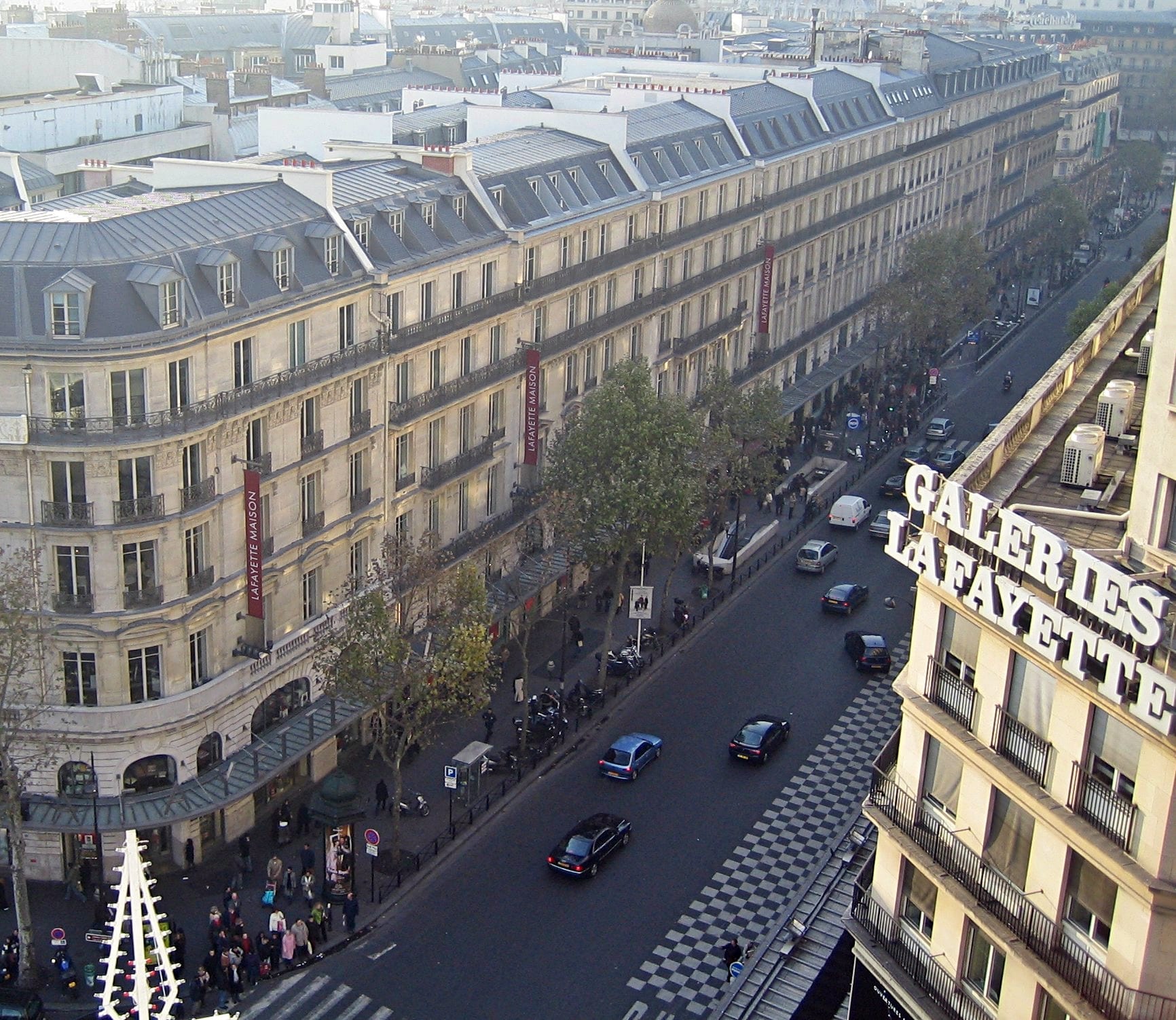
The broad, straight boulevards of 19th-century Paris replaced a tangle of medieval lanes.
Elsewhere, the old lanes survived because newcomers built around them. In Morocco and Tunisia, the French colonial authorities generally put up new planned towns, the villes nouvelles, outside the walls of the historic cities rather than rebuilding them. Partly as a result, medinas such as Fez kept their maze of lanes, and UNESCO listed the Medina of Fez as a World Heritage Site in 1981.