Attractions & Natural Wonders · Réunion
Why is Réunion's volcano one of the most active on Earth?
Piton de la Fournaise sits right over a hotspot that has been feeding volcanoes for 65 million years, and its runny lava escapes in frequent, mostly gentle eruptions.
By Globeway Editorial · 2 November 2026
The short answer
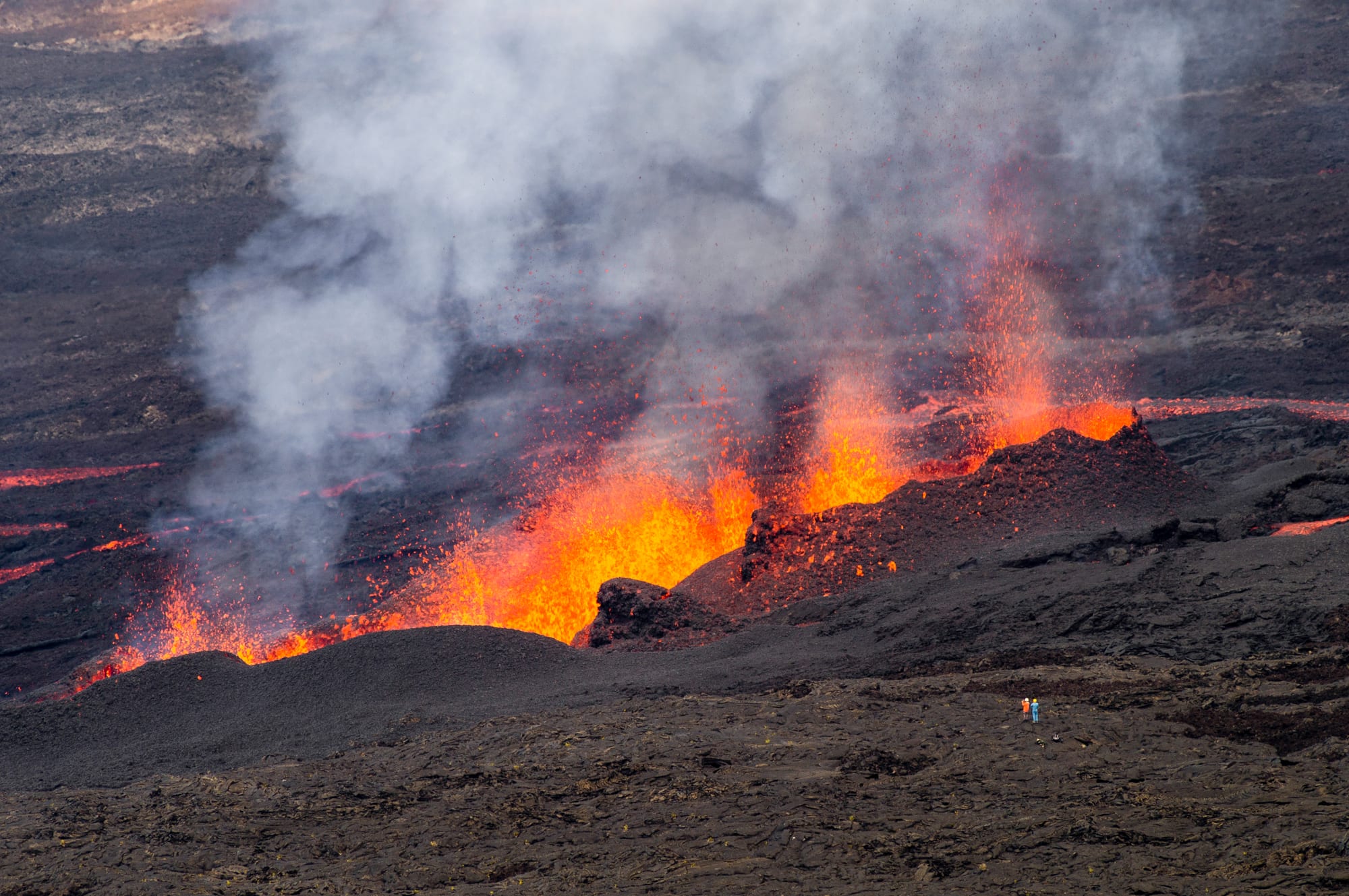
Piton de la Fournaise, the "Peak of the Furnace" on the south-east of Réunion, erupts so often because it sits directly over a hotspot: a place where unusually hot material from deep inside the Earth keeps melting its way to the surface. Réunion is the island that sits over that hotspot today, and Piton de la Fournaise is the part of the island still fed by it. Its magma is basalt, a runny, low-silica rock that tends to flow out of the ground rather than blast out of it.
The result is a volcano that erupts little and often. More than 150 eruptions have been recorded since the 17th century, and over a recent ten-year period it averaged about one every nine months, which probably puts it first in the world for the frequency of new eruptions. It is not the most productive, though: on average it releases about ten times less lava than Kīlauea in Hawaii, about the same as Etna in Sicily. It ranks alongside those two, Stromboli and Antarctica's Mount Erebus as one of the most active volcanoes on Earth.
A hotspot with a 65-million-year trail
The Réunion hotspot is believed to have been active for more than 65 million years. A huge outpouring from it around 65 million years ago is thought to have laid down the Deccan Traps, a vast bed of basalt lava covering part of central India. As the Indian plate drifted north over the hotspot, it punched through again and again, building a line of volcanoes that are now the atolls of the Laccadive Islands, the Maldives and the Chagos Archipelago.
Around 45 million years ago the hotspot passed under the African plate, and after a long quiet spell it created the Mascarene Islands. Mauritius formed about 8 to 10 million years ago, and Réunion within the last few million. On Réunion itself the activity has moved too. The older Piton des Neiges, at 3,069 metres the highest point in the Indian Ocean, forms the north-western two-thirds of the island and has been inactive for 20,000 years. Piton de la Fournaise, more than 530,000 years old, forms the rest and is where the hotspot's magma now comes up.
Runny lava and a broad shield
Piton de la Fournaise is a shield volcano, a wide, gently sloping mountain built from countless thin flows of fluid lava. Basalt magma has low viscosity, so gas bubbles can escape as it rises, and it tends to flow out rather than blast out. Most eruptions here are in the Hawaiian style, with fluid lava streaming from fissures and fountains of fire at the vent.
A typical eruption begins with a line of cracks a few hundred metres long, sometimes several kilometres, from which lava spurts in a glowing curtain. Within minutes or hours the activity focuses on one or a few vents, where spattering lava builds small cones. An eruption can last from a few hours to several months. The volcano also has quiet spells: after more than five years of calm from 1992, it erupted at least once every year from 1998 to 2010, paused until 2014, then resumed the same rhythm.
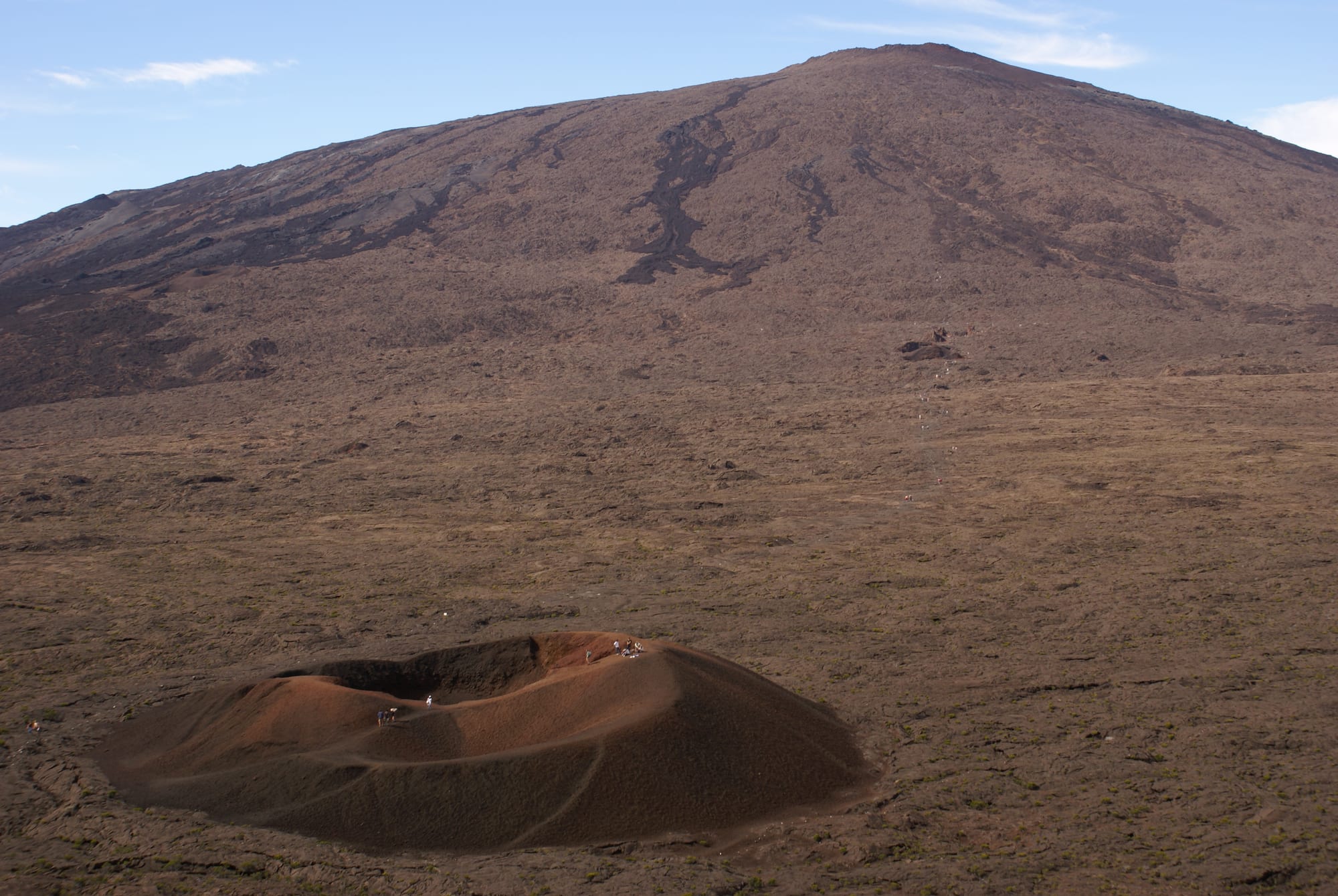
Formica Leo is named for its resemblance to the sand-pit trap of an antlion.
Craters that fall in
The summit keeps reshaping itself. When an eruption drains a magma chamber, the weight of the rock above can make its roof collapse into the empty space. The top of the volcano is a caldera, a great collapsed basin called the Enclos Fouqué, 8 kilometres wide, ringed by cliffs known as remparts and open to the sea on the south-east. Collapses of this kind happened about 250,000, 65,000 and 5,000 years ago.
The process can be watched in action. In April 2007 an eruption poured out an estimated 3 million cubic metres of lava a day, one of the largest at the volcano in a century. As the magma drained away, the floor of the summit's Dolomieu crater, 0.8 by 1.1 kilometres across, sank by 330 metres over nine days. The volcano is not always gentle, either: one eruption about 4,700 years ago may have been as explosive as the 1980 eruption of Mount St Helens, and an explosion in 1961 sent a plume of ash to 6,000 metres.
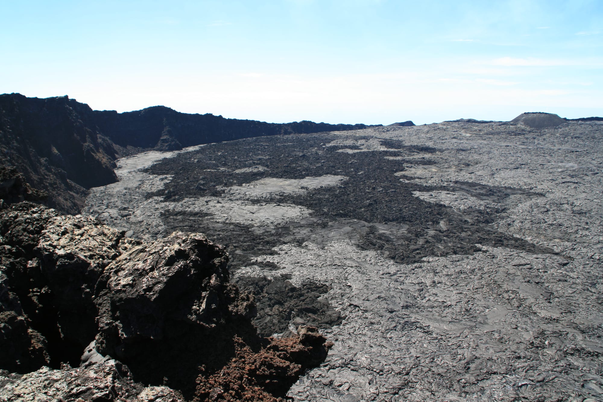
The floor of the Dolomieu crater dropped by about 330 metres during the 2007 eruption.
Living beside the furnace
Most eruptions stay inside the uninhabited caldera and pose little threat to the island's people. Lava does sometimes run down the lower slopes, called the Grand Brûlé or "Great Burn", across the N2 coastal highway and into the sea. In the early 2000s the road was cut one or more times a year and rebuilt each time, with signs now marking the year of each flow. In 2026 the volcano erupted briefly in January and again from mid-February, with activity continuing into April; in March that second eruption sent lava across the N2 and into the ocean.
Eruptions outside the caldera are rare but dangerous. Only six have been recorded, the most recent in 1986. In 1977 the village of Piton-Sainte-Rose was evacuated before lava destroyed several buildings. The flow surrounded the local church, entered through the front door, and stopped. The church was cleared and reopened as Notre-Dame des Laves, "Our Lady of the Lavas".
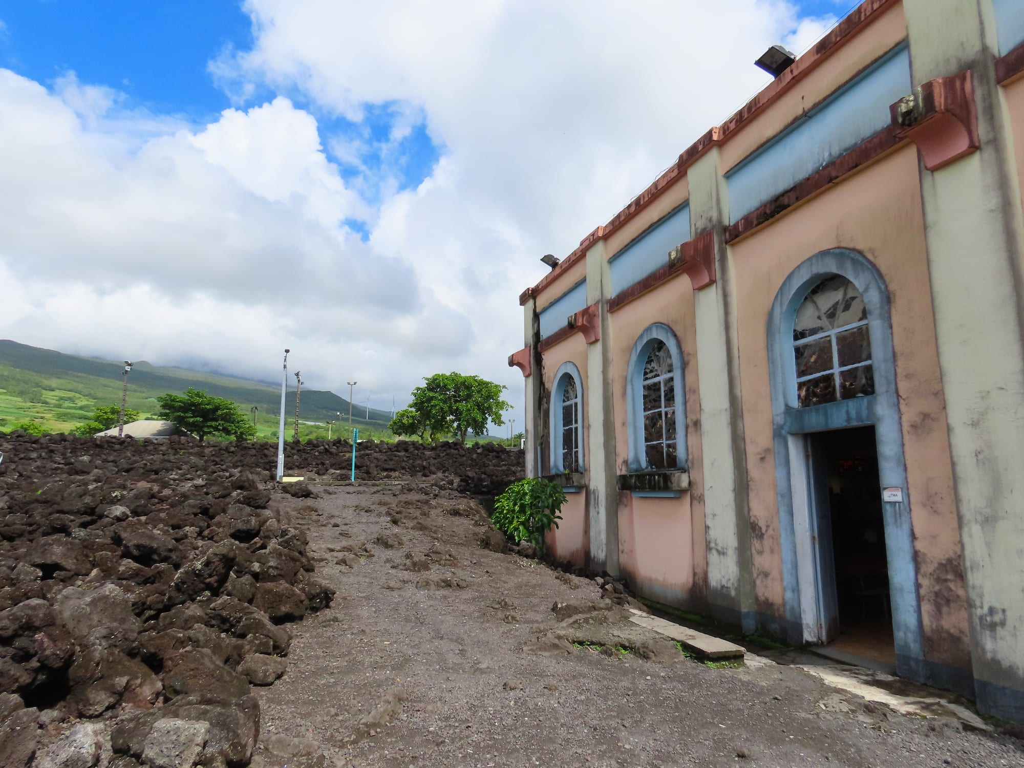
The 1977 eruption also led to the founding of the volcano observatory.
Since then the volcano has become one of the most closely watched in the world. The Piton de la Fournaise Volcano Observatory, founded in 1978 and run by the Institut de Physique du Globe de Paris, tracks swelling ground, earthquakes and gases, the most reliable warning signs. The prefect of Réunion sets alert levels on its advice, closing the caldera to the public when an eruption is coming or under way.
Seeing the volcano today
The volcano lies within Réunion National Park, whose volcanic landscapes became a World Heritage Site in 2010, and more than 400,000 people visit it each year. A forestry road leads to the Pas de Bellecombe, a viewpoint on the caldera rim, from which a stairway path descends to the caldera floor, and white paint marks on the rocks guide walkers up the central cone. The paths close during the earthquakes that can come before an eruption and during eruptions themselves. Fog is very common around the summit. Near the volcano some beaches are tinted green by olivine sand derived from the volcano's picrite basalt lavas.