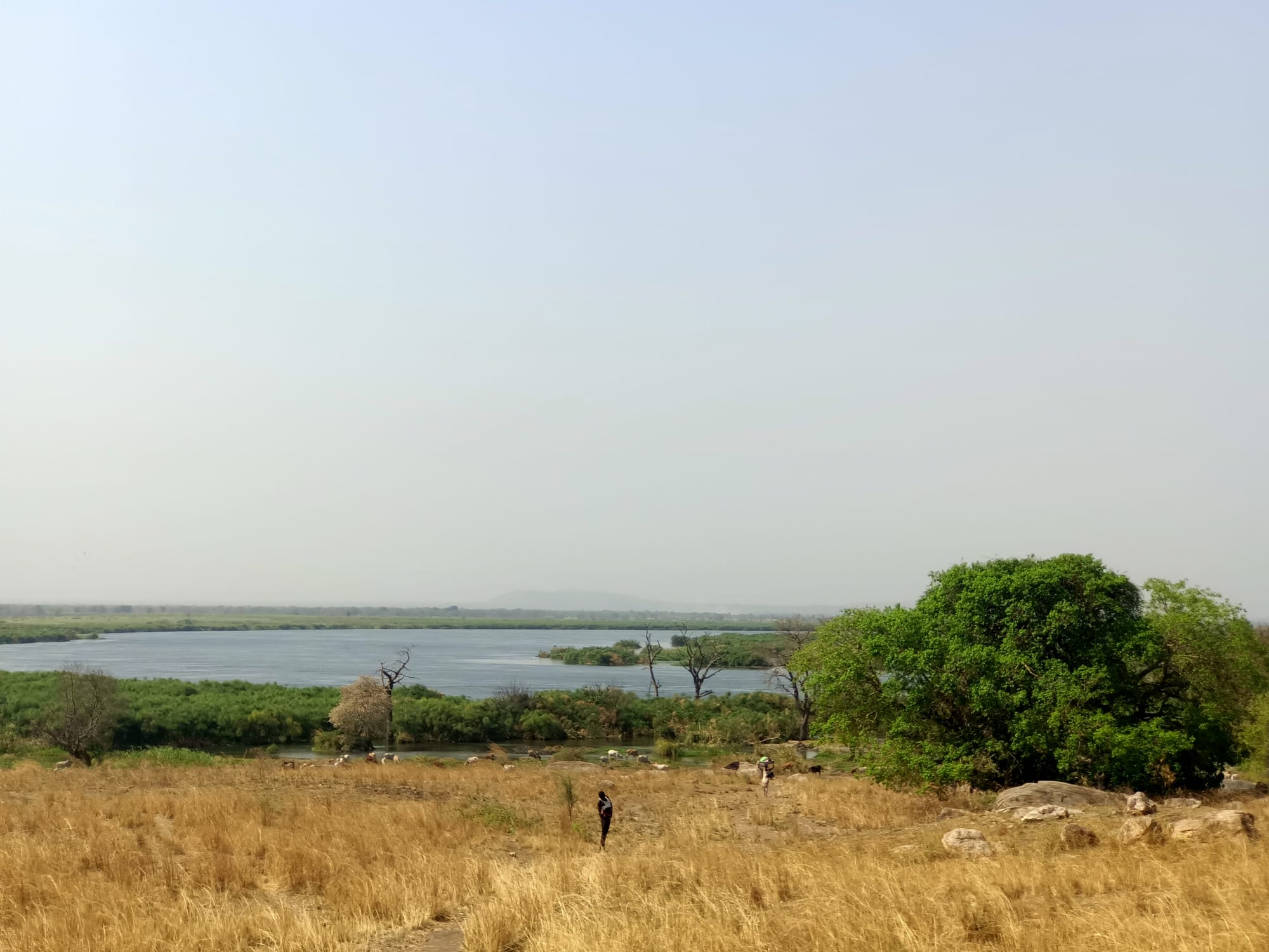
A wide, calm stretch of the Nile seen across dry grass and green riverside bush, with low hills on the far horizon

Juba & Equatoria, South Sudan

Nimule

The Nile seen from the high ground inside Nimule National Park, beside the town. (Bior ajang / Wikimedia Commons · CC BY-SA 4.0)

A border town in the far south of South Sudan, where the Nile enters the country from Uganda and drops through the Fula rapids beside Nimule National Park. It is the country's main land frontier, the point through which much of its imported food and fuel arrives, and the home of the Madi people. This page is written to explain the town, not to encourage travel.

Neighbourhoods

  • Nimule town centre
    • First-time visitors
    • Markets
    • Local life

    The compact centre beside the main road, with the market, small shops, bus and lorry yards, churches and the offices of the local administration. Almost everything in the town is within a short walk of it.

    Open in Maps
  • The border strip
    • Transport connections
    • Trade

    The stretch of road running south to the Ugandan frontier post at Elegu, lined with customs and immigration buildings, freight yards, money changers and queues of lorries waiting to clear. It is the busiest part of the town and the reason for its size.

    Open in Maps
  • The riverside and park edge
    • Quiet and residential
    • River views

    Housing and small compounds spread north-east of the centre towards the Nile and the edge of the national park, with fields and bush between them. The riverbank itself is left largely undeveloped, and the park boundary limits how far the town spreads.

    Open in Maps

Things to do

The river and the park

  • Nimule National Parkpark

    A national park on the Nile along the Ugandan border, established in 1954, covering some 410 square kilometres of woodland and hills.

    Open in Maps
  • The Fula rapidsattraction

    The stretch where the Nile, entering the country as the Albert Nile, narrows and breaks white over rock ledges about six kilometres downstream of the town.

    Open in Maps
  • The Nile riverbankviewpoint

    The banks north-east of the centre, where fishermen work from small boats below the rapids.

    Open in Maps

The town and the border

  • Nimule marketmarket

    The town's daily market, stocked with Ugandan produce, fish from the Nile, cloth and household goods brought across the frontier.

    Open in Maps
  • The Elegu border crossingtransit hub

    The frontier post a few kilometres south, the main land gateway between South Sudan and Uganda and the route by which much of the country's imports arrive; a one-stop border post opened on the Nimule side in 2020.

    Open in Maps

Seasonal events

  • Christmas and EasterDecember and March or April

    The principal church festivals, when families return to the town and services fill the churches of the centre.

  • Independence Day9 July

    The national anniversary of the 2011 separation from Sudan, marked with small official gatherings in the town.

Eat and drink

Long-standing places and food districts in Nimule. Hours, ratings and directions come from your maps app, always current.

Nimule staples

  • Grilled Nile fishrestaurant

    Tilapia and Nile perch caught in the river below the rapids, grilled over charcoal and served with cassava or flatbread at small eating places near the market.

    Open in Maps
  • Roadside grills and tea stallscafe

    Charcoal grills, sweet black tea and chapati along the transit road, serving lorry drivers and traders through the day.

    Open in Maps

Market food

  • Nimule marketmarket

    Cassava, maize flour, groundnuts, greens, dried fish and Ugandan fruit and vegetables trucked over the border.

    Open in Maps
  • Ugandan kitchensneighborhood

    Matoke, posho, beans and rolled-egg chapati cooked by Ugandan traders settled along the border road.

    Open in Maps

Experience Nimule

History

Nimule lies in the homeland of the Madi, farmers of the Nile valley on both sides of what is now the border with Uganda. In the nineteenth century the Fula rapids just downstream of the town blocked boats, so traders, soldiers and explorers moving between Gondokoro and the lakes travelled overland around them, and Nimule grew as the place where the river route and the road to Uganda met.

Because it sits on the frontier, the town has been shaped by every conflict in the country. In the two Sudanese civil wars it lay on the corridor between southern Sudan and Uganda along which refugees, supplies and fighters moved, and control of the road and the crossing mattered to both sides. Nimule National Park, on the river beside the town, was established in 1954, and the fighting of the decades that followed left the area insecure.

After the 2005 peace agreement, many people returned from refugee camps in northern Uganda, and the upgrading of the paved road to Juba turned the border into the country's principal supply line. Growth brought its own problems: returning Madi landowners and displaced families from other parts of the country have disputed land in and around the town, and the crossing was again crowded after fighting resumed in 2013 and 2016 and people moved south into Uganda.

Culture & Customs

The Madi give the town its character. They are settled farmers rather than cattle herders, growing cassava, maize, sorghum, groundnuts and simsim, and their villages spread along the Nile on both sides of the border, so families and clans commonly have relatives in Uganda. Madi is the everyday language, with Juba Arabic used in the market, English in offices and schools, and Acholi, Luganda and Swahili heard from traders and drivers.

Churches dominate community life, as across Equatoria, and choirs, youth groups and church-run schools organise much of the town's social calendar. Traditional authority still counts: chiefs and elders mediate disputes over land, inheritance and marriage, and customary practice works alongside the formal courts. Drumming, dancing and communal work parties mark weddings, funerals and harvests.

Being a frontier town shapes manners as much as anything else. People are used to outsiders, Ugandan goods, music and football are part of daily life, and many residents spent years as refugees in Uganda and returned with its habits and languages. At the same time the question of who belongs, and who owns the land, is discussed carefully; it has been the most sensitive local issue since the returns began.

Daily Life

Nimule's population was estimated at 45,000 people in 2006 and no recent figure is published; it is swollen by displacement and by the trade at the crossing, and fluctuates with events elsewhere in the country. The town is low and spread out: tin roofs, compounds of mud brick and concrete, churches, schools, fuel stations and the long line of lorry yards along the road south.

The border is the economy. Customs revenue, freight, clearing agents, money changing, loading work and the guesthouses and eating places that serve drivers all depend on the traffic between Juba and Uganda, and when the road closes or fighting interrupts trade the town feels it immediately. Around that, most households farm plots outside the town or fish in the river.

The day starts before dawn with buses leaving for Juba and lorries queuing for clearance, and slows through the hot middle of the day. Water comes from boreholes and the river, power from generators and solar panels, and mobile phone signals often work better on the Ugandan network. Malaria, floods in the wet season, disputes over land and the price of fuel and food are the recurring concerns of local life.

Food

The food here is closer to northern Uganda than to the cattle country of the north. Cassava is the everyday staple, boiled or dried and pounded into flour for a stiff porridge, alongside maize meal, sorghum kisra, the thin fermented flatbread, and sweet potatoes. These are eaten with stews of beans, okra, pigeon peas, boiled greens, simsim, sesame paste, or groundnut sauce.

Fish from the Nile is the local speciality, since the rapids and pools beside the town are productive: tilapia and Nile perch are grilled whole over charcoal, fried, or split and sun-dried for the market. Goat and chicken appear at celebrations, and roadside grills along the transit road serve meat to drivers at all hours.

Cross-border trade fills the market with Ugandan produce — matoke bananas, tomatoes, onions, rice, sugar and cooking oil — and with it Ugandan dishes such as posho and chapati. Sweet black tea is drunk from early morning at stalls under the trees, bottled beer and soft drinks come up from Uganda, and local brews made from sorghum, maize or cassava are made at home for gatherings.

Planning tools

Budget

There is no visitor economy. Accommodation is limited to basic guesthouses and compounds used by traders, drivers and aid staff, priced in dollars or pounds and well above their standard. Food in the market is cheap because it comes straight from Uganda, but any vehicle hire or security arrangement dominates the cost of being here.

Daily Budget Midrange
USD 150–300 for the wider region — in Nimule itself, a modest room, meals and a hired vehicle with driver
Daily Budget Shoestring
USD 40–80 (a basic guesthouse room, market meals, shared transport on the Juba road)

Carry US dollar cash and Ugandan shillings as well as South Sudanese pounds, since the border trade uses all three.

Best Time to Visit

The dry months from December to March are when the road north to Juba is most reliable and the park's tracks are passable, and when the river is low enough for the rapids to show clearly. Rain from April to November slows road transport and makes bush tracks difficult. Security conditions decide whether any visit is possible at all.

Suggested Number of Days

A day or two covers the town, the market and the riverbank. A little longer allows time on the edge of the national park and along the border road. Most people here are passing through rather than staying.

First Visit
1–2 days
With Surroundings
2–3 days

Transportation

Nimule sits on the paved highway between Juba and the Ugandan border, and buses, minibuses and shared cars run north to the capital and south into Uganda. Motorcycle taxis handle short journeys inside the town. There is no rail and no scheduled air service, and tracks into the park require a four-wheel drive vehicle.

Road travel is arranged for daylight hours, and the crossing and customs formalities can take much of a day for vehicles carrying goods.

Airport & Station Connections

The town is about 195 kilometres by road south-east of Juba on the country's main paved road, several hours by bus or car depending on checkpoints. From the Ugandan side it is reached through the Elegu post on the road from Gulu, about 120 kilometres to the south, and from Kampala beyond it. The nearest international airport is at Juba.

Walkability

The town is small and flat, and the centre, the market and the churches are all within twenty minutes on foot. The border post lies a few kilometres south along a busy lorry road, which is not a pleasant walk, and the riverbank and park edge are best reached by vehicle.

Safety

The border road has seen ambushes and banditry in the past, checkpoints are frequent, and cross-border cattle raiding and land disputes affect the surrounding countryside. Malaria is constant, and medical care is limited, with the nearest better facilities across the border in Uganda.

Most governments advise against all travel. Anyone present for work should move only with a security plan, avoid road travel after dark, keep away from the riverbank on foot and hold evacuation cover. Check current official travel advice before travelling.

Climate

Tropical and green, wetter than most of South Sudan because of its position close to Uganda, with rain from roughly April to November and a hot dry season from December to March.

Summer
rainy season, roughly April to November: warm and humid, about 24–32°C, with heavy afternoon storms
Winter
dry season, December to March: hot and dusty, frequently 34–37°C by afternoon, cooler at night

Local Customs

Nimule is Madi country, and Madi is spoken alongside Juba Arabic, English and the Acholi and Luganda heard from traders across the border. Churches are central to social life and Sunday is quiet. Dress is modest, greetings are unhurried, and the town's long history of displacement and return makes land ownership a sensitive subject.

Ask before photographing anyone, never photograph the border post, customs buildings, soldiers or police, and avoid discussing local land disputes.

Common Payment Methods

The South Sudanese pound is the official currency, but Ugandan shillings and US dollars circulate freely in a town that lives on cross-border trade. Cash is the only practical means of payment; there are no reliable ATMs and cards are not accepted. Money changers operate openly near the border.