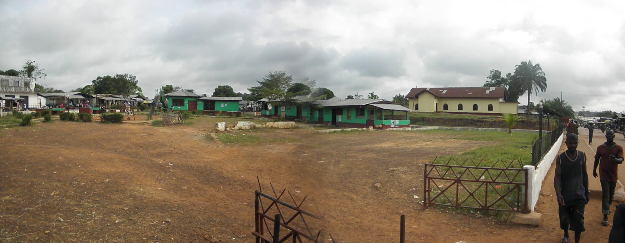
Single-storey green and white buildings around an open, reddish-earth yard, with palm trees under a cloudy sky

Liberia

Gbarnga, Nimba & the Interior

A street scene in Zwedru, the capital of Grand Gedeh County in south-eastern Liberia. (Mr.R.Sobah / Wikimedia Commons · CC BY 3.0)

The inland counties of Liberia, an arc of rainforest, farmland and hills from Gbarpolu and Lofa on the Guinea and Sierra Leone borders through Bong and Nimba to Grand Gedeh and River Gee near Côte d'Ivoire — home to the Kpelle, Mano, Gio, Loma, Krahn and other peoples, and to Liberia's highest mountains and iron-ore ranges.

Explore Gbarnga, Nimba & the Interior

History

The interior was home to the peoples who formed most of Liberia's population — the Kpelle in the centre, the Mano and Gio (Dan) in Nimba, the Loma, Kissi, Gbandi and Mandingo in Lofa, the Gola in the north-west, and the Krahn and Grebo in the south-east. Long-distance trade linked the forest to the Mande world of the savanna, and Mandingo traders brought Islam along these routes.

The Liberian government extended its authority over the interior only slowly. Missions such as Ganta Methodist Mission, founded in 1926, and Cuttington College, which moved to Suacoco near Gbarnga in 1948, brought schools and hospitals. Later the Liberian American-Swedish Minerals Company (LAMCO) mined iron ore in the Nimba mountains, building Yekepa and a railway to Buchanan.

The region was central to the civil wars. Samuel Doe was a Krahn from Grand Gedeh, and in December 1989 Charles Taylor's National Patriotic Front of Liberia entered Nimba from Côte d'Ivoire; the conflict soon took on ethnic lines, with violence against Gio, Mano, Krahn and Mandingo civilians. Taylor ran his territory from Gbarnga in the early 1990s. A later rebel group, LURD, active from 1999, made its headquarters at Voinjama in Lofa. In 2014 Lofa was among the first areas of Liberia hit by Ebola.

Culture & Customs

Kpelle is the largest language group in Liberia and dominates Bong County, while Mano and Gio are spoken across Nimba, Loma in Lofa, and Krahn and Grebo in the south-east. Liberian English connects them all. Most people are Christian, while the Mandingo community is Muslim, and traditional beliefs remain strong.

The Poro and Sande societies shape adulthood across much of the interior, with bush schools that teach custom, craft and responsibility. The Dan (Gio) of Nimba are known internationally for their carved wooden masks, and Loma, Kpelle and Mano masquerades appear at funerals, initiations and celebrations. Iron rods known as Kissi pennies once served as currency among the Kissi, Loma, Kpelle and neighbouring peoples.

The wars left deep ethnic wounds. Disputes over land and belonging have occasionally turned violent since, and reconciliation work continues.

Daily Life

The interior's towns are small. Ganta, a trading hub on the Guinea border with roughly 40,000 people, is among the largest; Gbarnga, the Bong county seat, is a university and administrative town; Voinjama, Zwedru, Sanniquellie, Bopolu and Fish Town are county capitals of a few thousand to a few tens of thousands. Most people live in villages and farm upland rice, cassava, plantain and vegetables, with cocoa, coffee, rubber and oil palm as cash crops.

Mining is the main industry: ArcelorMittal exports iron ore from the Nimba range, and informal gold and diamond digging draws young people to parts of the interior. Logging and forest concessions bring money and conflict over land. Roads are the defining issue — the difference between getting crops to market or not — and rainy-season isolation is part of the rhythm of the year in the south-east.

Food

Upland "country rice" grown on the farms of Lofa, Bong and Nimba is the foundation of every meal, eaten with palm butter, cassava leaf or potato greens, or with soups made with bitter balls, a small bitter garden egg. Fufu and dumboy made from cassava are eaten with pepper soup.

Forest products fill the markets: palm oil, kola nuts, wild mushrooms, snails and plantains. Bushmeat is widely eaten and considered a delicacy. Lofa and Nimba grow coffee and cocoa, sold as cash crops more than drunk locally. Groundnuts, roasted corn and fried plantain are the snacks of the road, and palm wine and cane juice are the drinks of village gatherings.

Attractions & Natural Wonders

Gbarnga is the hub of central Liberia and was Charles Taylor's wartime headquarters, with Cuttington University nearby at Suacoco in Bong County.

In Nimba, Ganta is a lively border market town with the old Methodist mission. To the north-east, Yekepa sits below the Nimba mountains, where decades of iron-ore mining have cut into the ridges while the forested slopes of the East Nimba Nature Reserve remain protected; the range continues across the border into Guinea and Côte d'Ivoire.

In Lofa, Voinjama is the gateway to the north, with the Wologizi range in the county, rising to Mount Wuteve, at about 1,440 metres the highest point in Liberia. Its forested slopes are an Important Bird Area and hold forest elephants and western chimpanzees.

In the south-east, the rainforest of Grand Gedeh and River Gee is home to western chimpanzees, pygmy hippos and giant pangolins. Part of it is protected in the Grebo-Krahn National Park, and Zwedru is the base for trips into the region.

Cities in Gbarnga, Nimba & the Interior

Planning basics

Budget

The interior is cheaper than Monrovia, with simple guesthouses and cook shops in Gbarnga, Ganta, Voinjama and Zwedru, but choice is limited and comfort basic. The real costs are transport — a four-wheel-drive vehicle with driver and fuel for the long, rough roads to Lofa and the south-east — and guides for forest or mountain visits.

Daily Budget Midrange
USD 120–250 (best local hotel, a four-wheel drive with driver, guides and fees)
Daily Budget Shoestring
USD 30–55 (basic guesthouse, local food, shared taxis and motorbike taxis)

Bring US dollars and Liberian dollars (LRD) from Monrovia; ATMs outside the capital are few and often out of service.

Safety

The interior is peaceful, but facilities are thin. The main risks are road accidents on long, poorly maintained routes and with motorbike taxis, isolation in the rainy season, malaria and Lassa fever, and limited medical care, with serious cases needing transfer to Monrovia. Land disputes in some counties occasionally flare into local unrest, and informal gold-mining camps can be rough.

Travel by day with a reliable driver, carry supplies and a charged phone, and take malaria precautions. Check current official travel advice before travelling.

Climate

Tropical, with a rainy season from about May to October that is somewhat less intense than on the coast. The north, in Lofa and upper Nimba, has a clearer dry season, with harmattan haze from December to February, and the Nimba and Wologizi highlands are cooler, especially at night. The south-eastern forest counties stay humid year-round.

Summer
the wet season, about 22–29°C, with heavy rain and deep mud on unpaved roads
Winter
the dry season, 22–33°C, with harmattan haze in the north and cooler hill nights

Transportation

A paved highway runs from Monrovia through Kakata to Gbarnga and Ganta, with a branch to Yekepa, served by shared taxis and minibuses. Roads north to Voinjama and south-east to Zwedru and Fish Town are partly unpaved and can become impassable after heavy rain. Motorbike taxis cover the last stretches to villages. The iron-ore railway from Yekepa to Buchanan carries freight, not a regular passenger service.

Monrovia to Gbarnga takes roughly three to four hours by road; allow a full day or more for Zwedru or Voinjama.

Best Time to Visit

December to April, when the roads to Lofa, Grand Gedeh and River Gee are passable and forest and mountain walks are drier. In the rains some routes to the south-east can be cut for days, so trips need flexible timing.