Attractions & Natural Wonders · American Samoa
American Samoa: Eight Attractions and Natural Wonders
A US national park spread across three islands, a drowned volcanic crater for a harbour, and rainforest ridges that drop straight into the Pacific
By Globeway Editorial · 30 September 2026
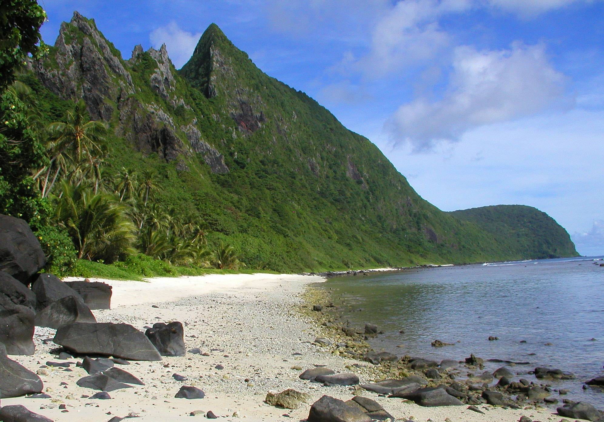
The only inhabited US territory south of the equator
American Samoa is a cluster of small, steep, intensely green volcanic islands in the South Pacific — a US territory, but one where the land is held communally by Samoan families and daily life runs on fa'a Samoa, the Samoan way. It gets very few tourists: there is one main island with a road, a scattering of outer islands reached by small plane or boat, and a national park unlike any other.
The eight places below are nearly all on the main island, Tutuila, within reach of the capital, Pago Pago. The outer Manuʻa Islands — Ofu, Olosega, Taʻu — take more effort and reward it. It is hot, humid, and rainy year-round, around 82–88°F; May to October is slightly drier.
1. The National Park of American Samoa
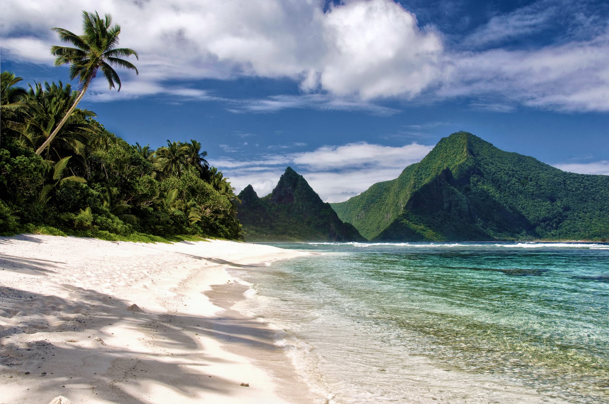
The National Park of American Samoa is split across three islands and protects tropical rainforest, cloud forest, coral reef, and fruit-bat colonies rather than canyons or geysers. It is also the only unit of the US National Park Service south of the equator, and its land is leased, under a 50-year agreement signed in 1993, from the Samoan village councils that own it, so visiting means passing through people's communities.
On Tutuila the park covers the rainforest ridgeline and steep northern slopes near Pago Pago, around Vatia. On Ofu it protects a two-mile reef-fringed beach that most visitors who reach it consider the park's most attractive. There are no park lodges; accommodation is in villages and small guesthouses.
2. Pago Pago Harbor
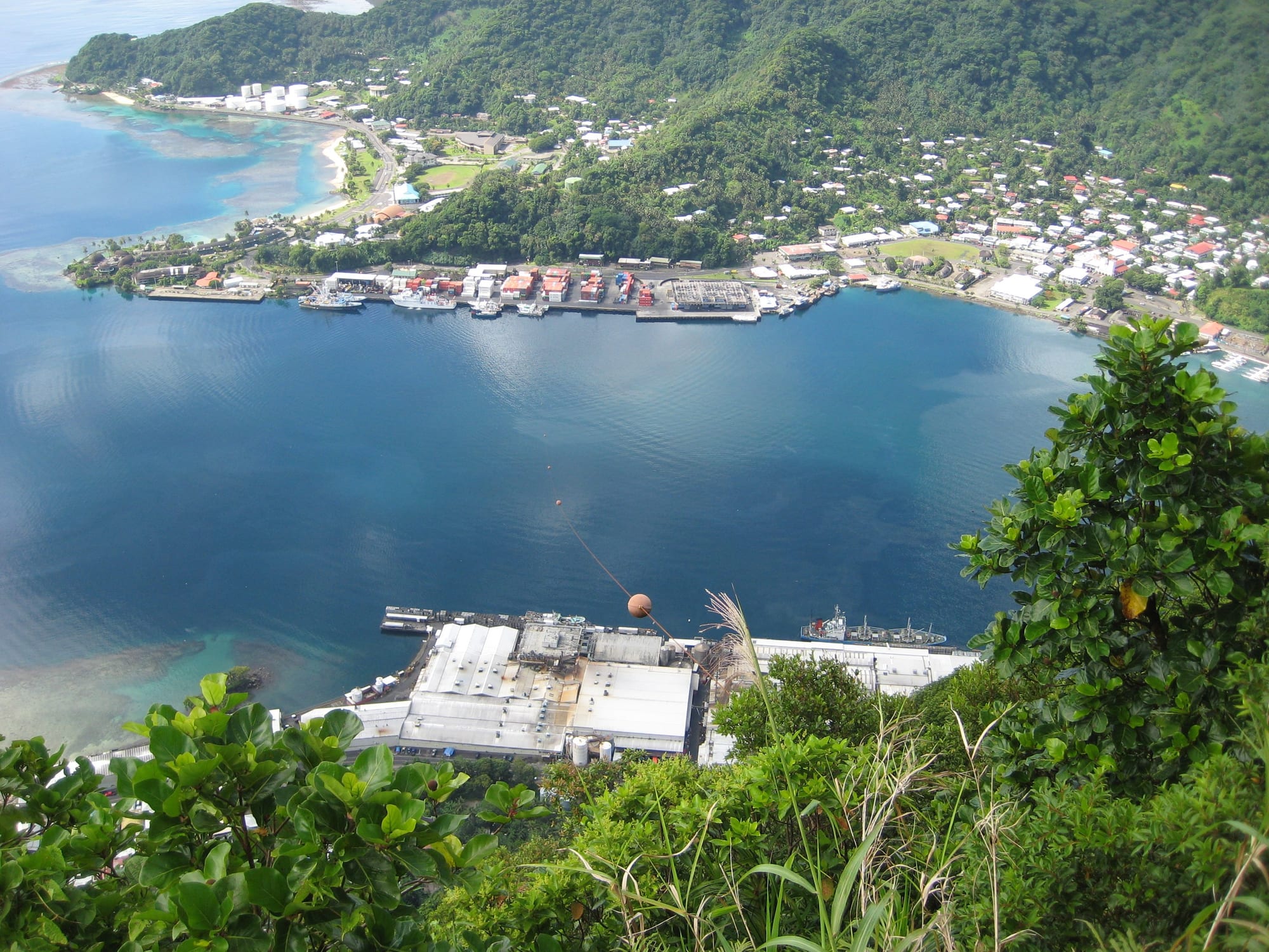
Pago Pago Harbor is a volcano that lost a wall: the sea broke into the old crater and left a long, deep, sheltered inlet almost surrounded by mountains. It is the reason the US Navy wanted the islands in the first place, as a coaling and naval station, and it is still the territory's working heart, with a tuna cannery, the docks, and the little capital strung along the shore.
The setting is dramatic — green walls rising straight from the water on both sides — and best appreciated from the road that loops around the bay or from the ridge trails above.
3. Rainmaker Mountain
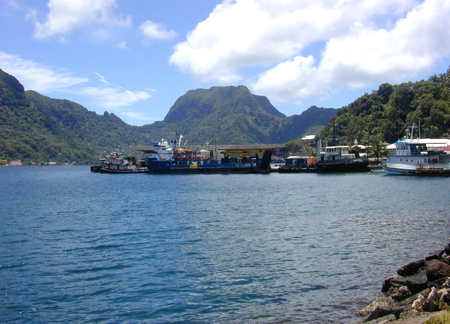
The blunt green peak that looms over the harbour entrance is Mount Pioa, better known as Rainmaker Mountain. It snags the trade winds and wrings the rain out of them, giving Pago Pago the highest annual rainfall of any harbour, around 200 inches a year on the mountain itself, and keeping the slopes so lush.
It has been a National Natural Landmark since 1972, protected for the tropical vegetation on its slopes, and it faces Matafao Peak, Tutuila's highest point, across the bay; several endemic species live only on these two mountains. The harbour road runs right below it.
4. Mount 'Alava
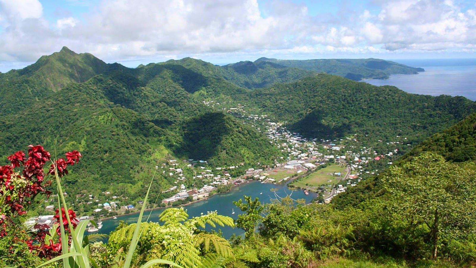
Mount 'Alava, Tutuila's second-highest mountain, rises 1,610 feet directly above the harbour, and its summit is the classic Tutuila hike — a forest trail along the ridge from Fagasā Pass, ending at a clearing with a wide view down over Pago Pago and out to sea. At the top are the rusting remains of a cable-car station; the aerial tramway that once ran here was struck by a Navy plane during the Flag Day celebrations of 1980, and although it was repaired it closed not long after.
The energetic can take the Mount 'Alava Adventure Trail, a steep route of 56 ladders and 783 steps, and Vatia on the north coast can also be reached on foot from the mountain.
5. Vatia and Pola Island
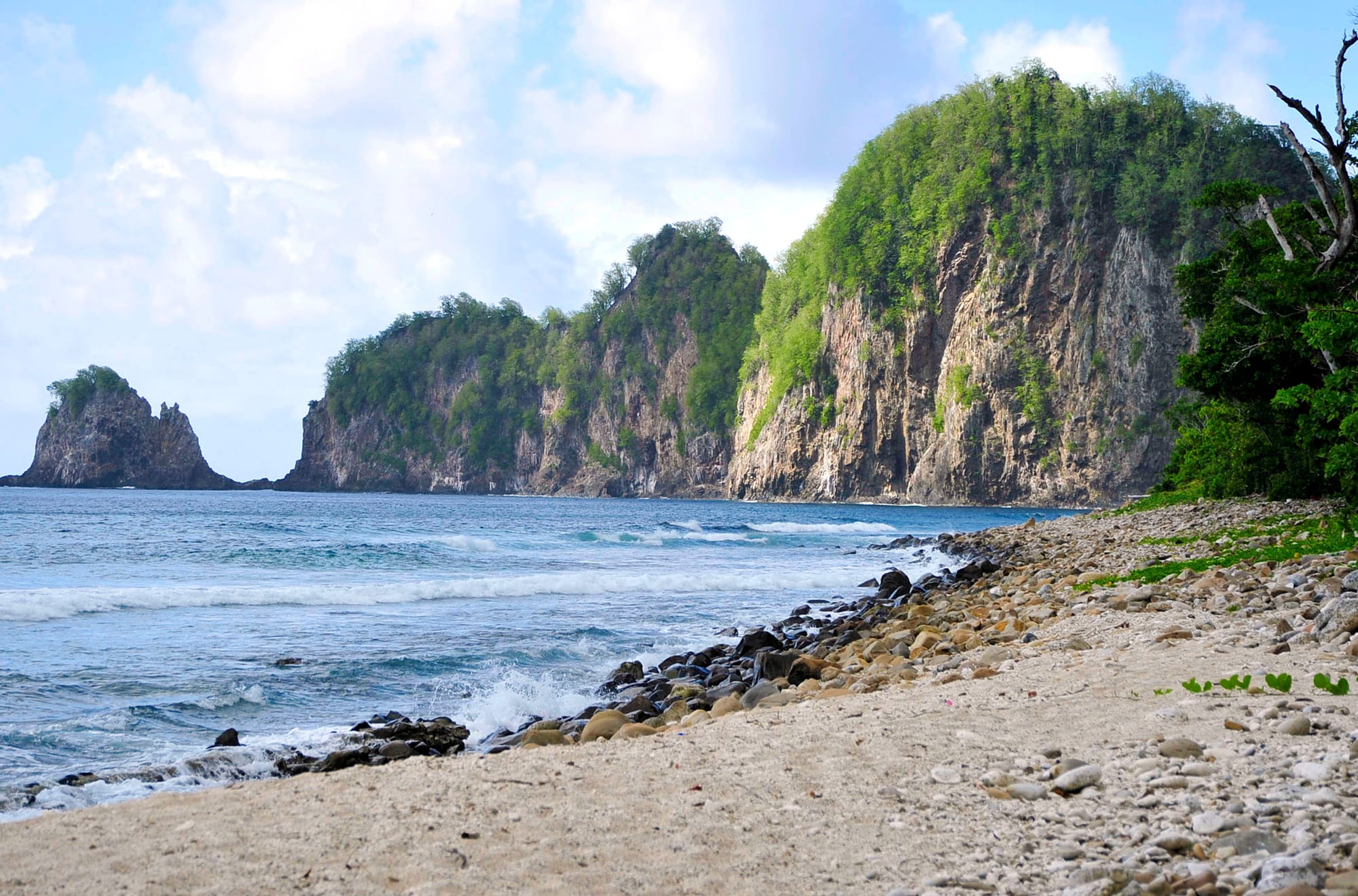
The village of Vatia, on Tutuila's wild north coast, sits inside the national park and looks out on Pola Island — a saw-toothed rock rising sheer from the sea, its cliffs rising about 400 feet, home to the boobies, noddies, and frigatebirds that nest on it. It is one of the most striking views in the territory.
The short Pola Island Trail, from the end of the road beyond the village school, leads to a rocky cliff looking across the strait to the stack. Getting to Vatia itself is half the point: the road over the mountains from Pago Pago is steep, narrow, and green on every side.
6. Fagatele Bay
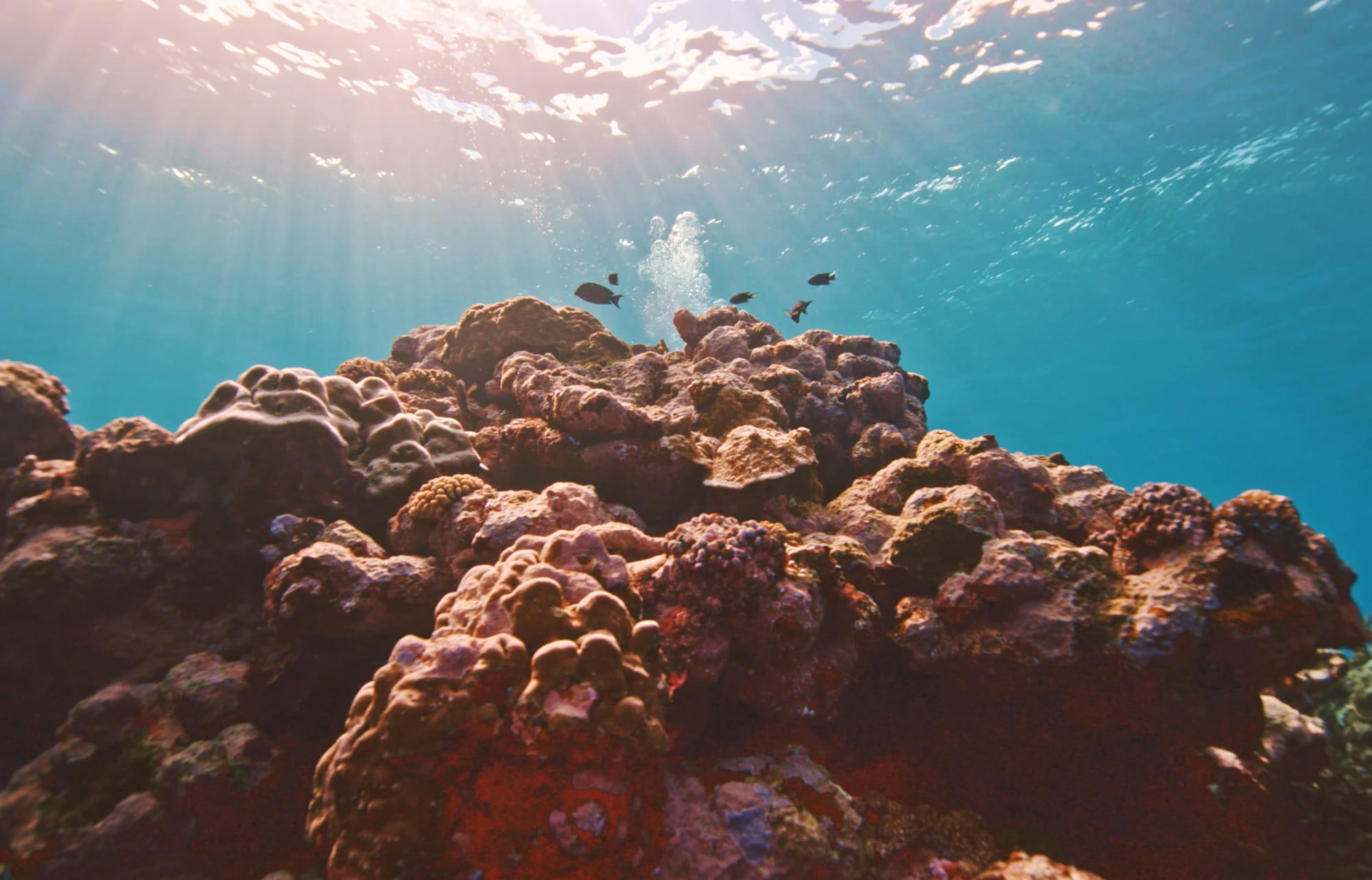
Fagatele Bay is another breached crater, this one on the southwest tip of Tutuila, and its steep forested rim shelters a fringing coral reef that has been studied for decades as it recovered from a crown-of-thorns starfish outbreak in the late 1970s — with parrotfish, butterflyfish, hawksbill and green turtles, and humpback whales offshore from June to September.
It was designated a national marine sanctuary in 1986, the original core of what became the National Marine Sanctuary of American Samoa in 2012. Diving and snorkelling in this near-enclosed bowl of reef are among its draws.
7. Aunuʻu Island
Aunuʻu is a tiny volcanic island a short boat ride off the eastern end of Tutuila, and for its size it packs in an unusual amount: the territory's only lakes (Pala Lake and Red Lake inside the crater), its only quicksand, its largest freshwater marsh, and the only taro paddy fields in American Samoa. Its crater has been part of a National Natural Landmark since 1972, and the island is a quiet single-village community with only a few cars.
The crossing from the boat dock at Auʻasi on Tutuila is by small, family-run motorboat. It makes an easy, gentle half-day from the main island.
8. Blunts Point Battery
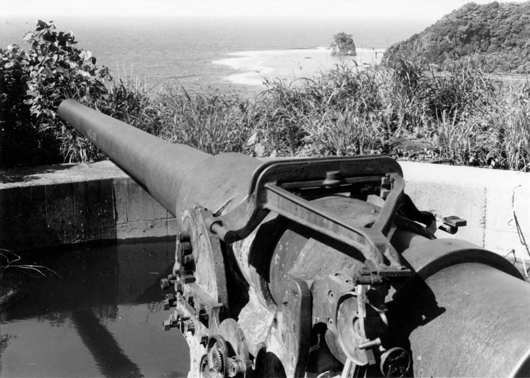
On a headland on the west side of the harbour mouth, about 200 feet above the sea and reached by a moderately difficult trail, sit two six-inch naval guns, test-fired in August 1941, to cover the entrance to Pago Pago. American Samoa was a significant staging base in the Pacific war — Marines outnumbered the local population for a time — and gun mounts, pillboxes, and bunkers are scattered along this coast.
The Blunts Point walk ends at the guns, still in place and in good condition, with a clear view across the harbour entrance. The battery was declared a National Historic Landmark in 1987.
American Samoa asks visitors to slow down and follow local courtesies — Sunday is for church and rest, visitors should stop quietly during the evening sa prayer curfew, and modest dress is expected off the sand. In return, few Pacific islands feel so far from the tourist trail.