Daily Life · Brunei
Why is part of Brunei's capital built on stilts over the river?
The capital began on the water. Kampong Ayer is what remains of it, a smaller share today than half, but still a living town of about 10,000 people.
By Globeway Editorial · 2 November 2026
The short answer
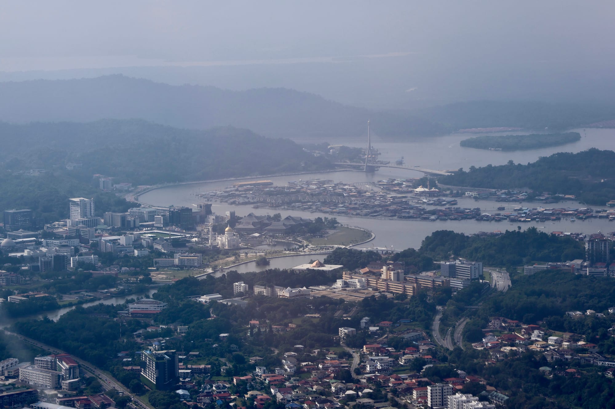
For most of its history, Brunei's capital was not half on the water: it was almost entirely on the water. The settlement now called Kampong Ayer, Malay for "water village", grew up on stilts in the Brunei River as the seat of a seafaring sultanate whose wealth came by boat. The town on dry land that visitors see today was built mostly after 1906, when British administrators began moving government ashore and encouraging the river's residents to follow.
The "half" in the question is an overstatement. Kampong Ayer covers about 10 square kilometres of a municipal area of 100.36 square kilometres, and it had about 10,250 residents in 2016, against an estimated 72,133 for the whole municipal area in 2025. What survives on the river is a slice of the capital, not half of it, yet it is often called the largest water village in the world, a town of houses, schools, mosques and police and fire stations linked by walkways on stilts.
A sultanate that faced the sea
Brunei's rulers built their power on trade and ships. As early as 1225 a Chinese official reported that Boni, a kingdom many scholars link to Brunei, kept 100 warships to protect its trade. At its height under the fifth sultan, Bolkiah, the Sultanate of Brunei controlled the coasts of north-west Borneo and reached as far as the Sulu Archipelago in what is now the southern Philippines. Historians call such a state a thalassocracy, an empire of the sea.
For a power like that, the river was the street. The primary settlement of the capital is thought to have existed on the water as early as the reign of Sultan Muhammad Shah, between 1363 and 1402, and it served as a busy port exporting a wide range of goods. Arab travellers described Brunei's capital as a city built on water, with tides rising and falling twice a day, and its harbour as safe, sheltered and prosperous, drawing merchants from China, Java, Siam and Cambodia.
Raising houses on stilts is an old habit across the Austronesian world, the family of seafaring peoples that includes the Malays. The raised design limits damage from floods and keeps out vermin from the ground, and very tall examples could even serve as defences. On the Brunei River, homes stood on piles roughly 3 metres above the tide.
What the first European visitors saw
The most famous early description comes from Antonio Pigafetta, the Italian chronicler of Ferdinand Magellan's expedition, who reached Brunei in 1521. He described a city built entirely in salt water, with 25,000 hearths, or families, in houses made of wood and raised on tall pillars.
Eighty years later the Dutch navigator Olivier van Noort, who stayed from December 1600 to January 1601, noticed something stranger about the homes of the nobles. They stood on such light piles, he wrote, that in a storm or other emergency the houses could be moved from one side of the river to the other.
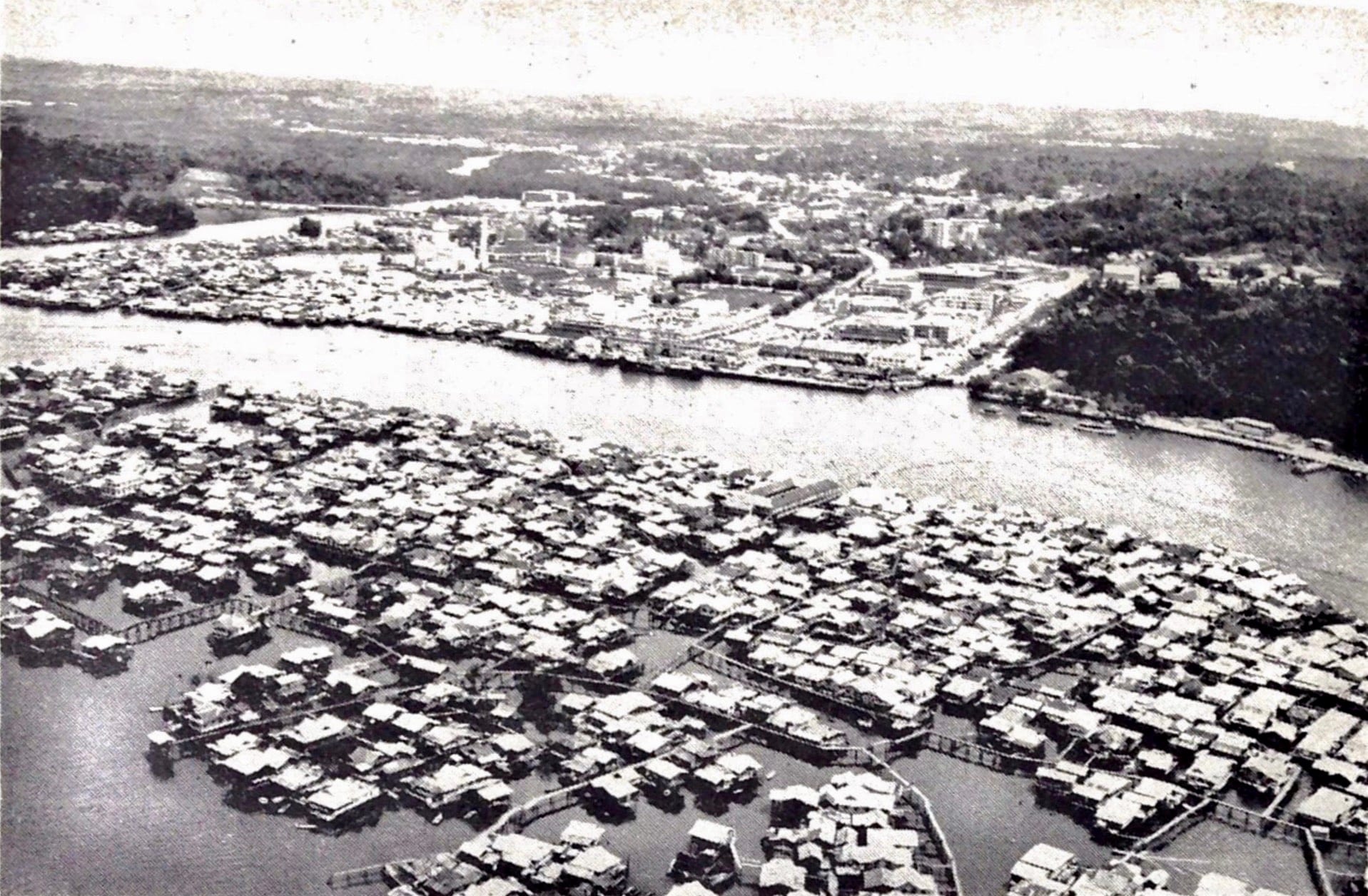
By the 19th century the sultanate had lost much of its territory to Sarawak's Brooke rulers, the British and others, and the river capital shrank with it. By 1840 its population was barely 15,000. Visitors in the middle of the century found houses on mudflats, ringed by mud at low tide and water at high tide, and a floating market of traders selling goods from canoes.
How the capital moved ashore
The turning point came with British rule. In 1906 the British Resident, Malcolm McArthur, began shifting the settlement to land. His main concern was sanitation, which was at its worst in the water village, then home to between 8,000 and 10,000 people. He started with his own residence on the bank, Bubungan Dua Belas, even though the sultan's palace was still on the river.
The new town grew step by step. In 1920 the land area was officially designated Brunei's capital and municipal territory, and government buildings and a mosque went up along the western riverbank. A Sanitary Board, set up on 1 January 1921, oversaw the town's development, and when the sultan moved his palace inland in the early 20th century, resettlement gained momentum. Attempts to coax families onto land were unsuccessful at first, but from the 1920s they spread to new areas beyond the centre.
- 1363–1402
The water settlement is thought to exist under Sultan Muhammad Shah.
- 1521
Antonio Pigafetta describes a city of 25,000 households built in salt water.
- 1840
The population has fallen to barely 15,000.
- 1906
Resident Malcolm McArthur begins moving the capital onto land.
- 1920
The land town is designated the official capital.
- 1944–1945
Allied bombing destroys most of the land town; the water village survives.
- 4 October 1970
Brunei Town is renamed Bandar Seri Begawan.
- 2007
The municipal area grows from 12.87 to 100.36 square kilometres.
The Second World War tested both halves of the city. Allied bombing in 1944 and 1945 destroyed much of the town on land, but Kampong Ayer survived. Oil wealth then transformed the capital on land: Brunei Town was renamed Bandar Seri Begawan on 4 October 1970, and a business district rose in the 1970s and 1980s.
Life on the water today
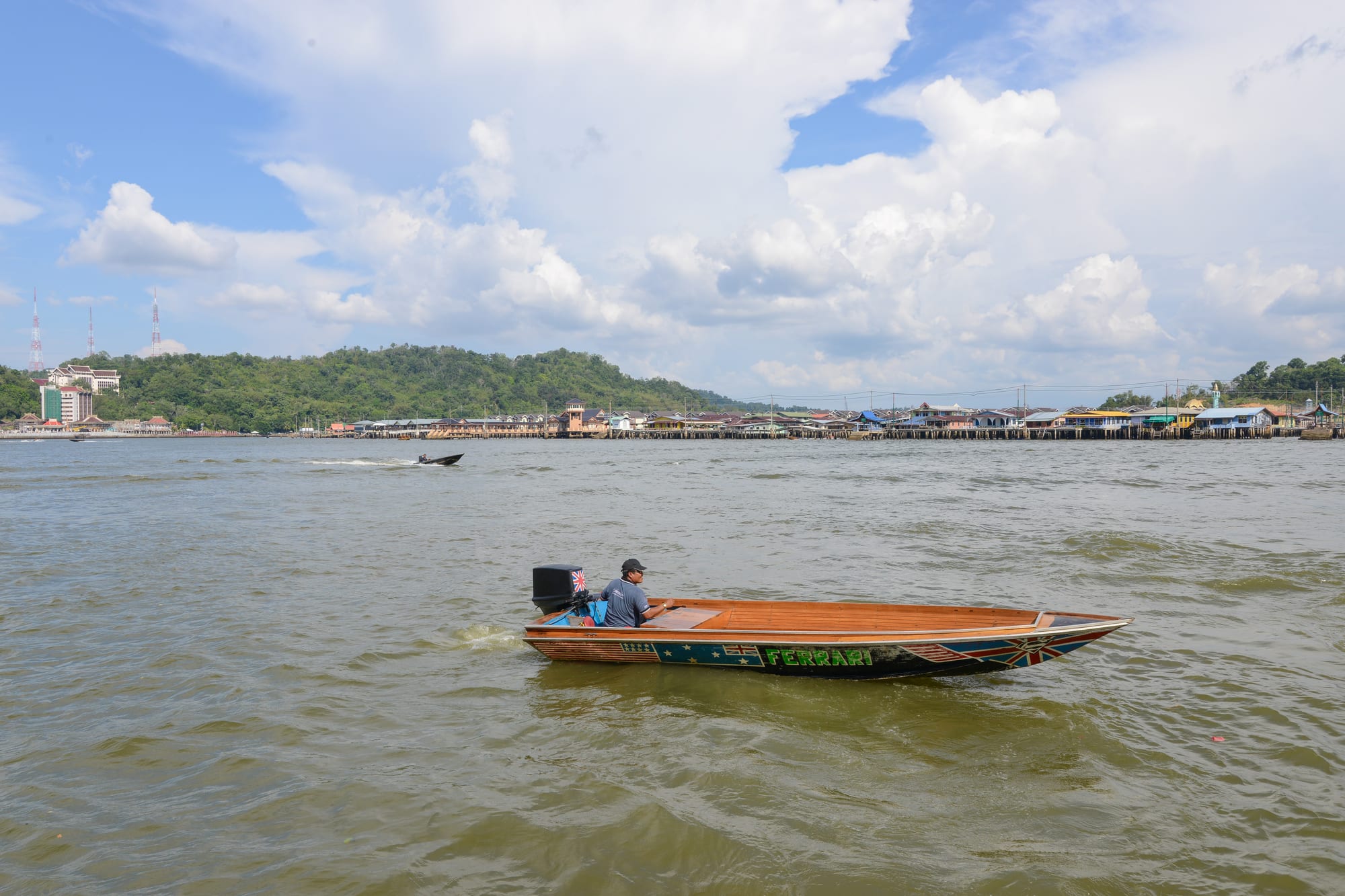
Kampong Ayer still works as a neighbourhood rather than a museum. It is divided into six mukims, or local districts, all within the municipal area of Bandar Seri Begawan. Houses, up to two storeys high and traditionally built of wood in the Malay style, are joined by walkways and footbridges of wood, concrete or metal. Where wide waterways separate one cluster from another, people travel by perahu tambang, wooden motorboats that work as water taxis and charge fares like taxis on land. Homes have electricity, piped water, telephone lines and internet, and every mukim has at least one primary school. Awang Semaun Secondary School is the only secondary school built over the water.
Life over the river has its problems. Fires are common, blamed largely on faulty wiring and on buildings made mostly of wood. Rubbish and sewage float on the water, partly because waste washes down from land upstream, and systematic sewage disposal exists only in the planned public-housing villages. Above all, people keep leaving for homes on land: the population fell from about 28,000 in 1981 to 13,000 in 2011, and many worry that the customs and close community of the water village are fading with them.
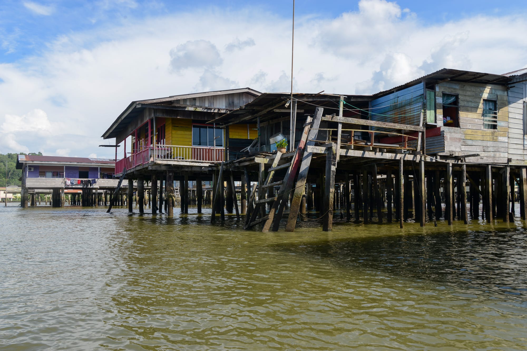
Visitors cross from the city waterfront by water taxi, and the Kampong Ayer Cultural and Tourism Gallery tells the village's story. The view from the water shows the capital's history in a single sweep: the old city on stilts on one side of the river, and the town that replaced it on the other.