Attractions & Natural Wonders · Montserrat
Why is half of Montserrat a no-go zone buried in ash?
The Soufrière Hills volcano woke in 1995, buried the capital, Plymouth, and still has the power to send scorching avalanches down the island's southern half.
By Globeway Editorial · 2 November 2026
The short answer
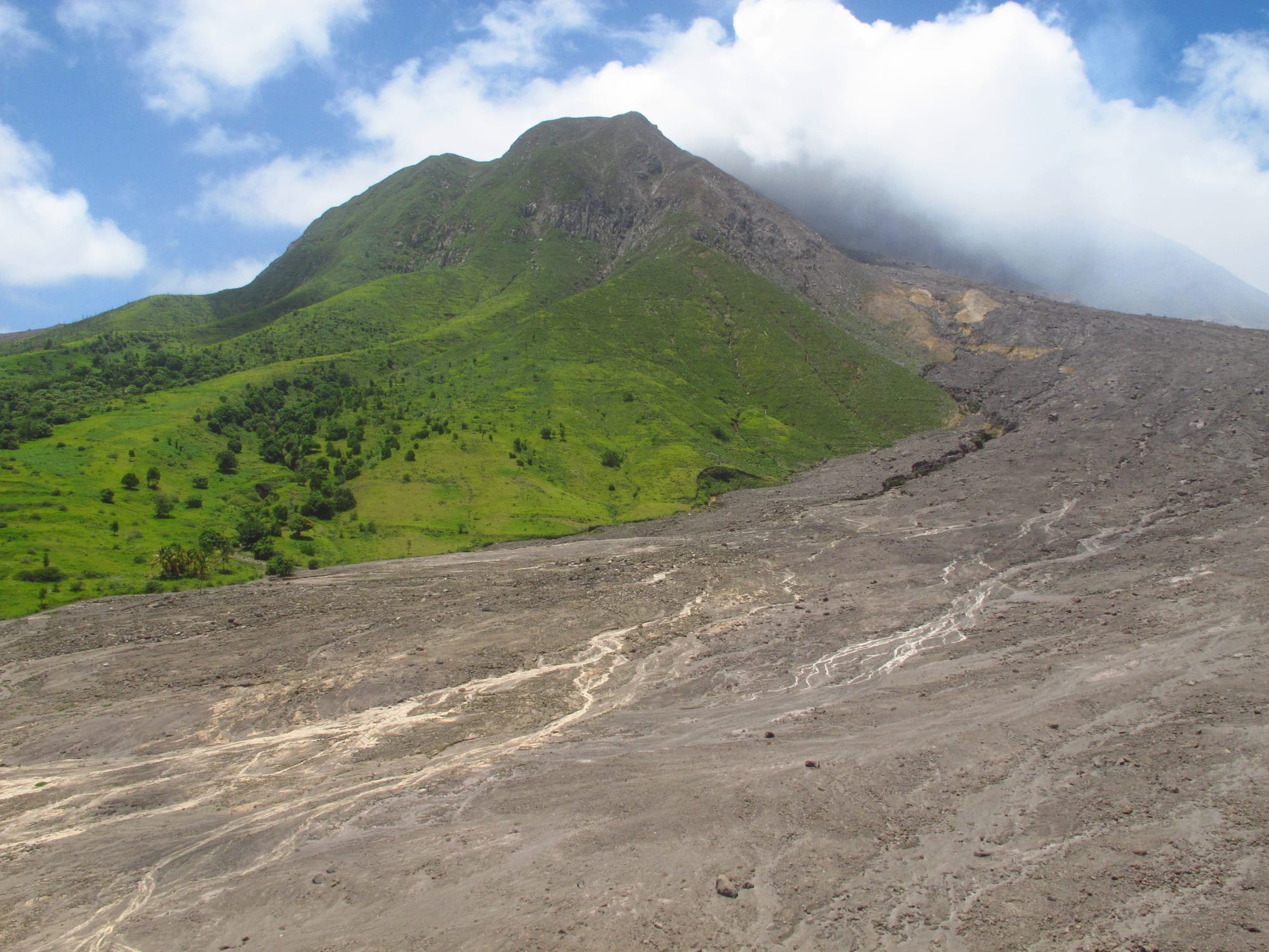
In July 1995 the Soufrière Hills volcano, at the southern end of Montserrat, came back to life after centuries of quiet. Over the next few years it smothered the south of the island in ash, pyroclastic flows (avalanches of hot rock, ash and gas that race downhill) and mudflows. The capital, Plymouth, about 4 miles from the summit, was evacuated for good in 1996 and buried in 1997. Nineteen people died, two-thirds of the population left, and the whole southern half of the island was declared an Exclusion Zone.
The zone stays closed because the danger has not gone away. This volcano builds domes of thick, sticky lava at its summit that can suddenly collapse and send new flows down the slopes, as it did repeatedly until 2010. It has been relatively quiet since then and last erupted in 2013, but it is still active and closely watched. The most dangerous part of the zone, including the ruins of Plymouth, can be entered only with a government-authorised guide.
A volcano that had slept for centuries
Montserrat is a small British Overseas Territory in the Leeward Islands, about 10 miles long and 7 wide, nicknamed "the Emerald Isle of the Caribbean" for its likeness to coastal Ireland and the Irish ancestry of many of its people. Plymouth, its capital, was a Georgian town of about 4,000 people built on old lava deposits on the west coast, and for centuries it was the island's only port of entry. It held almost all of its shops and services, and the seat of government.
The volcano above it had given warnings before. Swarms of earthquakes shook the area in 1897 and 1898, from 1933 to 1937 and in 1966 and 1967, but none ended in an eruption. Geologists date one eruption of lava, at Castle Peak, to around 1550. When the mountain began to stir again on 18 July 1995, after centuries of silence, scientists had little local experience to go on. A monitoring base was set up immediately, and the volcanologists came under intense political pressure to say what would happen next. The crisis has since been called a classic example of a rare, hard-to-predict event.
How Plymouth was lost
- 18 July 1995: The Soufrière Hills volcano becomes active.
- 21 August 1995: The first steam-driven explosion blankets Plymouth in ash; the south is evacuated until 3 September.
- 1 December 1995: A growing lava dome forces a second evacuation, lasting a month.
- 3 April 1996: After pyroclastic flows and mudflows begin, southern Montserrat, including Plymouth, is evacuated for good.
- 25 June 1997: A pyroclastic surge spills out of the Mosquito Ghaut ravine and kills 19 people in the evacuated Streatham area.
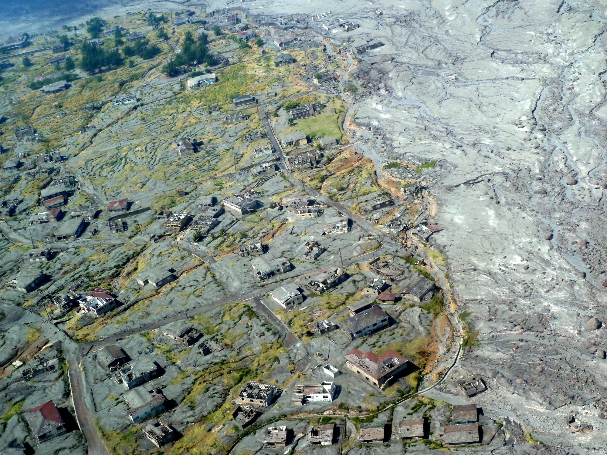
- 4 to 8 August 1997: Eruptions destroy about 80 per cent of Plymouth, burying it under 4.6 feet of ash.
- 11 February 2010: A partial collapse of the lava dome sends ash clouds over Guadeloupe and Antigua and buries the remains of the old airport.
The killer at Soufrière Hills is not lava streaming from a crater. Its lava is andesite, so stiff that it piles up into a dome at the summit instead of flowing away. As the dome grows it becomes unstable, and when part of it collapses the hot rock shatters into a pyroclastic flow that pours down the valleys. Flows were first seen on 27 March 1996; that September one badly damaged the village of Long Ground. In June 1997 a surge proved too large for the steep ravine that should have channelled it to the sea, spilled out and caught people who had gone back into the zone. The island's airport on the east coast, which had stayed open until then, was put out of action and later buried.
Why the south cannot simply be dug out
It might seem that a buried town could be cleared once the eruptions eased. But the flows, ash and mudflows that filled Plymouth set into deposits about as dense as concrete, in places more than 39 feet deep. Removing them would take explosives and bulldozers on a scale far too expensive to attempt, and the soil beneath was expected to have been scorched sterile by the heat. The mudflows, known as lahars, add their own danger: slurries of volcanic debris and water that pour down river valleys and destroy whatever lies in their path.
Above all, the volcano is still capable of doing it again. On 28 July 2008 it erupted without any warning signs, sending flows into Plymouth and an ash column to about 40,000 feet. Scientists believe two linked magma chambers lie beneath it, one about 3.7 miles below the surface and another about 7.5 miles down. The boundary of the zone follows the risk: it runs as far north as parts of the Belham Valley and also takes in two stretches of sea next to the most active slopes.
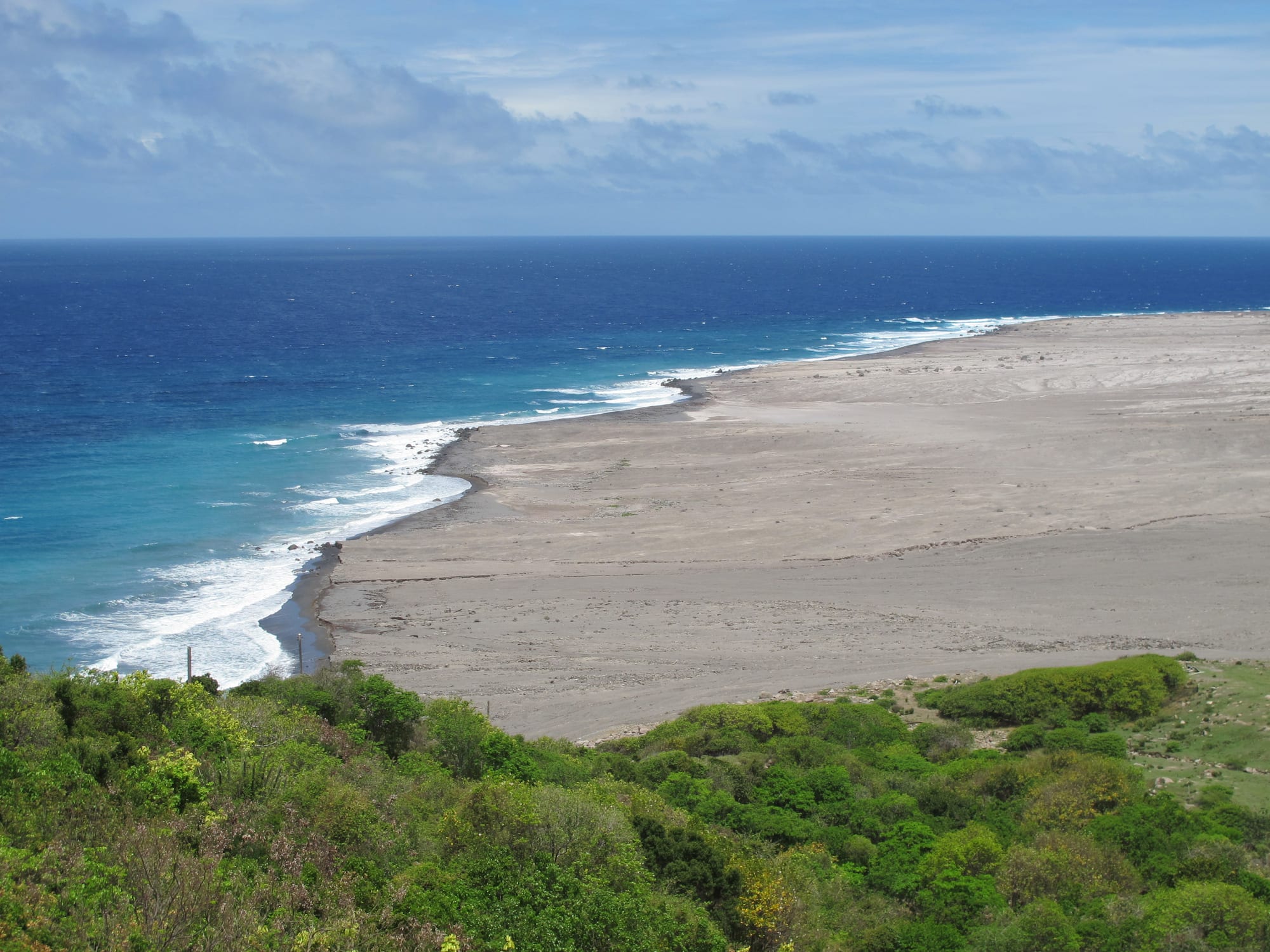
The island is slowly growing: volcanic deposits building up on the south-east coast are adding new land to its 40 square miles.
An island that moved north
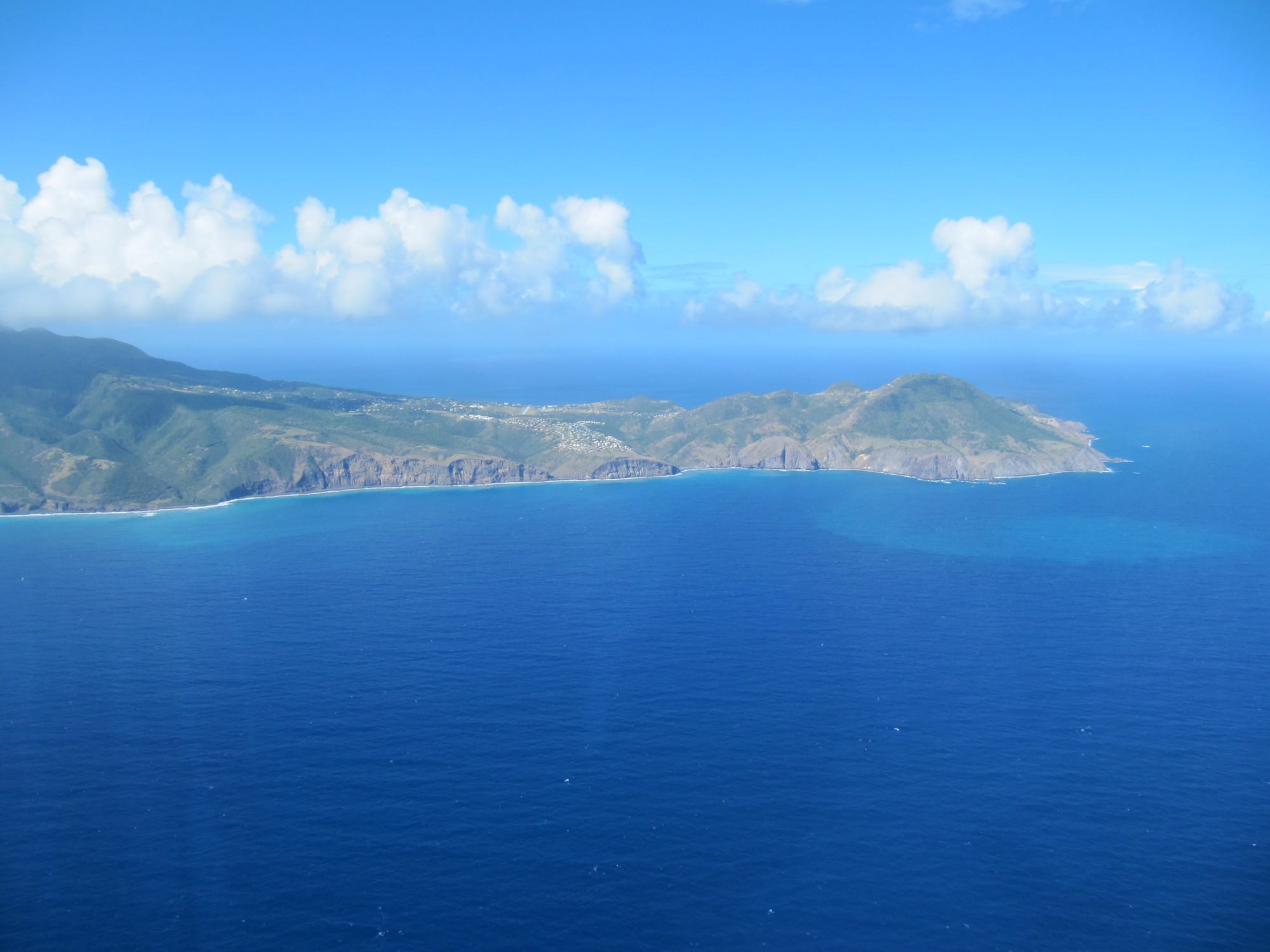
The human cost was enormous for so small a place. About 7,000 people, two thirds of the population, left Montserrat, around 4,000 of them for the United Kingdom; by 1997 fewer than 1,200 remained. In 1998 Britain granted Montserratians full residency rights in the UK. The government moved north to Brades, which became the temporary capital that year, and a new airport opened in the north in 2005. Today only the parish of Saint Peter, in the north-west, is inhabited; the island's other two parishes are still too dangerous.
The population has slowly recovered, to nearly 5,000 by 2016. Work on a new port at Little Bay, in the north-west, began in June 2022, and a new capital is planned around it.
The zone today
The Exclusion Zone is no longer a single closed block. Since 2014 it has been divided into subzones with different rules that change with the volcano's behaviour, and by 2020 some outer areas were open around the clock and inhabited again. Daytime access to Plymouth has been allowed for some purposes since about 2015, including digging sand and gravel for building. The innermost zone, with the former capital, remains off limits to casual visitors, because of the volcano and because the ruined streets have had no upkeep for decades.
For most visitors, the view comes from outside. From the top of Garibaldi Hill, overlooking Isles Bay, the grey ruins of Plymouth are spread out below, and licensed guides can take people closer when the alert level allows. The Montserrat Volcano Observatory, in the village of Flemmings in the west of the island, publishes regular reports on the volcano, which remains closely monitored.