Attractions & Natural Wonders · Montenegro
Why is the Bay of Kotor called a fjord when it isn't one?
It looks the part, with sheer mountains plunging into deep blue water, but the bay is a drowned river canyon, not a valley carved by a glacier.
By Globeway Editorial · 2 November 2026
The short answer
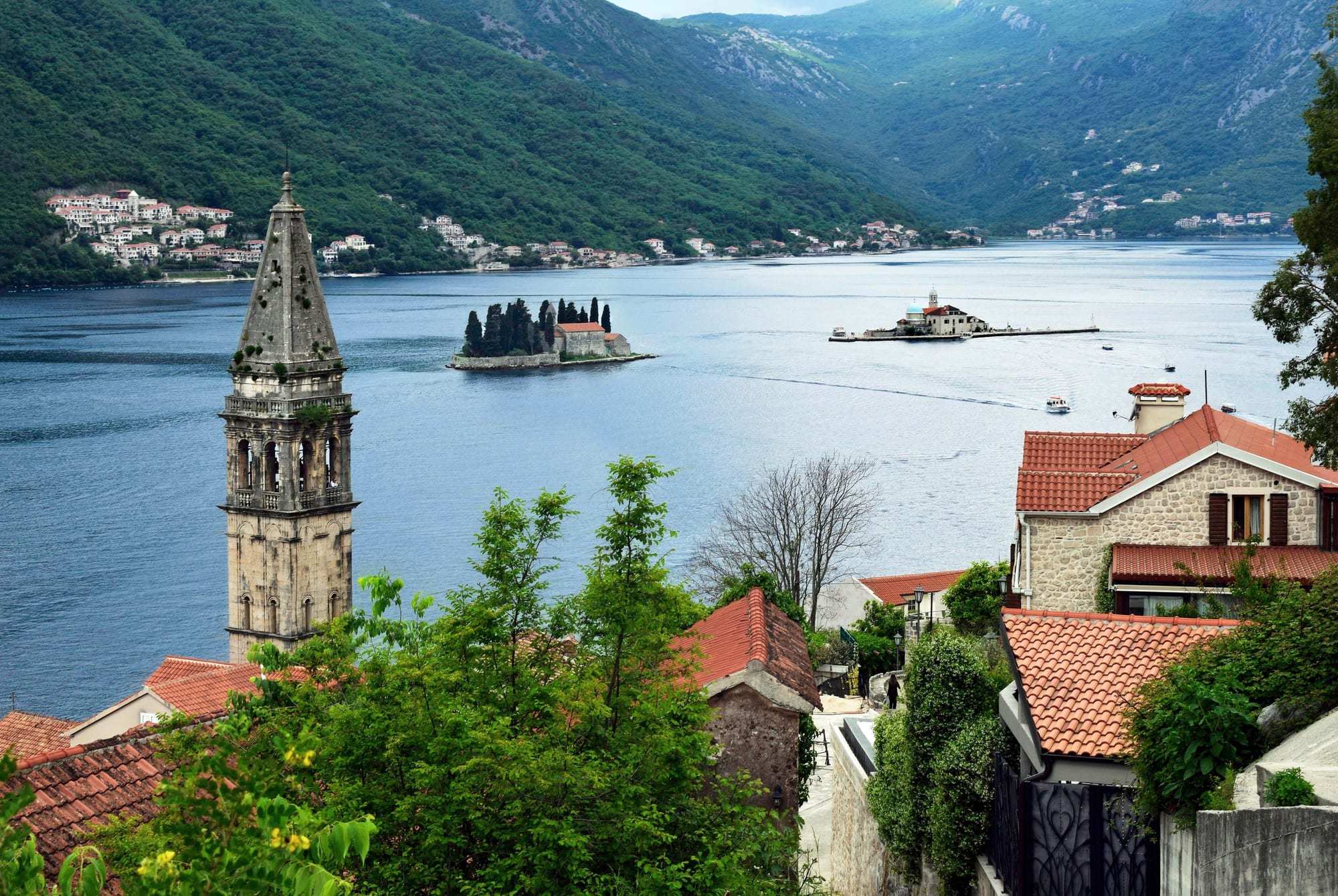
The Bay of Kotor in Montenegro gets called a fjord because it looks so much like one. A long, winding arm of the Adriatic Sea pushes deep inland between mountains that rise almost straight out of the water, and to anyone who has seen the coast of Norway the resemblance is obvious. The word "fjord" has also been used loosely for a long time, for almost any narrow, steep-sided inlet.
To a geologist, though, a fjord is a valley carved by a glacier and then invaded by the sea. The Bay of Kotor was carved by a river. It is a ria, a river valley that was drowned when the sea rose and flooded it. The ice of the last Ice Age shaped the mountains above the bay but never dug the bay itself.
What makes a fjord a fjord
A true fjord begins with a glacier. As a tongue of ice grinds down a valley towards the sea, it scrapes and plucks at the bedrock and turns a narrow river valley into a broad trough with a flat floor and steep walls, the classic U-shape. The ice leaves the valley "overdeepened": its floor lies well below the level of the open sea outside. Norway's Sognefjord reaches as much as 1,300 metres below sea level.
Near the mouth, where the glacier ran out of force and dumped its load of rock and gravel, most fjords have a raised sill, a lip of bedrock or debris that makes the inlet shallower at its entrance than further in. These sills and overdeepened basins are the strongest evidence that ice, not water, did the work. When the glacier melted away, the sea poured into the empty trough.
A river canyon the sea swallowed
The Bay of Kotor has none of those signatures. It is about 28 kilometres long, but its deepest point is only around 60 metres, and its average depth is just over 27 metres. Its shape is a series of broad basins (the bays of Herceg Novi, Tivat, Risan and Kotor itself) joined by narrow channels. The tightest of these, the Verige Strait, is just 340 metres wide.
That pattern is the fingerprint of a river system. Geologists describe the bay as a ria of the vanished Bokelj River, which once flowed down from the high plateaus of Mount Orjen. Over time the river broke apart: the land around it was pushed up and pulled down by movements of the Earth's crust, and the limestone it ran through was dissolved by rainwater into a "karst" landscape of caves, sinkholes and underground channels. Today the bay is fed by karst springs and by sources that rise from beneath the sea itself. When sea level rose, the sea flooded the old valleys, and the winding canyon became a winding bay.
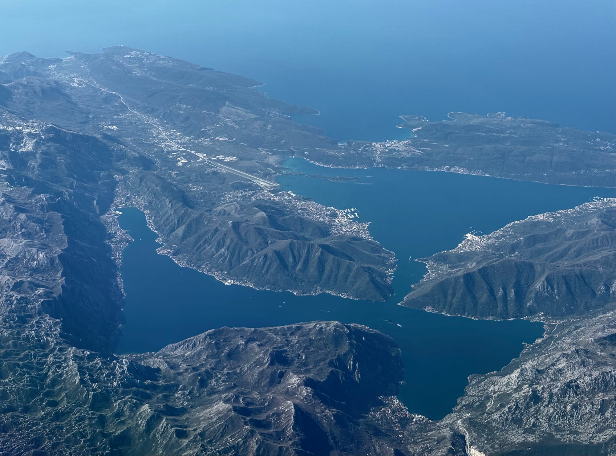
The word ria comes from Galician, the language of north-western Spain, where it is derived from río, "river". The Galician coast is lined with them. A ria typically branches like the river system that made it, and it often forms a very large inlet at the mouth of a relatively insignificant river. Montenegro's bay sits in good company: Croatia's coast is dotted with rias too, among them the Lim inlet in Istria, which is also sometimes nicknamed the "Lim fjord".
Why the name sticks
Part of the confusion comes from the word itself. "Fjord" is borrowed from Norwegian, and in Norway it has always had a broader meaning than in English science. It goes back to Old Norse fjǫrðr, a body of water used for crossing and ferrying, and in Scandinavia it is still applied to almost any long, narrow stretch of water. In eastern Norway some freshwater lakes are called fjords, and in Danish the word can even describe a shallow lagoon.
Geologists, by contrast, settled on a strict definition tied to glaciers. For a time European scientists also used "ria" loosely, for any broad river mouth, including fjords. In this century the preferred usage among geologists is to keep the two apart: a ria is a drowned river valley that was never glaciated, and a fjord is its glacial equivalent.
Meanwhile, the looser everyday meaning has spread around the world. Steep inlets from the calanques of Provence to the Saco do Mamanguá in Brazil, which is sometimes billed as the only "tropical fjord", get the label. The Bay of Kotor's sheer walls make it one of the most convincing lookalikes of all.
Ice on the mountains, but not in the bay
There is a twist that makes the nickname more forgivable. During the Ice Age, Mount Orjen, the massif on the bay's north-western side, carried one of the largest ice caps in the Mediterranean. Everything above about 900 metres lay under a thick sheet of ice, and glacial tongues crept down from it to around 500 metres above sea level. The mountain is still scarred with the evidence: cirques (bowl-shaped hollows where glaciers formed), U-shaped valleys, moraines of dumped rock and jagged ridges.
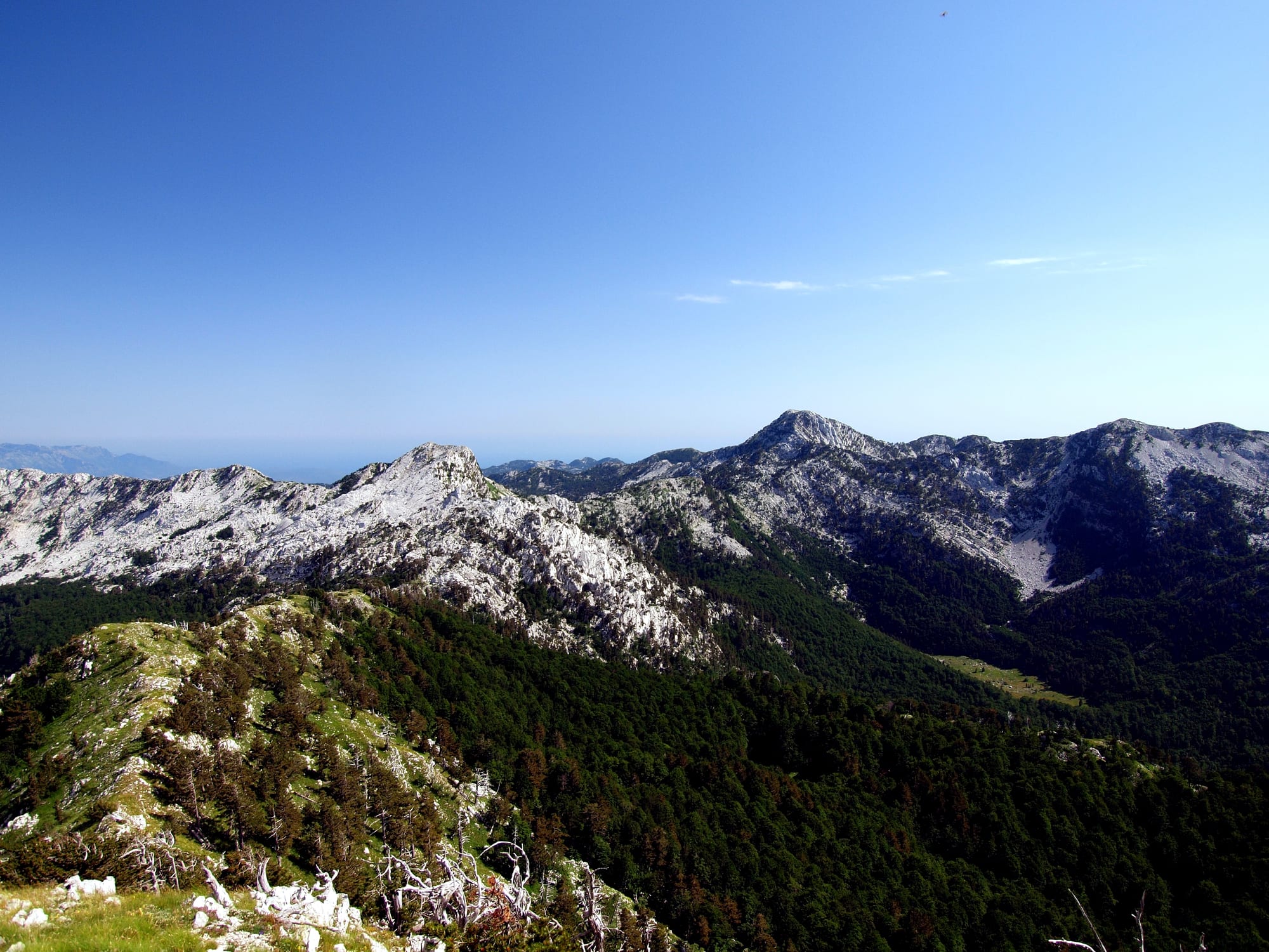
So the landscape around the bay really was sculpted by ice, high up. What the glaciers did not do was gouge out the inlet itself. Orjen itself is a block of crust lifted up between faults, towering above the lowered ground where the bay now lies, which is why the walls look so dramatic. Glacial and karst landforms combine here into a coastal scenery found almost nowhere else.
Seeing the "fjord" today
The bay is the heart of the Natural and Culturo-Historical Region of Kotor, listed by UNESCO as a World Heritage Site in 1979. The protected area covers the inner bay beyond the Verige Strait, with the walled town of Kotor, Risan, Perast and the two islets off Perast. Kotor's fortifications climb more than 260 metres up the mountainside behind the old town and look out over the whole inner bay.
The steep mountains that make the bay look like a fjord also make it one of the wettest places in Europe. The Krivošije plateau above the Bay of Risan receives over 5,000 millimetres of rain a year, a European record, and after heavy rain the Sopot spring near Risan bursts out of the cliff as a waterfall 20 metres above the sea. In winter the cold Bora wind can roar down the slopes with gusts of up to 250 km/h, while in August the area is often completely dry.