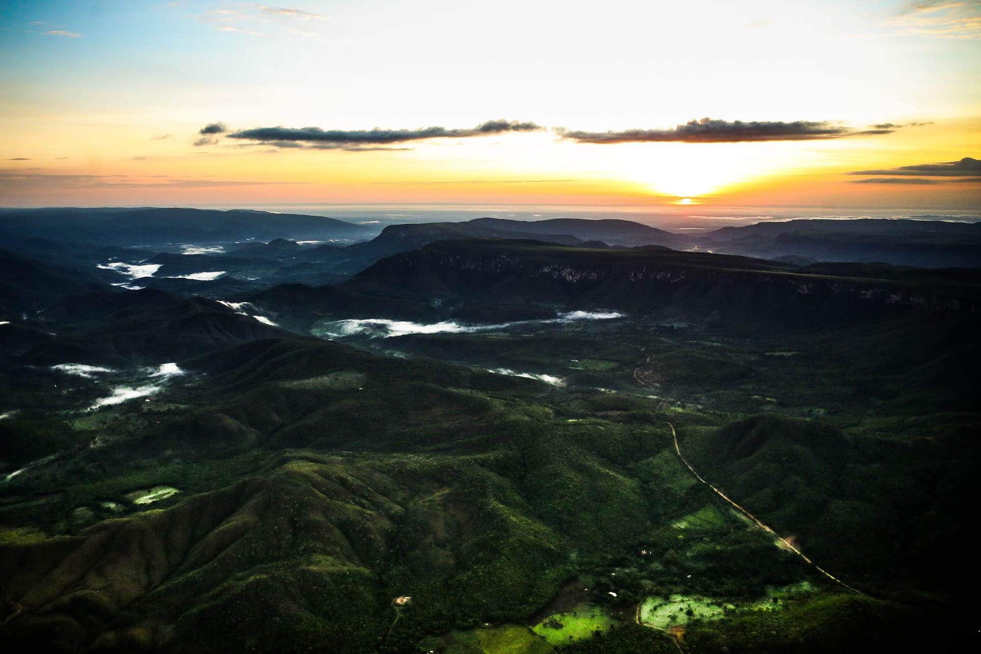
Green forested hills and ridges with patches of mist in the valleys, under a sunrise sky over the plateau

Brasília & the Central West, Brazil

Alto Paraíso de Goiás

Hills and valleys of the Chapada dos Veadeiros in the municipality of Alto Paraíso de Goiás. (Marcelo Camargo/Agência Brasil / Wikimedia Commons · CC BY 3.0 br)

A small highland town in north-eastern Goiás, about 220 km north of Brasília, that began as an 18th-century cattle ranch and is now the main base for the Chapada dos Veadeiros National Park. Waterfalls, canyons and cerrado trails surround it, and its reputation for mysticism and alternative communities, linked by believers to the quartz beneath it, shapes the town's character.

Neighbourhoods

  • Alto Paraíso town
    • First-time visitors
    • Best for food
    • Close to the waterfalls

    The town itself has most of the region's hotels, inns, campsites, bars and restaurants, along with bakeries, pharmacies and ATMs, close to the main avenue and the bus station. It is a few kilometres from the national park and well placed for many of the waterfalls and trails around it.

    Open in Maps
  • São Jorge
    • National park
    • Quiet and rural

    A village of about 250 people beside the entrance to the national park, around 35 km west of town on a paved road with a cycle lane. It is quieter and closer to the park's trails and the Vale da Lua, but has fewer services.

    Open in Maps

Things to do

The national park

  • Chapada dos Veadeiros National Parkpark

    A park on an ancient plateau of about 1.8 billion years, created in 1961 and listed by UNESCO in 2001, with canyons, waterfalls and cerrado trails; its main entrance is at São Jorge.

    Open in Maps
  • Vale da Luaattraction

    The 'Valley of the Moon' on the São Miguel river, off the road to São Jorge, where the river has shaped the rock into a moon-like landscape, suited to bathing rather than swimming.

    Open in Maps

Waterfalls near town

  • Loquinhas Fallsattraction

    The waterfalls closest to the town, a series of small falls and pools.

    Open in Maps
  • Cristais Fallsattraction

    The Cachoeira do Cristal, also known as dos Cristais, a waterfall close to town.

    Open in Maps
  • São Bento and Almécegas Fallsattraction

    On a farm off the road to São Jorge: São Bento, a broad natural pool easy for children, and the falls of Almécegas I and the pool of Almécegas II on the Couros river.

    Open in Maps

Landmarks and viewpoints

  • Morro da Baleiaviewpoint

    The 'Whale Hill', a landmark beside the road to São Jorge.

    Open in Maps
  • Sertão Zentrail

    A harder trek of about 8 km near the town, ending at a waterfall.

    Open in Maps

Eat and drink

Long-standing places and food districts in Alto Paraíso de Goiás. Hours, ratings and directions come from your maps app, always current.

Alto Paraíso classics

  • Goiás home cookingrestaurant

    Simple restaurants serving traditional Goiás food and set plates, the prato feito, with rice, beans and meat.

    Open in Maps
  • Pinga de arnicamarket

    Cane spirit infused with arnica, sold in town shops alongside crystals and hippie clothing.

    Open in Maps

Food districts

  • The main avenueneighborhood

    Most of the town's restaurants, pizzerias and bars are on or within two blocks of the main avenue, and local musicians play in some of the bars.

    Open in Maps

Experience Alto Paraíso de Goiás

History

The history of Alto Paraíso goes back to the middle of the 18th century, when Francisco de Almeida set up a cattle ranch on the plateau and called the area Veadeiros, from the deer that lived there. The first settlers raised cattle and, because of the altitude and cooler climate, wheat. For a long time it remained a remote ranching district in the hills north of what would become the Federal District.

Veadeiros appeared as a district of Cavalcante in 1938 and separated from it in 1953 to become a municipality. In 1961 President Juscelino Kubitschek created a national park on the plateau, the year after he inaugurated Brasília, and the new capital, some 220 km to the south, later became the source of most of its visitors.

In more recent times the town changed character. Visitors drawn by the waterfalls and canyons were joined by people seeking a spiritual life, and the town gained a reputation as a centre of mysticism, with dozens of religious and philosophical communities. In 2001 the national park was listed by UNESCO as a World Heritage Site, and the area around the town became part of the Pouso Alto environmental protection area. Tourism is now an important business.

Culture & Customs

Alto Paraíso is best known in Brazil for its mystic reputation. Some 40 mystical, philosophical and religious communities are counted here — Daimists, followers of Osho, Hare Krishna devotees, Kardecist spiritists, Buddhists and Protestants among them. Believers hold that a vast layer of quartz crystal beneath the plateau makes this a chosen place that emanates positive energy, and the 14th parallel, which also crosses Machu Picchu, passes through the town, a source of stories about UFOs. Alternative and esoteric therapies are offered in many parts of town, and crystal souvenirs and hippie clothing are sold in town.

Alongside the newcomers lives the older rural culture of the Goiás highlands, rooted in the cattle farms that founded the town, and the mixture gives it a character unlike other farming towns of the region.

Nights are relaxed rather than loud. Local musicians in the town's bars favour rock, blues, reggae and esoteric music.

Daily Life

Alto Paraíso is a small town in a large, thinly populated municipality, where most residents live in the town and the rest on farms and in São Jorge, a village of about 250 people. It has a more developed infrastructure than São Jorge, with hotels, inns, campsites, bars, restaurants, small shops, bakeries, pharmacies and banks. Three banks have branches here — Banco do Brasil, Caixa Econômica Federal and Itaú — and the municipality's schools include Bona Espero, a rural community school for poor children run by a German Esperanto organisation.

Tourism is a major source of work, through inns, restaurants, guiding and crafts, while cattle ranching and farming continue on the plateau. The tourist calendar sets the rhythm of the year: the dry months from May to September and the school holidays bring crowds, while the rainy season is quieter.

The town sits within the Pouso Alto environmental protection area, and protecting the cerrado, the springs and the waterfalls is a central local concern, especially in the dry season, when wildfires threaten the plateau.

Food

The food of Alto Paraíso is the cooking of Goiás. Simple restaurants serve traditional Goiás dishes and the prato feito, a set plate of rice, beans and meat, and some offer feijoada, the black-bean stew, and salads. Pequi, the strongly scented fruit of the cerrado, flavours rice and chicken dishes across the state, and visitors are warned not to bite into its spiny stone.

Other Goiás favourites include empadão goiano, a large pie filled with chicken, pork sausage, cheese and hearts of palm, and pamonha, a sweet or savoury paste of fresh maize cooked in its husk. There are pizzerias too, and most places to eat are on or near the main avenue.

The local drink sold in town shops is pinga de arnica, a strong cane spirit infused with arnica, sold alongside crystals and hippie clothing as a souvenir. In the evening, local musicians play in the town's bars.

Planning tools

Budget

Rooms and meals cost less than in Brasília, but the dry-season months and holidays fill the town and push prices up. Many waterfalls are on private farms, some trails are best walked with a hired guide, and a car or a tour is needed to reach most sites.

Daily Budget Midrange
USD 95–190 (inn or pousada, restaurant meals, a guided trail or a hire car)
Daily Budget Shoestring
USD 35–65 (campsite or hostel, set-plate lunches, buses and shared rides)

Ask inn owners and local guides about trails and waterfalls before setting out; book ahead for the dry-season holidays.

Best Time to Visit

The dry season in the Goiás cerrado, from May to September, is the main tourist season, with clear skies and safer river crossings. The rainy months from about October to March are greener and the falls fuller, and travel is quite possible, but heavy rain upstream can make some waterfalls dangerous.

Suggested Number of Days

Most visitors stay three or four days, as each trail or waterfall takes a morning or a whole day. Allow five to seven to cover more of the national park and the falls further north, especially for longer guided treks.

First Visit
3–4 days
With Surroundings
5–7 days

Transportation

There is no public transport to the sights. Most visitors bring or hire a car in Brasília, use local tours or hire a guide with a vehicle. The road to São Jorge is paved, with a cycle lane alongside, but some waterfalls are reached by dirt roads, and a few need a four-wheel-drive vehicle.

Drive the GO-118 and the dirt roads in daylight, and check with local guides before using unpaved roads in the rainy season.

Airport & Station Connections

Alto Paraíso is about 220 km north of Brasília by the GO-118/BR-010 highway; Brasília International Airport is the usual point of arrival. Daily buses run from Brasília's interstate bus station. The town has a small airstrip but no scheduled flights with major airlines.

Walkability

The town is small and easy to walk: the bus station, shops, restaurants and many inns are on or near the main avenue. Almost all the natural sights are outside town, and walking to them along the highway is not practical.

Safety

Brazil has high rates of crime, including violent crime, and it is the main practical concern for visitors — though very unevenly distributed. Alto Paraíso is a small, quiet town, and most trails and waterfalls are safe, but rain upstream can raise rivers suddenly, notably in the Vale da Lua. Heat, sun and dry-season wildfire smoke are other risks.

Ask hotel staff, inn owners or guides about rain at the head of a river before swimming, and carry water on trails. Check current official travel advice before travelling.

Climate

A tropical savanna climate, with rain from about October to March and a dry season from May to September. The altitude makes Alto Paraíso one of the highest and coolest towns in Goiás. Summer is December to February.

Summer
warm and rainy, with afternoon storms; the station's record high is 35.2 °C, set in October 2020 as the rains began
Winter
dry and sunny with cool nights; the lowest recorded temperature is about 4 °C, in May 2022

Local Customs

The town is home to dozens of spiritual and religious communities, from Daimists and Hare Krishna devotees to Buddhists and Kardecists, and many alternative and mystical therapies are offered around town. Visitors are welcome, but private ceremonies are private. A service charge is usually added to restaurant bills.

Ask before photographing people or ceremonies, take rubbish back from trails and waterfalls, and do not remove crystals or plants from protected areas.

Common Payment Methods

The currency is the Brazilian real (R$). Restaurants and inns accept cards and the Pix transfer system. Banks and ATMs are in the town; carry some cash for São Jorge and the waterfalls.