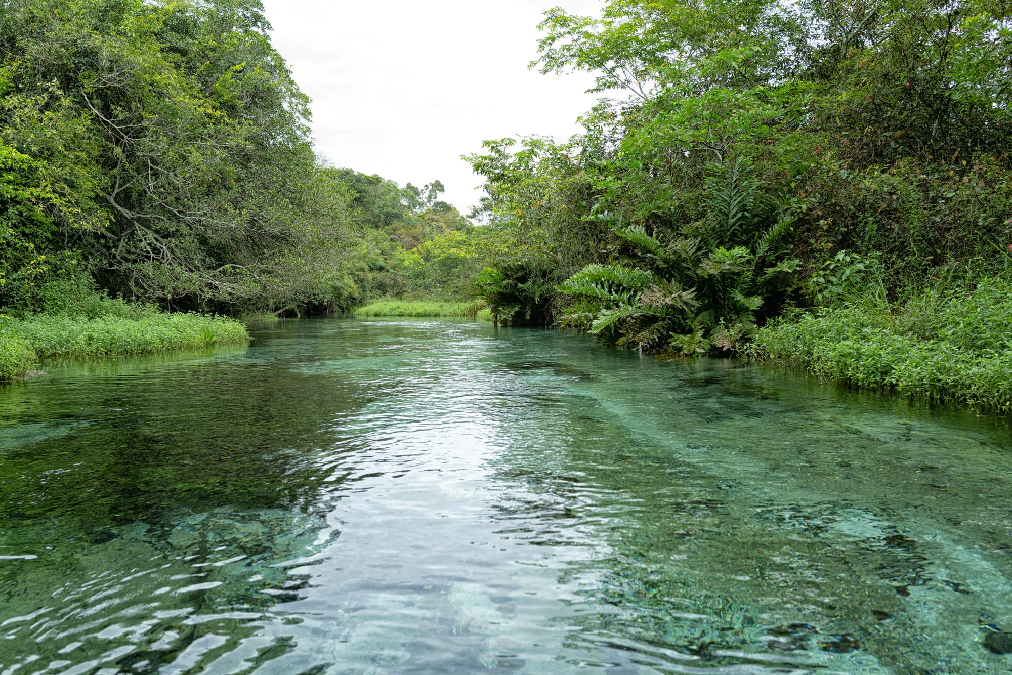
A clear, shallow green river flowing between banks of dense trees, ferns and long grass under a pale sky

Brasília & the Central West, Brazil

Bonito

A clear river in the countryside of Bonito, Mato Grosso do Sul. (Otávio Nogueira / Wikimedia Commons · CC BY 4.0)

A small town in the limestone hills of south-western Mato Grosso do Sul, about 300 km by road from Campo Grande, that grew from a 19th-century cattle farm into one of Brazil's best-known nature destinations. Spring-fed rivers clear enough to float over the fish, flooded caves and waterfalls surround it, and visits run through a regulated system of guided tours.

Neighbourhoods

  • Town centre
    • First-time visitors
    • Best for food
    • Tour agencies

    A grid of low streets where most of the tour agencies, restaurants, shops and simpler places to stay are found, around Rua Coronel Pilad Rebuá. Every tour is booked here and most leave from here by vehicle, so it is the practical base for anyone without a car.

    Open in Maps
  • The rural roads
    • Quiet and rural
    • Nature

    Pousadas and farm lodges spread along the roads out of town, such as the road towards Bodoquena, closer to the rivers and caves. They are quieter and greener than the centre, but a car or transfer is needed for meals and tours.

    Open in Maps

Things to do

Caves

  • Gruta do Lago Azulattraction

    The Blue Lake Cave, protected since 1978: a sloping hall that leads down to an underground lake of intense blue water, lit by sunshine through the wide entrance; fossils of giant sloths and sabre-toothed cats have been found here.

    Open in Maps
  • Abismo Anhumasattraction

    A cave entered by abseiling 72 metres down to an underground lake about 80 metres deep, where snorkellers and divers see underwater cones of rock up to 18 metres high.

    Open in Maps

Rivers and swimming

  • Aquário Naturalattraction

    A clear stretch of river reached by a forest walk, followed by a snorkel float of about 900 metres among fish and underwater plants.

    Open in Maps
  • Rio Sucuriattraction

    A clear river floated with a snorkel, similar to the Rio da Prata, with fewer fish but a landscape often thought more beautiful.

    Open in Maps
  • Rio Formosoattraction

    One of the clear rivers of the area offered as a snorkel float, among the regular tours from the town.

    Open in Maps
  • Balneário Municipalbeach

    The town's riverside swimming area, where local people sunbathe, play volleyball and swim among shoals of fish; cheaper than the float tours.

    Open in Maps

Short trips from the town

  • Rio da Prataattraction

    One of the best-known float trips of the area, a forest walk followed by a snorkel down a crystal-clear river full of fish, with lunch included.

    Open in Maps
  • Buraco das Ararasattraction

    A sinkhole about 100 metres deep in the cerrado, home to red-and-green macaws and araçari toucans, seen from viewing points along a short trail.

    Open in Maps
  • Serra da Bodoquena National Parkpark

    The national park protecting the forested limestone hills of the Serra da Bodoquena, whose rivers are known for their very clear water.

    Open in Maps

Eat and drink

Long-standing places and food districts in Bonito. Hours, ratings and directions come from your maps app, always current.

Bonito classics

  • Caiman and river fishrestaurant

    Town restaurants serve fish from the local rivers and jacaré, caiman meat, the dishes visitors most often seek out here.

    Open in Maps
  • Tererécafe

    Cold yerba mate drunk from a shared horn cup, a daily habit across Mato Grosso do Sul inherited from neighbouring Paraguay.

    Open in Maps

Food districts

  • Restaurants of the centreneighborhood

    The streets of the town centre around Rua Coronel Pilad Rebuá hold most of Bonito's restaurants and bars, busy in the evening after the day's tours.

    Open in Maps

Experience Bonito

History

The land where the town stands was once the Rincão Bonito cattle farm, an area of about 27 square kilometres acquired in 1869 by Captain Luiz da Costa Leite Falcão, who is considered the founder of Bonito and became its first registrar and notary. The name, meaning "pretty", came from the farm. For decades it remained a small ranching settlement.

A state law of 1915 created the district of Bonito out of the municipality of Miranda. In 1943 it was absorbed into the short-lived Federal Territory of Ponta Porã, then returned to Mato Grosso, and in 1948 it became a municipality of its own. In 1924 a local Indigenous man came upon the entrance to the cave now known as the Gruta do Lago Azul, which was declared a natural monument in 1978 together with the neighbouring cave of Nossa Senhora Aparecida. When Mato Grosso do Sul was split from Mato Grosso, Bonito became part of the new state.

Tourism transformed the town. The clarity of its rivers and the caves of the Serra da Bodoquena drew snorkellers and divers, and farmers opened their land to visitors. A regulated system grew up in which almost every tour is booked through an accredited agency in town and led by an accredited guide, with limits on numbers at each site. An airport opened in 2005, and direct flights from Campinas were announced in 2013, bringing more visitors from São Paulo.

Culture & Customs

Bonito's identity rests on its water. The rivers, caves and springs are the town's fortune, and the rules that protect them — booking through official agencies and accredited guides on almost every outing — shape every visit. Many families work in tourism as guides, drivers, agency staff or pousada owners.

Beneath the tourist trade it remains a country town of Mato Grosso do Sul, and most attractions are on private farmland. The culture of the state's south-west is close to that of Paraguay, and tereré, cold yerba mate shared from a horn cup, is drunk throughout the day. The Casa da Memória Raída, founded by Fernanda Reverdito and Ramona Vieira de Souza as a cultural centre, is the town's only museum recognised by Brazil's national museums institute.

The rhythm of the year follows the tourist seasons. Brazilian school holidays in July and from late December to January fill the town, while the rest of the year is quieter. In the evening after the tours, visitors and residents gather in the restaurants of the centre.

Daily Life

The municipality of Bonito had about 23,700 inhabitants at the 2022 census, spread over nearly 5,000 square kilometres of town and countryside. It is a small place where people know one another, and the town centre is quiet once the evening crowds thin out.

Tourism is the main business of the region. More than 30 tours operate in the area, most of them based on the natural environment, and they employ guides, drivers and staff in hotels, pousadas and restaurants. Most attractions are on private land, so farmers who own springs, caves and stretches of river earn from visitors. Tourism also brings the pressures of high season, when rooms are hard to find and prices rise.

The main concerns are environmental: the clarity of the rivers, which heavy rain can cloud, is the basis of the whole economy, and protecting the springs and caves is a constant local question. Daily life starts early, as tour vans leave the centre in the morning, and quietens in the heat of the afternoon.

Food

Bonito eats the food of Mato Grosso do Sul. Fish from the local rivers is the staple of many restaurants, served fried, grilled or in stews, and some menus offer jacaré, caiman meat, as local game. Cattle country means beef, and churrasco is common, as is arroz carreteiro, rice with dried beef, known in the Central-West as maria-isabel.

The Paraguayan influence of the state's south-west shows in chipa, small cheese breads, and in sopa paraguaia, which despite its name is a savoury cornbread with cheese and onion. Baru, a nut from a cerrado tree, is eaten roasted as a snack.

Tereré is the drink of the region, shared through the day. Bars in the centre serve cold beer, fresh fruit juices and drinks made with cachaça and local fruits. The restaurants and bars of the centre fill in the evening, and some tours, such as the Rio da Prata float, include lunch at the farm where they take place.

Planning tools

Budget

The town itself is moderately priced, but each tour carries its own fee, and the most popular floats and caves are among the dearer outings in the region; transport to sites outside town is often extra. Rooms are hard to find and prices rise in the holiday seasons of July and December to March. The municipal swimming area and other balneários cost much less than the float tours.

Daily Budget Midrange
USD 120–220 (pousada, restaurant meals, one or two paid tours with transport)
Daily Budget Shoestring
USD 45–80 (hostel bed, set lunches, one cheaper balneário or waterfall tour)

Book the tours that most matter through a local agency before arriving in the holiday seasons, as places on each are limited.

Best Time to Visit

The rivers are clearest outside heavy rain, which makes the water murky and coincides with the yearly fish migration, the piracema. Late December to February brings sunshine directly into the Gruta do Lago Azul, while the cooler dry months from May to August have warm days and fresh nights. July and the summer holidays are the busiest times.

Suggested Number of Days

Most visitors stay three or four days, since most tours take half a day or more and each must be booked separately. Five or six days allow for the more distant sites and some time in the national park, and many combine Bonito with a few days in the southern Pantanal.

First Visit
3–4 days
With Surroundings
5–6 days

Transportation

Almost every sight is on private land outside town and is reached by vehicle, either the agencies' shuttles or a hire car, often on dirt roads. Moto-taxis reach most destinations, and bicycles can be hired in the centre for the ride to the municipal swimming area. The shuttle fare can cost as much as the entry ticket.

Driving yourself still requires a booked tour and voucher for each site; check road conditions after heavy rain.

Airport & Station Connections

Bonito Airport is about 13 km from the town, with only a handful of domestic flights a week. Most visitors fly to Campo Grande, about 300 km away, and continue by bus, van or hire car, a trip of around four to five hours. Buses also link Bonito with Dourados.

Walkability

The centre is small, flat and easy to walk, with restaurants, agencies and shops a few blocks apart. Nearly all the natural sites are well beyond walking distance, and the rural pousadas need a car or transfer.

Safety

Brazil has high rates of crime, including violent crime, and it is the main practical concern for visitors — though very unevenly distributed. Bonito is a small, quiet tourist town, and the practical risks are on the tours: deep water, caves, heat and sun. Accredited guides accompany nearly every outing.

Follow the guides' instructions in caves and rivers, wear repellent against dengue, and drink plenty of water. Check current official travel advice before travelling.

Climate

A warm and humid tropical climate with a hot, rainy summer and a cooler, drier winter. Summer is December to February.

Summer
hot and rainy — temperatures easily reach 35 °C, and rain can cloud the rivers
Winter
drier, with warm days and fresh nights; across the state July averages highs of about 25 °C

Local Customs

Nature tourism is the town's livelihood and its rules are strict: almost every site must be booked through an official agency and visited with an accredited guide, whose instructions on protecting the water are followed. A service charge is usually added to restaurant bills. English is spoken at the more expensive hotels but rarely elsewhere.

Ask before photographing people, and share tereré if offered — it is passed round the group.

Common Payment Methods

The currency is the Brazilian real (R$). Agencies, pousadas and most restaurants accept cards and the Pix transfer system. Carry some cash for small shops and for farms on the rural roads.