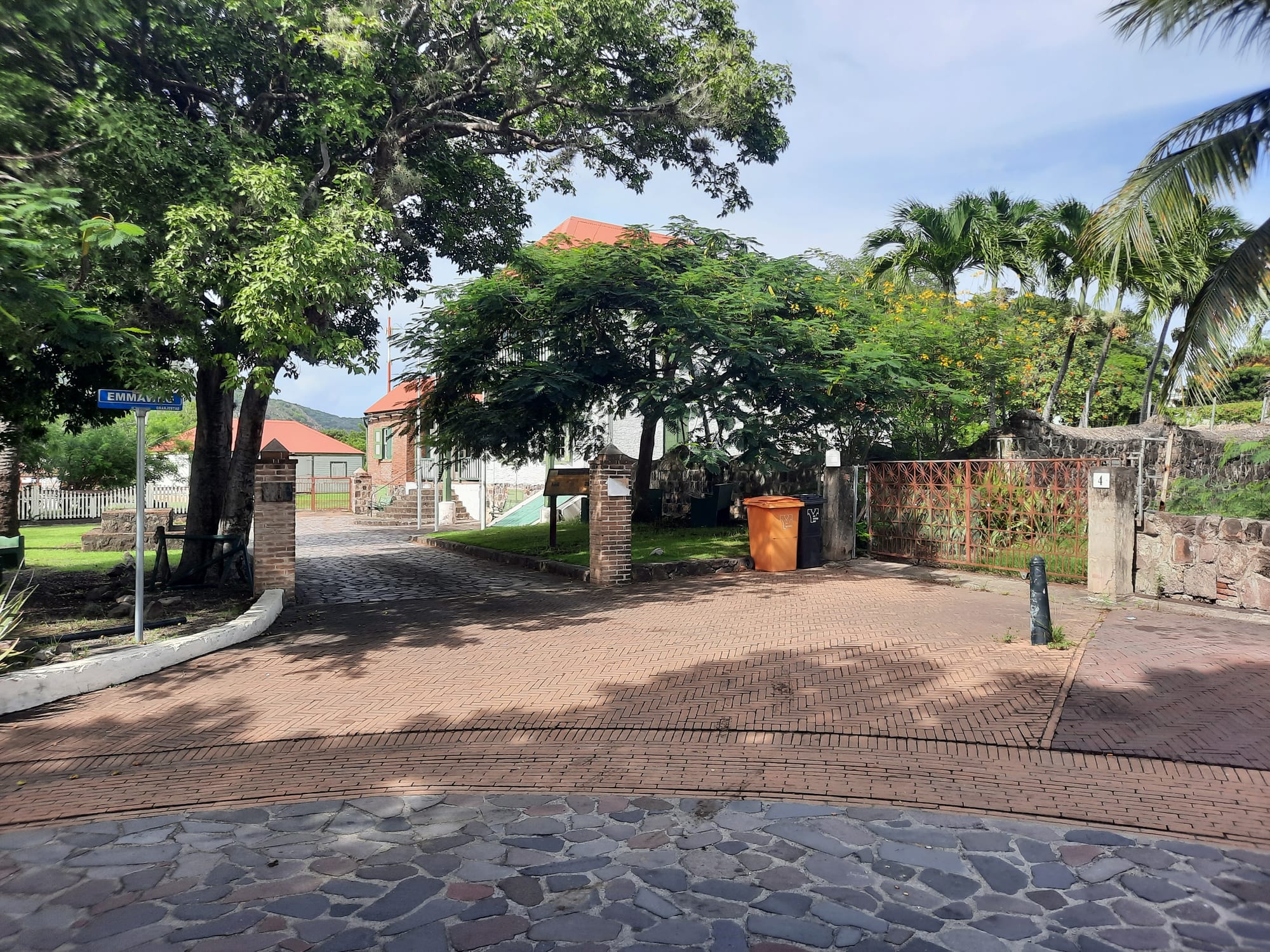
A brick-paved street in Oranjestad's Upper Town with shade trees, stone walls and a red-roofed house behind a gate

Caribbean Netherlands

Oranjestad

A street in the Upper Town of Oranjestad, Sint Eustatius. (Ymnes / Wikimedia Commons · CC BY-SA 4.0)

The capital of Sint Eustatius, a small town split between a cliff-top Upper Town and a single waterfront street below. In the 18th century it was a free port and a major trading hub, and in 1776 its fort returned the salute of an American warship. Today it is a quiet town of restored merchants' houses and ruined warehouses.

Neighbourhoods

  • Upper Town
    • First-time visitors
    • Historic district
    • Local life

    The main part of town on top of the cliff, with a restored historic core around Fort Oranje, the museum, the ruined Dutch Reformed church and the synagogue ruins. It is also the island's commercial and residential centre, with grocery stores, restaurants, bars, the library, schools and government offices.

    Open in Maps
  • Lower Town
    • Waterfront
    • Diving
    • Ruins

    A single street of buildings just above sea level along Oranje Bay, with the harbour, dive shops, the national parks office and the ruins of 18th-century warehouses, some of them partly underwater. It borders the island's safest beach.

    Open in Maps

Things to do

Historic town

  • Fort Oranjelandmark

    The cliff-top fort built by the Dutch in 1636 on the site of a French fort of 1629, with cannons, bastions and a courtyard overlooking Oranje Bay — the fort that returned the salute to an American ship in 1776.

    Open in Maps
  • Dutch Reformed Churchlandmark

    A church built in 1755, partly in ruins but still accessible, whose tower can be climbed for long views over the town and the bay.

    Open in Maps
  • Honen Dalim synagogue and Jewish cemeterylandmark

    The ruins of one of the oldest synagogues in the Western Hemisphere and the cemetery beside it, remnants of the large Jewish community of the trading era.

    Open in Maps
  • Sint Eustatius historical museummuseum

    The museum run by the St Eustatius Historical Foundation, housed in the Simon Doncker House, an imposing 18th-century former governor's residence.

    Open in Maps

The waterfront

  • Lower Town and Oranje Bayneighborhood

    The ruins of the warehouses that once lined the bay, with remains of 18th-century buildings that slid into the sea lying in the shallows for snorkellers to explore.

    Open in Maps
  • Oranje Bay beachbeach

    Swimming is possible at the sheltered north end of the bay, where there is still some sand.

    Open in Maps

Short trips on the island

  • The Quilltrail

    The dormant volcano above the town, 601 metres high and the second-highest mountain in the Netherlands, protected since 1998 as a national park with trails maintained by the island's national parks foundation.

    Open in Maps
  • Quill/Boven National Parkpark

    Protected land at opposite ends of the island, both parts recognised as Important Bird Areas for their threatened and restricted-range bird species.

    Open in Maps

Seasonal events

  • Statia Day16 November

    The island's day, marking the 1776 salute to the American flag from Fort Oranje.

Eat and drink

Long-standing places and food districts in Oranjestad. Hours, ratings and directions come from your maps app, always current.

Oranjestad classics

  • Statia home cookingrestaurant

    Caribbean-English dishes such as goat water, johnnycakes, saltfish and fresh fish, served in the town's small local restaurants.

    Open in Maps
  • Chinese restaurantsrestaurant

    The island has five Chinese restaurants, a staple of eating out on Statia.

    Open in Maps

Bars and casual places

  • Smoke Alleyrestaurant

    A casual place popular with contractors working on the island, known for large portions of American staples such as cheesesteaks and burgers.

    Open in Maps
  • Upper Town grocery storesmarket

    The town's grocery stores, where imported food and drink are sold to islanders and self-catering visitors.

    Open in Maps

Experience Oranjestad

History

English and French colonists reached Sint Eustatius in 1625, and the French built a fort on the cliff above the bay in 1629. The Dutch built Fort Oranje on the same site in 1636 for the Dutch West India Company, and the island changed hands several times among the Dutch, English and French. Below the fort, Oranjestad grew into the port of an island that produced sugar and cotton but above all became a centre of the North American slave trade. Its free port made it so rich that it was known as "the Golden Rock", and warehouses lined the road along Oranje Bay; by 1780 the island had an estimated 20,000 people, including the enslaved.

On 16 November 1776 the American brig Andrew Doria sailed into the anchorage below the fort flying the Continental Colours and fired a thirteen-gun salute. Governor Johannes de Graaff answered with eleven guns from the fort — the "First Salute" to the flag of the newly declared United States. The ship then bought munitions on the island. In 1781, during the Fourth Anglo-Dutch War, the British under George Rodney captured and plundered the island, destroying its archives, emptying the warehouses and deporting Jewish heads of families.

The town never recovered its trade. The island's population fell to 2,273 by 1829. On 12 June 1848 free and enslaved Africans gathered outside the lieutenant governor's residence to demand emancipation, and after slavery ended many formerly enslaved workers moved into Oranjestad. In 1939 Franklin Roosevelt presented a plaque commemorating the salute. In 2010 Sint Eustatius became a special municipality of the Netherlands; a later Dutch government intervention set the elected island council aside, elections were finally held in October 2020, and local powers have been handed back in stages.

Culture & Customs

Oranjestad is English-speaking: English is the language of daily life and, since 2014, the only language of instruction in the island's schools, and a local English-based creole is used informally. Dutch is official, and many islanders also speak Spanish or Papiamento. Christianity shapes the week, with Methodist, Catholic, Seventh-day Adventist, Pentecostal and Anglican congregations; Methodism has the largest following, and the 18th-century Methodist preacher Black Harry is among the island's notable historical figures.

History is the town's identity, and its motto, "The Historic Gem", reflects it. Archaeologists have recorded prehistoric sites, plantations, forts, trading sites and shipwrecks on and around the island, and a research centre has worked on the island since 2004. Excavations at the 18th-century Golden Rock African Burial Ground led to protests in 2021 by residents who said the community had not been involved, and a government commission investigated and reported in 2022.

Statia Day, on 16 November, marks the First Salute and is the island's main celebration. The national parks foundation, based in Lower Town, looks after the Quill, the marine park and a botanical garden, and its staff are a source of local knowledge about the island's nature.

Daily Life

Oranjestad is home to about 1,000 people, and the whole island had about 3,270 residents in January 2025. The town is the island's main commercial and residential centre, with grocery stores, restaurants, bars, a library, schools, a clinic and the government's administrative offices; most of the island's people live in the flat saddle between its two high areas, in the centre of the island.

The government is the largest employer on the island, and the oil terminal owned by GTI Statia is the largest private employer. Tourism, mostly diving, is the other long-running industry. Everyday life is small-scale: islanders know one another, goats, cows and chickens wander the roads, and much depends on the flights and ferries from Sint Maarten.

As Dutch nationals, Statians are citizens of the European Union, and moving to the Netherlands for education, healthcare and work is common. All three islands rely heavily on Dutch state funding, and imported goods are expensive.

Food

Statia eats Caribbean-English home cooking. Goat water, a spiced goat stew, is the classic, alongside johnnycakes, saltfish, pea soup and pumpkin soup, fresh fish and lobster, with pigeon peas and rice on the side. Fish and lobster come from the surrounding waters.

Imported groceries fill most of the gaps, as on the other islands, at a high cost, and regional beers, local rums and fresh juices are the usual drinks. The island has five Chinese restaurants, and one casual place known as Smoke Alley serves large portions of American staples such as cheesesteaks and burgers to the contractors who work on the island.

Eating out is limited and informal in a town of about a thousand people. Upper Town has the grocery stores, restaurants and bars, and most visitors who self-cater shop there.

Planning tools

Budget

Sint Eustatius has only a handful of small hotels and guesthouses and little else to spend money on besides diving, meals and taxis. The main cost is getting there, by a short, pricey flight or ferry from Sint Maarten. Imported goods make groceries expensive.

Daily Budget Midrange
USD 160–330 (small hotel, restaurant meals, taxis or a hire car, guided dives)
Daily Budget Shoestring
USD 70–120 (guesthouse room, self-catering and local snacks, walking and the odd taxi)

Book the limited flights or ferry crossings from Sint Maarten well ahead, and book taxis in advance.

Best Time to Visit

December to April is the drier part of the year and falls outside the hurricane season. The hurricane season runs from June to November. Statia Day, on 16 November, is the island's main celebration.

Suggested Number of Days

The town can be seen in a day, and most visitors add a day or two for the volcano and the sea. Divers usually stay longer, and weather can add a day at either end of a trip.

First Visit
2–3 days
With Surroundings
4–5 days

Transportation

There is no public transport. A few people run taxi services, which need booking ahead, and the town itself is small enough to cover on foot. Goats, cows and chickens roam freely, including on the roads.

Arrange a taxi before arriving, especially for the airport.

Airport & Station Connections

F. D. Roosevelt Airport, opened in 1946 as Golden Rock Airport, has flights from Sint Maarten with the regional airline Winair, the only regular service. Makana ferries connect the harbour in Lower Town with Philipsburg on Sint Maarten and with Saba on some days of the week.

Walkability

Oranjestad is small and walkable, and a historical walking tour of the capital covers about 1.6 kilometres. The climb between Lower Town and Upper Town is steep, and a trail from the town leads up the Quill.

Safety

All three islands have low crime and a strong community feel; petty theft from cars and unattended dive gear on Bonaire is the main issue. On Sint Eustatius the real hazards are the steep trail up the Quill, the strong waves and currents on the Atlantic coast, and the hurricane season. Medical facilities are basic, and serious cases may need transfer off the island.

Swim only on the sheltered Caribbean side, never on the Atlantic beach; take water and a map for the Quill; carry insect repellent. Check current official travel advice before travelling.

Climate

A tropical monsoon climate, warm and humid all year and exposed to hurricanes. The hurricane season runs from June to November, and December to April is drier.

Summer
warm and humid across the island, with July highs around 32°C and lows around 24°C, in the hurricane season
Winter
warm across the island, with January highs around 30°C and lows around 22°C, and the drier part of the year

Local Customs

English is the language of everyday life and of the schools, and a local English-based creole is spoken informally; Dutch is the official language. Most islanders are Christian, with Methodists the largest group, followed by Catholics and Seventh-day Adventists. The island is small and close-knit.

Dress modestly away from the beach and in churches, and ask before photographing people.

Common Payment Methods

The currency is the US dollar. Cards are taken at some of the main places, but many businesses on the island do not accept them, so carrying enough cash in dollars is essential.