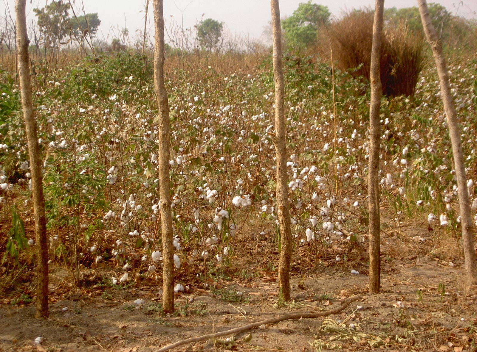
A field of cotton plants with open white bolls among dry grass and slender bare trees under a hazy sky

Bossangoa, Bambari & the North, Central African Republic

Bossangoa

Cotton growing in the savanna of the northern Central African Republic, the farming country in which Bossangoa stands. (Jean-Francois Dontaine / Wikimedia Commons · CC BY 2.0)

The capital of the Ouham prefecture, about 300 kilometres north of Bangui on the Ouham river, in the savanna country that grew the Central African Republic's cotton. It is a market and mission town at a crossroads of unpaved roads, and one of the places most affected by the conflict that began in 2013. This page is written to explain the town, not to encourage travel.

Neighbourhoods

  • The administrative centre
    • First-time visitors
    • Administration

    The prefecture offices, the market and the main crossroads sit together on the higher ground of the town, where the roads from Bangui, Bozoum and Batangafo meet. Most of what business the town does happens within a few hundred metres of it.

    Open in Maps
  • The mission quarter
    • Historic buildings
    • Churches

    The Catholic mission, the cathedral and the schools and clinic attached to them form a compound of their own. Church institutions have long provided much of the town's education and health care, and their grounds have sheltered people in times of violence.

    Open in Maps
  • The riverside quarters
    • River views
    • Local life
    • Fishing

    Houses of mud brick and thatch run down towards the Ouham, where women wash and fish traps are set. The river flows east of the town towards a series of falls before turning north for Chad.

    Open in Maps
  • The outer quarters and displacement sites
    • Local life
    • Quiet and residential

    Compounds of farming households spread out along the roads into the bush. Since 2013 sites for displaced families have stood among them and around the mission, and aid agencies work from bases on this edge of the town.

    Open in Maps

Things to do

In the town

  • The Catholic cathedral and missionlandmark

    The seat of the Catholic diocese of Bossangoa, created as an apostolic prefecture in 1959 and raised to a diocese in 1964; its cathedral, schools and clinic make it the largest institution in the town.

    Open in Maps

The river

  • The Ouham riverattraction

    A headwater of the Chari that runs past the town and on through a series of falls to the east before turning north across the border.

    Open in Maps

Short trips from the town

  • Bozoumattraction

    A market and mission town in rolling farm country towards the Cameroon and Chad borders, and the administrative centre of Ouham-Pendé.

    Open in Maps
  • Batangafoattraction

    A town at the confluence of the Ouham and the Fafa rivers, and since December 2020 the capital of Ouham-Fafa, the prefecture separated from Ouham in that year.

    Open in Maps

Eat and drink

Long-standing places and food districts in Bossangoa. Hours, ratings and directions come from your maps app, always current.

The market and local food

  • Bossangoa marketmarket

    The town's central market, selling cassava and cassava flour, sorghum and millet, groundnuts, sesame, okra, dried fish from the Ouham, peppers and small amounts of imported rice, oil and sugar.

    Open in Maps
  • Roadside grillsneighborhood

    Skewers of beef or goat grilled over charcoal at stalls near the crossroads and the market, the usual ready-made food in a cattle-keeping part of the country.

    Open in Maps
  • Riverside fishneighborhood

    Fish caught in the Ouham is sold fresh at the water's edge or smoked for keeping, and is the protein most households can afford regularly.

    Open in Maps

Experience Bossangoa

History

Bossangoa grew up as a French administrative post in the savanna between the Ouham and its tributaries, in country long settled by Gbaya and Mandjia farming communities whose resistance to raiding from the north is part of their own history. Under colonial rule the north-west was turned into a cotton belt: villagers were required to grow the crop for export, and Bossangoa became the collecting point for the fields around it, with a ginning plant opened in 1928, warehouses and the road links that a cash crop demanded. The town and the country around it had been in rebellion against the French administration between 1901 and 1905.

Protestant missionaries made the town a centre of their work in the 1920s, and Catholic institutions followed: an apostolic prefecture was created at Bossangoa in 1959 and raised to a diocese in 1964, its mission running schools and a clinic. Through the decades after independence in 1960 the town remained what the colonial state had made it — a prefecture capital and a cotton market — while the industry that supported it declined, and politicians from the north-west came to dominate national politics.

The crisis that began in 2013 reached Bossangoa quickly. Fighting between armed groups and militias in the Ouham drove large numbers of people from villages in the prefecture; families sheltered at the Catholic mission and at sites on the edge of the town, and aid agencies established bases to supply them. The population of the town swelled with the displaced, and the pattern of life there has been shaped by that displacement ever since.

Culture & Customs

The prefecture is Gbaya and Mandjia country. The Mandjia, one of the largest peoples in the Central African Republic, are concentrated around Bossangoa, and the Gbaya, closely related to them, extend west towards Bozoum and Bouar. Both are farming peoples with a long tradition of initiation ceremonies, dance and storytelling that mark the passage from childhood, and with a historical memory of resisting invasion from the north — the Gbaya rising of 1928 to 1931 against forced labour is remembered in the west.

Christianity, Catholic and Protestant, is the dominant religion, and the mission compounds are as much social centres as religious ones: choirs, youth groups, schooling and medical care all run through them. A Muslim minority, many of them traders and cattle keepers, has long lived in the town's commercial quarters, and the violence since 2013 divided communities that had shared the same streets.

Sango is spoken by everyone, with French for official business and Gbaya and Mandjia at home. Music is made with drums, harps and the sanza thumb piano; football is played on cleared ground at the edge of the town; and the market, the church and the extended family set the shape of the week.

Daily Life

The 2003 census counted about 36,000 people in Bossangoa, and the number living in and around it since 2013 has risen and fallen with displacement from the countryside. Most households live in compounds of mud brick under thatch or corrugated iron, with a courtyard, a cooking fire and a plot of cassava nearby.

Farming is the basis of everything: cassava above all, with sorghum, millet, maize, groundnuts and sesame, and cattle kept by Fulani herders on the surrounding savanna. Cotton, once the town's cash crop and the reason for its ginnery, has largely collapsed as an industry, and what money circulates now comes from trade, transport, aid employment and remittances. Coffee is the other crop the area is known for.

Services are limited and largely provided by the mission and by international agencies: the hospital, the schools and the water points. Electricity comes from generators where it comes at all. The day begins at first light with the walk to the fields and the market, slows through the heat of the afternoon, and ends early; movement between villages depends on the state of the roads and on the security of the week.

Food

Cooking in Bossangoa follows the northern pattern of a starch and a sauce. Gozo, the stiff cassava paste eaten across the country, is the staple, but here a thick porridge of millet or sorghum often stands beside it, reflecting the drier savanna and its grains. Both are eaten by hand, pinched off and dipped.

The sauces are made from pounded cassava leaves, sorrel leaves, okra, groundnut paste and sesame, cooked with palm oil and hot pepper. Cattle country means more beef than in the south: grilled skewers at the roadside, and stews for occasions, with goat as the meat of choice for celebrations. Dried and smoked fish from the Ouham is the everyday protein for most households, and chicken is kept for guests and feast days.

The savanna adds what it has in season — wild honey, shea nuts, mushrooms and edible caterpillars gathered when they swarm. Mangoes and papaya grow around the compounds. Local beers brewed from sorghum and millet are drunk in the villages, and in the Muslim quarters sweet tea is the social drink. In years of poor harvest or heavy displacement, families depend on distributions of maize, beans and oil.

Planning tools

Budget

There is no visitor economy here and no normal way to price a stay. Costs are those of getting to the town and staying safely in it: charter or humanitarian flights, four-wheel-drive vehicles, fuel carried in, and security arrangements. Market food and local goods cost very little, but supplies are irregular and prices rise sharply when the roads are cut.

Daily Budget Midrange
USD 200–400 (guesthouse or compound accommodation with a vehicle and driver; flights and security arrangements cost far more)
Daily Budget Shoestring
USD 40–80 (basic local lodging and market food only, excluding any transport to the town)

All cash is carried in; there are no reliable banking services in the town.

Best Time to Visit

December to April is the dry season, when the roads from Bangui and westward are firmest and the rivers are low. The rains from about May to October flood the plains and close stretches of road for weeks. In practice the security situation, not the season, rules out travel.

Suggested Number of Days

The town itself is small enough to see in a day. Anyone travelling here for work usually stays longer because transport in and out is infrequent and has to be arranged, and because road journeys in the prefecture are slow.

First Visit
1 day
With Surroundings
2–3 days

Transportation

Movement in the town is on foot, by bicycle and by motorcycle taxi. Beyond it, unpaved roads run south to Bangui, west to Bozoum and north-east to Batangafo, all of them slow and subject to roadblocks, banditry and seasonal flooding. Humanitarian and United Nations flights use the small airport on the west side of the town, which takes light aircraft.

Road travel in the prefecture is arranged in convoy or not at all, and rarely continues after dark.

Airport & Station Connections

Bossangoa lies about 300 kilometres north of Bangui by the northern road, a journey of many hours in the dry season and longer or impossible in the rains. Most outsiders arrive instead on humanitarian or United Nations flights to the small airport on the west side of the town, which serves light aircraft.

Walkability

The town is flat, compact and walked easily enough in the cooler hours, with the market, the offices and the mission close together. Streets are of packed earth and become muddy in the rains, there is no street lighting to speak of, and people generally do not walk after dark.

Safety

Bossangoa and the Ouham prefecture were among the areas worst affected by the violence that followed 2013, and armed groups, banditry and roadblocks remain serious risks in the surrounding countryside. A United Nations peacekeeping presence and aid agencies work in the town. Most governments advise against all travel to the whole country, and to the north in particular.

Globeway covers the Central African Republic so it can be understood, not to encourage travel there now. The north is among the country's most dangerous areas, and any presence there is organised through an agency or specialist operator. Check current official travel advice before travelling.

Climate

Tropical savanna: a single rainy season and a long dry one, hotter and dustier than the forested south. Rain falls in heavy storms rather than steady drizzle, and the hottest weeks come at the end of the dry season before the rains break.

Summer
the rains, roughly May to October, about 21–31°C, humid with heavy storms and flooded roads
Winter
the dry season, November to April, cooler nights and days of about 30–36°C, dusty and hazy with the Harmattan

Local Customs

Sango is the everyday language and French is used in offices and schools. The Gbaya and Mandjia are the main communities of the prefecture. Church life is central, greetings are formal and unhurried, and elders and the town's chiefs are addressed with care.

Photographing soldiers, police, peacekeepers, checkpoints and displacement sites is not acceptable, and permission is asked before photographing anyone.

Common Payment Methods

The currency is the Central African CFA franc (XAF). Payment is in cash for everything; cards are not used and cash machines are absent. Small denominations matter in the market, and euros would have to be changed in Bangui before travelling.