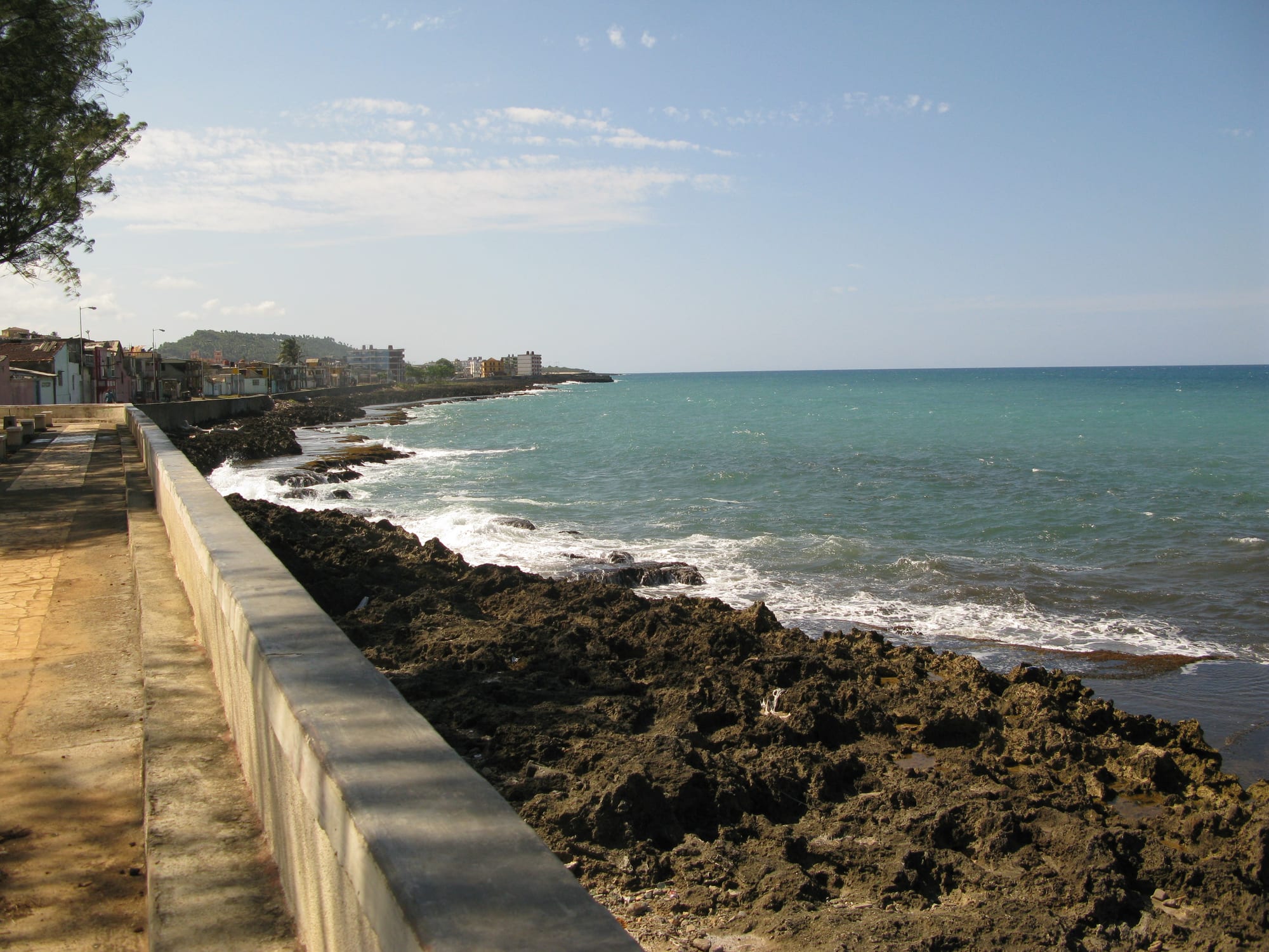
A seafront walkway and wall above black rocks and turquoise sea, with low houses curving along the coast

Santiago de Cuba & the East, Cuba

Baracoa

The Malecón, the seafront promenade of Baracoa. (Rastapopulous / Wikimedia Commons · CC BY-SA 3.0)

The oldest Spanish settlement in Cuba and the island's first capital, founded in 1511 on the Bay of Honey near the eastern tip of the island. Cut off by mountains until a road was built in the 1960s, it is a small town of seafront streets, old forts, cacao groves and rivers, below the flat-topped mountain of El Yunque.

Neighbourhoods

  • Parque Independencia and the old centre
    • First-time visitors
    • Historic district
    • Music

    The town's main square, with a fountain, a statue of the Taíno chief Hatuey and the cathedral, sits at the heart of a grid of low colonial houses. The Casa de la Trova and the Casa de la Cultura, the two main music venues, are close by, as are many casas particulares and paladares.

    Open in Maps
  • The Malecón
    • Sea views
    • Quiet and residential

    Baracoa's own seafront promenade runs along the rocky shore from the bus terminal at the northern tip of town to Fuerte Matachín. Some casas look straight out over the water, and a park with a monument to the Spanish landing stands about halfway along.

    Open in Maps
  • Fuerte Matachín and Playa de Miel
    • Beaches
    • Museums

    The southern end of town, where the old Spanish fort of Matachín holds the municipal museum. Just beyond it, the dark-sand Playa de Miel runs along the Bay of Honey, with the town's baseball stadium on the beach itself.

    Open in Maps

Things to do

Forts and the old town

  • Cathedral of Nuestra Señora de la Asunciónlandmark

    The cathedral on the main square keeps the remains of the Cruz de la Parra, a cross said to have been brought from Spain by Columbus; carbon dating fits the period, but it is made of a local wood.

    Open in Maps
  • Parque Independencialandmark

    The main square, with its fountain and a statue of Hatuey, the Taíno chief who fought the Spanish conquest and is the town's local hero.

    Open in Maps
  • Fuerte Matachínmuseum

    A Spanish fort built in 1802 at the southern end of the Malecón, now the municipal museum, with collections from the island's Indigenous cultures and archaeological finds from the town.

    Open in Maps
  • Fuerte La Puntalandmark

    The western fort, built in 1803, now holding a restaurant, with a small beach beside it.

    Open in Maps

The seafront and beaches

  • The Malecóntrail

    A quiet seafront walk from the bus terminal to Fuerte Matachín, with a monument to Columbus and the Spanish landing near its midpoint.

    Open in Maps
  • Playa de Mielbeach

    A black-sand beach on the Bay of Honey, within easy walking distance of the centre.

    Open in Maps
  • Playa Maguanabeach

    A secluded beach north of town on the road to the national park, often the last stop on a day of hiking.

    Open in Maps

Short trips from the town

  • El Yunquetrail

    The 575-metre table mountain shaped like an anvil, which Columbus almost certainly described in his log; it is climbed on an official trail with an obligatory guide, and its isolation shelters ferns and palms found nowhere else.

    Open in Maps
  • Toa Riverpark

    The largest river in Cuba, whose valley near Baracoa holds cacao groves under royal palms and many waterfalls.

    Open in Maps
  • Alejandro de Humboldt National Parkpark

    A UNESCO World Heritage Site since 2001, named after Alexander von Humboldt, protecting rainforest, mountains and a wealth of endemic plants and animals; visits are made with guides.

    Open in Maps

Eat and drink

Long-standing places and food districts in Baracoa. Hours, ratings and directions come from your maps app, always current.

Baracoa classics

  • Baracoa chocolatemarket

    Chocolate made from the local cacao is sold all over town, most of all around the main square, including mild unsweetened balls and the local drinking chocolate.

    Open in Maps
  • Coconut stands on Playa de Mielmarket

    Fresh coconuts sold along the beach beyond the stadium, in a town known as the land of chocolate and coconut.

    Open in Maps
  • Restaurant at Fuerte La Puntarestaurant

    A restaurant inside the 1803 fort at the western end of town, beside a small beach.

    Open in Maps

Paladares and music

  • Paladares in the old centreneighborhood

    Private restaurants around the main square and the Malecón are the places to try fish and seafood in coconut milk sauce and the other local dishes, which state restaurants rarely serve.

    Open in Maps
  • Casa de la Trovacafe

    A traditional music venue and bar by the cathedral, where visitors drink and dance with local people.

    Open in Maps

Experience Baracoa

History

Columbus reached Cuba on his first voyage and named his landing place Porto Santo. It is generally thought from his description that this was Baracoa, though Gibara also makes the claim; he also described a nearby table mountain, almost certainly El Yunque, and called the spot the most beautiful place in the world. According to tradition he planted a cross, the Cruz de la Parra, in the sands of the harbour. Around 15 August 1511, the official foundation day, the conquistador Diego Velázquez de Cuéllar, first governor of Cuba, built a settlement here and named it Nuestra Señora de la Asunción de Baracoa, making it the oldest Spanish settlement in Cuba and its first capital. It received the title of city in 1518, when the first Cuban bishop was appointed here. The Taíno chief Hatuey, who had fled from Hispaniola and raised an army against the Spanish, was captured and burned at the stake.

Cut off from the rest of the island by mountains, Baracoa lived in the 17th and 18th centuries from contraband trade with French and British merchants. Early in the 19th century refugees from the Haitian Revolution settled here and began growing coffee and cocoa, and the forts of Matachín and La Punta were built in 1802 and 1803. Later in the century expeditions of independence fighters, including Antonio Maceo and José Martí, landed on this coast.

Until the revolution the only way in was by sea. In the 1960s La Farola, a 120 km road over the mountains from Guantánamo, ended the isolation. Hurricane Matthew caused widespread damage in October 2016, gutting many buildings with its storm surge, and in 2024 Hurricane Oscar made landfall nearby, its waves breaching the seawall and flooding the coast.

Culture & Customs

Baracoa's identity rests on being first: Cubans call it the Ciudad Primada, the first city, and its people point to the Cruz de la Parra in the cathedral and to the spot on the Malecón where the Spanish landing is remembered. Its hero, though, is the man who resisted the conquest. Hatuey's statue stands in the main square, and local art and crafts have an Indigenous inflection seen in few other Cuban towns.

Its long isolation also preserved a distinctive local culture and cuisine, built around coconut and cacao, which sets the town apart from the rest of the island. The name itself is thought to come from a Taíno word meaning "the presence of the sea".

Music is everywhere in the evenings. The Casa de la Cultura near Parque Independencia is the more polished stage, and the Casa de la Trova by the cathedral is the more traditional one, where local people and visitors dance together to live music. Baseball is followed as keenly as anywhere in Cuba, and the town's stadium stands on the beach at Playa de Miel. Mass tourism has stayed away, and the pace of life is slow, sociable and lived largely in the street.

Daily Life

About 78,000 people lived in the municipality of Baracoa in 2022, spread between the town and villages such as Boca de Yumurí, Jamal and Nibujón along the coast and in the hills. The area's main products are bananas, coconut and cacao, grown under royal palms along the Miel, Duaba, Toa and Yumurí rivers, and it is Cuba's main chocolate-making area. Tourism, mostly small-scale and run from family homes, is the other mainstay.

Getting around and getting supplies are constant concerns. Goods and visitors arrive over the single mountain road or by air, and the fuel shortages that have hit all of Cuba make both less reliable. The east suffers some of the longest power cuts in the country, along with water and food shortages, and repeated hurricanes have left many homes in poor condition. Hurricane Matthew in 2016 and Hurricane Oscar in 2024, which flooded the seafront, are both remembered.

Life is lived outdoors: bicitaxis and bicycles on the narrow streets, neighbours talking on doorsteps and along the Malecón in the evening breeze, and music drifting from the venues around the main square after dark.

Food

Baracoa has a cuisine of its own, built on the coconut and cacao that grow around the town. Fish and seafood are served in a coconut milk sauce, a dish likened to a Thai curry and quite unlike the plainer cooking of the rest of the island. Bacán is made from bananas, wrapped in a banana leaf and cooked, and cucurucho is a sweet of coconut and plenty of sugar, mixed with orange, guava or pineapple and packed into a cone of palm leaf with a handy lid. Red bananas are sold along La Farola on the way in.

Chocolate is the town's pride. Baracoa is Cuba's main chocolate-making area, and bars and balls of chocolate are sold all over town, especially around Parque Independencia; the balls are unsweetened but mild. The local drink is hot chocolate brewed with cinnamon leaves.

State restaurants rarely serve the local dishes, so the best places to try them are the paladares and the family tables of the casas particulares. Fresh coconuts are sold along the beach at Playa de Miel.

Planning tools

Budget

Baracoa is no more expensive than other places in Cuba, with many casas particulares and paladares, though choice and supplies are thinner than in Havana. Guided trips to El Yunque and the national park, taxis to the beaches and the long journey in and out are the main costs. Visitors pay largely in cash, and shortages make prices hard to predict.

Daily Budget Midrange
USD 80–170 (a good casa, paladar dinners, guided hikes and a driver for day trips)
Daily Budget Shoestring
USD 30–55 (casa particular with home-cooked meals, street snacks, buses and bicitaxis)

Bring enough cash in euros or US dollars for the whole stay, as exchange and card options are scarce in the east and US-issued cards do not work.

Best Time to Visit

Rain falls all year in Baracoa, with a noticeably wetter stretch from October to December. The drier months from about February to April are the most comfortable for walking up El Yunque and in the national park. September and October carry the highest hurricane risk.

Suggested Number of Days

Two or three days are enough for the small town and its seafront. Four or five allow time for the mountain, the rivers and the national park as well, and since getting in and out takes the best part of a day each way, extra time is wise when fuel shortages disrupt transport.

First Visit
2–3 days
With Surroundings
4–5 days

Transportation

The town is small and walkable, and bicitaxis cover short trips around town. Mopeds and scooters can be rented near the main square. The national park and the beaches to the north are usually reached on group tours by bus or with a hired driver, over a badly potholed road.

Arrange guided trips through an agency or a casa host rather than independently; a guide is obligatory on El Yunque.

Airport & Station Connections

Gustavo Rizo Airport, a small domestic airport about 2 km north of town, has had flights from Havana, though they are infrequent. By road, the only way in is La Farola, a 120 km mountain road from Guantánamo built in the 1960s; Víazul buses from Santiago de Cuba take about four to five hours via Guantánamo, and shared taxis run the same route. Planes and buses are often full in high season, and fuel shortages regularly disrupt flights, buses and taxis.

Walkability

The centre, the Malecón and Playa de Miel are all within an easy walk of each other, and the bus terminal is a short walk from the main square. Streets are flat near the sea, and the only climb is to the hill above town. Heat, humidity and sudden heavy rain are the main discomforts.

Safety

Cuba has low levels of violent crime and is generally very safe for visitors. In the east daily hardship is severe: power cuts are among the longest in the country, and water and food shortages are common, especially since recent hurricanes. Hotel touts and taxi drivers crowd arrivals at the bus terminal, and on the mountain and in the park the risks are steep, muddy trails, heat and heavy rain.

Walk from the bus terminal and choose a casa in person, hike with a licensed guide, and carry water, basic medicines and a torch. Check current official travel advice before travelling.

Climate

Baracoa has a tropical rainforest climate, hot and wet throughout the year, and the town and the mountains around it are the wettest part of Cuba. There are no true wet and dry seasons, but October to December is noticeably wetter, and hurricanes are a serious risk late in the season.

Summer
Baracoa summers are hot and very humid, with frequent heavy rain; on the south coast at Santiago de Cuba days often reach 32–35°C
Winter
Baracoa winters are warm, around 27–30°C by day on the eastern coast, with rain still common

Local Customs

Baracoans are proud of being the first city of Cuba and of Hatuey, the Taíno chief who resisted the Spanish, and local art has a distinctive Indigenous touch. Music is played most evenings in the venues near the main square, and casa hosts often cook the local specialities for their guests.

Ask before photographing people and homes, dress modestly in the cathedral, and tip musicians, guides and casa hosts in cash.

Common Payment Methods

The currency is the Cuban peso (CUP), but many services for visitors are priced in US dollars or euros, and exchange rates vary widely. Bring cash in euros or US dollars for the whole stay; US-issued cards do not work, and ATMs are unreliable.