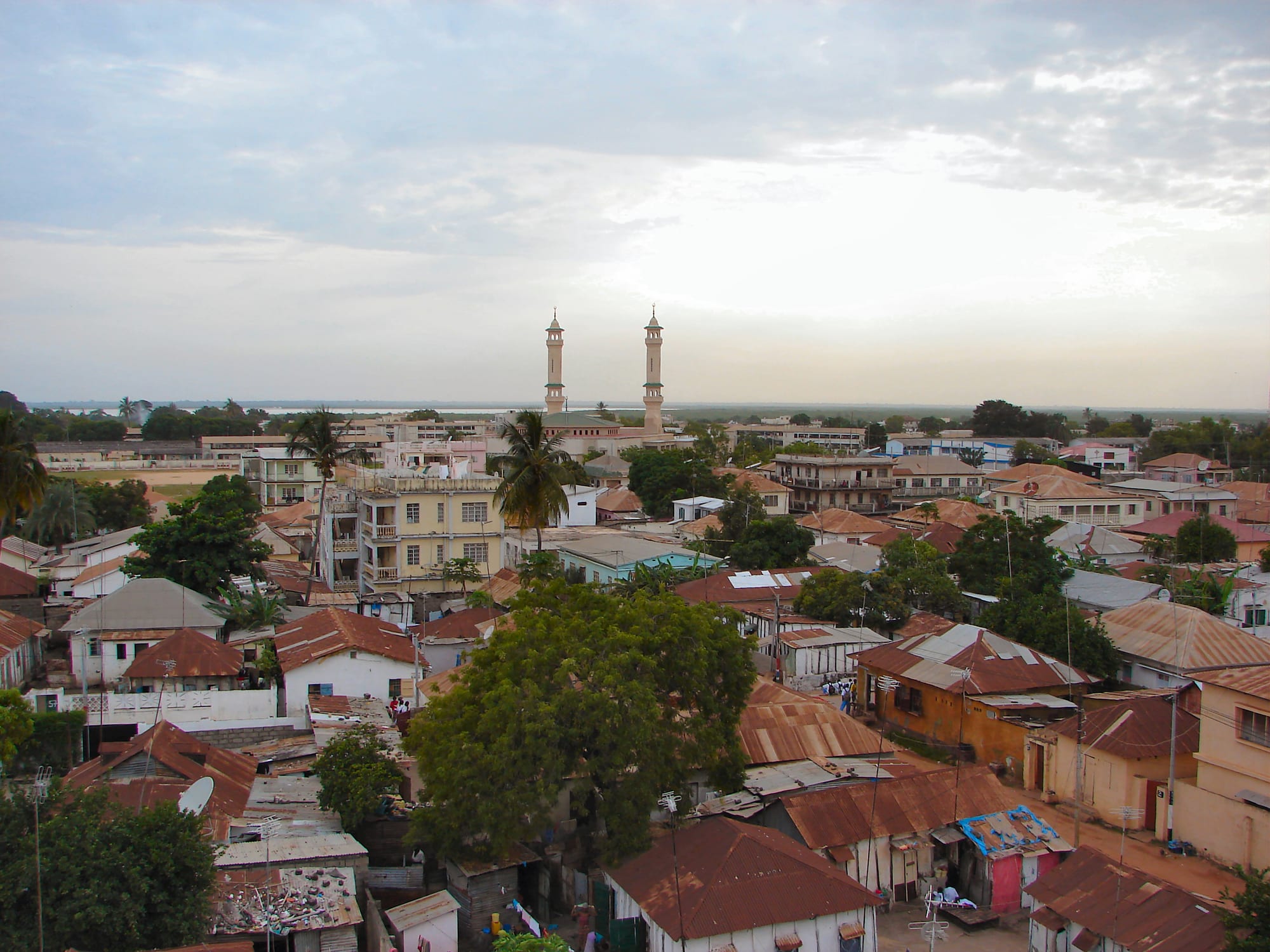
Rust-red tin roofs and low houses spreading to the horizon in Banjul, with the two white minarets of a large mosque rising above the trees

The Gambia

Banjul

Banjul's low tin-roofed streets, with the minarets of the King Fahad Mosque rising behind them. (Bjørn Christian Tørrissen / Wikimedia Commons · CC BY-SA 3.0)

The Gambia's capital, on a low sandy island where the Gambia River meets the Atlantic. Founded by the British in 1816 as Bathurst and renamed Banjul in 1973, it is a small administrative and port town of colonial streets, mosques and a busy market, ringed by mangrove creeks and linked to the north bank by ferry.

Neighbourhoods

  • Central Banjul
    • First-time visitors
    • Historic district
    • Markets

    The grid of streets around July 22 Square and Albert Market, where the ministries, banks, the National Museum and the old trading houses stand. Everything in the city centre is within a short walk, and the streets empty out in the evening when workers cross back to the mainland.

    Open in Maps
  • Half Die
    • Local life
    • Quiet and residential

    The quarter on the south-eastern fringe of the island, whose name is said to come from the high death toll of the 1837 yellow fever outbreak or the 1869 cholera epidemic. Long prone to flooding, it is residential and workaday, with small shops and compounds rather than sights.

    Open in Maps
  • Bakau and Cape Point
    • Beaches
    • Close to the city
    • Gardens

    A coastal town about 12 km west of the island, with beaches at Cape Point, the botanic gardens and the Kachikally crocodile pool. It is quieter than the main resort strip and popular with residents and birdwatchers.

    Open in Maps
  • Serekunda
    • Local life
    • Markets
    • Best for food

    The country's largest urban area, about 10 km from Banjul, and the place where most people who work in the capital actually live. Its market and dense trading streets are the commercial heart of the Gambia.

    Open in Maps

Things to do

Famous landmarks

  • Arch 22landmark

    A tall ceremonial gateway built in 1996 at the entrance to the city to mark the coup of 22 July 1994, with a viewing gallery over the streets and the creeks.

    Open in Maps
  • King Fahad Mosquelandmark

    Banjul's largest mosque, its twin minarets a landmark on the city's skyline.

    Open in Maps
  • Banjul Ferry Terminaltransit hub

    The riverside terminal where vehicle ferries cross to Barra on the north bank, a crowded, noisy scene of lorries, traders and passengers.

    Open in Maps

Museums and markets

  • National Museum of the Gambiamuseum

    The country's national museum, opened in 1985, with three floors covering the history of Banjul, the colonial and post-independence periods, Gambian musical instruments and the archaeology of the region.

    Open in Maps
  • Albert Marketmarket

    The city's main market, running back from Liberation Avenue, with produce, dried and smoked fish and fabric, trading since it was built in the mid-nineteenth century.

    Open in Maps
  • Serekunda Marketmarket

    The largest market in the country, about 10 km from the island, spilling through the streets of the Gambia's biggest town.

    Open in Maps

Water, wetlands and wildlife

  • Tanbi Wetland Complexpark

    The mangrove creeks and mudflats between the island and the mainland, a Ramsar-listed wetland where more than 360 bird species have been recorded and women harvest oysters from the mangroves; the Denton Bridge carries the road off the island across it.

    Open in Maps
  • Kachikally Crocodile Poolattraction

    A privately owned sacred pool in the heart of Bakau, one of three in the country used for fertility rites, holding an estimated 80 crocodiles, long called Nile crocodiles but now thought to be West African crocodiles, with a small museum beside it; the town's botanical gardens are close by.

    Open in Maps

Short trips from the city

  • Abuko Nature Reservepark

    The Gambia's first designated wildlife reserve, a short drive from the city — a small patch of gallery forest and savanna with three species of monkey and more than 270 recorded bird species.

    Open in Maps
  • Kunta Kinteh Islandlandmark

    The ruined river fort upstream, part of a UNESCO World Heritage Site inscribed in 2003 with its related sites on the north bank and at the river mouth, reached by boat.

    Open in Maps
  • Banjul International Airporttransit hub

    The country's only commercial airport, at Yundum on the mainland, and the arrival point for the winter charter flights from Europe.

    Open in Maps

Seasonal events

  • Independence DayFebruary

    The national day on 18 February, marked in the capital with parades and official ceremonies.

  • Koriteh and Tobaskivaries with the Islamic calendar

    The Gambian names for Eid al-Fitr and Eid al-Adha, the two biggest family festivals of the year, when the city empties into compounds for prayers and shared meals.

Eat and drink

Long-standing places and food districts in Banjul. Hours, ratings and directions come from your maps app, always current.

Markets and food streets

  • Albert Marketmarket

    Fish, rice, groundnuts, chillies and fruit, with cooked-food sellers along the edges dishing out benachin and domoda from big pots.

    Open in Maps
  • Central Banjul food stallsneighborhood

    Small canteens and stalls around the ministries and the ferry terminal serving the lunchtime rice dishes, grilled fish and afra, barbecued meat cut up and wrapped in bread.

    Open in Maps
  • Serekunda market foodneighborhood

    The biggest concentration of everyday Gambian eating in the country, from bean-fritter breakfasts to fish and rice at midday.

    Open in Maps

Cafés and bars

  • Bakau and Cape Pointneighborhood

    Beach-side restaurants and bars a short drive from the capital, mostly serving grilled fish, prawns and Gambian stews.

    Open in Maps

Experience Banjul

History

Banjul was founded in 1816, when Captain Alexander Grant established a British post on the sandy island at the mouth of the Gambia River to control the waterway and suppress the seaborne slave trade. The settlement was named Bathurst after the colonial secretary, built up with houses, barracks and trading houses, and peopled by soldiers, merchants and liberated Africans landed from intercepted ships. The island, then called St Mary's, was low, swampy and unhealthy; the south-eastern quarter is still called Half Die, a name said to recall the high death toll of the 1837 yellow fever outbreak or the 1869 cholera epidemic.

For a century and a half the town was the administrative and commercial centre of a colony whose wealth came from groundnuts shipped down the river. Wharves, warehouses and the market handled the crop, while the British governed from the island and the interior was ruled indirectly through chiefs. Bathurst grew slowly and stayed small, hemmed in by water on every side.

The Gambia became independent in 1965 with Bathurst as its capital, and the city was renamed Banjul in 1973. Because the island could not expand, growth went to the mainland instead: Serekunda and the coastal towns overtook the capital many times over, and Banjul became a place of offices, ministries, the port and the market rather than of homes. Arch 22, built in 1996 at the entrance to the city, belongs to the later era of Yahya Jammeh's rule, which ended with the political transition of 2016 and 2017.

Culture & Customs

Banjul has long had a Wolof majority among its African population, and the mix on its streets — Wolof, Mandinka, Fula, Jola, Serer, Aku and Lebanese trading families — has given it a distinct urban identity. The Aku, descendants of liberated Africans and settlers from Sierra Leone, were prominent in the colonial town as clerks, teachers and traders, and their Krio language and Christian congregations are part of the city's character alongside its mosques.

Islam shapes the public calendar. The call to prayer from the King Fahad Mosque and dozens of smaller mosques marks the day, Friday midday prayers empty the offices, and Koriteh and Tobaski are the great family festivals. The small Christian minority keeps Christmas and Easter, and religious mixing within families is normal and unremarkable.

Music is central. Griot families, the hereditary praise singers and oral historians of the region, perform at naming ceremonies and weddings, and the kora and balafon are heard alongside mbalax, reggae and Gambian hip hop from shop speakers and taxis. National ceremonies fill July 22 Square, and wrestling, played out in sand rings with drumming and charms, remains a popular spectacle. Manners are formal by regional standards: long greetings, respect for elders, and the use of the right hand.

Daily Life

Only about 26,000 people live in the city itself, recorded at the 2024 census, but the Greater Banjul Area holds about 400,000, and the population of the island falls steeply each evening as workers cross to Serekunda, Bakau and the settlements strung along the coast. The island cannot grow, so the capital functions as a workplace: ministries, banks, the courts, the port, the market and the ferry.

The port is the country's economic hinge, handling the country's imports and exports as well as the groundnut trade that built the town. Government employment, trading, fishing and the transport business around the ferry and the market account for most work; tourism earnings arrive from the coast rather than here. Many buildings in the centre are colonial-era structures in poor repair, and the city's low elevation means that heavy rain floods streets and compounds in the wet season.

The day starts early, with market deliveries and the first ferry, quietens in the heat of the afternoon, and ends with the commute out of town. Attaya, green tea brewed in three sweet rounds over a charcoal burner, is drunk through the afternoon in compounds and on shop steps, and it is the setting for the slow conversation that fills a Banjul evening.

Food

Banjul eats the dishes of the wider Senegambian coast, built on rice and fish. Benachin, known in Senegal as thieboudienne, is rice cooked in a thick sauce of tomato, fish and vegetables in one pot, and is the everyday midday meal. Domoda, a groundnut stew with meat or fish served over rice, and yassa, chicken or fish in a sharp sauce of onions, lemon and mustard, are the other mainstays, with superkanja, an okra stew enriched with palm oil and smoked fish.

Fish and shellfish come from the Atlantic and the creeks: bonga and barracuda smoked or grilled, prawns from the mangroves, and oysters gathered by women from the roots in the Tanbi wetlands and sold along the road. Street eating means afra — meat barbecued over wood and served with onions and chilli in a length of tapalapa, the dense baguette-like local bread — along with akara bean fritters, grilled corn and small bags of roasted groundnuts.

Drinks are mostly non-alcoholic. Attaya is the social ritual; wonjo, a deep red infusion of hibiscus, baobab juice from the fruit's chalky pulp, and ginger and tamarind drinks are sold chilled in bags and bottles. Mangoes, cashew fruit, papaya and oranges fill the market in season, and beer is available in bars, mainly on the coast rather than in the city centre.

Planning tools

Budget

Banjul itself is cheap: market food, shared minibuses and small guesthouses cost very little, and the museum and market charge almost nothing. Most visitors sleep on the coast rather than on the island, so the hotel cost belongs to the resort strip. Boat excursions, hired cars with drivers and guided birdwatching are the expensive items.

Daily Budget Midrange
USD 60–130 (coastal hotel, a driver for the day, a river or creek excursion)
Daily Budget Shoestring
USD 25–45 (guesthouse, market food, shared 'gelli-gelli' minibuses)

Carry small dalasi notes for taxis, ferries and market stalls, and agree taxi and guide fees before setting off.

Best Time to Visit

November to February is the most comfortable time, dry and not too hot, and the height of the birdwatching season on the creeks around the island. March to May is dry but increasingly hot, and June to September brings heavy rain, humidity and flooded streets in the low-lying parts of the city.

Suggested Number of Days

The city centre is small enough to see in a day. Three or four days suit those adding Bakau, Serekunda, the nature reserve and a boat trip on the river or the creeks. Rain, ferry queues and slow road traffic all stretch the time needed.

First Visit
1 day
With Surroundings
3–4 days

Transportation

Shared yellow taxis and 'gelli-gelli' minibuses run along fixed routes between the island, Serekunda and the coastal towns, and green tourist taxis can be hired by the hour or the day. The single causeway and Denton Bridge carry all road traffic on and off the island, so the morning and evening rushes are slow. Ferries cross the river mouth to Barra.

A taxi hired for a half-day is the practical way to combine the city with Bakau or the reserve; shared taxis are far cheaper but stop constantly.

Airport & Station Connections

Banjul International Airport at Yundum lies on the mainland, under an hour from the city by road, and takes seasonal charter flights from northern Europe as well as scheduled regional services. Most visitors arrive on a package to the coast and come into Banjul for the day. Vehicle ferries link the city with Barra on the north bank, and bush taxis run upriver on both banks.

Walkability

The centre is flat, compact and easily walked: Arch 22, the museum, the square, the market and the ferry terminal stand within about a kilometre of one another. Pavements are broken or absent in places, there is little shade, and the midday heat is strong, so walking is easiest in the early morning. Anywhere beyond the island needs a taxi or a minibus.

Safety

Banjul is a quiet city by day and largely deserted at night, when most workers have returned to the mainland. The usual problems are petty theft in crowded market and ferry areas, overcharging, and persistent approaches from young men offering guiding or friendship, which is more of a beach issue than a city one.

The Gambia is generally safe and welcoming, with low levels of violent crime. Politeness combined with a firm refusal works best with unwanted guides, valuables are better left at the hotel, arranged taxis are worth using after dark, and modest dress is appreciated away from the resorts. Check current official travel advice before travelling.

Climate

A hot Sahelian climate with one long dry season and a short, intense rainy season. The sea breeze makes the island a little cooler than inland, and the dusty Harmattan wind can blow between December and February.

Summer
the rains, roughly June to September — hot and very humid, around 27–32°C, with heavy downpours and thunderstorms
Winter
the dry season, November to February — warm, sunny and less humid, typically 24–32°C by day and cooler at night

Local Customs

The Gambia is overwhelmingly Muslim, and the capital's rhythm follows the daily prayers and Friday midday worship. Greetings matter and are long: asking after family and health before any business is normal courtesy, and the right hand is used for eating and giving. Modest dress covering shoulders and knees is respected in the city, and swimwear belongs on the beach. Food is often shared from a common bowl.

Ask before photographing people, and avoid photographing the ferry terminal, State House, military posts and airport buildings. Alcohol is sold openly but drinking is discreet in Muslim areas, and Ramadan daytime eating is best kept out of sight.

Common Payment Methods

The currency is the Gambian dalasi, which cannot be bought abroad, so money is changed on arrival. Banjul and the coastal strip have banks, exchange bureaux and ATMs, several of which take foreign cards, but cash is expected almost everywhere. Cards are accepted only in larger hotels. Euros, pounds and US dollars are the easiest currencies to exchange.