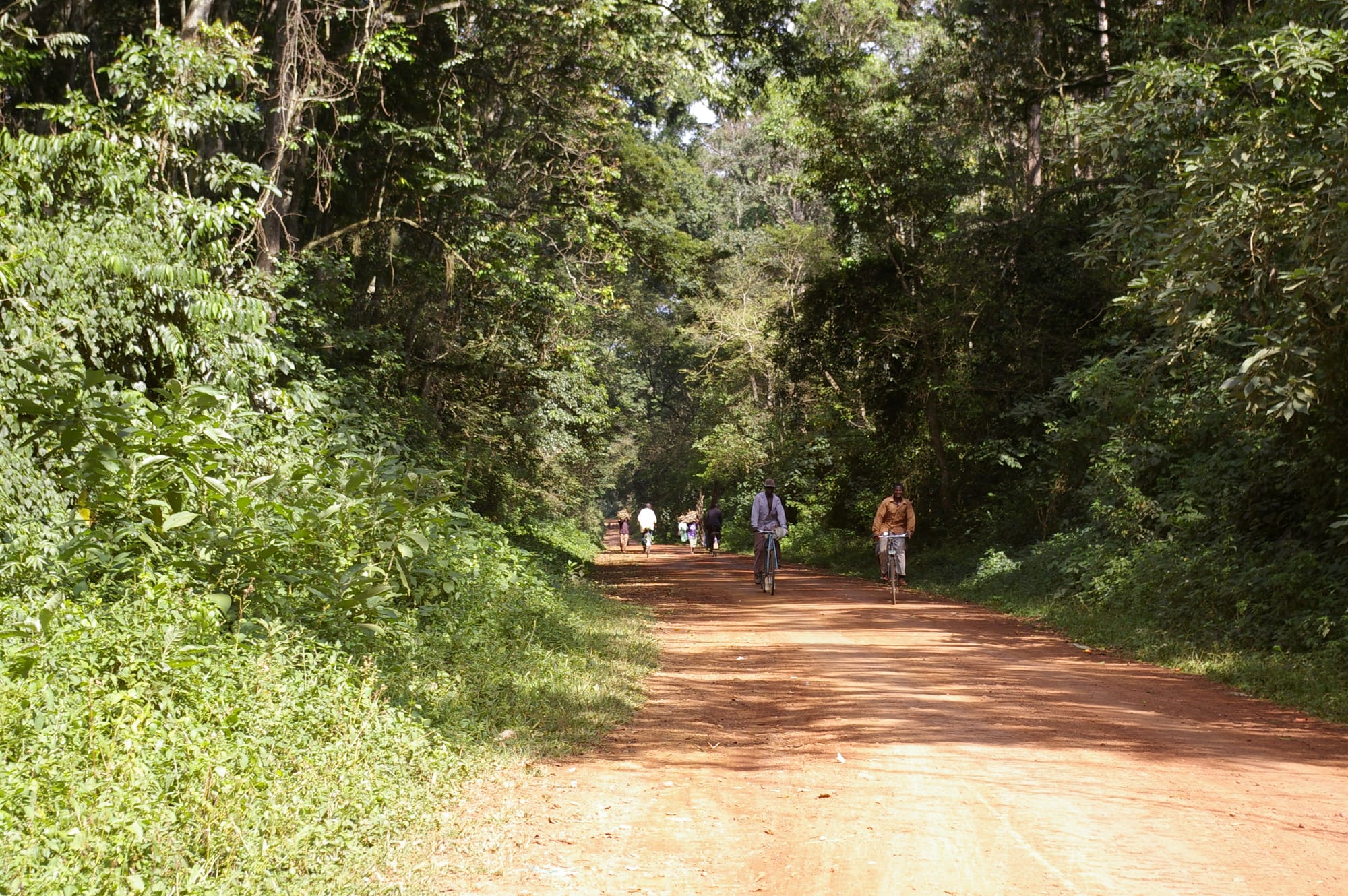
A red earth road running between dense green rainforest, with cyclists and people walking along it

Kisumu, Kakamega & Western Kenya, Kenya

Kakamega

A road through Kakamega Forest, the rainforest that begins a short drive from the town. (Nao Iizuka / Wikimedia Commons · CC BY 3.0)

A county town in the green, densely farmed hills of western Kenya, north-east of Kisumu and close to Kakamega Forest, the country's surviving patch of Guineo-Congolian rainforest. A short-lived gold rush in the early 1930s put it on the map; today it is a market, administrative and university town in the middle of Luhya country.

Neighbourhoods

  • Town centre
    • First-time visitors
    • Markets
    • Close to transport

    A few busy streets around the market, the bus and matatu stages, the county offices, banks and small hotels. Everything a visitor needs is within a short walk, and vehicles for the forest and for Kisumu leave from here.

    Open in Maps
  • Amalemba and Milimani
    • Quiet and residential
    • Guesthouses

    The older residential quarters just off the centre, with government housing, churches, schools and several of the town's guesthouses on quieter tree-lined streets.

    Open in Maps
  • The university side
    • Students
    • Value accommodation

    The area around Masinde Muliro University on the edge of town, with student hostels, photocopy shops, cheap canteens and bars, and a younger crowd than the rest of Kakamega.

    Open in Maps
  • Shinyalu and the forest road
    • Forest access
    • Rural life

    The road east towards Shinyalu and Isecheno, past homesteads, tea plots and sugar cane, where the farmland gives way to the edge of the rainforest and the guesthouses and camps used by birdwatchers.

    Open in Maps

Things to do

The forest

  • Kakamega Forestpark

    The rainforest east of the town, its northern portion protected as the Kakamega National Reserve since 1985, with trails from Isecheno and Buyangu, forest monkeys, snakes, 489 recorded butterfly species and 367 recorded birds.

    Open in Maps

The town

  • Masinde Muliro University of Science and Technologyattraction

    The public university on the edge of the town, named after the western Kenyan politician, and the reason for much of Kakamega's student population.

    Open in Maps
  • Crying Stone of Ilesilandmark

    A tall rock beside the Kisumu–Kakamega highway at Ilesi, known as Ikhongo Murwi, which local legend says is a jilted woman weeping; eucalyptus planted around it has since dried the water that ran down its face.

    Open in Maps

Short trips from the town

  • Mumiasattraction

    The capital of the Luhya kingdom of Wanga, whose last sovereign ruler was Nabongo Mumia, and later a sugar town built around a mill that has since collapsed.

    Open in Maps
  • Webuyeattraction

    A town on the Nzoia river north of Kakamega, known for its paper mill and for the Nabuyole Falls a few kilometres away.

    Open in Maps
  • Kisumuattraction

    Kenya's lake port on Lake Victoria, with fishing beaches, a regional museum and a small impala sanctuary on the shore.

    Open in Maps
  • Mount Elgon National Parkpark

    The Kenyan slopes of an extinct volcano on the Ugandan border, with moorland, forest and caves visited by elephants.

    Open in Maps
  • Nandi Hillsattraction

    Steep tea country on the escarpment east of the sugar belt, the home district of several of Kenya's best-known runners.

    Open in Maps

Seasonal events

  • Bullfighting contestsweekends, especially around holidays in December and August

    In the Isukha and Idakho areas around Kakamega two bulls are set head to head in a field, accompanied by isukuti drumming and large crowds; it is a long-standing Luhya tradition rather than a staged show.

  • Christmas and the December homecomingDecember

    Families return from Nairobi and beyond, markets and churches fill, and bull contests, weddings and funerals cluster in the holiday weeks.

  • The long rainsMarch to May

    The heaviest rains of the year turn the county intensely green, bring afternoon storms and make the forest trails muddy but the birdlife easy to hear.

Eat and drink

Long-standing places and food districts in Kakamega. Hours, ratings and directions come from your maps app, always current.

Kakamega classics

  • Ingokho and obusumarestaurant

    Chicken stewed the Luhya way and served with obusuma, the local name for ugali, is the dish of honour, cooked in the town's canteens and at any family occasion.

    Open in Maps
  • Nyama choma and mutura grillsrestaurant

    Roast beef and goat ordered by weight, and mutura sausage grilled at roadside stalls in the evening, eaten with kachumbari salad.

    Open in Maps

Markets and food streets

  • Kakamega town marketmarket

    The town's produce market, piled with bananas, maize, beans, sweet potatoes, traditional greens and sugar cane from the surrounding smallholdings.

    Open in Maps
  • The town centre streetsneighborhood

    Chai, mandazi and chapati from early morning, canteens serving githeri and stews at lunchtime, and small bars behind the main street.

    Open in Maps

Experience Kakamega

History

The hills around Kakamega have been farmed by Luhya communities — Isukha and Idakho closest to the town, Tiriki, Maragoli and others nearby — for centuries, in a countryside of smallholdings, clan land and homesteads rather than large settlements. Trade routes to the Wanga kingdom at Mumias and to the lake passed through, and the surrounding forest supplied timber, medicine, honey and game.

The modern town dates from the colonial period, when a small administrative station and mission were established in the district. Its moment came in the early 1930s, when gold was found in the area and a rush followed, fuelled in part by the reports of the geologist Albert Ernest Kitson, and for a few years Kakamega had a reputation out of proportion to its size. The deposits proved modest, the rush faded within the decade, and the town settled back into its role as a district centre, though small-scale gold mining still goes on in the county.

Kakamega became the headquarters of the old Western Province and then, under the 2010 constitution, the capital of Kakamega County, one of the most populous in Kenya. The university that carries the name of the politician Masinde Muliro opened on the edge of the town and grew quickly. The forest, meanwhile, shrank — cleared for farms, grazing and charcoal over the twentieth century — before protection as a national reserve and the arrival of birdwatchers gave the remaining fragment a new value.

Culture & Customs

Kakamega is Luhya heartland, and the Luhya are not one people but a cluster of sub-groups with their own dialects and customs. Around the town the Isukha and Idakho are best known for isukuti, a fast drumming and dance tradition played on short drums covered in cowhide, widely known across Kenya and heard at births, weddings, funerals, church events and political rallies alike. In 2014 the Isukuti dance of the Isukha and Idakho communities was inscribed on UNESCO's list of intangible cultural heritage in need of urgent safeguarding.

The other tradition the county is famous for is bullfighting, which in Kenya means two bulls pushed head to head in a field while crowds, drummers and the animals' owners follow the contest. Bulls are kept and fed for the purpose, matches draw large crowds on holiday weekends, and the winning animal is paraded home. Rites of passage matter here too: circumcision ceremonies mark the passage to manhood among several Luhya groups, with their own seasons, songs and feasting.

Chicken, prepared as ingokho, is the formal gesture of hospitality, and its parts are traditionally shared by seniority. Christianity is dominant, with large Sunday congregations, and football rouses strong feeling, with AFC Leopards the club most closely associated with Luhya support. Respect for elders, extended family obligation and the pull of the ancestral home shape daily behaviour.

Daily Life

About 107,000 people lived in the town at the 2019 census, in a county of some 1.87 million and one of the most densely settled rural landscapes in Kenya. Almost every family farms: maize and beans, bananas, sweet potatoes, cassava, tea on the higher ground and sugar cane towards Mumias and Butere, most of it on plots of a few acres subdivided again with each generation. Land pressure is the county's defining economic fact.

The town lives on administration, trade and education — the county government, the referral hospital, schools and Masinde Muliro University are among the largest employers — along with the market, transport and small workshops. Small-scale gold mining continues in parts of the county, hard and often hazardous work. Many households depend on remittances from relatives working in Nairobi or abroad.

Mornings start early with produce coming into the market and motorbikes ferrying people in from the villages; afternoons are often broken by rain; and evenings are quiet outside the bars and the student quarter. The forest edge is where the pressures show most clearly, with firewood, grazing and new farms pressing against a reserve that is also a source of tourism income and of water for the streams below.

Food

Western Kenyan cooking is built on obusuma, the Luhya name for ugali, made from maize meal and eaten with almost everything. The dish of honour is ingokho, free-range chicken stewed slowly with tomato and onion, served to guests and at celebrations. Beef and goat appear as nyama choma, roasted over charcoal and eaten by the kilo with kachumbari, and mutura, a grilled sausage, is sold from evening stalls.

Vegetables are taken seriously in a county where they grow easily. Traditional greens — murere or omurere (jute leaves), likhubi, tsisaga (African nightshade) and lisebebe (pumpkin leaves) — are cooked with milk or groundnut paste and eaten with obusuma. Beans, green grams, sweet potatoes, cassava, arrowroot and boiled bananas fill out everyday meals, and termites and other insects are a seasonal delicacy after the rains.

Sugar cane from the mills to the west is chewed and sold everywhere, and the county grows tea on its eastern hills. Chai with mandazi or chapati is the standard breakfast, busaa and other traditional brews are still made in the villages, and bottled lager is drunk in the town's bars.

Planning tools

Budget

Kakamega is cheap even by western Kenyan standards. Guesthouses in town, canteen meals and matatus cost very little, and the main outlays are reserve entry and a guide for the forest, and a vehicle if the trip extends to Mount Elgon or the sugar towns. Forest lodges and camps cost more than the town's hotels.

Daily Budget Midrange
USD 60–120 (good hotel or forest camp, restaurant meals, reserve entry and a guide)
Daily Budget Shoestring
USD 20–40 (guesthouse, local food, matatus and boda-bodas)

Hire a forest guide at the reserve gates rather than in town, and carry cash, as card payment is limited outside the larger hotels.

Best Time to Visit

December to February and June to September are the driest stretches and the best for forest trails, when paths are firmer and early mornings clear. The long rains from March to May are heavy in this county; birdwatching remains good all year, and butterflies are most numerous in the wetter months.

Suggested Number of Days

The town itself needs only a day. Two or three suit anyone walking the forest trails properly, with early mornings for birds, and the number rises again if the trip continues to the mountain country on the border or south to the lake.

First Visit
1 day
With Surroundings
2–3 days

Transportation

Matatus and boda-boda motorbike taxis are the everyday transport, with stages in the town centre for Kisumu, Eldoret, Bungoma, Busia and the villages towards the forest. Matatus run to Shinyalu and Khayega for the southern forest entrance, and reaching the northern Buyangu side or moving between the two is easier with a hired vehicle or a motorbike.

Agree a boda-boda fare before setting off, wear a helmet, and allow extra time on the forest roads after heavy rain.

Airport & Station Connections

Kakamega has no airport of its own; the nearest are at Kisumu, about an hour and a half to the south, and Eldoret to the east, both with flights from Nairobi. Most people arrive by road: coaches and matatus run from Kisumu, Eldoret, Bungoma and Busia, and the trip from Nairobi through Nakuru and Kisumu takes the best part of a day.

Walkability

The centre is small and easily walked from end to end, with the market, stages, banks and hotels a few minutes apart, though pavements are narrow and the traffic of motorbikes constant. Everything else — the university, the Crying Stone, the forest gates — is a ride away, and the forest itself is walked on foot with a guide.

Safety

Kakamega is a calm town where the usual risks are petty theft in the market and around the stages, and road traffic, especially at night on the highways and on motorbikes. Protests and heavy-handed policing have occurred in western towns at times of disputed elections. In the forest the practical concerns are slippery trails, snakes and biting insects, and malaria is common across the county.

Do not swim in the lake, travel on boats only with life jackets, take malaria precautions, and avoid political rallies at election time. Walk the forest with a guide, keep to the trails, and use a torch after dark in the town's unlit streets. Check current official travel advice before travelling.

Climate

Warm, green and among the wettest parts of Kenya, at about 1,500 metres. Rain falls in most months, usually as heavy afternoon and evening storms, with the long rains from March to May the heaviest and a second wet spell later in the year. Mornings are often bright and the nights mild.

Summer
January and February are the driest and warmest, with days around 28–30°C
Winter
June to September is cooler and showery, with days around 26°C and mild nights

Local Customs

This is Luhya country, and the Isukha and Idakho dialects are heard alongside Swahili and English. Isukuti drumming, played on short cowhide-covered drums, accompanies births, weddings, funerals and celebrations of every kind. Chicken is the dish of honour for a guest, greetings are unhurried, elders are greeted first, and churches are full on Sundays.

Ask before photographing people, bull contests or homesteads; dress modestly in the market and at church; tipping is not expected, though a guide in the forest is normally tipped.

Common Payment Methods

The currency is the Kenyan shilling. Mobile money covers almost every transaction, from matatu fares to market stalls and guide fees, and cards are accepted at larger hotels and supermarkets. ATMs are in the town centre; cash is needed for the forest gates, stalls and villages.