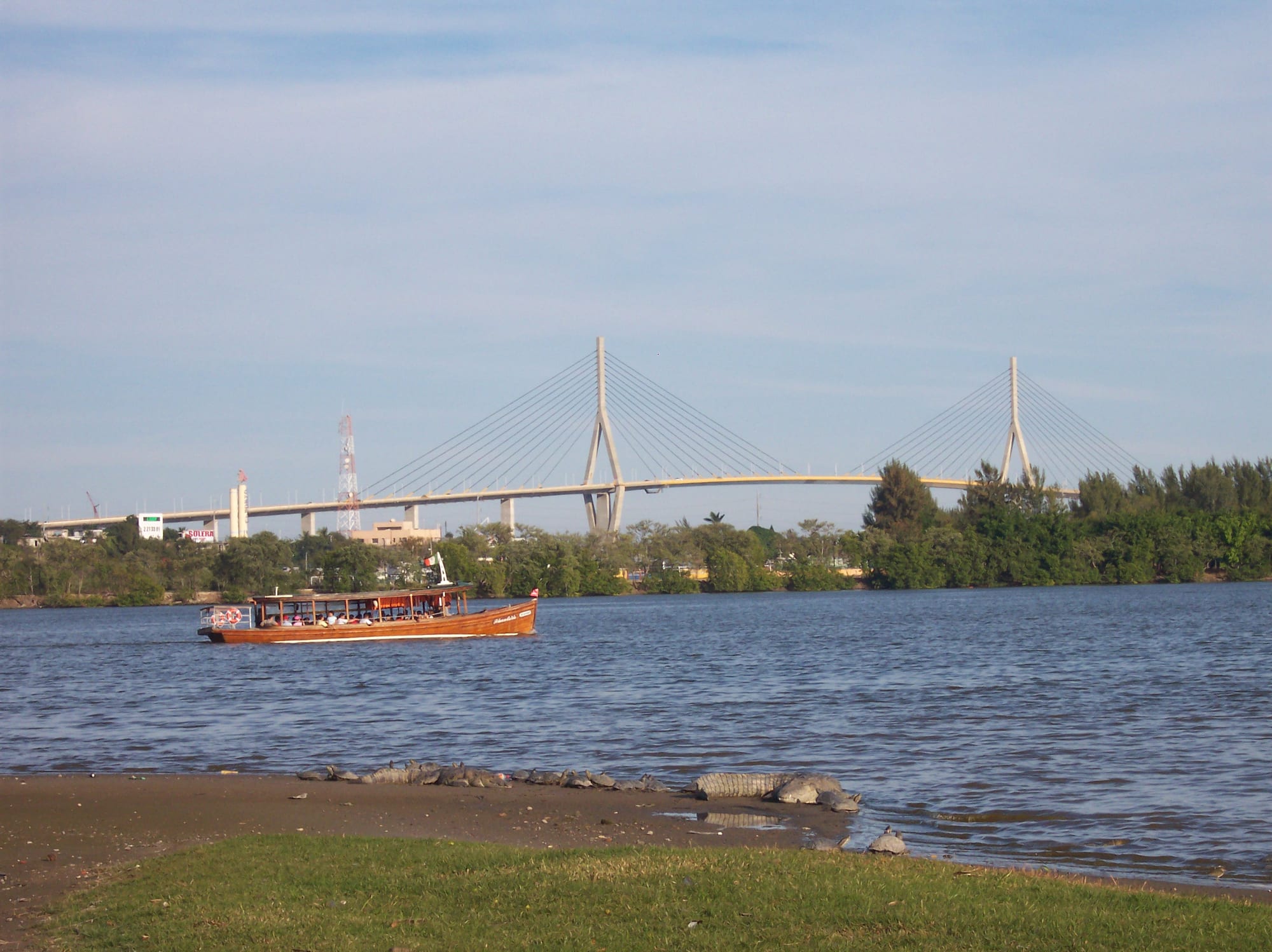
A wooden passenger boat on the Laguna del Carpintero, crocodiles on the shore and a cable-stayed bridge beyond the trees

Monterrey & the Northeast, Mexico

Tampico

A boat on the Laguna del Carpintero in Tampico, with the Tampico Bridge in the distance. (Gabriel Carranza Olguin (GabboMatamoros (talk)) / Wikimedia Commons · CC BY-SA 3.0)

A port on the north bank of the Pánuco River, about 10 km from the Gulf of Mexico, in the Huasteca region of southern Tamaulipas. Refounded in 1823, it became the chief oil-exporting port of the Americas in the early 20th century, and the boom left a centre of wrought-iron balconies, lagoons full of crocodiles and a seafood-loving city with beaches nearby.

Neighbourhoods

  • Centro Histórico
    • First-time visitors
    • Historic district
    • Best for food

    The old centre around the Plaza de Armas and the Plaza de la Libertad, with the cathedral, the town hall and buildings with wrought-iron balconies from the oil-boom years. The municipal market and the torta stalls by the old customs house are a short walk away, though some grand buildings still stand empty.

    Open in Maps
  • Laguna del Carpintero
    • Parks
    • Families
    • Culture

    The lagoon in the heart of the city, linked to the river by the Canal de la Cortadura and home to Morelet's crocodiles. Its banks hold the Espacio Cultural Metropolitano, the convention centre and newer redevelopment.

    Open in Maps
  • Ciudad Madero and Miramar
    • Beaches
    • Seafood
    • Oil-town history

    The neighbouring city on the Gulf coast, a centre of oil refining, where the long sands of Playa Miramar end at the breakwater of Las Escolleras by the mouth of the Pánuco. Many visitors from Monterrey stay near the beach.

    Open in Maps

Things to do

The historic centre

  • Tampico Cathedrallandmark

    The Cathedral of the Immaculate Conception on the Plaza de Armas, begun in 1841 and consecrated in 1931, a neoclassical church with a London-made clock in its east tower and a Carrara marble altar.

    Open in Maps
  • Plaza de Armaslandmark

    The main square, with the neoclassical town hall, the cathedral and the market streets close by.

    Open in Maps
  • Plaza de la Libertadlandmark

    The second historic square, ringed by buildings with cast-iron balconies, some still bearing the plaques of the Derbyshire foundry that made them.

    Open in Maps
  • Antigua Aduana Marítimamuseum

    The English-style redbrick customs house on the docks, opened in 1902, with an exhibition on its ground floor of arms and flags surrendered by the Spanish army in 1829.

    Open in Maps

Lagoons and the river

  • Laguna del Carpinteropark

    The lagoon in the heart of the city, home to Morelet's crocodiles and the focus of a redevelopment project.

    Open in Maps
  • Canal de la Cortaduraattraction

    The canal joining the lagoon to the Pánuco River, with boat tours among the crocodiles and wildlife of the canal and the lagoon.

    Open in Maps
  • Espacio Cultural Metropolitanoattraction

    The Metropolitan Cultural Centre beside the Laguna del Carpintero, opened in 2003 for theatre, concerts and exhibitions.

    Open in Maps
  • Laguna del Chairelpark

    A lagoon where kayaks can be hired, with the city's seafood market on its shore near the river.

    Open in Maps
  • Tampico Bridgelandmark

    The cable-stayed road bridge over the Pánuco River linking Tamaulipas with Veracruz.

    Open in Maps

Huastec heritage

  • Las Floreslandmark

    An archaeological site of the Huastec civilisation within the city, an important settlement that flourished between about 1000 and 1250.

    Open in Maps

Beaches and sport

  • Playa Miramarbeach

    The long Gulf beach in Ciudad Madero, the main weekend escape for the city and for visitors from Monterrey.

    Open in Maps
  • Las Escollerasviewpoint

    The breakwater at the southern end of Playa Miramar, with a small lighthouse at its tip and views of ships and shrimp boats at the river mouth.

    Open in Maps
  • Estadio Tamaulipasattraction

    The football stadium of the Jaiba Brava, whose centre line sits on the boundary between Tampico and Ciudad Madero.

    Open in Maps

Eat and drink

Long-standing places and food districts in Tampico. Hours, ratings and directions come from your maps app, always current.

Tampico classics

  • Tortas near the Antigua Aduananeighborhood

    A cluster of torta restaurants by the old customs house serves the torta de la barda, a sandwich with more than a dozen fillings; Tortas René has made it since 1928.

    Open in Maps
  • Mercado Municipalmarket

    The municipal market just south of the Plaza de la Libertad, one of the largest in Tamaulipas, selling groceries and crafts.

    Open in Maps

Seafood

  • Mercado de Mariscos La Puntillamarket

    The city's seafood market on the shore of the Laguna del Chairel near the Pánuco River.

    Open in Maps
  • Seafood restaurantsneighborhood

    Crab is the city's emblem, and restaurants across Tampico and Ciudad Madero serve jaibas rellenas, stuffed crabs, shrimp and Gulf fish.

    Open in Maps

Experience Tampico

History

The name comes from the Huastec tam-piko, "place of otters", after the animals that lived in the rivers and lagoons of the Pánuco delta. The Huastec people settled the area for centuries, and Las Flores, within today's city, flourished between about 1000 and 1250. In 1532 the Franciscan Andrés de Olmos set up a mission over a Huastec village, and a Spanish town, San Luis de Tampico, followed in 1554; pirate raids led to its abandonment in 1684, and the north bank was left empty for nearly 150 years.

The present city was founded on 13 April 1823, soon after independence, as a river port that exported silver and served a farming hinterland. In 1829 Spain landed troops from Cuba in an attempt to reconquer Mexico; fighting ran along the Pánuco to the Plaza de la Libertad, and in September the invaders surrendered to Mexican forces under Santa Anna.

Oil transformed the city. Mexico's first oil well was drilled at nearby Ébano in 1901, US companies poured in investment, and Tampico became the chief oil-exporting port of the Americas, with a large American community. The money built the balconied centre, often compared with New Orleans. In April 1914 the arrest of US sailors in the city, the Tampico Affair, led to the American occupation of Veracruz. The oil industry was nationalised in 1938, and in the 1970s Tampico absorbed neighbouring Ciudad Madero into its metropolitan area. The drug war of the 2010s emptied much of the centre, which has since been partly restored.

Culture & Customs

Tampico belongs to the Huasteca, the cultural region shared with Veracruz, San Luis Potosí and Hidalgo, and it takes its name from the Huastec language. The state's huapango music and the cuera tamaulipeca, a fringed suede jacket that is Tamaulipas's traditional dress, are part of its regional identity.

The people of Tampico call themselves jaibas, crabs, and the crab appears everywhere, from sports logos and buses to park benches. The football club Tampico Madero, the Jaiba Brava, was founded in 1945 and won the national league in 1953. Visitors from other parts of Mexico, particularly Monterrey, come mainly for the beach, and international tourists are few, so locals often greet foreigners with friendly curiosity.

Cultural life centres on the restored historic squares, the cathedral and the Espacio Cultural Metropolitano on the Laguna del Carpintero, opened in 2003 as part of a long programme to restore the centre and develop the lagoon and the Canal de la Cortadura. The old customs house and its museum recall the victory of 1829.

Daily Life

At the 2020 census the city of Tampico had about 297,000 inhabitants, and the metropolitan area, which includes Ciudad Madero and Altamira in Tamaulipas and Pánuco and Pueblo Viejo across the river in Veracruz, had about 927,000. Tampico is the flagship of the area and the most developed part of the state, living mainly from commerce, petrochemical industry and services.

Oil still matters: Ciudad Madero is a centre of refining, and when the refinery is running its smell reaches the city. The port exports minerals, lumber and farm produce, while container traffic goes mainly to neighbouring Altamira, and rail and air links connect the city with Mexico City and the United States. The Autonomous University of Tamaulipas has one of its two largest campuses here.

The scars of the drug war remain visible in once-grand buildings left half ruined in the centre, alongside new developments around the canal and the lagoon. For many families, weekends mean a trip to the beach at Playa Miramar.

Food

Seafood is the heart of Tampico's cooking. Crab, the city's emblem, is eaten as jaibas rellenas, crab shells stuffed with seasoned crabmeat, and shrimp boats come and go from the mouth of the river. The seafood market at La Puntilla lies on the Laguna del Chairel near the Pánuco.

The torta de la barda is the local sandwich: a large roll packed with more than a dozen fillings, sold in the cluster of torta shops by the old customs house, where Tortas René has served it since 1928. Carne a la tampiqueña, steak served with refried beans and entomatadas, tortillas in tomato sauce with cheese, carries the city's name.

Tacos and tortas of cecina, cured beef, are another local order, and the municipal market just south of the Plaza de la Libertad is one of the largest in the state. Seafood restaurants are spread across the metropolitan area, from the centre to Ciudad Madero near the beach, and one sits on a dock built out over the Pueblo Viejo lagoon across the river. Crab remains the dish most tied to the city.

Planning tools

Budget

Tampico is cheaper than Monterrey. Street food, tortas and market meals cost little, and seafood restaurants are good value. Much of the accommodation caters to travellers arriving by car and is spread along the roads towards the beach rather than in the centre, so taxis or ride-hailing add to daily costs.

Daily Budget Midrange
USD 80–160 (business or beach hotel, seafood restaurants, taxis and boat tours)
Daily Budget Shoestring
USD 35–55 (budget hotel, tortas and market food, shared route taxis)

The squares, the lagoon shore and the beach are free; flying in avoids long drives across Tamaulipas.

Best Time to Visit

November to April is the most comfortable time, with warm days, though cold fronts across the Gulf bring strong winds in autumn and winter. Summer is hot and very humid, rain is frequent from June to October, and the Gulf hurricane season runs from June to November.

Suggested Number of Days

Two days cover the historic centre, the lagoons and the beach. Three or four suit a slower stay on the coast or longer journeys into the Huasteca, though road travel in the region needs care.

First Visit
2 days
With Surroundings
3–4 days

Transportation

Driving or taxis are the easiest ways around, and Uber and DiDi operate. Carros de ruta, shared taxis on fixed routes, run across the city, including to the beach, and water taxis cross the Pánuco from landings east of the centre.

Use taxis or ride-hailing at night, and ask locals for the shared 'Tampico-Playa' route to Miramar.

Airport & Station Connections

Tampico International Airport lies about 8 km north of the city centre and is the second busiest in north-eastern Mexico, with flights to Mexico City, Monterrey and Houston. The central bus station has intercity services to Mexico City, Monterrey and the north. Driving through Tamaulipas carries risks, so flying or taking a major bus line is the safer choice.

Walkability

The historic centre is compact and flat, with the two plazas, the cathedral, the market and the customs house a few blocks apart. Heat and humidity make walking hard in summer. Beyond the centre, hotels and restaurants are spread out, and the beach is a ride away.

Safety

Safety varies enormously by state and even neighbourhood. Tamaulipas has some of the highest government advisories in Mexico because of organised-crime violence, kidnapping and armed robbery, especially on highways and in the border cities. Tampico was badly hit by drug-war violence in the 2010s, when hundreds of businesses closed and much of the centre was abandoned; the government later regained control, and the city has been redeveloping since.

Fly or use major bus lines rather than driving across Tamaulipas, avoid road travel at night, and use registered taxis or apps. Check current official travel advice before travelling.

Climate

Tropical savanna: mild in spring and autumn, hot and extremely humid in summer, with rain mostly from June to October. Cold fronts in autumn and winter bring strong winds, and rare cold waves have brought temperatures near freezing.

Summer
hot and humid — August averages a high of 32°C and a low of 23°C, with heat indices reaching 40°C
Winter
warm — January averages a high of 23°C and a low of 13°C, with windy northerly fronts

Local Customs

Tampiqueños call themselves jaibas, crabs, and the crab appears on football badges, buses and park benches. People are generally warm and curious towards visitors, and English is not widely spoken. Tipping is customary in sit-down restaurants. The cathedral and churches are working places of worship.

Learn some basic Spanish, dress modestly in churches, and keep a distance from the crocodiles at the lagoon edge.

Common Payment Methods

The currency is the Mexican peso (MXN). Cards are accepted in hotels, malls and many restaurants; cash is needed for markets, torta stalls, shared taxis and water taxis. ATMs are found in banks and shopping centres.