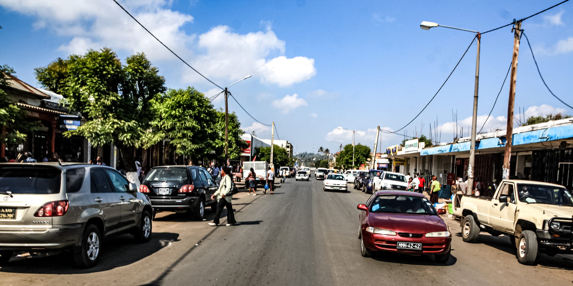
A broad tarmac street in Beira lined with shopfronts, parked cars and shade trees under a blue sky with white clouds

Beira, Gorongosa & the Centre, Mozambique

Beira

A commercial street in Beira, the main port of central Mozambique. (Edward Middleton / Wikimedia Commons · CC BY-SA 4.0)

The main city of central Mozambique, a port on the Indian Ocean where the Púngoè and Búzi rivers meet the sea. Built by a chartered company as the ocean end of the railway to Rhodesia, it is still the country's central trading gateway, a low, hot city of colonial avenues, a seafront lighthouse and beaches, rebuilding after Cyclone Idai struck it in 2019.

Neighbourhoods

  • Baixa, the city centre
    • First-time visitors
    • Architecture
    • Close to transport

    The old commercial core between the port and the main square, laid out in the colonial decades with banks, trading houses and arcaded shopfronts. Most offices, the main square and the market are here, and the streets are busy by day and quiet after dark.

    Open in Maps
  • Ponta Gêa
    • Quiet and residential
    • Architecture

    The residential quarter west of the centre, with low villas, walled gardens and jacaranda-shaded streets, and the cathedral at its edge. It is a short drive from both the centre and the seafront.

    Open in Maps
  • Macuti
    • Beaches
    • Sea views

    The eastern seafront district that takes its name from the palm-thatch roofs of the old fishing settlement. The lighthouse, the wreck on the sand and the long beach are here, along with much of the city's hotel and restaurant trade.

    Open in Maps
  • Manga
    • Local life
    • Markets

    A large inland district on the road out of the city towards Dondo, residential and working-class, with its own markets and workshops. It is where much of Beira's population actually lives and a long way in feel from the seafront.

    Open in Maps
  • Praia Nova
    • Local life
    • Fish and seafood

    A dense fishing quarter on the shore beside the port entrance, where wooden boats land their catch and the fish is sold and grilled on the spot. Low-lying and crowded, it was badly exposed in the 2019 cyclone.

    Open in Maps

Things to do

Famous landmarks

  • Our Lady of the Rosary Cathedrallandmark

    The Gothic Revival cathedral of the archdiocese of Beira, begun in 1900 and inaugurated in 1925, its foundation stones taken from the Portuguese fort of São Caetano at Sofala. It was heavily damaged by Cyclone Idai in 2019.

    Open in Maps
  • Macuti lighthouselandmark

    The lighthouse at the eastern end of the seafront, which runs from the Grande Hotel along the beaches to the light, and one of the city's listed pieces of built heritage.

    Open in Maps
  • Grande Hotellandmark

    A vast reinforced-concrete hotel opened in 1954 that failed commercially, closed for business in 1963 and has been occupied since the civil war; more than 3,000 people live in it. It is a ruin and a home, not a visitor attraction.

    Open in Maps
  • Beira railway stationtransit hub

    The modernist terminus of the line inland to Zimbabwe, completed in 1966 and one of the city's listed buildings, at the heart of the Beira corridor.

    Open in Maps

The shore

  • Macuti beachbeach

    A long stretch of grey-gold sand along the eastern edge of the city, with a big tidal range and a seafront road that carries the city's evening walkers.

    Open in Maps
  • Port of Beiratransit hub

    The country's second largest port, built in the 1890s to replace old Sofala and the terminus of the railways that carry goods to and from Zimbabwe and Malawi, visible from the roads along the river mouth.

    Open in Maps

Markets

  • Beira central marketmarket

    The city's main produce market near the Baixa, selling vegetables from the Manica highlands, dried and fresh fish, cashews and capulana cloth.

    Open in Maps

Short trips from the city

  • Dondoattraction

    A railway and industrial town about 30 kilometres inland on the corridor road, the junction for traffic heading north and west.

    Open in Maps
  • Sofalaattraction

    The site of the medieval Swahili gold port south of the city, later a Portuguese fort, now largely lost to the sea and marked only by its setting and story.

    Open in Maps
  • Rio Savanebeach

    A river mouth and long empty beach about 32 kilometres from the city, reached by a sand track and a short boat crossing.

    Open in Maps

Eat and drink

Long-standing places and food districts in Beira. Hours, ratings and directions come from your maps app, always current.

Beira classics

  • Seafood grills on the Macuti seafrontneighborhood

    The restaurants strung along the seafront road are where the city eats prawns, crab and grilled line fish with piri-piri and garlic.

    Open in Maps
  • Praia Nova fish landingmarket

    Boats bring in the day's catch beside the port, and fish is sold and grilled over charcoal at the water's edge.

    Open in Maps

Markets and food districts

  • Beira central marketmarket

    Cassava and maize meal, coconuts, cashews, tomatoes and chillies from the highlands, and stalls selling snacks and chamuças.

    Open in Maps
  • Baixa cafés and pastelariasneighborhood

    The old commercial streets keep the Portuguese habit of strong coffee, bread rolls, rissóis and custard tarts through the morning.

    Open in Maps

Experience Beira

History

Beira is a young city on an old coast. The Swahili and then Portuguese gold port of Sofala lay a short way down the shore, and by the late nineteenth century it was silting up and failing. In 1890 the Portuguese began building a new port on the sandy spit at the mouth of the Púngoè; from 1891 the settlement was the headquarters of the Mozambique Company, the chartered concern that governed Manica and Sofala on Portugal's behalf. The place was first called Chiveve, after a local river, and then renamed in honour of the Prince of Beira. Its purpose was the railway inland: the line to the gold and farming country of Rhodesia reached the border in the 1890s and made the town the ocean end of what is still called the Beira corridor.

Trade built the city. Cargo for Southern Rhodesia, Nyasaland and Northern Rhodesia moved through its wharves, and the company laid out avenues, a cathedral, offices and villas for a population of Portuguese settlers, Goan and Indian traders and Mozambican workers drawn from across the centre. The chartered company's rule ended in 1942 and the state took over, and by the 1960s Beira was a seaside resort as well as a port, complete with a grand hotel that never paid its way.

Independence in 1975 and the departure of most settlers, then the civil war of 1977 to 1992, cut the city off from its hinterland and emptied its economy; the corridor was defended by Zimbabwean troops to keep it open. Peace and the rehabilitation of the port and railway revived trade from the 1990s. On 15 March 2019 Cyclone Idai came ashore here, destroying or damaging much of the city's housing and its power and water systems and flooding the Búzi and Púngoè valleys behind it. Rebuilding, and defending a low-lying city from the sea, have shaped Beira ever since.

Culture & Customs

Beira is the cultural capital of central Mozambique because it is where the centre meets: Sena speakers from the Zambezi, Ndau from southern Sofala and Manica, Manyika from the highlands, and Portuguese as the shared language of work and school. Older families trace roots to Goa, Portugal, Greece and the Indian trading communities of the port, and the mosque, the cathedral and a growing number of Pentecostal and Zionist churches all draw crowds at the weekend.

Music and dance here lean towards the region rather than the capital. Ndau and Shona rhythms, and popular music from Zimbabwe and Malawi carried in along the corridor, are heard as much as Maputo's marrabenta, and local bands mix them with pandza and South African house. Spirit mediums and traditional healers are consulted alongside clinics, particularly by families with roots in Manica, and funerals and initiations remain large family obligations.

Politically the city has long had a mind of its own: for many years it was run by the opposition and it has a reputation for outspokenness that Beirenses enjoy. Football is followed closely, with local clubs and the national league drawing crowds, and the beach at Macuti serves as the city's public space on Sunday afternoons, when families walk, swim and eat along the seafront. Greetings are unhurried and formal — a handshake, an enquiry after the family — and impatience is read as rudeness.

Daily Life

About 530,000 people lived in Beira in 2019, making it the fourth largest city in the country after Maputo, Matola and Nampula. Most live in the inland bairros — Manga, Munhava, Inhamízua and others — rather than in the colonial centre, in houses of block and sheet metal along sand roads that flood in the rains.

Work comes from the port and the corridor above all: stevedoring, haulage, customs, warehousing and the coal and chrome traffic that moves by rail from Zimbabwe and Tete. Fishing and prawn processing employ many along the shore, and the markets, workshops and small trade of the bairros absorb the rest. Salaried jobs are scarce, and a great deal of the city works informally.

The day starts before dawn, with chapas filling on the main avenues and the fish landing at Praia Nova; by mid-afternoon the heat has slowed everything, and the seafront fills in the evening. The issues people talk about are drainage and flooding — much of Beira lies at or below the high-tide line, and the Chiveve channel and the sea wall are permanent subjects — along with the slow rebuilding after Idai, water and power cuts, malaria and the cost of living.

Food

Beira eats from the sea and from the highlands behind it. Prawns are the local pride, grilled with garlic and piri-piri or stewed with coconut, and crab, squid and grilled line fish appear on almost every menu. The regional dish is frango à zambeziana, chicken cooked with coconut milk, garlic and chilli, and mucapata, rice cooked with coconut milk and mung beans, is a common accompaniment.

Inland cooking sets the everyday table: xima, a stiff maize porridge, with a relish of beans, dried fish or leaves in peanut sauce, and matapa, cassava leaves stewed with ground peanuts and coconut. The Manica highlands send potatoes, tomatoes, cabbages, citrus and bananas down the corridor to the city's markets, and coconut, cashews and mangoes are sold at every junction.

Portuguese habits survive strongly in the Baixa: crusty bread rolls in the morning, prego and bifana sandwiches at lunch, rissóis and custard tarts with strong coffee. Indian influence, from the old trading families, shows in chamuças and curries. The everyday drinks are 2M and Laurentina lagers, sugarcane and fruit juices, and in the bairros home-brewed maize and sorghum beers.

Planning tools

Budget

Beira is a working port rather than a resort, so prices are moderate by Mozambican standards: simple pensões and local restaurants in the centre, a handful of mid-range hotels near the seafront. The main extras are taxis, because the city is spread out, and any trip inland to Gorongosa, where park fees, a lodge and a guided drive dominate the cost.

Daily Budget Midrange
USD 100–250 (seafront hotel, restaurant meals, taxis, a hired car or a park trip)
Daily Budget Shoestring
USD 30–55 (pensão or guesthouse, market food and local restaurants, chapas)

Carry meticais for chapas, markets and small restaurants; cards are useful only at hotels and larger establishments.

Best Time to Visit

May to October, the dry season, is the comfortable time: warm days, low humidity, passable roads inland and the best months for wildlife at Gorongosa from August. The wet season from November to April is hot and humid, and the central coast around Beira carries the country's highest cyclone risk from January to March.

Suggested Number of Days

A day or two covers the city itself, which is more a place to understand than a place of many sights. Four or five days suits anyone combining it with the park and the coast inland and north, since road journeys in the centre are slow.

First Visit
1–2 days
With Surroundings
4–5 days

Transportation

The city is flat and spread out, and most people move by chapa minibus along the main avenues or by taxi and motorcycle taxi. Distances between the centre, the seafront and the inland neighbourhoods are a few kilometres. Hired cars and drivers are the usual way to reach Gorongosa National Park, about 170 kilometres north-west, or the corridor road west towards Chimoio and Zimbabwe.

Agree a taxi fare before setting off, and travel between towns by day, as unlit roads and heavy lorry traffic on the corridor make night driving risky.

Airport & Station Connections

Beira Airport lies a few kilometres north-east of the centre and has domestic flights to other Mozambican cities and limited international links. The EN6 corridor road runs west to Chimoio and the Zimbabwean border, and the EN1 north and south; long-distance buses and chapas use both. The railway to Zimbabwe and the coal line from Tete carry mostly freight.

Walkability

The Baixa and the area around the main square are walkable, and the seafront road at Macuti makes a long, flat walk with the sea beside it. Between districts the distances are too great and the pavements too broken for walking to be practical, and the city is not comfortable on foot after dark.

Safety

Beira is away from the conflict in the far north, and the clashes that affected roads in Sofala and Manica in the mid-2010s have long since quieted. The practical risks are opportunistic street crime and bag snatching in the centre and around the markets, malaria, which is high year round, and the cyclones and flooding that hit this low-lying coast in the wet season; Idai flooded much of the city in March 2019.

Avoid Cabo Delgado and adjacent districts entirely, don't walk in cities after dark or display valuables, and check the current situation before travelling to the centre and north. Follow cyclone and flood warnings between January and March, and use mosquito precautions and prophylaxis. Check current official travel advice before travelling.

Climate

Tropical and humid, tempered a little by the sea. The wet season runs from about November to April, with heavy rain and the country's highest cyclone exposure; the dry season from May to October is warm and far more comfortable. This is the southern hemisphere, so summer falls in December to February.

Summer
hot and humid, December–February, around 30–33°C by day with heavy rain, thunderstorms and the risk of cyclones
Winter
warm and dry, June–August, around 25–27°C by day and cooler at night, with little rain

Local Customs

Portuguese is the language of the city, with Sena and Ndau widely spoken at home; a greeting and a few words of Portuguese are appreciated. Dress is informal but modest away from the beach, and swimwear stays on the sand. Tipping is not obligatory; rounding up or about ten per cent in a restaurant is normal.

Ask before photographing people, markets or the Grande Hotel, where families live, and avoid photographing the port, bridges, police and government buildings.

Common Payment Methods

The currency is the metical. Beira is largely a cash economy: markets, chapas and small restaurants take cash only, while hotels and larger restaurants accept cards, Visa more reliably than Mastercard. ATMs are in the centre and at the larger shops, and South African rand and US dollars are sometimes accepted at hotels but at poor rates.