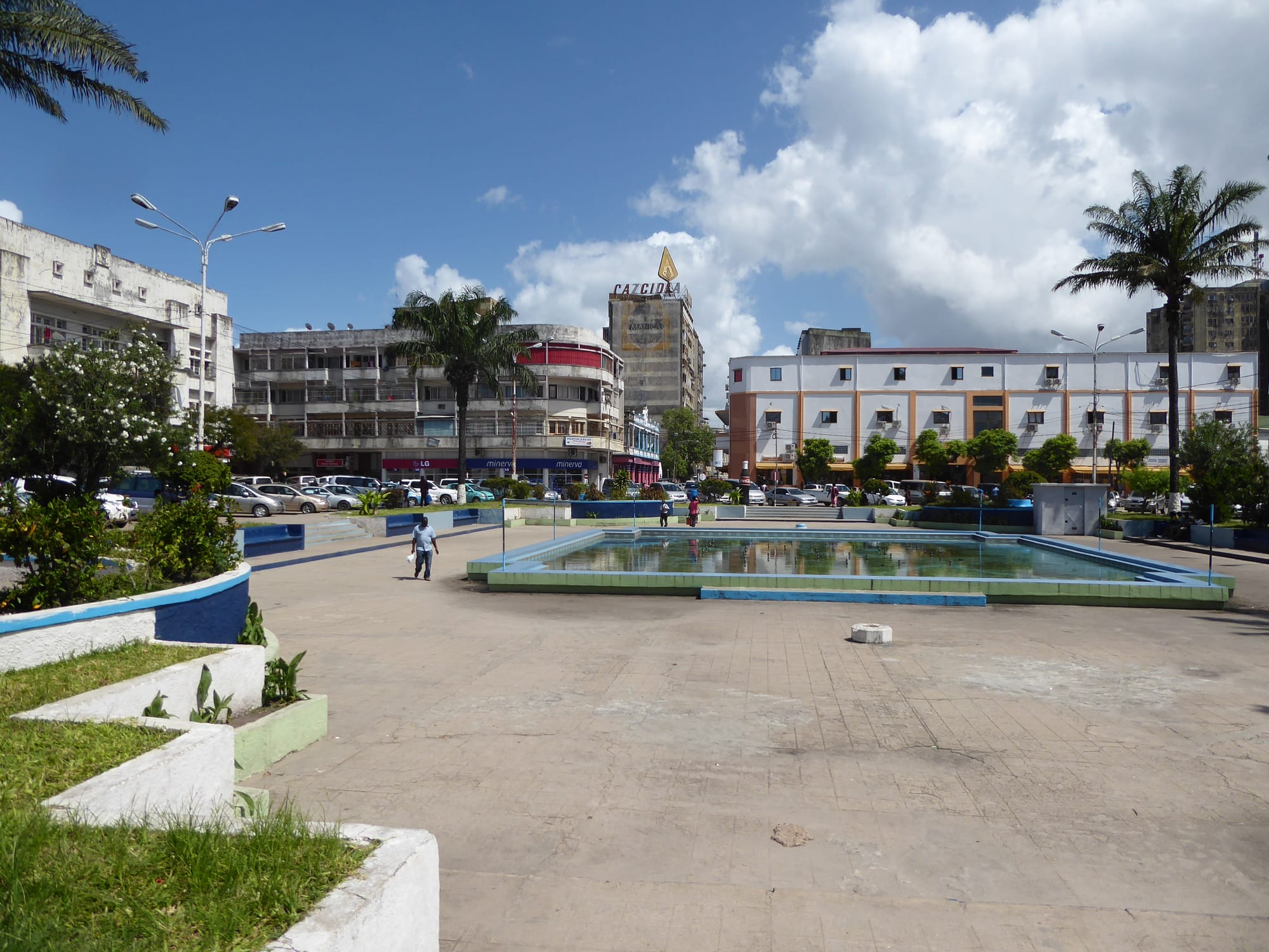
A wide paved square with a shallow rectangular pool, palm trees and flower beds, surrounded by multi-storey concrete buildings under a blue sky

Mozambique

Beira, Gorongosa & the Centre

Praça do Município, the main square in the centre of Beira, Mozambique's second port city. (Cornelius Kibelka / Wikimedia Commons · CC BY-SA 2.0)

Central Mozambique, the provinces of Sofala, Manica, Tete and Zambézia, where the Zambezi crosses the country to the sea — a region of the port city of Beira, the restored wildlife of Gorongosa, the Chimanimani mountains on the Zimbabwean border, the Cahora Bassa dam and the coconut coast around Quelimane.

Explore Beira, Gorongosa & the Centre

History

Long before the Portuguese, the centre was the link between the gold fields of the Zimbabwe plateau and the Indian Ocean. Swahili merchants traded gold and ivory at the port of Sofala, south of modern Beira, and the inland kingdom of Mutapa controlled the routes. Portugal built a fort at Sofala in 1505 and pushed up the Zambezi, founding Sena and Tete as trading posts in the sixteenth century. Over the following centuries the valley was divided into prazos, crown estates leased to settlers and traders who ruled with private armies.

At the end of the nineteenth century Portugal leased much of the centre to chartered companies. The Mozambique Company ran Manica and Sofala from Beira, which it built as a port for the railway to Rhodesia, and forced labour marked colonial life. FRELIMO carried the independence war into Tete, and Portuguese troops killed villagers at Wiriyamu in 1972, while engineers built the Cahora Bassa dam in the Zambezi gorge.

After independence the centre bore much of the 1977–92 civil war between the government and Renamo, whose headquarters lay in the Gorongosa area, and the park's wildlife was almost wiped out. Renamo's leader Afonso Dhlakama returned to the Gorongosa mountains during renewed clashes in the 2010s; he died there in 2018, and a new peace accord was signed in 2019. Cyclone Idai in 2019 flattened much of Beira and flooded the Búzi and Púngoè valleys, killing hundreds.

Culture & Customs

The centre is a patchwork of languages. Sena is spoken along the lower Zambezi and in Sofala, Ndau in southern Sofala and Manica, Manyika and Tewe around Chimoio, Nyungwe in Tete and Chewa in the Angónia highlands on the Malawian border; Zambézia adds Chuabo around Quelimane and Lomwe inland. Portuguese is the shared language of the cities, and Beira's mix of peoples from across the region makes it the centre's cultural capital.

Ndau and Shona traditions of spirit mediums and ancestral ceremonies remain strong in Manica, where healers are consulted alongside clinics, and among the Chewa of Tete the masked Nyau dancers perform at funerals and initiations. The old prazo families left a Catholic and Luso-African heritage in Sena, Tete and Quelimane, while Pentecostal and Zionist churches have spread quickly.

Politically, Beira was governed for years by the opposition Movimento Democrático de Moçambique. Football, markets and music from Zimbabwe and Malawi as well as Maputo shape everyday entertainment.

Daily Life

More than ten million people live in the four central provinces. Beira, with roughly 530,000 people, is the region's port and commercial city; Chimoio is Manica's capital on the corridor to Zimbabwe; Quelimane and Tete are the other provincial capitals; and Dondo, Caia, Manica and Gurúè are important towns.

The Beira corridor, with its port, railway and road to Zimbabwe, Zambia and Malawi, is the region's economic spine. Tete's coal mines at Moatize and the Cahora Bassa dam, which exports electricity to South Africa, bring in revenue but comparatively few jobs. Zambézia grows coconuts, tea on the hills around Gurúè, rice and cassava, Manica farms vegetables and fruit in its cool highlands, and fishing and prawns support the coast.

Days begin early with chapas crowding into town and markets opening at dawn. Rebuilding after Idai and later storms, rising seas on Beira's low-lying shore, poor rural roads and the slow reach of mining wealth are the issues people talk about.

Food

The centre's cooking mixes the Zambezi's river fish and the coast's seafood with coconut, peanut and chilli. A well-known regional dish is frango à zambeziana, a spicy chicken dish made with coconut milk, while mucapata is rice cooked with coconut milk and beans. On the coast, prawns are grilled with garlic and piri-piri or stewed in coconut sauces.

Inland, meals centre on xima, the stiff maize porridge, with relishes of beans, leaves in peanut sauce or dried fish. Kapenta, small sardine-like fish introduced to Lake Cahora Bassa, support a large fishery on the lake. The Manica highlands send potatoes, tomatoes, citrus and bananas to Beira's markets, and Zambézia's coconuts and cashews are sold at every roadside stall.

Bottled 2M and other lagers are the everyday drinks, alongside home-brewed maize and sorghum beers and strong local spirits.

Attractions & Natural Wonders

Gorongosa National Park, at the southern end of the Great Rift Valley in Sofala, is the centre's great sight: floodplains, woodland and the seasonal Lake Urema, restored since the mid-2000s with the reintroduction of animals including wild dogs and with large herds of waterbuck, elephants and lions recovering. Mount Gorongosa, with its rainforest and waterfalls, was added to the park. Beira, on the coast, has the ruined Grande Hotel, the cathedral, the Macúti lighthouse and beach, and a busy central market, and the Zambezi delta's wetlands lie to the north.

In Manica, the Chimanimani mountains rise along the Zimbabwean border, a protected area of quartzite peaks, montane forest and grassland, crowned by Monte Binga, the highest point in Mozambique. Chimoio, the provincial capital, sits near the rock known as the Cabeça do Velho, the "old man's head".

Up the Zambezi, Tete straddles the river beside the Samora Machel Bridge, and upstream at Songo the Cahora Bassa dam blocks a narrow gorge, creating a long lake with a large kapenta fishery. In Zambézia, Quelimane, founded as a trading post on the Rio dos Bons Sinais, has an old cathedral and the nearby Zalala beach, and the tea estates and Mount Namuli rise inland around Gurúè.

Cities in Beira, Gorongosa & the Centre

Planning basics

Budget

The centre sees fewer tourists than the south, so there are fewer budget lodges but also fewer tourist prices. Beira, Chimoio and Quelimane have simple pensões and local restaurants, while Tete is pricey for its size because of the mining industry. Gorongosa's lodges and camp, with park fees and guided drives, are the main expense.

Daily Budget Midrange
USD 100–250 (hotel or park lodge, restaurant meals, park fees and a guided drive)
Daily Budget Shoestring
USD 30–55 (pensão or basic guesthouse, local food, chapas)

Carry meticais for chapas and markets, and book Gorongosa accommodation and activities ahead in the dry season.

Safety

The centre is away from the northern conflict. Clashes between government forces and Renamo fighters affected roads in Sofala and Manica in the mid-2010s, and a breakaway group attacked vehicles until about 2021; the area has been calm since. The practical risks now are street crime in Beira and Tete, carjacking on isolated roads, cyclones and floods, and malaria, which is high throughout.

Avoid night travel, keep valuables out of sight in Beira, and follow cyclone and flood warnings in the wet season. Check current official travel advice before travelling.

Climate

The centre is hotter and wetter than the south and is the part of the country most exposed to cyclones, which strike the coast around Beira and Quelimane in the late wet season. The Zambezi valley around Tete is one of the hottest parts of the country, semi-arid and very hot before the rains, while the Manica highlands around Chimoio and Chimanimani are cooler and greener.

Summer
hot, humid and wet, November–April, with heavy rain, flooding along the Zambezi and Púngoè and cyclone risk on the coast
Winter
dry and warm, May–October, pleasant on the coast and in the highlands, and very hot in Tete by September

Transportation

Beira, Tete, Quelimane and Chimoio have airports with domestic flights. The Beira corridor road and railway run west through Chimoio to Zimbabwe, and the EN1 crosses the Zambezi on the bridge at Caia. Gorongosa is a few hours' drive from Beira, while Chimanimani needs a 4x4 from Chimoio. Long-distance chapas and buses link the towns, slowly, and the rains can cut rural roads.

Travel by day on the EN1 and the Beira corridor, and check road and flood conditions before heading into Zambézia or the parks in the wet season.

Best Time to Visit

May to October is the season for travel: roads are passable, Gorongosa's animals concentrate around the shrinking lake and rivers from August, and the Chimanimani trails are dry. Gorongosa and many rural roads are hard going or closed in the rains, and the January–March cyclone peak is best avoided on the coast.