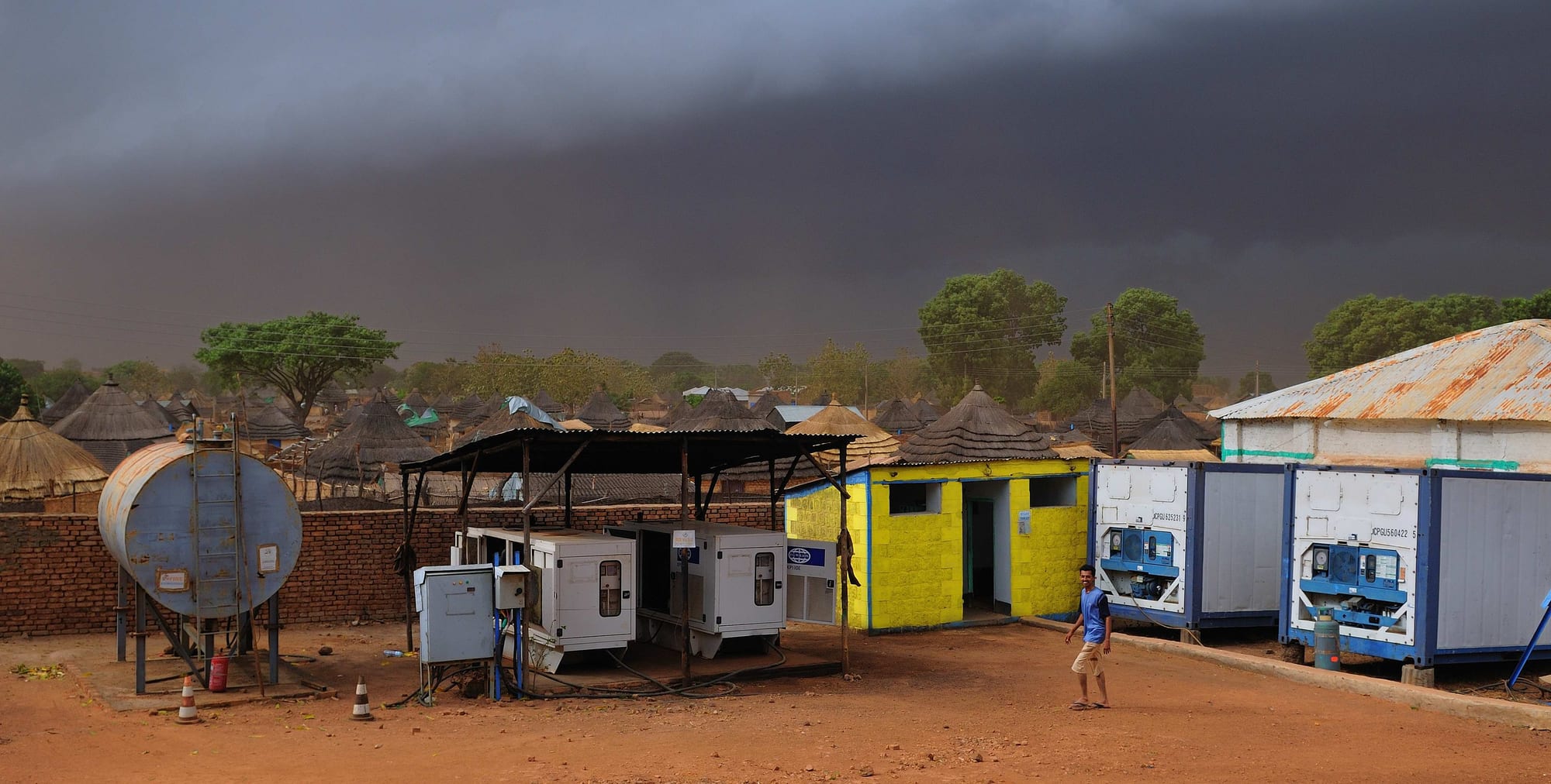
Thatched round huts and tin roofs among trees in Wau under a dark storm sky, with a water tank and containers on red earth in front

Wau & Bahr el Ghazal, South Sudan

Wau

A corner of Wau, with thatched homes and storage compounds under a gathering storm. (Michael Walsh / Wikimedia Commons · CC BY 3.0)

The largest town of Bahr el Ghazal, set on the Jur River in the north-west of South Sudan, grown from a nineteenth-century trading station into a mission, garrison and railway town. Its mixed population of Fertit, Luo and Dinka communities gives it a character unlike the cattle towns around it. This page is written to explain the city, not to encourage travel.

Neighbourhoods

  • Wau town centre
    • First-time visitors
    • Historic district
    • Markets

    The old core laid out under Anglo-Egyptian administration, with a grid of streets, government offices, the main market, shaded avenues of mango and neem trees and the surviving colonial-era and mission buildings.

    Open in Maps
  • The cathedral quarter
    • Churches
    • Local life

    The district around the Catholic cathedral and its schools, long the heart of the town's Christian institutions. Church compounds, classrooms and clinics sit among ordinary housing, and the area filled with displaced families during the fighting of 2016 and 2017.

    Open in Maps
  • The riverside
    • River views
    • Quiet and residential

    Housing and gardens on the banks of the Jur, where the bridge carries the road out of town. Women wash and draw water at the edge, fishermen work from canoes, and the strip is green well into the dry season.

    Open in Maps
  • The station area
    • Historic district
    • Transport connections

    The quarter around the old railway terminus north-east of the centre, where the line from Babanusa in Sudan through Aweil ends. The line was completed in 1961, and railway buildings and yards stand among newer building.

    Open in Maps
  • The outer neighbourhoods
    • Local life
    • Quiet and residential

    Spreading districts of mud brick and thatch beyond the old grid, where most of the town's people live and where its growth has gone since 2005. Services and paving stop quickly at the edges.

    Open in Maps

Things to do

Landmarks and buildings

  • Cathedral of St Marylandmark

    The Catholic cathedral, built in 1905 and the seat of the Diocese of Wau, and a refuge for displaced families during the fighting of 2016 and 2017.

    Open in Maps
  • The old railway terminuslandmark

    The end of the line from Babanusa in Sudan through Aweil, completed in 1961 and the only railway in South Sudan; it was rehabilitated and reopened in 2010 but has carried little regular traffic since.

    Open in Maps
  • The colonial-era town gridneighborhood

    The shaded streets and administrative buildings of the old centre, laid out under Anglo-Egyptian rule and still the most formally planned townscape in this part of the country.

    Open in Maps

The river and the markets

  • The Jur Riverattraction

    The river that runs past the town on its western bank, a tributary of the Bahr el Ghazal in the Nile basin, used for fishing, washing and water and green along its banks through the dry season.

    Open in Maps
  • Wau marketmarket

    The town's main market, selling sorghum, groundnuts, sesame, dried and fresh fish from the Jur, cloth and goods brought in by lorry from Juba and Sudan.

    Open in Maps

Getting around

  • Wau Airporttransit hub

    The town's airport, with flights to Juba and to Khartoum, and the practical way in and out for most outsiders.

    Open in Maps

Seasonal events

  • Christmas and EasterDecember and March or April

    The biggest events of the year in a strongly Catholic town, with processions, all-night choir singing and packed cathedral services.

  • Independence Day9 July

    The anniversary of independence from Sudan in 2011, marked with official parades and gatherings.

  • Dry-season wrestling and dancesDecember to March

    Community wrestling matches and dances held between villages and neighbourhoods once the harvest is in and travel is easy.

Eat and drink

Long-standing places and food districts in Wau. Hours, ratings and directions come from your maps app, always current.

Wau staples

  • Kisra and stew kitchensrestaurant

    Small eating houses serving kisra, the thin fermented sorghum flatbread, with okra, groundnut or dried-fish stew, the standard meal of the town.

    Open in Maps
  • Ful and bread stallsrestaurant

    Stewed brown beans with oil and bread, a breakfast habit inherited from Sudan and still the cheapest filling meal in the market.

    Open in Maps

Markets and street food

  • Wau marketmarket

    Sorghum, groundnuts, sesame, wild fruit in season, fresh and sun-dried fish from the Jur, and imported rice, sugar and oil.

    Open in Maps
  • Charcoal grillsrestaurant

    Goat and beef grilled over charcoal at roadside stands in the evening, eaten with bread, salt and chilli.

    Open in Maps
  • Tea stallscafe

    Sweet black tea, milky tea and spiced coffee sold under the trees, a fixture of market life from early morning.

    Open in Maps

Experience Wau

History

Wau grew out of the violence of the nineteenth-century ivory and slave trade in Bahr el Ghazal, when traders from the north built fortified camps, or zaribas, along the rivers; a station on the Jur developed into the town. The many peoples of the surrounding woodland — collectively known as the Fertit — and the Luo, or Jur, who give the river its name, were the population the traders preyed on, and the town's mixed character dates from this period of upheaval. The French Marchand Mission established a post here called Fort Desaix.

After the Anglo-Egyptian reconquest of Sudan, Wau became the administrative centre of Bahr el Ghazal province, laid out on a grid with shaded avenues and government buildings. The Cathedral of St Mary was built in 1905 and is the seat of the Catholic Diocese of Wau, and the cathedral and its schools made the town an important centre of Christian education in southern Sudan. The railway from Babanusa in Kordofan, running through Aweil, was completed in 1961 and linked the town to the north.

Both civil wars hit Wau hard. It remained a government garrison town through the long second war, with its population swollen by people displaced from the countryside, and the railway stopped after the bridge at Aweil was destroyed in the 1980s, leaving the town without rail access for more than twenty years until the line was rehabilitated and reopened in 2010. Wau is the capital of Western Bahr el Ghazal, and fighting reached the town in 2016 and 2017, displacing thousands into church compounds and the United Nations site, with many not returning to their homes.

Culture & Customs

Wau's defining feature is its mixture. Most of its people are Luo and Fertit, since the town lies on the boundary between the two, and Dinka from the surrounding counties and families of northern Sudanese trading descent live here as well, so a local Arabic closer to Sudanese Arabic than to Juba Arabic serves as the common language, alongside English, Dinka, Luo and the Fertit languages.

The Catholic Church has shaped the town more than any other institution. Its cathedral, schools and choirs are central to community life, the church calendar organises the year, and brass bands, hymn singing in local languages and church youth associations are part of the town's identity. There are Anglican and Muslim communities as well, the latter concentrated in the old trading quarters.

Music and dance are taken seriously, with drums, dancing at weddings and funerals and wrestling matches between neighbourhoods and villages in the dry season. Older residents speak with pride of Wau as an educated, cosmopolitan town, and its people often set that against the cattle-keeping culture of the plains around it. Since the fighting of 2016 and 2017, relations between communities are handled with care, and questions of land and belonging are sensitive.

Daily Life

Wau's population was estimated at 151,320 people in 2011, and in 2008 it was the third-largest city in the country after Juba and Malakal, though the figure moves sharply with displacement. Beyond the old grid the town is a wide spread of mud brick, tin roofs and thatch, with compounds, churches, schools and small workshops scattered among unpaved streets.

Work comes from trade, government, the churches, aid organisations and farming just outside the town. Households grow sorghum, groundnuts and sesame on plots in the surrounding countryside, keep some cattle and goats, and fish the Jur. Goods arrive by lorry from Juba, and formerly by rail and road from Sudan, so prices rise steeply whenever routes close. Many families still depend at times on food assistance, and displaced people remain in and around the town years after the fighting.

Days begin early, with water fetched from boreholes or the river and tea drunk at the market; work stops through the hot middle of the day and resumes in the late afternoon. Power comes from generators and solar panels, mobile coverage is patchy, and the rainy season turns the outer streets to mud. Insecurity on the roads, the cost of imported food and the weakness of the pound dominate local concerns.

Food

Sorghum is the foundation of the diet: ground and cooked into a stiff porridge, or fermented and cooked on a hot plate as kisra, the thin sour flatbread eaten with almost everything. The usual accompaniments are stews of okra, often dried and pounded, beans, leafy greens, groundnut paste or sesame, with dried fish or meat where a household can afford it.

The Jur River gives the town its most distinctive food. Fish is eaten fresh, grilled over charcoal or stewed, and split and sun-dried for storage and trade, and dried fish from Bahr el Ghazal travels far beyond the region. Milk, fresh or soured, comes in from the cattle camps, and meat is a food for weddings, funerals and church feasts, when an animal is slaughtered and shared.

Sudanese habits are stronger here than in Equatoria: ful, slow-stewed brown beans dressed with oil, is the standard breakfast, bread and lentils are common, and tea is drunk black and very sweet, or with milk, at stalls throughout the day. Wild fruits and shea nuts gathered from the savanna add variety in season, and sorghum beer is brewed at home for gatherings and ceremonies.

Planning tools

Budget

There is no tourist economy. Accommodation means a small number of basic guesthouses and compounds used by aid workers, traders and officials, charged in dollars or pounds and expensive for what they are. Market food is cheap; the real costs are the flight from Juba and vehicle hire, which dwarf everything else.

Daily Budget Midrange
USD 100–250 (a basic compound room, meals and a vehicle with driver, before flights and security costs)
Daily Budget Shoestring
USD 60–100 (a basic guesthouse room, market meals, shared transport) — independent budget travel is not realistic here

Bring US dollars in cash, arrange rooms and transport through a host organisation in advance, and expect to pay for a vehicle by the day.

Best Time to Visit

December to March, the dry season, is the only period when the roads around the town are reliably passable and when the cattle camps gather near the rivers. From May to October rain closes tracks and floods the plains to the north. Security conditions and permissions, not the calendar, decide whether travel happens.

Suggested Number of Days

The town itself is small enough to see in a day or two at a slow pace. Three or four days allows for the river and the country around it, which is where the flights and the vehicle hire are really needed. Movement depends on clearances rather than distance.

First Visit
1–2 days
With Surroundings
3–4 days

Transportation

Movement inside the town is on foot, by motorcycle taxi or in shared pick-ups; aid organisations and officials use their own four-wheel drive vehicles. The roads out to Juba, Aweil and Rumbek are unpaved, slow, cut by rain for months at a time and marked by checkpoints. The railway from Sudan reaches the town but has carried little regular traffic for years.

Road journeys between towns are planned in daylight and with current security advice, and a spare fuel supply matters more than speed.

Airport & Station Connections

Most outsiders arrive by air: Wau Airport handles flights from Juba and from Khartoum. By road the journey from Juba is about 650 kilometres, over dirt for much of the way, and takes days rather than hours in poor conditions. Aweil and Rumbek are linked by unpaved roads from the town.

Walkability

The old grid at the centre is flat, shaded by mango and neem trees and easy to walk, with the market, the offices and the cathedral quarter within twenty or thirty minutes of each other. Beyond it the town spreads into unpaved streets with open drains, and the heat of the afternoon and the dust or mud, depending on the season, make walking hard work.

Safety

Wau saw heavy fighting in 2016 and 2017, when thousands of people were displaced and sheltered in church and United Nations sites, and tension between communities in and around the town has not gone away. Cattle raiding, armed robbery, checkpoints and ambushes affect the roads, and medical care is minimal.

Most governments advise against all travel. Anyone present for work should follow their organisation's security rules, avoid road travel at night and keep evacuation cover. Check current official travel advice before travelling.

Climate

Tropical savanna, strongly seasonal. Rain falls from about May to October, flooding low ground and cutting roads, and the dry season from November to April is hot and dusty, with the greatest heat in March and April.

Summer
rainy season, roughly May to October: warm and humid, about 22–33°C, with storms and impassable tracks
Winter
dry season, November to April: hot and dusty, often near 38°C by March, with cooler nights in December and January

Local Customs

Wau is more mixed than the countryside around it: Fertit communities, Luo (Jur), Dinka and Arabic-speaking traders live side by side, and an Arabic closer to Sudanese Arabic than to Juba Arabic serves as the common language of the market. Catholic institutions are central to public life and Sunday is given over to church. Dress is modest and greetings are taken seriously.

Ask before photographing anyone, never photograph soldiers, the airport or government buildings, and avoid discussing local ethnic politics, which remain raw after the fighting of 2016 and 2017.

Common Payment Methods

The South Sudanese pound is the currency, but US dollars are used for rooms, vehicles and anything substantial, and are changed through trusted contacts rather than on the street. Cards are not accepted, ATMs cannot be relied on, and clean recent dollar notes are strongly preferred.