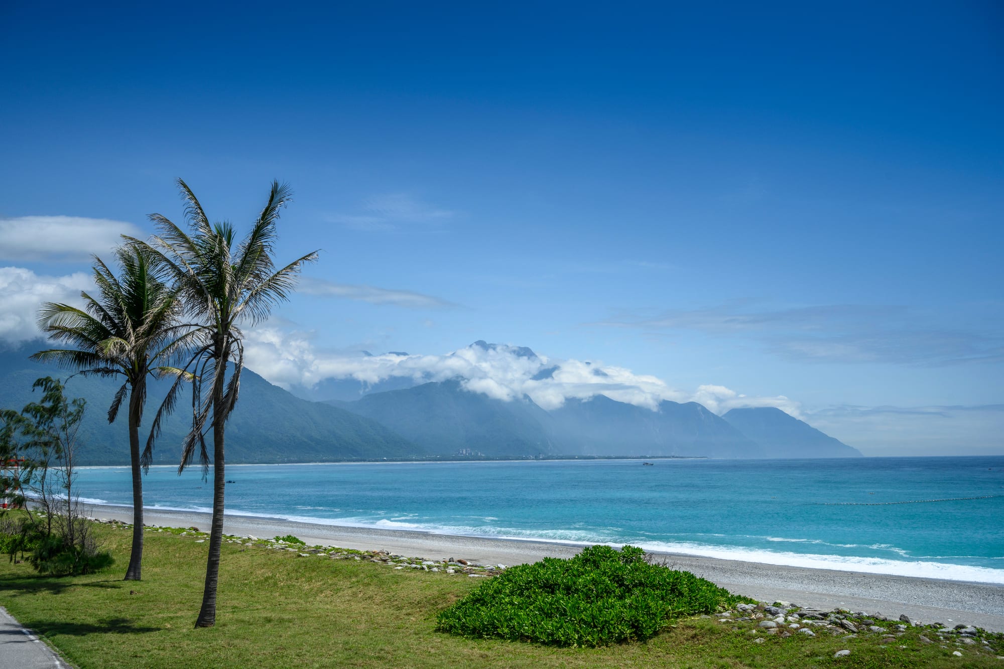
A grey pebble beach curving beside turquoise water, with palm trees in the foreground and cloud-covered mountains along the coast

Hualien, Taitung & the East Coast, Taiwan

Hualien

Qixingtan beach north of Hualien, with the mountains of the east coast beyond. (Artemas Liu / Wikimedia Commons · CC BY-SA 2.0)

The largest city on Taiwan's east coast, set on a narrow coastal plain between the Central Mountain Range and the Pacific. A Japanese-planned port and railway town that grew on marble, cement and sugar, it is now the base for visits to Taroko Gorge and the Qixingtan pebble shore, and the administrative and cultural centre of a county with a large Amis and Truku population.

Neighbourhoods

  • Downtown and the station district
    • First-time visitors
    • Close to public transport
    • Budget stays

    The blocks around Hualien railway station and along Guolian and Zhongshan roads hold most of the city's hotels, hostels, bus stops and car hire desks. It is functional rather than pretty, but almost everything arrives and departs from here.

    Open in Maps
  • Dongdamen and the old centre
    • Best for food
    • Nightlife
    • Evenings out

    The older commercial heart nearer the coast, around Zhongzheng Road and the large night market on the site of the old railway station. Shops, dessert stalls, bars and the city's main evening crowd concentrate in a few walkable blocks.

    Open in Maps
  • Meilun
    • Quiet and residential
    • Parks and views
    • Museums

    A leafy district on the northern side of the city, laid out around Meilun Mountain and the river of the same name. Government offices, schools, a hillside park with views over the plain and some of the better hotels are here.

    Open in Maps
  • The harbour and Nanbin
    • Waterfront walks
    • Cycling

    The working port and the coastal strip south of it, where a seafront path and cycle route run along the shingle beside the Pacific. Cargo cranes, fishing boats and a breakwater sit at one end and open coast at the other.

    Open in Maps
  • Qixingtan and the northern coast
    • Beaches
    • Sunrises
    • Scenic drives

    A long crescent of grey pebbles about seven kilometres north of the centre, backed by a cycle path, cafés and guesthouses. The road continues north towards the mouth of Taroko Gorge and the cliffs beyond.

    Open in Maps
  • Ji'an
    • Quiet and residential
    • Local life

    The township immediately south of the city, a grid of farmland, temples and low housing settled by Japanese migrants in the colonial period. It has spread into a suburb of Hualien while keeping its fields and irrigation canals.

    Open in Maps

Things to do

Around the city

  • Hualien Railway Culture Parkmuseum

    The railway department's Hualien branch office of 1932, which controlled the narrow-gauge line down the east coast, preserved as a gallery of wooden offices, workshops and railway relics.

    Open in Maps
  • Pine Gardenattraction

    A Japanese military command post of 1943 on a pine-covered bluff above the harbour, now an arts venue with views over the coast.

    Open in Maps
  • Hualien Cultural and Creative Industries Parkattraction

    Twenty-six warehouses of a Japanese-era factory in the centre of the city, converted into galleries, studios and performance spaces.

    Open in Maps
  • Hualien Porttransit hub

    The east coast's main commercial harbour, built out from a rocky shore, shipping cement and marble and handling occasional cruise calls.

    Open in Maps

Coast and countryside

  • Qixingtan Beachbeach

    A long arc of grey and white pebbles facing the Pacific, with a coastal cycle path; the shelf drops steeply and the water is not for swimming.

    Open in Maps
  • Liyu Lakepark

    The largest inland lake in the county, in the hills south-west of the city, with a shore path, pedal boats and a forest recreation area with old logging trains beside it.

    Open in Maps
  • Farglory Ocean Parkattraction

    A marine theme park on a hillside above the coast south of the city, with aquarium tanks, rides and sea views.

    Open in Maps

Short trips

  • Taroko National Parkpark

    The marble gorge of the Liwu River north-west of the city, with tunnels, cliffs and shrines; landslides from the April 2024 earthquake and the floods that followed have kept much of the park closed since.

    Open in Maps
  • Qingshui Cliffviewpoint

    Twenty-one kilometres of coastal cliffs averaging about 800 metres above the sea along the Suhua highway north of Taroko.

    Open in Maps
  • Shakadang Trailtrail

    A riverside path cut into the cliff above a clear blue tributary at the entrance to Taroko Gorge, one of the trails struck by rockfalls in the 2024 earthquake and subject to the closures in the park since.

    Open in Maps
  • Eternal Spring Shrinelandmark

    A shrine set above the Changchun Falls in Taroko Gorge in memory of the 212 veterans who died building the Central Cross-Island Highway; landslides have destroyed it more than once, and the present building dates from 1989.

    Open in Maps

Seasonal events

  • Amis harvest festivalsJuly to September

    Villages along the coast and the valley hold days of singing and circle dancing to mark the millet and rice harvest, some of them open to visitors.

  • Daylily bloomAugust and September

    Orange daylily fields cover the hills of Liushidan and Chihke in the valley south of the city, turning whole slopes orange for a few weeks.

  • Lunar New Year temple seasonJanuary or February

    Temples in the city and in Ji'an hold processions, opera performances and offerings through the first weeks of the lunar year.

Eat and drink

Long-standing places and food districts in Hualien. Hours, ratings and directions come from your maps app, always current.

Hualien classics

  • Mochimarket

    Soft glutinous rice cakes filled with peanut, sesame or red bean are the city's standard souvenir, made by long-established shops in the centre and sold in boxes at the station.

    Open in Maps
  • Biandang lunchboxesrestaurant

    Railway lunchboxes of braised pork or fried chicken cutlet over rice, a fixture of the east coast line, sold at the station and in shops around it.

    Open in Maps
  • Wonton souprestaurant

    Hualien has a run of old wonton shops serving thin-skinned pork dumplings in clear broth, several of them trading since the mid-twentieth century.

    Open in Maps

Markets and food streets

  • Dongdamen Night Marketmarket

    The city's big night market, gathering stalls from several older markets on one site, with an Indigenous section selling wild vegetables, sticky rice in bamboo and grilled meat.

    Open in Maps
  • Zhongshan and Zhongzheng road shopsneighborhood

    The everyday eating streets of the centre, with beef noodle shops, dessert counters, bakeries and breakfast stalls between the station and the old town.

    Open in Maps
  • Xinguang Zhaocai marketmarket

    The city's morning markets sell mountain vegetables, betel flower, seafood landed at the port and the fruit of the valley, and have cooked-food stalls at the edges.

    Open in Maps

Experience Hualien

History

Amis villages worked the Hualien plain and Truku communities the gorges behind it long before Han settlement. Chinese farmers from the west reached the river mouth in the nineteenth century and called the place Kilai; the Qing pushed roads over the mountains after 1874 and began to govern the east directly, and conflicts with Indigenous communities ran through the period. The later name Hualien is usually explained as a description of the swirling water where the river meets the sea.

Japanese rule from 1895 made the modern city. The colonial government laid out a grid of streets, dredged a harbour at the rocky shore, and built the narrow-gauge east coast railway from Hualien down the valley to Taitung, completed in 1926; Japanese farming villages such as Yoshino, now Ji'an, were settled nearby, and sugar, timber and rice moved through the port. The Truku war, fought between May and August 1914, broke Indigenous resistance in the mountains and opened them to logging and, later, to the road through Taroko.

After 1945 Hualien became a county seat and an industrial town of marble and cement quarried from the mountains behind it, with veterans who had built the Central Cross-Island Highway settling in the area. The round-island railway was completed in 1991 and the reworked Suhua highway opened in 2020, both shortening the journey from Taipei. Earthquakes have repeatedly marked the city: a strong shock in February 2018 brought down buildings in the centre, and the April 2024 earthquake damaged the gorge and hit the tourist economy hard.

Culture & Customs

Hualien County has one of the largest Indigenous populations in Taiwan, and the city is where that shows in an urban setting. The Amis, whose own name for themselves is Pangcah, are the most numerous, with Truku communities in the mountain townships and the Sakizaya, recognised as a distinct people in January 2007, centred on Hualien itself. Harvest festivals from July to September, circle dancing, woven and beaded clothing, and wild mountain vegetables in the markets are all part of everyday life here rather than a display for visitors.

Layers of migration sit on top of that: Hokkien and Hakka farmers from the west, Japanese colonial settlers whose wooden houses and shrine remains survive in Ji'an and Meilun, and mainland veterans who arrived after 1949. The city is also the home of the Tzu Chi Foundation, the Buddhist charity founded here in 1966, whose hospital, university and volunteers in blue and white are a visible presence.

Stone is part of the local identity too — marble from the gorge appears in pavements, public art and souvenirs, and the city's craft economy grew around it. Manners are Taiwanese and unhurried: people queue, speak quietly on trains, take shoes off where asked and are generous with directions. Residents are proud of living on the quiet side of the mountains and quick to point out that recovery from the last earthquake is still going on.

Daily Life

About 100,000 people live in Hualien City, with roughly 320,000 in the county as a whole — one of the least densely populated parts of Taiwan, strung along a plain that is nowhere more than a few kilometres wide. The city is the county's administrative, hospital and school centre, and people come in from the valley and the coast for offices, markets and medical care.

Work is in government, health and education, in tourism, and in the cement and stone industries that quarry the mountains and ship out through the port. Farming in the surrounding townships produces rice, daylilies, sticky rice, betel and fruit. Younger people leave for Taipei and Kaohsiung, and the population has been slowly falling, though some return to run guesthouses and cafés.

Days follow the weather and the train timetable. Mornings begin early at the markets, the sea breeze picks up in the afternoon, and evenings gather at the night market and along the seafront. Typhoons and earthquakes interrupt the pattern, and the closure of much of Taroko after April 2024 has been the central economic fact for the tourism businesses that many families depend on. Housing is cheap by Taiwanese standards, the mountains are visible from almost every street, and the pace is markedly slower than in the west.

Food

Mochi is the city's signature. Soft pounded glutinous rice cakes, filled with peanut, sesame, red bean or taro, are made in shops that have been trading for generations and sold in gift boxes that leave on every train; a related speciality is thin sheets of mochi-like rice dough wrapped around sweet fillings. The other classic souvenir is the sweet, crisp rice cracker and the peanut brittle sold beside it.

Everyday eating is plain and good. Wonton soup, with thin-skinned pork dumplings in clear broth, is a Hualien institution with several shops of long standing. Biandang lunchboxes — rice under braised pork or a fried chicken cutlet with pickled vegetables and an egg — belong to the railway and are eaten on the platform as much as at a table. Beef noodle soup, sticky rice rolls at breakfast and scallion pancakes fill in the rest of the day.

Two things set the region apart. The first is Indigenous food: wild greens such as bird's nest fern and bitter melon vine, betel flower, freshwater shrimp, flying fish, millet wine and sticky rice steamed in bamboo tubes, sold at the night market and in village restaurants. The second is what the valley grows — daylily buds, dried and fresh, in soups and omelettes; rice from Yuli and Fuli that is among Taiwan's most prized; and pomelo, sugar apple and pineapple in season. Cold drinks lean on local fruit, and the mountain water is a point of local pride.

Planning tools

Budget

Hualien is cheaper than Taipei for food and rooms, and hostels and homestays are plentiful. Prices rise sharply on summer weekends, national holidays and during festivals, when the city's rooms sell out. The largest variable cost is transport: car or scooter hire, or a driver for the day, is close to essential for the gorge and the coast.

Daily Budget Midrange
USD 95–190 (hotel or hot-spring resort room, restaurant meals, car hire or a guided day trip, park entry)
Daily Budget Shoestring
USD 40–60 (hostel or homestay bed, night-market and lunchbox meals, trains and a hired scooter)

Book trains from Taipei and summer weekend rooms as far ahead as possible; the beach, the coastal cycle path and the city parks cost nothing.

Best Time to Visit

October to December and March to May bring the steadiest weather, with warm days and less rain. Summer is hot and humid and is the typhoon season, when roads and trails can close; winter is mild but wet under the north-east monsoon, and the mountains behind the city stay cloudy for days at a time.

Suggested Number of Days

Two days are enough for the city and the nearest coast. Four or five allow the gorge, the coast road and the rift valley as well. Weather and road closures are the main reason to keep a spare day in hand.

First Visit
2 days
With Surroundings
4–5 days

Transportation

Trains along the east coast line are the backbone: they run north to Taipei and south down the valley to Taitung, with a small station at Xincheng for Taroko. The city centre is served by local buses and a growing number of public bicycles, and tourist shuttle buses run to the gorge and along the coast a few times a day. Most visitors hire a scooter or a car, or arrange a driver, for anything beyond the city.

Much of Taroko has been closed since the 2024 earthquake, so check which roads and trails are open before setting out, and remember that buses on the coast and in the valley run only a few times a day.

Airport & Station Connections

Express trains from Taipei take roughly two to two and a half hours through the tunnels of the Suhua route, and the same line continues south to Taitung. Hualien Airport, north of the city, has a small number of domestic flights. Drivers use the improved Suhua highway from Yilan, and long-distance buses run along the same road.

Walkability

The centre is flat and compact: the station, the night market and the old commercial streets are within twenty to thirty minutes of each other on foot, and the seafront path is an easy walk or ride from the middle of town. Beyond that the city spreads out along wide roads, and the beach at Qixingtan and the gorge are too far to reach without wheels.

Safety

Crime is low, but natural hazards are higher than elsewhere in Taiwan. Hualien sits on an active fault zone and suffered a strong earthquake in April 2024, since when much of Taroko National Park has stayed closed. Rockfall, landslides and typhoons can close roads, and the coast has strong currents and a steep shelving shore.

Obey closures in Taroko, do not swim in the open sea at Qixingtan, and know the drill for earthquakes in a hotel room. Check current official travel advice before travelling.

Climate

Subtropical, warmer and wetter than the west of the island at the same latitude, and the first part of Taiwan to meet Pacific typhoons. Rain falls in every month, heaviest in the typhoon season and again under the winter monsoon, and the mountains directly behind the city wring more out of the cloud.

Summer
hot and humid, about 28–33°C, with typhoons from July to September
Winter
mild and often wet, about 16–24°C, with long cloudy spells

Local Customs

Tipping is not expected. Temples welcome quiet visitors who keep out of the way of worshippers. Indigenous villages and festivals in the county are communities first and attractions second: harvest festivals have rules about who may enter the dance circle and when, and photography may be restricted, so ask rather than assume.

Ask before photographing people or ceremonies, use the names communities use for themselves — Amis or Pangcah, Truku, Sakizaya — and take rubbish away from the beaches and riverbeds.

Common Payment Methods

The currency is the New Taiwan dollar. Cards are accepted in hotels, supermarkets and larger restaurants, but night-market stalls, small eateries, homestays and scooter hire usually want cash. ATMs are common in the centre and at convenience stores, which also top up the EasyCard used on buses and trains.