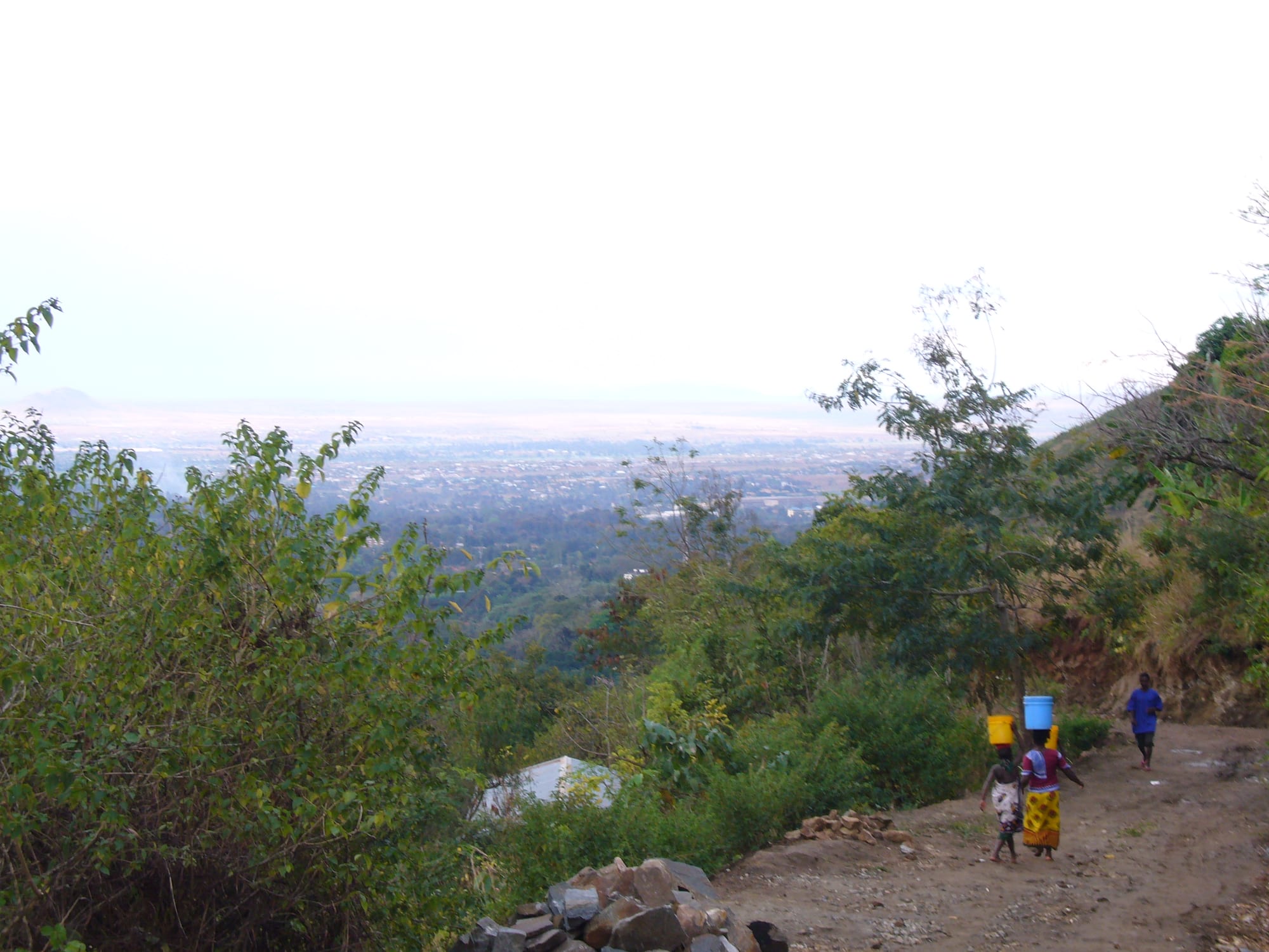
A hazy view over a wide green plain and the roofs of a town, seen from a dirt track on a bushy mountain slope

The Southern Highlands & the South, Tanzania

Morogoro

Morogoro spread over the plain below the slopes of the Uluguru Mountains. (MillaVillaKulla / Wikimedia Commons · CC BY-SA 2.0)

A city at the foot of the Uluguru Mountains on the highway and railway west from Dar es Salaam. Founded as a German administrative post and grown on sisal and agriculture, it is now a market and university town, known for the fruit and vegetables farmed on the mountain slopes above it and as the road approach to Mikumi and the Udzungwa forests.

Neighbourhoods

  • The town centre
    • First-time visitors
    • Markets
    • Close to transport

    The commercial core between the old railway line and the main road, with the market, banks, bus stands, shops and most hotels. It is busy from early morning, easy to walk, and the mountains stand directly above it to the south.

    Open in Maps
  • The market quarter
    • Markets
    • Best for food
    • Local life

    The streets around the central market, where produce comes down from the Uluguru slopes each morning — bananas, avocados, tomatoes, spinach and fruit in quantity — alongside cloth, hardware and cheap eating houses.

    Open in Maps
  • The university and institute area
    • Students
    • Quiet and residential

    The eastern side of town around Sokoine University of Agriculture and the other colleges, with student housing, hostels, bookshops and small bars, quieter in the holidays and busy in term time.

    Open in Maps
  • The mountain foot
    • Walks
    • Views
    • Quiet and residential

    The southern edge of the city where the streets run out into the first slopes of the Uluguru range, with older bungalows, mission buildings, gardens and the paths that climb into the villages above.

    Open in Maps
  • The highway and industrial strip
    • Transport connections
    • Local life

    The corridor along the Dar es Salaam–Mbeya road on the northern side, lined with lorry stops, workshops, warehouses and the remains of sisal and processing industries, where much of the city's working life takes place.

    Open in Maps

Things to do

Mountains and walks

  • Uluguru Mountainstrail

    The steep, densely farmed range rising directly behind the city, with forest reserves at the top, rare plants and birds found nowhere else, and footpaths climbing to Luguru villages and waterfalls.

    Open in Maps

Universities and institutions

  • Sokoine University of Agricultureattraction

    Tanzania's main agricultural university, on the eastern edge of the city, with research farms, forestry and veterinary faculties and a large student population.

    Open in Maps
  • Mzumbe Universityattraction

    A public university in management and administration, established in 2001 at Mzumbe on the Iringa highway south of the city.

    Open in Maps

Short trips from the city

  • Mikumi National Parkpark

    Open plains crossed by the main highway, with giraffe, zebra, buffalo and elephants, and the savanna park most easily reached by road from Morogoro.

    Open in Maps

Eat and drink

Long-standing places and food districts in Morogoro. Hours, ratings and directions come from your maps app, always current.

Markets

  • Morogoro central marketmarket

    A large produce market, filled each morning with fruit and vegetables carried down from the Uluguru slopes, along with spices, dried fish and grains.

    Open in Maps

Food districts and grills

  • Town-centre eating housesneighborhood

    Everyday restaurants near the market and bus stands serve ugali with beans and greens, rice and stew, pilau, chapati, samosas and strong sweet chai.

    Open in Maps
  • The nyama choma barsneighborhood

    Open-air bars around the city grill goat and beef over charcoal, served on a board with kachumbari and either chips or grilled bananas.

    Open in Maps
  • Highway food stopsneighborhood

    Stalls along the Dar es Salaam–Mbeya road sell roasted maize, grilled meat, fruit and cold drinks to bus and lorry passengers breaking the journey.

    Open in Maps

Experience Morogoro

History

The Uluguru Mountains have been farmed by the Luguru for centuries, their steep slopes terraced and irrigated and their land held through the female line, and the plain below was crossed by caravan routes between the coast and the interior. In the middle of the 1800s a Zigula leader, Kisabengo, founded a fortified settlement called Simbamwene where the town now stands, and the Germans, who conquered the country in the 1890s, made it an administrative centre, building a boma, laying out a grid of streets and pushing the central railway from Dar es Salaam through the town.

Colonial agriculture shaped what followed. Sisal estates spread across the plains around Morogoro in the German and British periods, worked by migrant labour, and the town became a processing and transport centre for the fibre, as well as for cotton, oilseeds and later fruit and vegetables. By the middle of the twentieth century the largest sisal estates in East Africa lay in the drier plains that encircle the Uluguru Mountains.

After independence the sisal industry collapsed as synthetic fibres took over, and Morogoro turned back to food crops and institutions. The agricultural faculty at the edge of town became Sokoine University of Agriculture in 1984, named after the prime minister Edward Sokoine, who died in a road accident that year. The highway and, more recently, the standard-gauge railway have kept Morogoro on the country's main artery, and it has grown into one of the larger cities of southern Tanzania.

Culture & Customs

Morogoro's identity is bound to the mountains at its back. The Luguru have lived on the Uluguru slopes for generations, farming smallholdings on gradients that look impossible, and their matrilineal system, in which land and clan membership pass through the mother, is unusual in Tanzania and still governs much of rural life above the city. Their villages, footpaths and terraces are visible from the streets below.

The city itself is mixed. Sisal estates, the railway and the highway brought people from across the country, and Swahili is the common language of a population that includes Luguru, Pogoro, Ngindo, Sukuma and coastal families. Islam and Christianity are both long established, and the calendar runs through Ramadan and Eid as well as Christmas and Easter, with mosques and churches within a few streets of one another in the centre.

Students give Morogoro much of its character: Sokoine University of Agriculture and several other colleges fill parts of the city with young people, cheap restaurants, bars and music, and agricultural research shapes local conversation about seeds, prices and rainfall. Football is followed closely, market day is the social event of the week for many in the surrounding villages, and visitors are expected to greet before anything else.

Daily Life

The municipality counted about 316,000 people at the 2012 census and was projected to pass 390,000 by 2020, making Morogoro one of the larger urban centres in the southern half of the country. Work comes from trade and transport along the highway, from government offices and the universities, from food processing and small industry, and from the farms that ring the city.

Agriculture remains the foundation. The Uluguru slopes produce fruit and vegetables in remarkable quantity, and the plains grow maize, rice, sugar, sesame and sunflower, with the Kilombero valley to the south-west among the country's main rice and sugar areas. Lorries carrying produce to Dar es Salaam and returning with goods for the interior are a constant presence, and the railway adds freight of its own.

Life follows the market and the road. Traders come down from the mountain at dawn, the centre is busiest before the heat of the middle of the day, and evenings are spent at the grills and bars along the main streets. Current issues are the pressure of a growing population on mountain farmland and forest, soil erosion and landslides on the steep slopes, water supply, and the accident rate on the highway that runs through the city.

Food

Morogoro is known across Tanzania for its produce, and that shows on the plate. The market is piled with bananas and plantains in many varieties, avocados, mangoes, pineapples, oranges, tomatoes, aubergines, spinach and pumpkin leaves carried down from the mountain gardens, and vegetables feature more strongly here than in drier parts of the country.

The everyday meal is ugali with beans, greens and a stew of beef, goat or fish, or rice with a coconut-flavoured sauce reflecting the closeness of the coast. Makande, boiled maize and beans cooked together, is a common working lunch, and mchicha, amaranth greens cooked with groundnut or coconut, is the standard vegetable. Plantains are boiled, roasted and cooked into stews in the Luguru kitchen.

Grilled meat is the evening sociable food — nyama choma with kachumbari salad — and the street food follows the national pattern of chapati, mandazi, samosas, grilled cassava and roasted maize, with chai brewed with milk and plenty of sugar. Sugarcane juice and fresh fruit juices are sold everywhere given the supply of fruit.

The highway trade has added its own food culture: stalls and cafés along the road feed drivers and bus passengers at all hours, and travellers passing through often buy fruit here to take on to Dar es Salaam or the highlands.

Planning tools

Budget

Morogoro is inexpensive and geared to Tanzanian travellers rather than foreign ones, with plenty of guesthouses, a few comfortable hotels and cheap food everywhere. The costs that mount up are park fees and vehicles for the reserves nearby, which are usually arranged through operators in the city or in Dar es Salaam.

Daily Budget Midrange
USD 75–170 (hotel, restaurant meals, taxis and local excursions; park safaris cost far more)
Daily Budget Shoestring
USD 25–45 (guesthouse, local food, buses and the market)

A day trip by road to the nearest park is far cheaper here than a fly-in safari elsewhere; carry cash, since cards are accepted only at the bigger hotels.

Best Time to Visit

June to October is dry and clearer, the best stretch for the parks and for walking in the mountains, with warm days and comfortable nights. The rains from about November to April bring heat, humidity, green slopes and slippery mountain paths, and make the side roads harder going.

Suggested Number of Days

A night or two is enough for the city and a walk on the mountain behind it. Three to five days suit a stay that also takes in the parks to the west and south, where the driving distances are what set the pace.

First Visit
1–2 days
With Surroundings
3–5 days

Transportation

The centre is compact and walkable, and bajaji three-wheelers, motorcycle taxis and dalla dalla minibuses cover the rest of the city for very little. Long-distance buses along the Dar es Salaam–Mbeya highway are frequent, and cars with drivers are hired for the mountains and parks.

Agree fares before setting off, use a driver who knows the mountain tracks rather than an ordinary taxi, and avoid long road journeys after dark.

Airport & Station Connections

Morogoro is roughly 190 km west of Dar es Salaam on the main highway, a journey of about three to four hours by bus depending on traffic leaving the coast. The standard-gauge railway from Dar es Salaam also serves the city, and the old central line and the TAZARA route pass through the region, giving Morogoro unusually good connections for its size.

Walkability

Very walkable in the centre, which is flat, laid out on a grid and small enough to cross in twenty minutes or so, with the market, hotels and bus stands close together. The ground rises sharply towards the mountains, where walking becomes hill walking. Pavements are patchy, traffic is heavy on the main roads, and lighting is limited after dark.

Safety

Morogoro is a generally calm city, with petty theft around the market, the bus stands and the highway strip the commonest problem. The greater risks are traffic on the busy Dar es Salaam–Mbeya road, which sees frequent serious accidents, and malaria, which is common at this altitude. Walkers on the mountain should go with a local guide.

Keep well away from the Mozambique border areas of Mtwara and Ruvuma, drive only by day, and follow guides' instructions in the parks. Take malaria precautions, and keep valuables out of sight around the market and bus stands. Check current official travel advice before travelling.

Climate

Warm and humid at the foot of the range, with the mountains behind the city catching considerable rain and staying cooler and greener than the plain. Most rain falls between November and May, with the heaviest weeks around March and April.

Summer
December to March is hot and humid, with days around 31–32°C and heavy afternoon storms
Winter
June to August is drier and more pleasant, with days around 28°C and nights near 13°C

Local Customs

The Luguru of the mountains, who trace descent through the mother's line and hold land accordingly, are the people of this area, though the city itself is mixed and Swahili-speaking. Christians and Muslims live side by side, with mosques and churches close together in the centre. Greetings come first, elders are addressed with shikamoo, and dress in town is modest.

Ask permission before photographing people, farms or homesteads on the mountain, take a local guide for village paths, which cross private land, and tip guides rather than restaurant staff.

Common Payment Methods

The currency is the Tanzanian shilling. Banks and ATMs are easy to find in the centre, and the larger hotels, supermarkets and tour operators accept cards or US dollars. Markets, minibuses, bajaji and small restaurants take cash only, and mobile money is used for most everyday payments by residents.