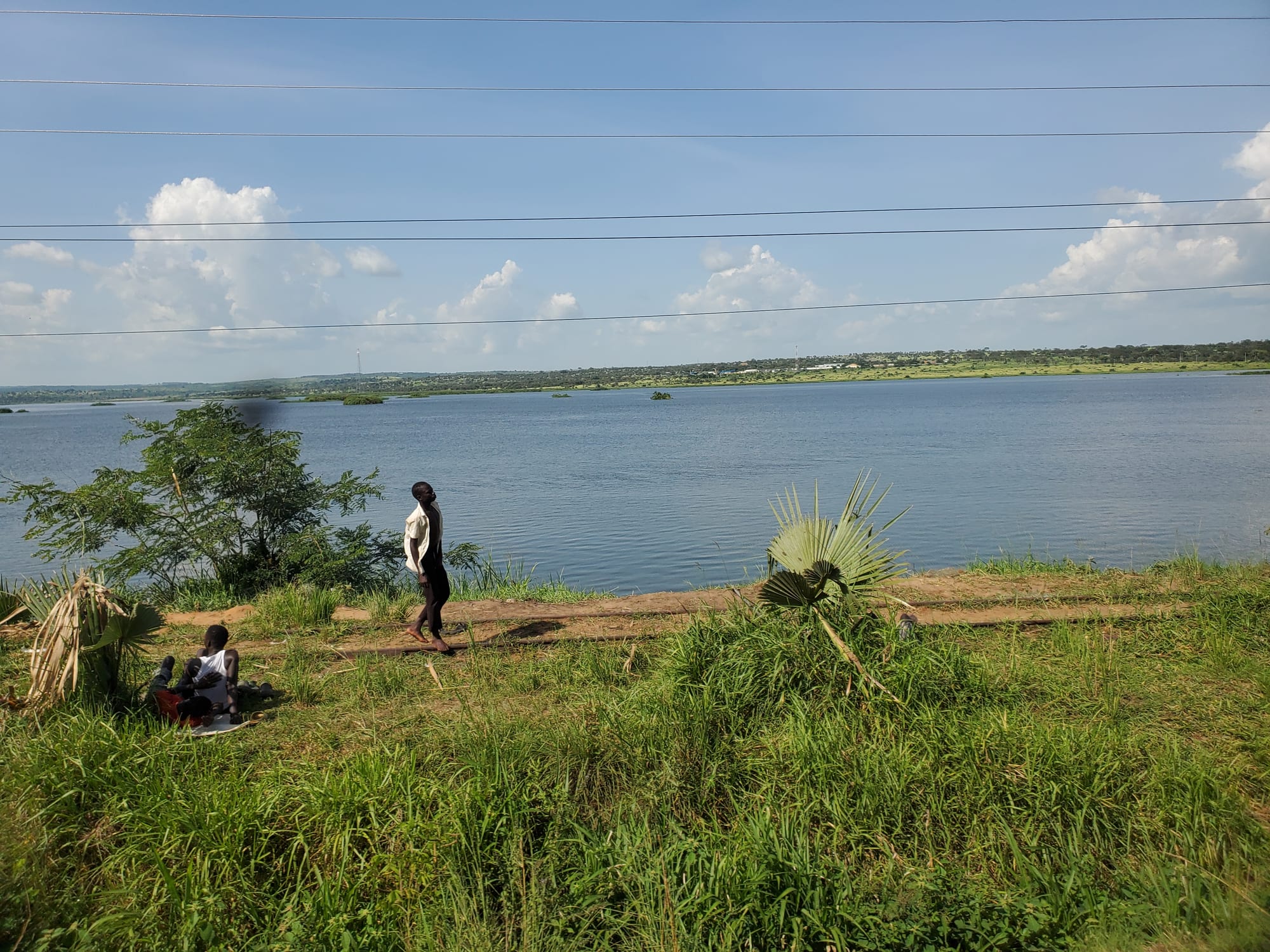
A wide blue river seen from a grassy bank with palms, power lines overhead and low green country on the far shore

Gulu, Kidepo & the North, Uganda

Pakwach

The riverside at Pakwach, in north-western Uganda. (Yesua Aliki Uriah / Wikimedia Commons · CC BY-SA 4.0)

A small town in north-western Uganda where the road to West Nile crosses the Albert Nile a short way downstream of Lake Albert. Home to the Alur, it grew around a ferry, a bridge and the end of a railway line, and lives today on fishing, trade and the traffic heading for the northern side of Murchison Falls National Park.

Neighbourhoods

  • The town centre
    • First-time visitors
    • Markets
    • Close to transport

    A few blocks of trading rows, lodges, fuel stations and bus stops either side of the main road, with the market at their heart. Buses and minibuses for Arua, Gulu and Kampala stop here, and boda-bodas wait for the traffic coming off the bridge.

    Open in Maps
  • The bridge and the riverside
    • Views
    • Local life

    The edge of town meets the Albert Nile, where the road bridge carries everything bound for West Nile. Fishing boats work the banks, hippos are sometimes seen in the river below, and the grassy shore gives long views upstream towards Lake Albert.

    Open in Maps
  • The old railway quarter
    • Quiet and residential
    • History

    Disused tracks and the buildings left from the old line stand on the southern side of the town, a reminder of the railway that once reached the river here. The streets around them are residential, with compounds, small shops and churches.

    Open in Maps

Things to do

In and around the town

  • The Albert Nile at the bridgeviewpoint

    The stretch of river below the road bridge, where the Nile runs north out of Lake Albert towards South Sudan, is wide, slow and busy with fishing canoes.

    Open in Maps
  • Pakwach marketmarket

    The town's trading centre, with smoked and fresh fish from the Nile, cassava, sim-sim, vegetables and household goods brought up from the south.

    Open in Maps

Short trips from the town

  • Murchison Falls National Parkpark

    Uganda's largest national park, whose northern savanna is entered from this side of the river, with elephants, Rothschild's giraffes, buffalo and lions on the tracks towards Lake Albert.

    Open in Maps
  • Murchison Fallslandmark

    The point where the whole Victoria Nile is forced through a gap in the rock only about seven metres wide and drops into the gorge, reached by launch from Paraa or from above.

    Open in Maps
  • Lake Albertattraction

    The long rift-valley lake on the border with the Democratic Republic of the Congo, fringed by fishing villages, whose outflow becomes the river at Pakwach.

    Open in Maps
  • Nebbiattraction

    The town about 50 kilometres west of Pakwach and the headquarters of Nebbi District, from which Pakwach District was later separated, with a market serving the Alur country around it.

    Open in Maps
  • Aruaattraction

    West Nile's main city, a trading centre close to the borders with the Democratic Republic of the Congo and South Sudan, with a busy market and scheduled flights to Entebbe.

    Open in Maps

Eat and drink

Long-standing places and food districts in Pakwach. Hours, ratings and directions come from your maps app, always current.

Pakwach eating

  • Fish at the landing sitesmarket

    Tilapia and Nile perch come off the canoes and are fried whole or smoked over wood; smoked fish is also the town's main export to markets inland.

    Open in Maps
  • The market food stallsmarket

    Cooked beans, cassava, boiled maize, greens with groundnut paste and sweet milky tea are sold among the produce stalls, busiest in the morning.

    Open in Maps
  • The main-road eating housesrestaurant

    Simple places along the highway serve travellers and drivers with rice, posho, beans, stewed goat or fish, chapati and the rolex — a chapati rolled around a fried egg.

    Open in Maps

Experience Pakwach

History

The land on both banks of the Albert Nile here belongs to the Alur, a Luo-speaking people who settled the hills and river country of West Nile over several centuries. They belong to the wider Luo group, whose related communities are spread through northern Uganda, South Sudan and Kenya, and in Uganda they live mainly in the Pakwach, Nebbi, Zombo and Arua districts.

The crossing made the modern town. Before any bridge, traffic between West Nile and the rest of Uganda depended on ferries over the Nile, and Pakwach was one of the points where the road met the river. Under British rule West Nile was a far corner of the protectorate, linked to the rest of the country across the water. A railway was pushed north-west in the 1960s and reached Pakwach, where the line met the steamer route that came down the Victoria Nile, and the town was briefly a railhead for cotton, tobacco and other produce; the tracks now lie disused and the road carries the traffic.

The town shared the upheavals of the north. The collapse of Idi Amin's government in 1979, and the fighting and movement of people that followed it in West Nile, unsettled the town, and the long insurgency in Acholi country to the east disrupted travel and trade for years. Since the mid-2000s the road has been rebuilt, refugee settlements have grown in the districts to the north, and Pakwach became the headquarters of its own district when it was separated from Nebbi.

Culture & Customs

Pakwach is an Alur town, and Alur, a Luo language related to Acholi and to the languages of the Kenyan and South Sudanese Luo, is what is spoken in the market and at home. The Alur kept chiefdoms under hereditary rulers, each called a rwoth, and the Alur Kingdom still counts dozens of chiefdoms in Uganda and across the border in the Democratic Republic of the Congo, alongside district government. Descent, clan and the respect owed to elders still order social life.

Music and dance are part of weddings, funeral rites and community gatherings, with drums, the adungu — the arched harp played across the north — and dances performed by lines of women and men. Christianity, Catholic and Anglican, is dominant, with a Muslim minority and long-standing traditional practices around fishing, rain and ancestors persisting quietly beside the churches.

Being a border-facing trading town shapes manners. Traders, lorry drivers, fishermen and travellers heading for Arua, the Congo and South Sudan pass through constantly, and the town is used to strangers without being a tourist place. Fishing communities on the Nile have their own rules and rhythms, and permission is expected before photographing boats, catches or landing sites. Greetings are unhurried, and time spent on them is never wasted.

Daily Life

About twenty-three thousand people lived in Pakwach at the 2014 national census, and official estimates put it past twenty-eight thousand by 2020, growth helped by its becoming a district headquarters, which brought offices, staff and services with it. The built-up area spreads along the main road, with newer housing on the outskirts and villages of compounds scattered through the surrounding bush and farmland.

Fishing is the oldest trade. Canoes work the Albert Nile and the northern end of Lake Albert for tilapia and Nile perch, and much of the catch is smoked and sent inland. Around it sit farming — cassava, sim-sim, millet, maize, groundnuts and sweet potato — trading in the market, transport work on the highway, and jobs with the district, schools, clinics and the national park. Falling fish stocks, restrictions on fishing gear and the seasonal nature of farming keep incomes uncertain.

The day starts before dawn at the landing sites and in the gardens, the market fills during the morning, and activity thins in the afternoon heat before picking up again towards evening at the roadside stalls and bars. Water supply, electricity that comes and goes, wildlife wandering out of the park, and the condition of the roads north and east are recurring local concerns.

Food

Cooking here belongs to the Alur and the wider north-west rather than to the matooke country of the south. Cassava is the everyday staple, boiled or dried and pounded into flour for a stiff bread, often mixed with millet or sorghum flour and eaten with the hands. Beans, cowpeas, greens and sauces thickened with groundnut or sim-sim (sesame) paste go with it, and shea butter from the trees of the north is used in cooking as well as on the skin.

Fish is what the town is known for. Fresh tilapia and Nile perch are fried whole or stewed with tomato and onion, and smoked fish, dried hard over wood fires at the landing sites, keeps for months and travels to markets far inland. Malakwang, the sour hibiscus-leaf dish cooked with groundnut paste, is eaten across the north and in West Nile is also prepared with fish or beans.

Roadside eating serves the highway: chapati, samosas, roasted maize and gonja (roasted plantain), goat grilled over charcoal, and the rolex, a chapati rolled around a fried egg with tomato and onion. Tea boiled with milk and ginger is drunk through the day, and local brewing — beers from fermented sorghum, millet or maize, sold in calabashes, and the distilled spirit known generally as waragi — is part of evening social life.

Planning tools

Budget

Pakwach itself is cheap, with simple lodges along the main road, local meals and shared transport. Costs rise sharply once the national park is involved: park entry, vehicle fees, a launch trip to the falls and lodge beds are all priced for safari travel, and a hired 4x4 with a driver is the usual way to cover the tracks.

Daily Budget Midrange
USD 160–390 on safari (lodge, park fees, 4x4 with driver-guide)
Daily Budget Shoestring
USD 20–40 (a basic lodge in town, local food, buses and boda-bodas; no park fees)

Draw cash before arriving, as banking is limited, and arrange park entry and a launch trip through an operator or at the gate rather than assuming space on the day.

Best Time to Visit

December to March is the driest time, when park tracks are firm, the grass is short and wildlife gathers near water, though it is hot and dusty. June to August is greener and cooler but wetter, with rougher roads after storms. The river is worth seeing in any season.

Suggested Number of Days

The town is small and takes only a few hours, so most people stay a single night. Two or three days allows time in the national park on the northern bank and a look at the river and lake. Road conditions and whether a vehicle is hired change the number.

First Visit
1 day
With Surroundings
2–3 days

Transportation

The main road from Karuma and Gulu to Arua runs through the town and over the bridge, and buses and minibuses use it all day, stopping at the centre. Boda-boda motorbikes cover the town, the landing sites and nearby villages. Park tracks need a 4x4, and the ferry at Paraa inside the park links the northern and southern banks of the Nile.

Travel between towns in daylight, agree a boda-boda fare before setting off, and allow extra time in the rains when murram side roads soften.

Airport & Station Connections

Pakwach is roughly 350 kilometres from Kampala by road, usually six to seven hours by way of Karuma, and about two hours from Gulu. Buses running between Kampala, Gulu and Arua pass through, and Arua, about 130 kilometres to the north-west by road, has scheduled flights from Entebbe. Charter flights also serve airstrips inside Murchison Falls National Park.

Walkability

The centre is compact and easily crossed on foot in ten or fifteen minutes, and the market, lodges and bus stops sit close together. The bridge and the riverbank are a short walk from the centre. Roads are dusty, there are few pavements, and the heat of the middle of the day slows everything down.

Safety

Uganda is generally safe for tourists on the main routes, with petty theft, road accidents, and boda-boda crashes the everyday risks. Pakwach is a calm trading town, and the region has been peaceful since the Lord's Resistance Army left Uganda in the mid-2000s. The particular hazards here are the river and the wildlife: hippos and crocodiles live in the Nile, and elephants and buffalo move across the park boundary near the road.

Keep well back from the water's edge and away from wildlife, take malaria precautions, avoid swimming in the river or lake because of bilharzia and crocodiles, and travel by day. Check current official travel advice before travelling.

Climate

Hot and lower-lying than most of Uganda, with a single long wet season from about April to October and a hot, dusty dry season from December to March. The river valley holds the heat, and afternoons regularly pass 30°C for much of the year.

Summer
June to August is the wet part of the year, green and about 20–31°C, with heavy afternoon storms
Winter
December to March is hot and dry, often 33–36°C by afternoon, with dust and haze

Local Customs

Alur is the language of daily life, with English used in offices and schools and Swahili heard among traders and travellers; Lugbara and Acholi are also spoken by people passing through. Greetings come before business and elders are greeted first. Dress is modest, churches and mosques are both well attended, and tipping is not expected outside tourist lodges.

Ask before photographing people, fishing boats or landing sites, avoid photographing the bridge, soldiers or police posts, and ask permission locally before visiting a cultural site.

Common Payment Methods

The Ugandan shilling is the currency, and cash is what the town runs on. Card payment is limited to a few lodges in or near the park, banking facilities are basic, and mobile money agents are the common way of sending and receiving funds. Park fees are often quoted in US dollars.