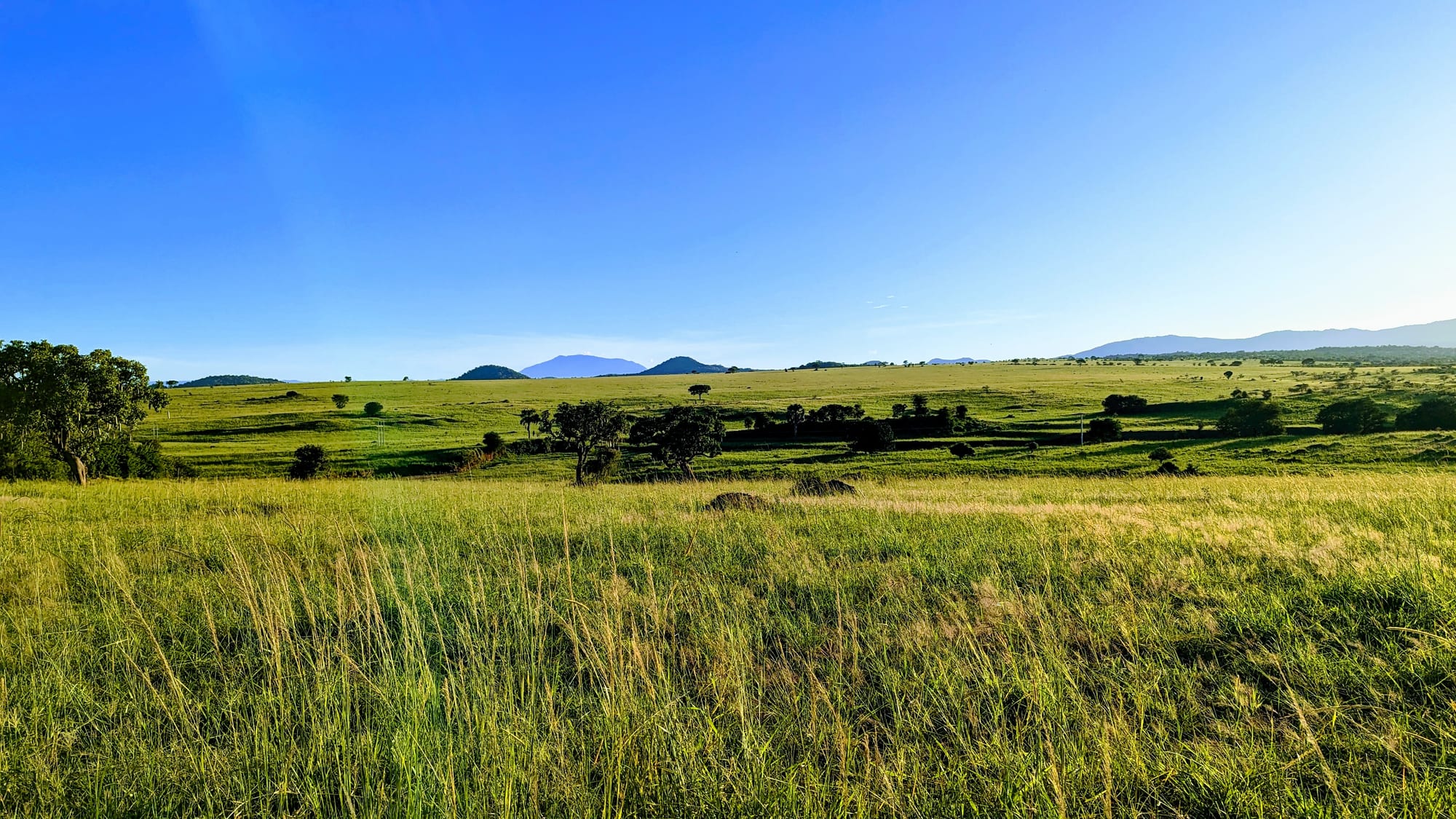
Open green grassland dotted with trees under a clear blue sky, with low blue hills and mountains on the horizon

Uganda

Gulu, Kidepo & the North

Savanna grassland and distant hills in Kidepo Valley National Park, in the far north-east of Uganda. (Kateregga1 / Wikimedia Commons · CC BY-SA 4.0)

Uganda's largest and least visited region, stretching north of Lake Kyoga and the Victoria Nile from West Nile to the semi-arid plains of Karamoja — the lands of the Acholi, Langi, Lugbara and Karimojong, still rebuilding after the Lord's Resistance Army war, with the northern bank of Murchison Falls and the remote Kidepo Valley.

Explore Gulu, Kidepo & the North

History

The north was settled over several centuries by Nilotic and Central Sudanic peoples moving up from the Nile valley and the southern Sudan. The Acholi formed dozens of small chiefdoms, each under a rwot, around Gulu and Kitgum; the Langi settled south of them towards Lake Kyoga; the Lugbara, Madi, Alur and Kakwa occupied West Nile; and the pastoral Karimojong, Jie and Dodoth took the dry north-east. In the 19th century Arab-Sudanese slave and ivory traders operated here, and Samuel Baker's expedition of the 1870s, in the service of Egypt, built Fort Patiko near Gulu to suppress them. West Nile was part of the Belgian Lado Enclave until 1910 and passed to Uganda in 1912.

The British treated the north as a labour and recruitment reserve, and Acholi and Langi men filled the colonial army and police. That legacy ran through independent Uganda's politics. Milton Obote was a Langi, and Idi Amin, from the Kakwa of the Koboko area in West Nile, purged Acholi and Langi soldiers from the army after his 1971 coup; after his fall in 1979 West Nile suffered reprisals and many of its people fled abroad. In 1985 the Acholi general Tito Okello briefly seized power before Museveni's forces took Kampala.

From the late 1980s, first Alice Lakwena's Holy Spirit Movement and then Joseph Kony's Lord's Resistance Army fought the new government. The LRA abducted tens of thousands of children as fighters and servants, and massacres such as those at Atiak and Barlonyo killed hundreds; by the early 2000s most of the rural population of Acholi lived in camps. The LRA withdrew from Uganda after 2006 and the camps closed around 2008–09. In 2021 the International Criminal Court convicted the former LRA commander Dominic Ongwen; Kony remains at large.

Culture & Customs

The north speaks mainly Nilotic and Central Sudanic languages, not the Bantu languages of the south. Acholi and Lango (Leb Lango) are closely related Luo languages, Alur is spoken around Nebbi, Lugbara around Arua, and Ngakarimojong across Karamoja. Acholi identity is strong and carries both pride and grief: the war shaped a whole generation, and post-war justice has leaned partly on traditional reconciliation rites such as mato oput, which both sides accepted at the Juba peace talks.

Acholi music and dance are admired across Uganda: bwola, a royal dance performed with drums and ostrich-feather head-dresses, and larakaraka, a courtship dance, along with the adungu harp. In Karamoja life turns on cattle, which carry wealth, bride price and social standing; young men have long raided cattle as a rite of passage and a way to build a herd. The raids have grown far deadlier as automatic rifles spread.

West Nile is home to a large Muslim minority, especially among the Aringa of Yumbe and the Kakwa, and Arua's culture looks as much towards South Sudan and Congo as towards Kampala.

Daily Life

Gulu, Lira and Arua are the three largest towns, all granted city status in 2020; Kitgum, Moroto, Koboko, Adjumani and Nebbi are smaller district centres. The north is poorer than the rest of the country, and Karamoja is Uganda's poorest sub-region, with chronic food insecurity after repeated droughts.

Most families farm sorghum, millet, simsim (sesame), sunflower, cassava and groundnuts. West Nile grows tobacco and trades across the borders with South Sudan and Congo. In Karamoja herding dominates, although government programmes have pushed settled farming and mining for gold and other minerals has spread around Moroto.

The region hosts much of Uganda's refugee population. Settlements such as Bidi Bidi in Yumbe, one of the largest in the world after the 2016 South Sudanese exodus, Rhino Camp and those around Adjumani give refugees land to farm among host communities. Gulu itself has become a university and aid town, with Gulu University, hospitals, radio stations and returning traders. Land disputes from the camp years, the long-term effects of war trauma, and youth unemployment are the pressing issues.

Food

Northern cooking is built on millet, sorghum, sesame and groundnut paste rather than matooke. Kwon kal, a stiff bread of millet flour, is the Acholi staple, eaten with a thick sauce of groundnut or simsim paste. Malakwang, the sour-leaved sorrel of the hibiscus family cooked with groundnut paste and often sweet potato, is the best-known Acholi dish; the Alur of West Nile also cook it with fish and beans, and it is dried to keep through the dry months. Smoked fish from the Nile is common across the region.

The shea tree grows wild across the north, and its butter is used for cooking as well as skin care; in West Nile, cassava and fish from Lake Albert and the Albert Nile take a larger place. In Karamoja herding comes first and crops are grown only where the rains allow, so milk and grain from the markets carry families through the lean months.

Beer is part of social life. Kwete, brewed by the Lugbara from fermented sorghum, millet or maize, is sold in calabashes in West Nile markets, and home brews of millet beer are shared at gatherings across the north.

Attractions & Natural Wonders

Kidepo Valley National Park, in the far north-east, is remote, and its landscape of long-grass savanna, fan palms and hills at the foot of Mount Morungole has few visitors. The wetter Narus valley draws elephants, giraffes and other game, and the park has recorded more than 77 mammal and 470 bird species. Visits to the Ik villages on Mount Morungole and to Karimojong homesteads can be arranged from the park.

Murchison Falls National Park straddles the Victoria Nile, and its savanna north of the river lies in this region: game-drive tracks lead towards Lake Albert, while launches from Paraa run upstream to the foot of Murchison Falls, where the whole river is forced through a gap in the rock; the southern bank belongs to the Western Region.

Gulu makes a base for Fort Patiko and for memorial sites of the war. Karamoja's plains can be crossed towards Mount Moroto and the Pian Upe Wildlife Reserve, and West Nile has Ajai Wildlife Reserve and the Albert Nile near Pakwach.

Cities in Gulu, Kidepo & the North

Planning basics

Budget

Daily costs in Gulu, Lira and Arua are low, with simple hotels, local food and buses at the cheapest levels in Uganda. The expense comes from distance: Kidepo is a very long drive or a charter flight, and a private 4x4 is needed for the park and for Karamoja. Murchison Falls park fees and lodges are similar to the other big parks, and lodges on the northern bank range from simple camps to upmarket.

Daily Budget Midrange
USD 160–390 on safari (lodge, park fees, 4x4 with driver-guide)
Daily Budget Shoestring
USD 20–40 (guesthouse, local food, buses between towns; no parks)

Combine Murchison's northern bank with Gulu and Kidepo in one loop to cut transfer days, and carry fuel and cash for Karamoja.

Safety

Acholi, Lango and West Nile have been peaceful since the Lord's Resistance Army left Uganda in the mid-2000s, and Gulu is a calm town; the everyday risks are road accidents and petty theft. Karamoja is different: armed cattle raiding between communities, and attacks on vehicles on some roads, persist despite repeated army disarmament campaigns, and governments advise against travel to parts of the sub-region. The border areas with South Sudan see spillover insecurity.

Check the current situation in Karamoja before any road trip, visit Kidepo with an established operator, and follow ranger and police guidance on routes. Check current official travel advice before travelling.

Climate

Hotter and drier than the south, with one long wet season rather than two — roughly April to October in Acholi, Lango and West Nile — and a hot, dusty dry season from about December to March, when the harmattan haze can dull the skies. Karamoja is semi-arid, with unreliable rains and frequent droughts, and afternoons regularly pass 30°C.

Summer
June to August is wet and green, about 18–30°C, with rough roads after storms
Winter
December to March is hot and dry, often 32–36°C, with dust and bush fires

Transportation

Gulu is about five to six hours from Kampala on a paved highway crossing the Nile at Karuma, and buses run on to Kitgum, Lira, Arua and the South Sudan border at Elegu. The northern bank of Murchison is reached from Gulu or across the Nile at Paraa. Kidepo is roughly ten hours or more by road from Kampala, via Gulu and Kitgum, and many visitors fly in by charter to the park's airstrip. Arua has scheduled flights from Entebbe.

Travel with a reputable operator and a 4x4 in Karamoja and Kidepo, and avoid driving between towns after dark.

Best Time to Visit

December to March is the best time for wildlife in Kidepo and on Murchison's northern bank, when grass is short and animals gather near water, though it is the hottest time of year. June to August is possible, but tracks in Kidepo and Karamoja can become impassable after rain. November and April are transition months.