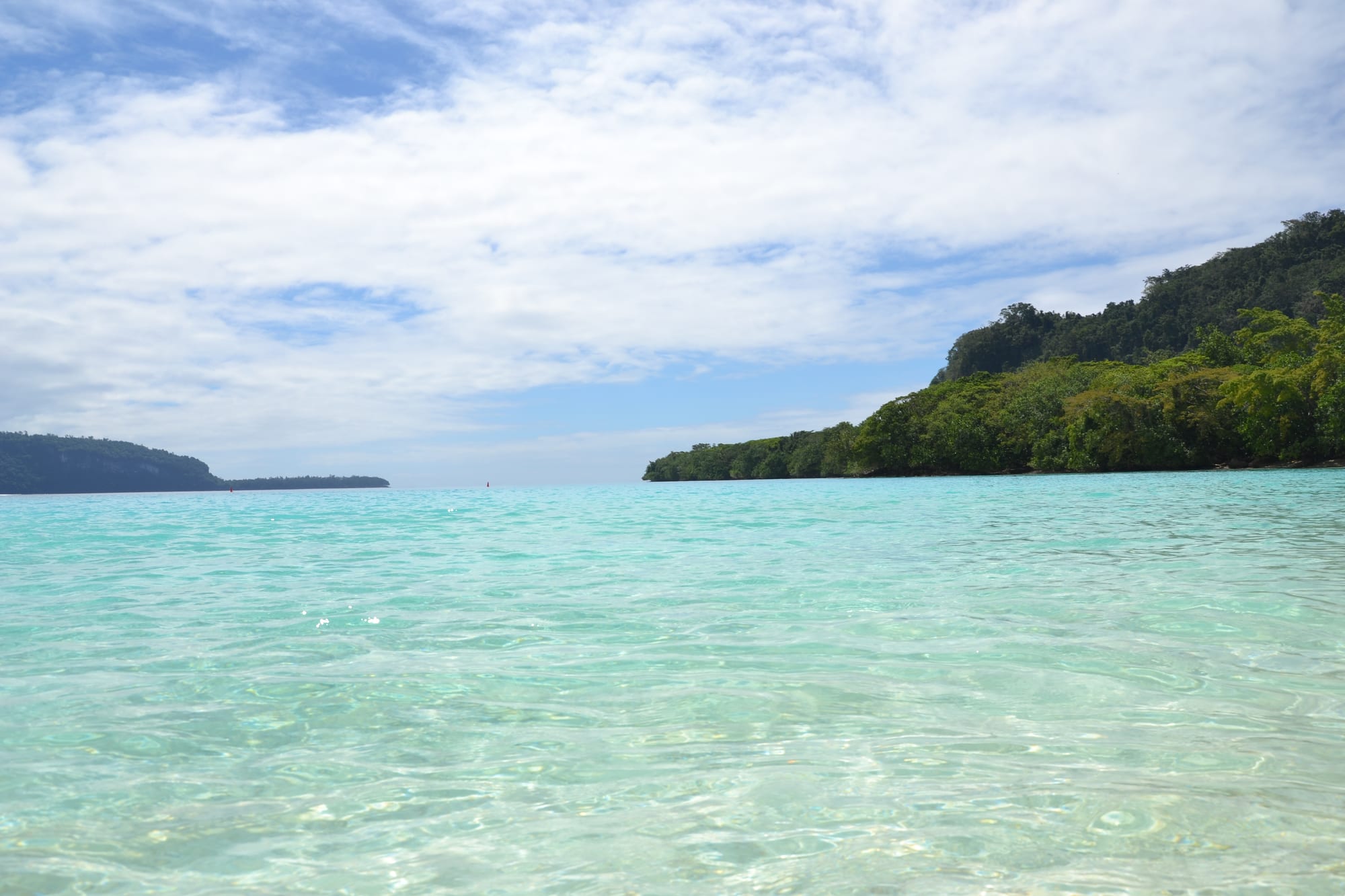
Clear pale turquoise water in a shallow bay, with low forested headlands closing the horizon on both sides

Vanuatu

Espiritu Santo

The shallow water of Champagne Beach on the north-east coast of Espiritu Santo. (Simon_sees from Australia / Wikimedia Commons · CC BY 2.0)

The largest island of Vanuatu, about 300 km north of the capital, with a mountainous forested interior, cattle country on its plains and a coast of white-sand beaches and clear water. Its town, Luganville, grew out of a huge American base of the Second World War, whose wrecks and dumped equipment now draw divers.

Neighbourhoods

  • Luganville
    • First-time visitors
    • Shops and services
    • Diving base

    Vanuatu's second town, laid out along Boulevard Higinson, the unusually wide main street left by the American forces. Banks, the market, the hospital, dive shops, guesthouses and the wharf are all here, and almost every trip on the island starts or ends in it.

    Open in Maps
  • The Segond Channel and Million Dollar Point
    • Diving
    • Wartime history

    The channel east of town, where the President Coolidge lies in diveable water close to shore and the shallows at Million Dollar Point are still full of machinery pushed into the sea at the end of the war. A road runs along the coast past dive operators and small beaches.

    Open in Maps
  • Turtle Bay and the east coast
    • Swimming
    • Rivers
    • Quiet

    The east coast north of Luganville, where rivers cross the coastal plain and Oyster Island lies a short boat ride offshore. Canal Road runs up the coast from the town, and Big Bay Highway turns inland near Turtle Bay.

    Open in Maps
  • Hog Harbour and Port Olry
    • Beaches
    • Day trips
    • Seafood

    The north-east coast, about two hours from town at the end of Canal Road, with Champagne Beach, Golden Beach and the Francophone village of Port Olry. Beach bungalows, simple restaurants and calm shallow water are the reason to go.

    Open in Maps
  • Big Bay and the west
    • Remote travel
    • Walks

    The great bay in the north and the mountain country behind it are the least accessible part of the island, reached by rough track, boat or small plane. Villages here keep strong kastom practice, and the interior rises to Vanuatu's highest peaks.

    Open in Maps

Things to do

Wartime relics and diving

  • SS President Coolidgeattraction

    An American liner converted to a troopship, sunk by mines off Luganville in October 1942 and now among the more accessible large wrecks for divers, its bow lying at about 21 metres and its stern at 73.

    Open in Maps
  • Million Dollar Pointattraction

    The shore where American forces dumped vehicles, supplies and equipment into the sea at the end of the war rather than ship them home, leaving a field of machinery in the shallows.

    Open in Maps
  • Boulevard Higinsonneighborhood

    The main street through town, made wide enough for four tanks to drive along it abreast when the base commander laid it out, and now lined with trade stores, offices and the market.

    Open in Maps

Beaches and islands

  • Champagne Beachbeach

    A curve of fine white sand in a sheltered bay on the north-east coast, drawing visitors for its white sand and clear water.

    Open in Maps
  • Port Olrybeach

    A Francophone village with a large Catholic population at the north-east tip of the island, with white-sand beaches and two small nature-reserve islands reached across a sandbar at low tide.

    Open in Maps
  • Oyster Islandbeach

    A small island a few hundred metres off the east coast, reached by a short boat ride, with sheltered water between it and the shore.

    Open in Maps

Reserves and the interior

  • Vatthe Conservation Areaattraction

    A protected area near Big Bay in the north, one of two conservation areas established to safeguard the island's biodiversity.

    Open in Maps
  • Loru Conservation Areaattraction

    A protected patch of forest on the east coast, set up with Vatthe to safeguard the island's plants and wildlife.

    Open in Maps
  • Mount Tabwemasanaviewpoint

    At about 1,879 metres the highest mountain in Vanuatu, rising in the west of the island above rainforest and reached only on a long guided trek from the coast.

    Open in Maps

Seasonal events

  • Independence Daylate July

    Vanuatu's national day on 30 July brings parades, string bands, sport and custom dancing to Luganville and the villages.

  • Dry-season divingMay to October

    The drier months bring the clearest water and the calmest conditions on the Coolidge and the reefs, and most dive operators work to that season.

  • Cruise ship callsApril to October

    Ships from Australia call at Luganville through the dry season, and market sellers, drivers and beach communities plan around the arrivals.

Eat and drink

Long-standing places and food districts in Espiritu Santo. Hours, ratings and directions come from your maps app, always current.

Luganville classics

  • Luganville marketmarket

    The market along Boulevard Higinson, known for inexpensive food, where growers from around Santo sell laplap, island cabbage, rice, fish and taro alongside stalls of fruit and root crops.

    Open in Maps
  • Main street restaurants and bakeriesneighborhood

    Cafés, bakeries and Vietnamese and Chinese kitchens along the main road, a legacy of the plantation-era labour trade that brought Vietnamese workers to Santo.

    Open in Maps
  • Santo beefrestaurant

    The island's cattle farms send beef to Japan, Australia and other Pacific countries, and steak appears on many menus in Luganville, often beside island cabbage and taro.

    Open in Maps

Experience Espiritu Santo

History

Espiritu Santo carries the oldest European name in Vanuatu. In 1606 the Spanish expedition of Pedro Fernández de Quirós anchored in Big Bay in the north and named the land La Austrialia del Espíritu Santo, in the belief that he had reached the great southern continent. The island had already been settled for thousands of years by Melanesian communities whose languages, gardens and kastom authority remain the basis of village life, and in the 19th century it was reached by sandalwood traders, labour recruiters and missionaries, with French and British planters taking coastal land for coconuts and cattle.

The transformation came in 1942. The United States built Base Button here, the largest American base in the South Pacific, with airfields, wharves, hospitals and roads; more than half a million service personnel passed through the New Hebrides and Espiritu Santo, supporting the Solomon Islands campaign. Two relics define the island's tourism: the President Coolidge, a liner turned troopship that struck defensive mines and sank off Luganville in October 1942, and Million Dollar Point, where surplus equipment was dumped into the sea at the end of the war. Luganville itself, laid out on the base's grid, grew into the country's second town.

Around independence the island was the centre of the Nagriamel movement led by Jimmy Stevens, which declared the Republic of Vemerana on the eve of independence in 1980; the rebellion, known as the Coconut War, was put down between May and August that year with Papua New Guinean troops. Since then Santo has depended on copra, cocoa, kava, cattle and tourism. Cyclone Harold crossed the island in April 2020, damaging houses, crops and infrastructure across the province.

Culture & Customs

Santo is linguistically varied even by the standards of Vanuatu, with more than thirty local languages spoken in its villages and Bislama used between them. French is the everyday second language in Catholic villages such as Port Olry, and Luganville itself was largely French-speaking by the later twentieth century, though more of its people now read English than French — a division that runs back to the condominium's two school systems and still shapes families and politics.

Kastom remains the framework of village life in the interior and the west, where chiefs hold authority, land and reefs belong to clans, and knowledge of gardens, medicine and ceremony passes through families. Access to almost any natural site on the island is therefore a matter of asking the right community, and the small fees charged at beaches, caves and other sites are the mechanism by which tourism income reaches landowners. Slit drums, pig-tusk exchange and grade-taking ceremonies are part of custom practice in parts of the island.

Luganville's culture is more mixed: Ni-Vanuatu from across the archipelago, descendants of Vietnamese plantation workers brought in the colonial period, Chinese traders and Francophone families. Church attendance is high, Sunday is quiet, and evenings belong to the nakamal, where kava is drunk in near silence. Football and school sport fill the afternoons, and Independence Day in July is the year's biggest public event.

Daily Life

Around 37,000 people live on Espiritu Santo, roughly 18,000 of them in Luganville, which makes the island the main population centre of northern Vanuatu. Villages line the east coast road and the bays; the interior is thinly settled, with communities that may be a day's walk from a road. Luganville has the province's hospital, its secondary schools and its wharf, so people travel in for medicine, schooling, banking and shipping.

The economy is more agricultural than the capital's. Santo's cattle farms, some of them founded by French settlers, send beef to Japan, Australia and other Pacific countries, while villages grow copra, cocoa, kava and peanuts, and coastal fishing and gardens feed households. Tourism is concentrated on diving, the north-east beaches and cruise calls, and seasonal work in Australia and New Zealand sends money home to many families.

Daily rhythms follow the light and the weather: gardening and fishing at dawn, the market and offices in the morning, quiet afternoons, kava at dusk. Road conditions dictate much of what is possible, and the wet season cuts off parts of the island. The recurring concerns are cyclone recovery, the price of shipping and fuel, the reliability of domestic flights, and access to health care and secondary education outside the town.

Food

Santo eats the island staples with more meat than most of Vanuatu. Laplap, the national dish, is grated yam, taro, breadfruit or banana mixed with coconut cream, wrapped in banana leaves and baked in a stone oven, and it is served with island cabbage and whatever protein is to hand. Simboro, a steamed roll of grated banana, manioc or taro wrapped in banana leaves with coconut milk, appears at the market and at feasts.

The island's cattle make beef unusually common: steak, beef stew and sausages are standard in Luganville, and Santo beef is sold across the country and exported. Seafood is the other strength: reef fish, lobster, crab and prawns are grilled simply with lime and coconut, and coconut crab is a delicacy whose capture is limited by minimum size rules.

Fruit is abundant — pawpaw, mango, pineapple, citrus, breadfruit and bananas — and the market sells island greens, peanuts and taro alongside them. Bakeries turn out baguettes and pastries, a French inheritance reinforced by Port Olry's Francophone community, and Vietnamese-descended families run long-standing kitchens in town. Tanna coffee, local juices and Tusker beer are drunk alongside kava, which is grown on the island and pounded fresh in the nakamals each evening.

Planning tools

Budget

Santo costs less than Port Vila for rooms and food and more for activities. Guesthouses in Luganville are modest, and beach bungalows on the north-east coast are simple; a few resorts sit at the top of the range. Diving the Coolidge, guided walks, car hire and the flight from the capital are the main outlays, and community-run beaches and other sites charge small access fees in cash.

Daily Budget Midrange
USD 150–320 (hotel or resort, restaurant meals, dive days or guided walks, domestic flights)
Daily Budget Shoestring
USD 55–100 (guesthouse or beach bungalow, market meals, shared transport)

Carry plenty of vatu in cash for beach and site entry fees, village guides and transport, as card acceptance ends outside Luganville.

Best Time to Visit

May to October is the dry season, with the best diving visibility, calmer seas and easier road travel to the north-east coast. November to April is hotter and much wetter, tracks become difficult, and cyclones are most likely between January and March.

Suggested Number of Days

Three or four days suit a first visit, and divers usually want longer because the main wreck takes several dives. Six to eight days allow the north-east coast, the reserves and a longer walk, with slack for weather and for domestic flights that change.

First Visit
3–4 days
With Surroundings
6–8 days

Transportation

Minibuses and shared trucks run along the main roads around Luganville and north up the east coast, filling as they go, and taxis work in town. Hire cars and drivers cover Canal Road north to Port Olry; anywhere else needs a four-wheel drive, a boat or a small plane. Distances are much greater than on Efate.

Arrange transport and guides through accommodation the day before, and allow far longer than the distance suggests once the sealed road ends.

Airport & Station Connections

Santo-Pekoa International Airport, the country's second airport, stands on the edge of Luganville and takes domestic flights from Port Vila along with services to other northern islands. Cargo and passenger ships run from the capital, and cruise ships and yachts use the Segond Channel.

Walkability

Luganville is flat and its main street can be walked end to end, which covers the market, the shops and the banks. Footpaths are patchy, and everything else on the island — the wreck sites, the beaches and the rivers — is too far to walk to in the heat, so a vehicle or a minibus is needed.

Safety

Crime is low, with petty theft the usual problem. The risks are natural and practical: mosquito-borne illness is a risk, so precautions are needed; cyclones strike in the wet season, and Cyclone Harold made landfall on the island in April 2020 causing severe damage; rivers rise quickly after rain; and roads away from the sealed route are rough. Diving the President Coolidge reaches considerable depth and demands appropriate qualifications. Northern Provincial Hospital in Luganville is the referral hospital for the northern islands and depends heavily on donations.

Take medical advice on malaria prophylaxis before travelling, dive the wreck only with a licensed operator and within qualifications, follow cyclone warnings, and carry insurance that covers medical evacuation. Check current official travel advice before travelling.

Climate

Tropical, hot and humid, wetter than southern Vanuatu. The wet season from November to April brings heavy rain, high humidity and cyclone risk; May to October is drier and breezier under the trade winds. The interior mountains are cloudier and much wetter than the coast.

Summer
hot, humid and wet — summer runs December to February in the southern hemisphere, with days around 30 to 32°C and frequent heavy rain
Winter
warm and drier — June to August days are typically around 26 to 28°C, with cooler nights and steadier wind

Local Customs

Bislama is the shared language, and French is widely spoken in Port Olry and other Catholic villages. Beaches, rivers, caves and walking routes are nearly all on custom-owned land, so access is arranged with the community and a fee is normal. Dress is modest away from beaches and resorts, Sunday is a church day, and kava is drunk in nakamals in the evening.

Ask before photographing people, villages or ceremonies, pay the posted community fees without bargaining, use village guides for caves and treks, and keep swimwear to the beach.

Common Payment Methods

The currency is the vatu (VUV). Luganville has banks, ATMs and card acceptance in hotels, dive shops and larger stores; beyond the town it is cash only, including for beach entry, boats, guides and village bungalows, so vatu should be drawn in town before setting out.