Attractions & Natural Wonders · Montserrat
Montserrat: Five Attractions and Natural Wonders
A Caribbean island whose capital was buried by its own volcano — the 'Emerald Isle' that lost two-thirds of its population and has spent three decades living beside an active volcano
By Worldlore Editorial · 30 September 2026
The island that lost its capital to a volcano
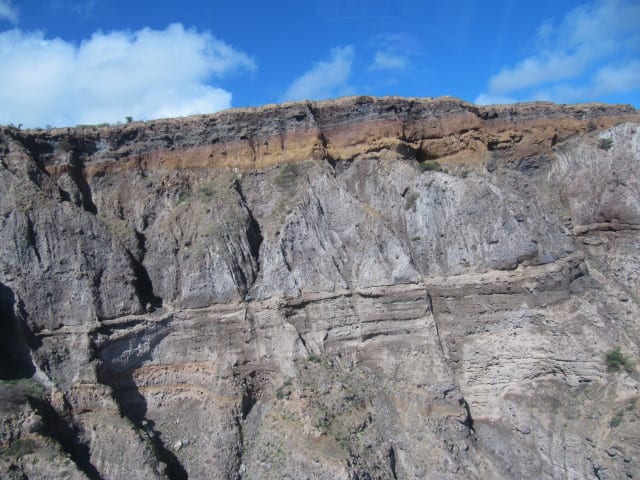
Montserrat, a small British Overseas Territory in the Leeward Islands, was known before 1995 mainly as a quiet, lush "Emerald Isle" retreat, home to the AIR Montserrat studio where the Police, Dire Straits, Paul McCartney, Elton John and other major artists recorded. On 18 July that year, the previously dormant Soufrière Hills volcano began erupting, and over the following years destroyed the capital, Plymouth, made more than half of the island uninhabitable, and forced about two-thirds of its people to leave: fewer than 1,200 remained in 1997, and the population had recovered to nearly 5,000 by 2016. The volcano remains active and closely monitored, and the southern half of the island is an exclusion zone with restricted access.
The five below are almost all connected to that story. Montserrat is warm year-round; the hurricane season runs June to November.
1. The Soufrière Hills volcano
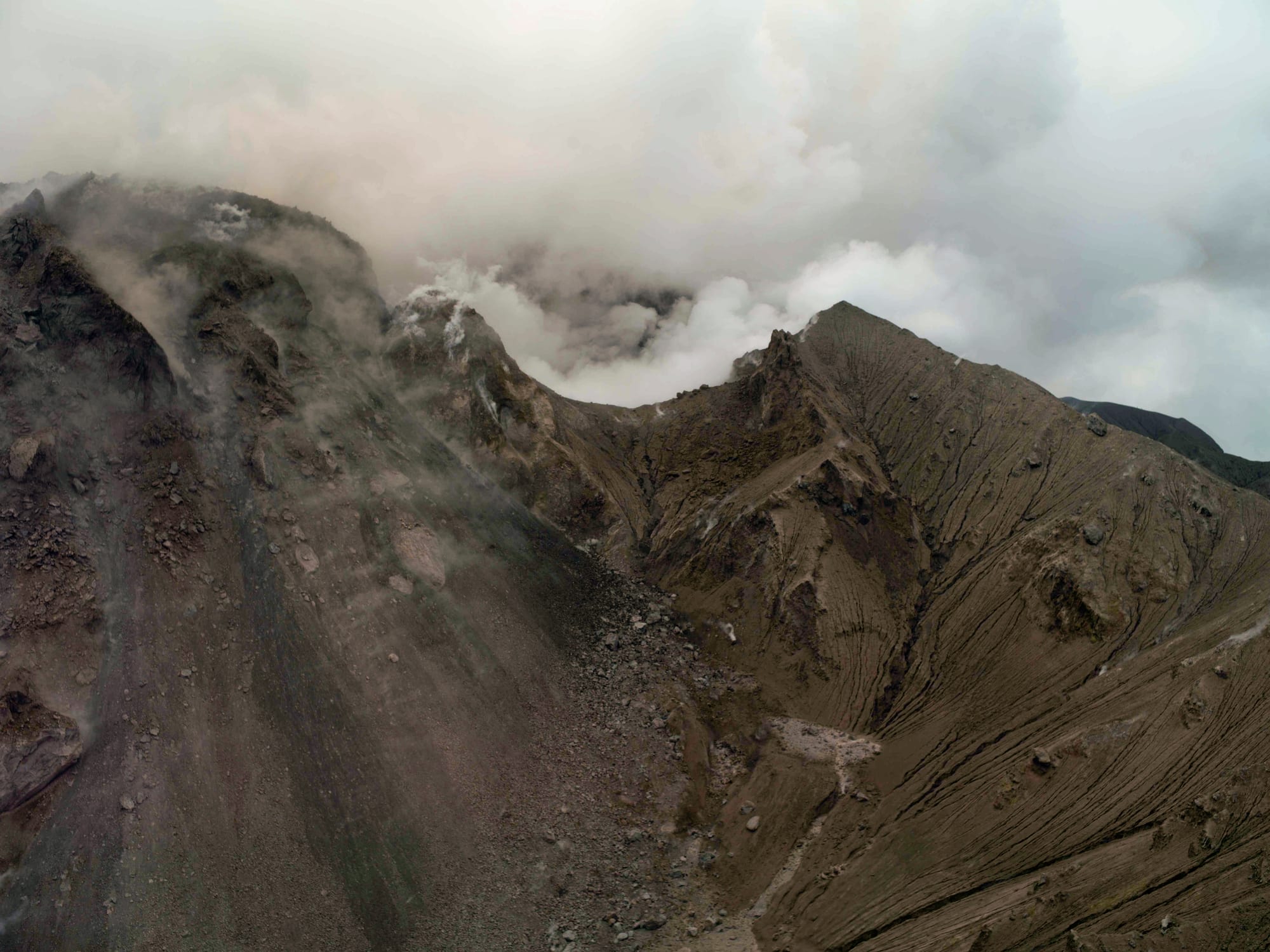
The Soufrière Hills volcano, dormant for centuries, began erupting on 18 July 1995 and continued until 2010 in cycles of activity, building and periodically collapsing lava domes that sent pyroclastic flows and ash across the south of the island. It remains an active volcano, monitored around the clock, and can be seen from safe viewpoints in the north.
The volcano's activity level changes over time; always check current status and access restrictions before planning a visit near it.
2. Plymouth, the buried capital
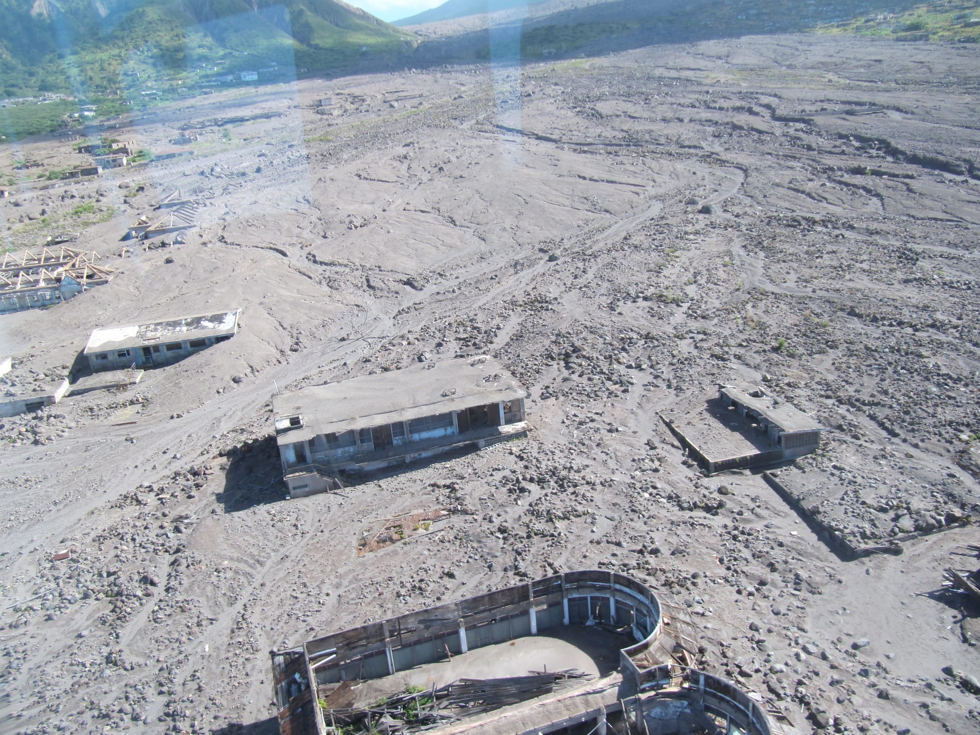
Plymouth, once a Georgian-era Caribbean capital of about 4,000 people, was progressively buried under more than 40 feet of ash, pyroclastic flows and volcanic mudflow (lahars) between 1995 and 1997, and abandoned entirely. It remains the de jure capital, the only ghost town that is the capital of a political territory. Rooftops and upper floors of buildings still protrude from the ash in places.
Plymouth lies inside Zone V, the highest-risk part of the exclusion zone, where there is currently no public access; it can be seen from Garibaldi Hill above Isles Bay.
3. The exclusion zone
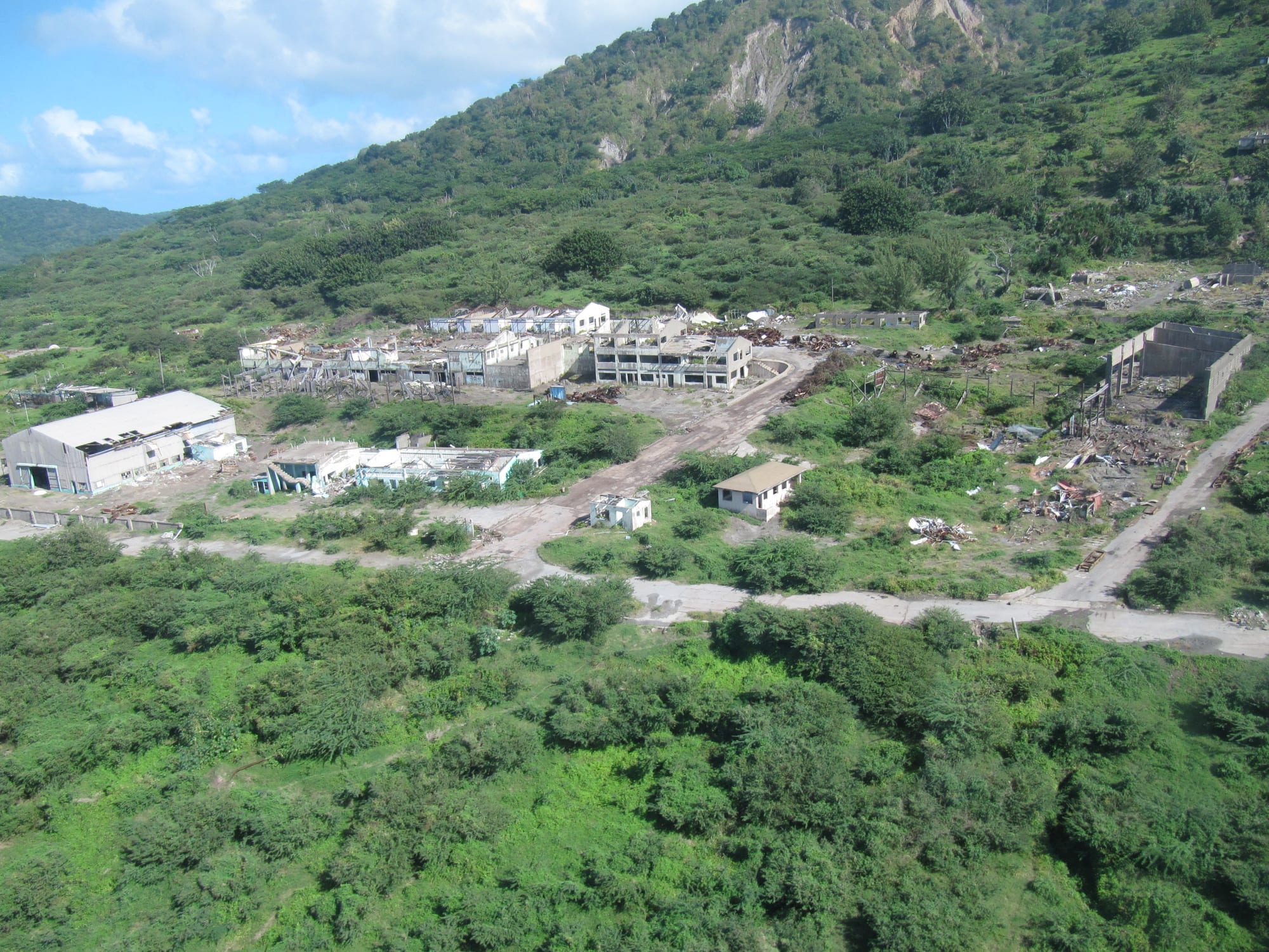
The southern half of Montserrat, including Plymouth and the former airport, is designated an exclusion zone because of ongoing volcanic risk, its abandoned villages and roads left largely as they were when evacuated. Viewpoints on the edge of the zone give a striking, sobering look at a landscape reshaped by the volcano.
Visitors are generally not permitted to enter the zone, and access depends on the hazard level set on the Observatory's advice.
4. The Montserrat Volcano Observatory
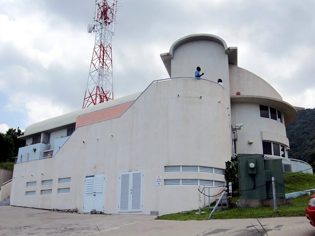
The Montserrat Volcano Observatory, in the village of Flemmings, has monitored the volcano since the first explosions in July 1995. Its visitor centre has posters, artefacts and interactive exhibits on the eruption and on how the volcano is monitored, along with a documentary about it. It is the best single stop for understanding what happened and what is still happening geologically.
It sits on the edge of the inhabited north, a natural first stop before any tour further south.
5. Little Bay and the new north
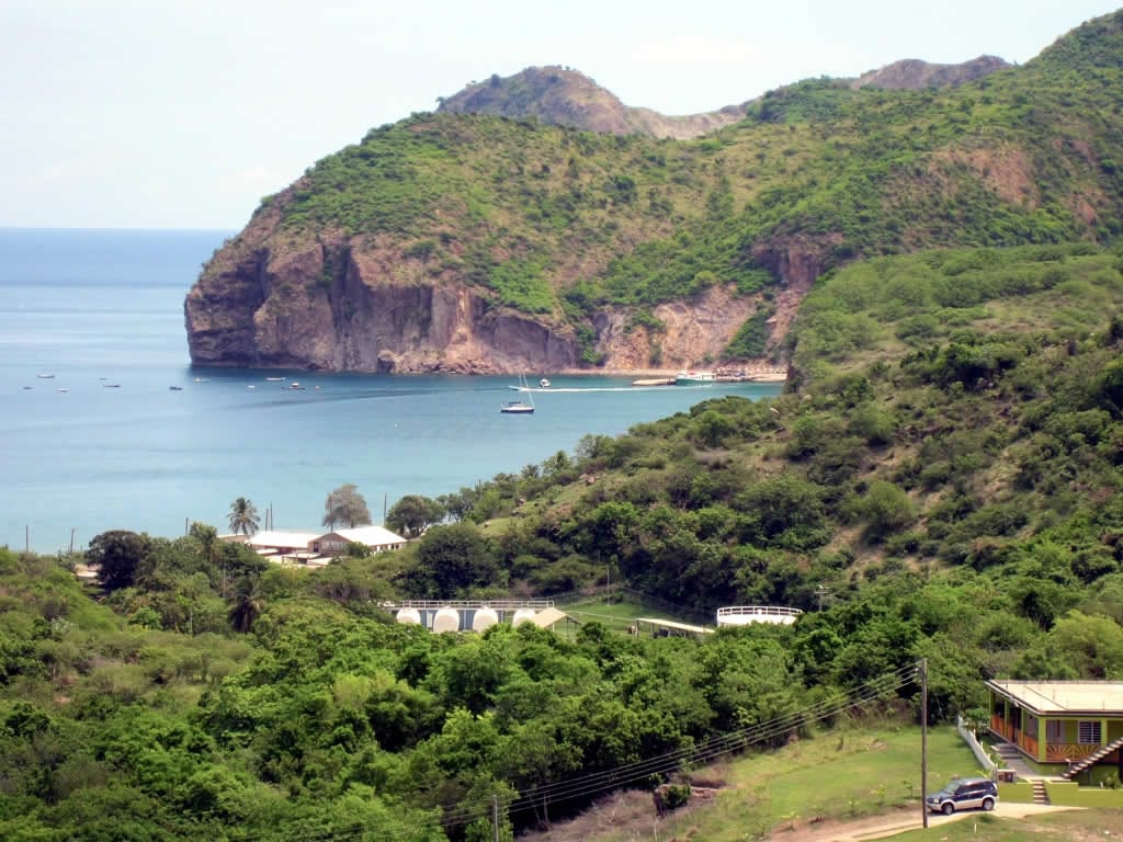
Since the disaster, life on Montserrat has rebuilt itself in the safer north of the island, centred on the small town of Brades, the de facto capital, and the planned new capital at Little Bay, where construction of a new port began in 2019. The island's volcanic soil and steep, forested terrain also make for good hiking in the Centre Hills, the last Montserrat refuge of the critically endangered mountain chicken frog, now very rare or gone in the wild there and kept going by captive breeding, alongside sandy coves on the western coast.
This is where almost all remaining island life, accommodation, and services are now based.
Montserrat is a small, specialist destination rather than a beach-resort trip — most visitors come specifically for the volcano story, arriving by small plane or boat from Antigua, about 25 miles away, and stay two or three days, split between the Observatory, a guided exclusion-zone tour, and the quieter north.