Attractions & Natural Wonders · Mauritania
What is the giant eye in the Sahara that you can see from space?
The Richat Structure in Mauritania is not a crater but a 40-kilometre dome of rock, pushed up by magma and worn down into rings over 100 million years.
By Globeway Editorial · 2 November 2026
The short answer
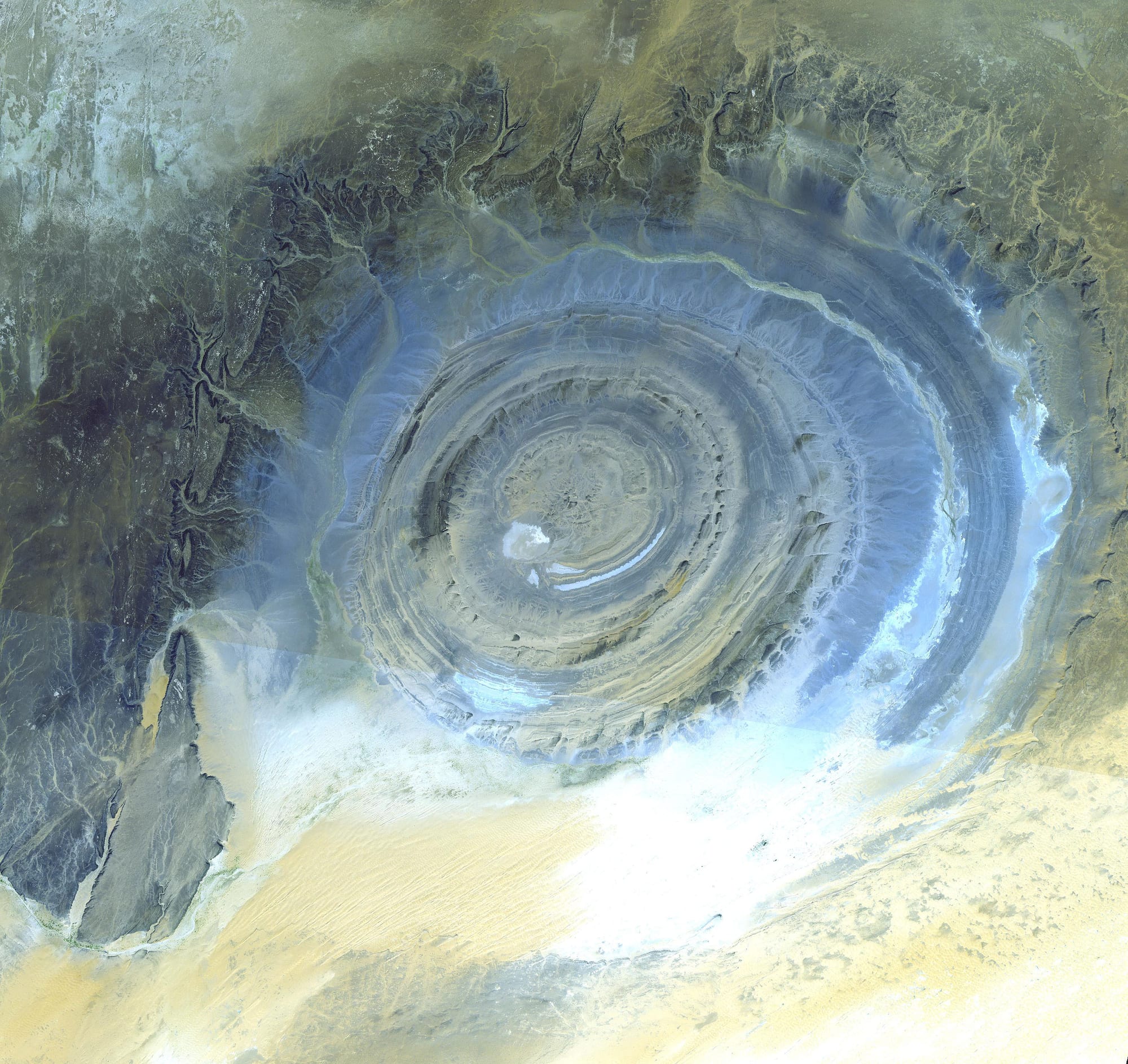
The "Eye of the Sahara" is the Richat Structure, known locally as Guelb er Richât, a ring-shaped landform about 40 kilometres across on the Adrar Plateau of Mauritania, near the old caravan town of Ouadane. From orbit it looks like a giant bull's-eye or an iris staring up from the desert, and astronauts have used it as a landmark since the early days of human spaceflight.
It is not an impact crater and not the work of people. It is an eroded dome. Around 100 million years ago, in the Cretaceous period, molten rock pushed up from below and bowed the overlying layers of sedimentary rock into a blister. Wind and water then planed the top off, exposing the tilted layers as concentric rings, like the cut face of an onion. Hard bands of quartzite stand up as ridges; softer rock between them has worn into hollows.
An onion sliced by erosion
The rings are a record of rock layers laid down over hundreds of millions of years. The oldest rocks, from the late Proterozoic eon, sit in the centre; the youngest exposed layers, Ordovician sandstones, form the outer edge. All of them tilt outward at 10 to 20 degrees, because the dome pushed them up in the middle. Where a hard layer of quartzite sits on softer rock, erosion has carved a cuesta, a ridge with a gentle slope on one side and a steep one on the other. Seen from above, the cuestas trace circle inside circle.
The engine underneath is still there, buried. Inside the structure geologists have found volcanic and intrusive rocks, including rhyolite lavas, gabbros, carbonatites and kimberlites. The gabbros form two ring dykes, walls of once molten rock that filled circular cracks: an inner ring about 30 metres wide, 3 kilometres from the centre, and an outer one about 70 metres wide, 8 kilometres out. Thirty-two carbonatite dykes and sills have been mapped, and these rocks cooled between 94 and 104 million years ago. Together they point to a large body of alkaline magma lying beneath the dome.
Hot water did the rest. Fluids circulating through the fractured rock above the magma dissolved and altered it, and the centre collapsed into a megabreccia, a jumble of broken rock fragments cemented by silica, at least 40 metres thick in the middle. That alteration has been dated to about 98 million years ago. A study published in 2024 suggests the story began even earlier, with the gabbros intruding some 230 to 200 million years ago and the carbonatites arriving about 100 million years ago.
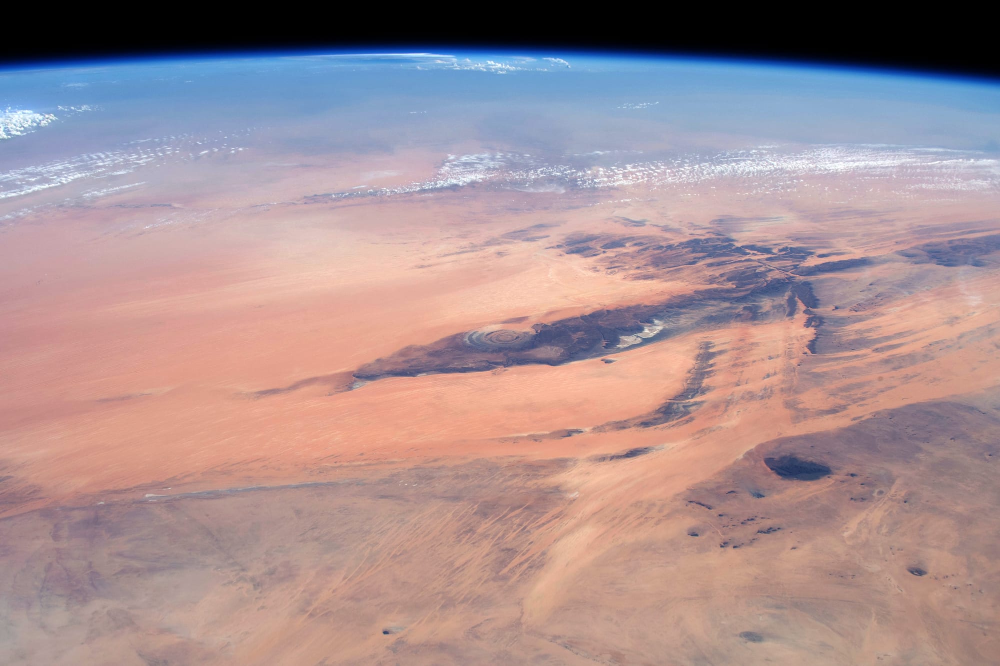
From about 410 kilometres up, the rings are one of the few features that break the evenness of the western Sahara.
Why it took space to see it
On the ground the Richat is surprisingly hard to grasp. Its ridges rise only 20 to 30 metres or so above the hollows, and they are so wide apart that a traveller crossing them sees a series of low escarpments, not a circle. French soldiers described it roughly as early as 1916, and it first appeared on a map in 1922. The French naturalist Théodore Monod became the first scientist to visit it, on 7 July 1934.
Its full extent was revealed only in 1965, when photographs taken during NASA's Gemini missions showed the whole bull's-eye at once. Its shape stood out in an otherwise featureless stretch of desert, and it became a reference point for astronauts and later for space shuttle crews.
The crater that was not
For a long time the obvious explanation was a meteorite. In 1952 an expedition led by Monod recorded four circular features in the region: Richât, Aouelloul, Temimichat-Ghallaman and Tenoumer. The other three are now accepted as impact craters, and the Richat was at first lumped in with them.
The evidence did not hold up. Field and laboratory studies in the 1960s found no sign of shock metamorphism, the changes that only the enormous pressure of a high-speed impact can make in rock. Coesite, a mineral formed by such shocks, was reported in early samples, but in 1969 a further analysis showed it had been mistaken for barite, an ordinary mineral. Studies by Matton and colleagues, published in 2005 and 2008, concluded firmly that it was not an impact structure, and aeromagnetic and gravity surveys of what lies underneath have since confirmed the picture of an uplifted, eroded dome. In October 2022 the International Union of Geological Sciences named it one of its first 100 geological heritage sites, as "a spectacular example of a magmatic concentric alkaline complex".
Hand axes, burial mounds and the Atlantis myth
The eye also holds a long human story. Its outer ring is the site of exceptional concentrations of Acheulean stone tools, the oval and pear-shaped hand axes associated with Homo erectus and related early humans, made from the quartzite of the ridges themselves. Later tools of the Aterian culture, made by modern humans between about 145,000 and 29,000 years ago, have been found too. Sediments laid down between 15,000 and 8,000 years ago, during the African humid period, when much of the Sahara was green, preserve freshwater fossils. The ridges are lined with thousands of stone burial mounds that have yet to be excavated and dated, and nearby rock art shows horsemen with javelins, chariots and elephants.
Its concentric rings have also made it the subject of a fringe claim that it was Plato's Atlantis, which he described as a city of rings. Most classicists regard Atlantis as an invention of Plato's, and critics point out that the Richat is a natural formation far older than any city, that no trace of a city or of Plato's canals has been found there, and that it lies hundreds of kilometres inland, in the middle of a desert.
Seeing the eye from the ground
Ouadane, the nearest town, lies on the southern edge of the Adrar Plateau. It was a staging post on the trans-Saharan caravan routes, trading in slabs of salt, and its ruined old town is part of a UNESCO World Heritage Site inscribed in 1996, together with Chinguetti, 93 kilometres to the south-west. As pictures of the Richat spread, visitors began to come, and a simple reception camp was set up at the site.
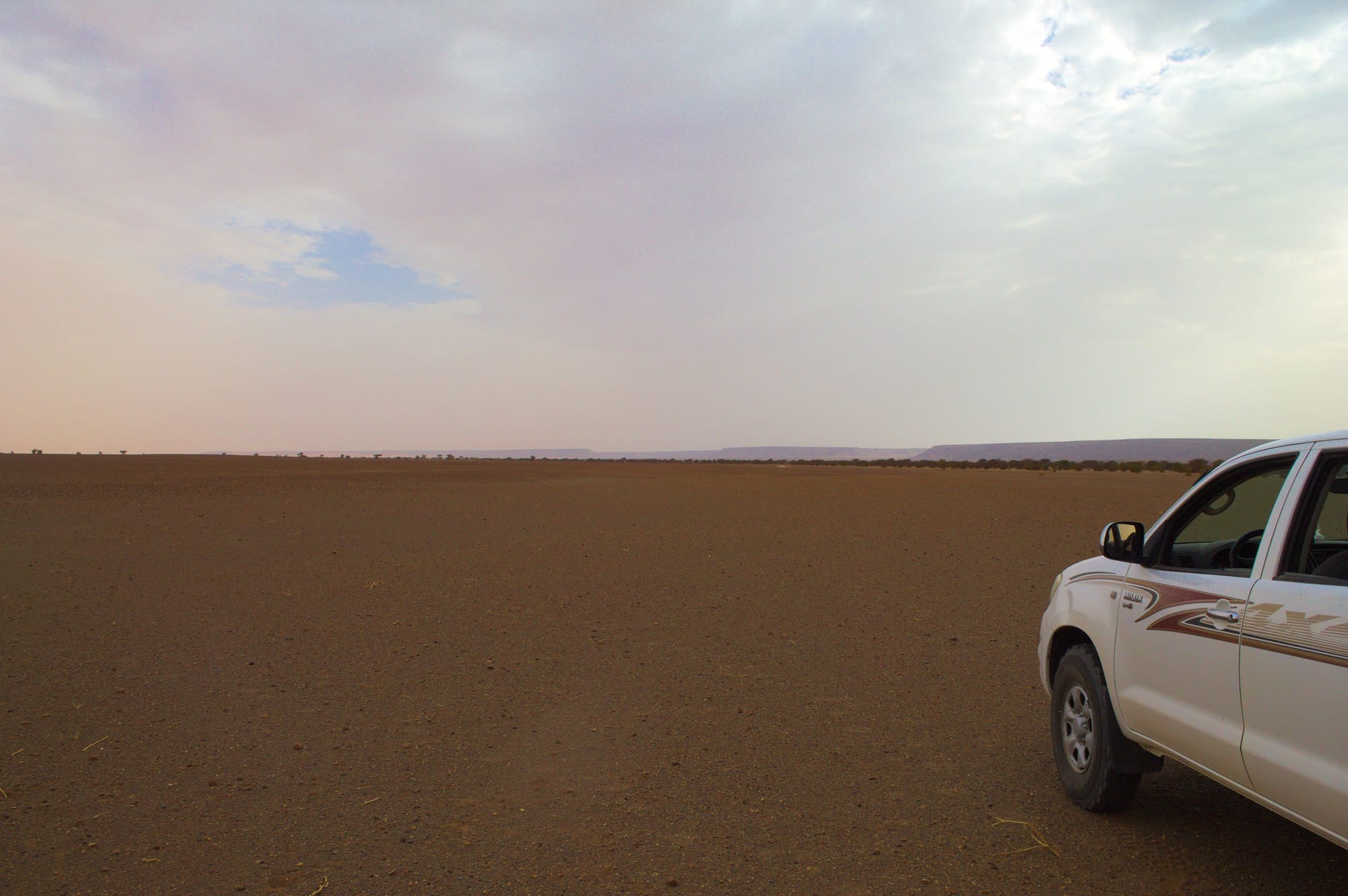
Crossing the structure means driving ridge to ridge across wide hollows; the pattern only makes sense from high above.
November to February is the season for the Adrar, with warm days and cold nights; inland summers often reach 40 to 45°C. The Adrar circuit around Atar, Chinguetti and Ouadane is generally calm, and the structure is usually reached by four-wheel drive with local operators, keeping to established desert routes.