History · Federated States of Micronesia
Who built the stone city on the coral islets of Micronesia?
Nan Madol was built by the people of Pohnpei themselves, as the ritual and royal capital of the Saudeleur dynasty, which ruled the island until about 1628.
By Globeway Editorial · 2 November 2026
The short answer
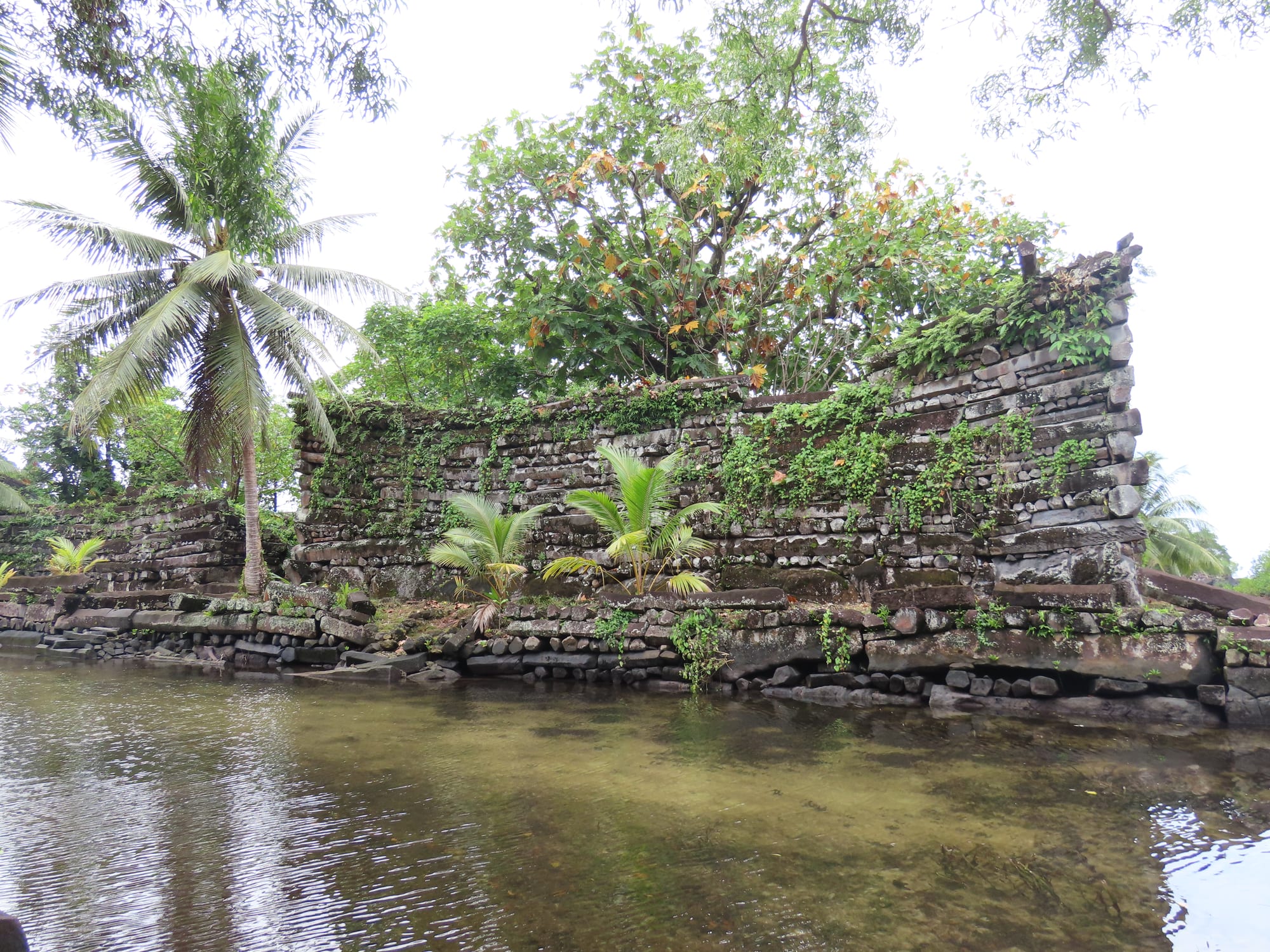
The stone city is Nan Madol, off the east coast of the island of Pohnpei, and it was built by Pohnpeians. Over several centuries the islanders raised 92 artificial islets on a coral reef flat in a shallow lagoon, then walled them with long, naturally six-sided columns of basalt, a dark volcanic rock. From around 1180 onwards the work was directed by the Saudeleur dynasty, the first government to unite all of Pohnpei, and Nan Madol became its ceremonial and political capital.
Pohnpeian tradition tells the story differently: twin sorcerers arrived from across the sea and flew the stones into place with the help of a flying dragon. Over the past century writers have also claimed the ruins for a lost continent or a forgotten ancient civilisation. Archaeology and radiocarbon dating point firmly to the island's own people, and experts in Pacific archaeology have called one recent alternative theory insulting to the Pohnpeian ancestors who built the city.
A city of islets and canals
Nan Madol lies in the Madolenihmw district of Pohnpei state, between the main island and the smaller Temwen Island. Its walled core covers an area roughly 1.5 kilometres long and 0.5 kilometres wide. Each islet is a platform of stone and coral fill, and tidal canals run between them, which explains both the name, usually translated as "within the intervals", and the modern nickname "Venice of the Pacific". An older name, Soun Nan-leng, means "Reef of Heaven".
People were active on the site as early as the first or second century AD. Islet building had started by the 8th or 9th century, and the distinctive megalithic architecture, built of huge stones, began around 1180 to 1200. In other words, Nan Madol was not raised in a single burst but grew over centuries, as Pohnpei's society became more organised and its rulers more powerful.
Basalt logs from the far side of the island
The building material is the most striking thing about Nan Madol. Its walls are made of long basalt columns, stacked in alternating layers, lengthwise and crosswise, like logs in a log cabin. These columns are not carved. Basalt sometimes cracks into regular many-sided columns as lava cools and contracts, a process geologists call columnar jointing, and the builders took advantage of it.
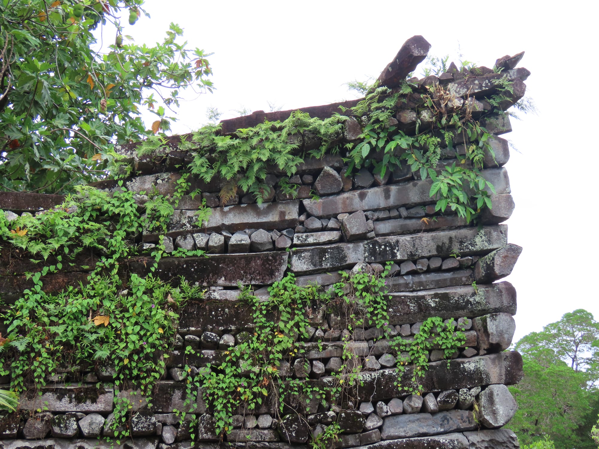
The columns are natural shapes, formed as lava cooled, not blocks cut by masons.
The stones were brought from the other side of Pohnpei, where a volcanic plug, the hardened core of an old volcano, supplied the columns. Some columns are several metres long and very heavy, and how they were moved is still debated. No written record of the methods survives, which is one reason the legends have flourished.
The finest structure is Nandauwas, the royal burial islet, where walls 5.5 to 7.5 metres high surround a central tomb enclosure. It was built for the first Saudeleur ruler. The 58 islets of the north-eastern sector, Madol Powe, were given over to the dead and to the priests who tended them, while others had practical jobs: canoes were built on Dapahu and coconut oil was made on Peinering.
The Saudeleur lords and their capital
The Saudeleur dynasty ruled Pohnpei from around the 12th century until about 1628, uniting an estimated 25,000 people. According to oral tradition, the dynasty began with the twin sorcerers Olisihpa and Olosohpa, who came from a mythical land to the west seeking a place to build an altar to their god of agriculture. When Olisihpa died, Olosohpa became the first Saudeleur, and his line produced sixteen more rulers.
Nan Madol was the seat of their power. Fewer than 1,000 people almost certainly lived there, and perhaps under 500. Some were chiefs, but most were commoners. Requiring rival chiefs to live in the city, rather than in their home districts, let the Saudeleur keep an eye on them. The islets had no fresh water and grew no food, so islanders brought everything by boat, and over the generations the rulers' demands for tribute grew heavier. In legend, the early rulers were kind and their successors increasingly oppressive.
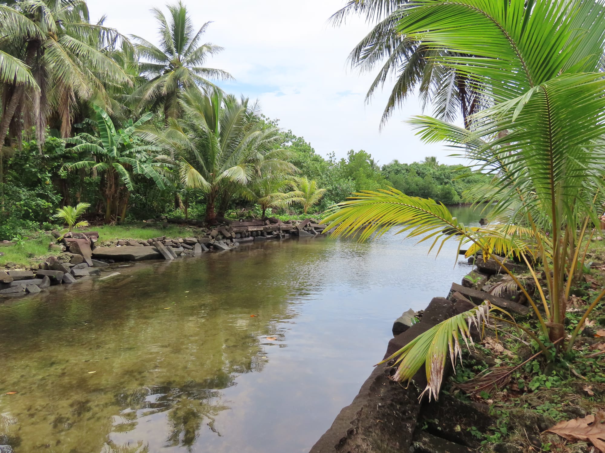
Food and fresh water had to be brought to the city by canoe along channels like this one.
The warrior who ended an era
The Saudeleur rule ended with an invasion led by Isokelekel, a semi-legendary hero said in most versions to be the son of the Thunder God. He sailed to Pohnpei with 333 followers, and at least 13 differing accounts of the war that followed have been published. All end with the Saudeleur defeated. Isokelekel lived at Nan Madol and introduced the system of chiefs called nahnmwarki, which divided power among Pohnpei's districts and is still in use on the island today. Modern Pohnpeian chiefs trace their descent from him.
Isokelekel's successors abandoned Nan Madol. Without the old tribute system, the chiefs had to fetch their own water and grow their own food, and the city emptied. A sharp decline in population may also have played a part.
Lost continents and other myths
Because so little was written down, outsiders have often tried to give Nan Madol to someone else. James Churchward claimed it from 1926 as part of a lost continent called Mu, an idea with no scientific basis. More recently a television series made false claims about the site's age. Underwater searches for sunken cities offshore turned up nothing of the kind: one of the "pillars" reported on the seabed was raised and cut open, and turned out to be solid coral.
Pohnpeian tradition has its own puzzle. It holds that builders came from Leluh, a stone city on the neighbouring island of Kosrae. Radiocarbon dates show that Nan Madol is the older of the two, so it is more likely that Nan Madol influenced Leluh.
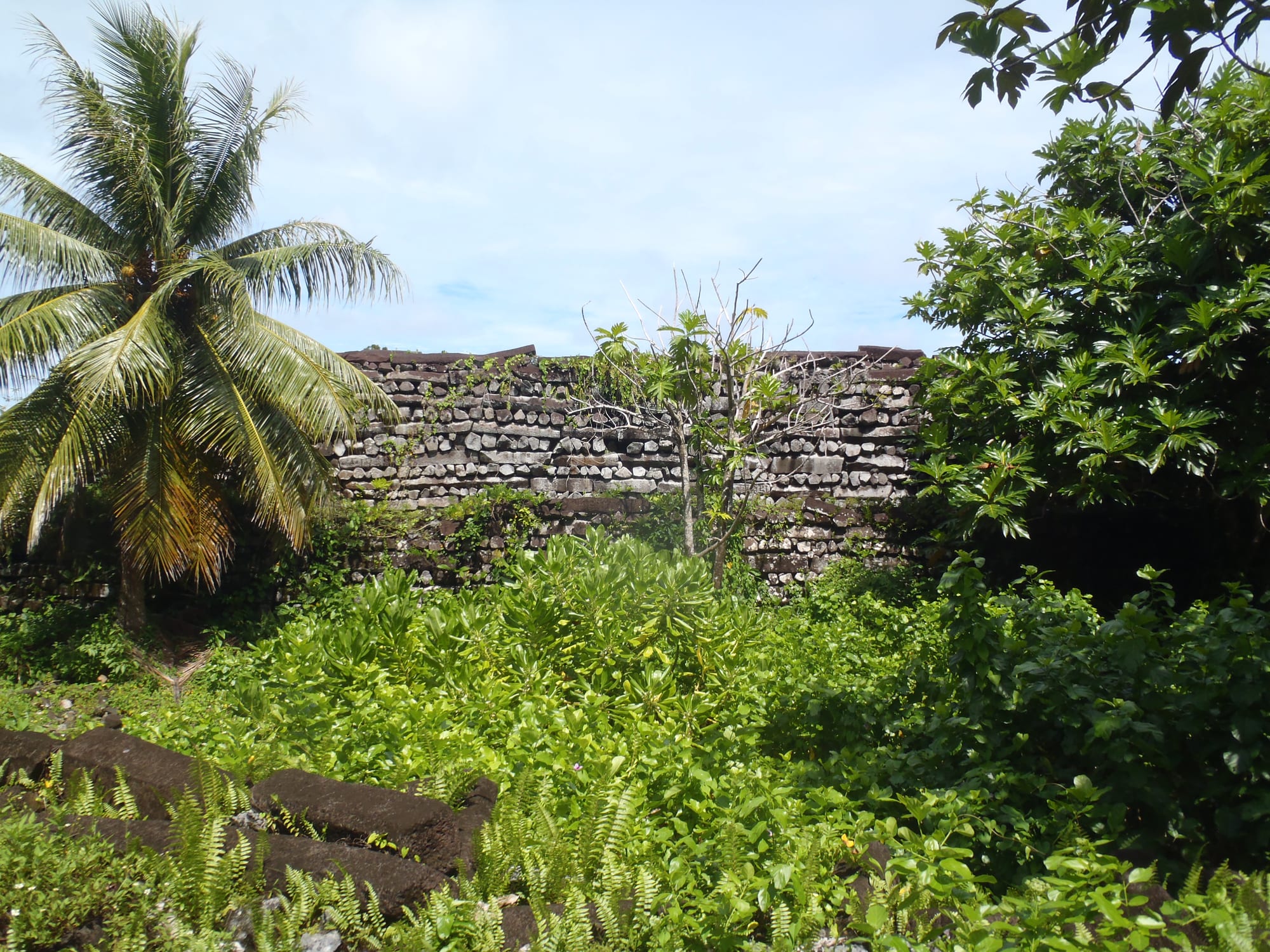
The Polish ethnographer John Stanislaw Kubary made the first detailed description of the ruins in 1874.
Nan Madol today
Nan Madol was declared a National Historic Landmark in 1985, and it is the Federated States of Micronesia's only UNESCO World Heritage Site. UNESCO has also listed it as World Heritage in Danger because of threats from natural causes, and many of the old canals have silted up or been overgrown by mangroves. The walls still rise straight out of the tidal flats.